Early Los Angeles City Views (1900 - 1925)
Coast, Cities, and the Making of Modern Los Angeles
Historical Photos of Early Los Angeles |
Introduction |
This page explores Southern California during a period of extraordinary growth and transformation, tracing how coastlines, transportation systems, recreation, industry, and urban development reshaped the region during the late nineteenth and early twentieth centuries.The journey begins along Santa Monica Bay, where beaches, rail lines, resorts, and highways transformed the coastline into some of Southern California’s most recognizable communities. From Santa Monica Canyon and Pacific Palisades to the amusement piers of Santa Monica Bay, Hermosa Beach, Redondo Beach, and the Hollywood Riviera, these sections follow the evolution of the coast from open shoreline to recreation and residential life.The story then expands southward and inland through the Palos Verdes Peninsula, San Pedro Harbor, and Long Beach, illustrating the growth of maritime commerce and the emergence of Southern California as one of the nation’s great coastal and industrial regions.From there, attention turns to the urban centers of Los Angeles through historic views of downtown streets, streetcars, tunnels, commercial districts, and public infrastructure that supported a rapidly growing population and increasingly connected communities.The final sections trace one of Southern California’s most remarkable landscape transformations: the evolution of Agricultural Park into Exposition Park and ultimately the Los Angeles Memorial Coliseum, reflecting the region’s continuing ability to adapt and reinvent itself. |
* * * * * |
Santa Monica Canyon and the Rise of Pacific PalisadesFrom Port Los Angeles to a Coastal Community |
Before Pacific Palisades became known for scenic homes and coastal drives, this stretch of shoreline at the northern edge of Santa Monica Bay was shaped by steep canyons, open beaches, rail lines, and competing visions for how Southern California’s coast would develop.In the 1890s, Santa Monica briefly emerged as a contender to become Los Angeles’ principal seaport. The Southern Pacific Railroad built Long Wharf and promoted the area as Port Los Angeles, creating a direct connection between ocean shipping and rail transportation. But after San Pedro Bay was selected as the region’s main harbor, the wharf gradually declined and was eventually removed.Over the following decades, the coast took on a different identity. Roads replaced rail as the dominant form of travel, beaches became destinations for recreation, and new communities appeared along the shoreline and canyon hillsides. By the 1920s, the foundations of Pacific Palisades had begun to emerge along a coastline once expected to become the region’s commercial gateway. |
 |
||
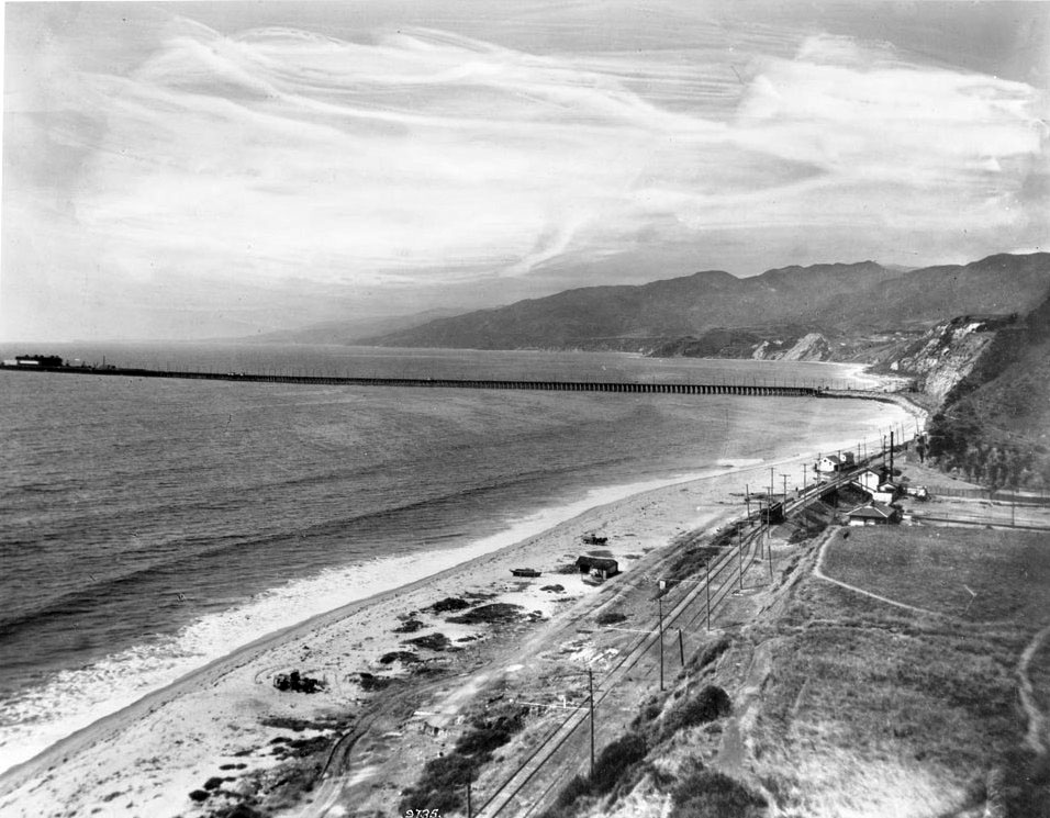
| (ca. 1912)* - View looking north toward Santa Monica Canyon and Long Wharf. Railroad tracks and a utility pole line run parallel to the beach in the middle distance. The mouth of Santa Monica Canyon appears at right while Long Wharf extends into deep water offshore toward a cargo vessel anchored in the bay. |
Historical Notes In 1893, the Southern Pacific Railroad built Long Wharf at the north end of Santa Monica Bay, extending approximately 4,700 feet into the ocean and making it one of the longest piers in the world at the time. The company promoted the facility as Port Los Angeles, creating a direct connection between ocean shipping and rail transportation. Freight cars traveled onto the wharf itself, allowing cargo to move directly between ships and the growing Southern California rail network. That vision soon became part of a larger political battle over the future of Los Angeles Harbor. Railroad interests supported Santa Monica, while free harbor advocates led by Senator Stephen M. White argued for San Pedro Bay and federal development independent of railroad control. In 1897, San Pedro was selected as the region’s principal harbor, effectively ending Santa Monica’s ambitions to become the city’s main port. Although Long Wharf remained active for several more years, its importance steadily declined. By the time this photograph was taken around 1912, the structure already represented an earlier era of coastal development. The wharf was demolished in 1920, and within a generation the former site of Port Los Angeles had become part of one of Southern California’s most desirable residential and recreational coastlines. |
 |
||
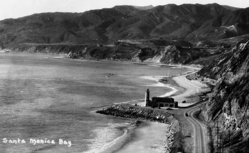
| (ca. 1927)* - View of the Santa Monica Bay coastline showing the lighthouse bathhouse near Pacific Palisades. The structure stood near the point where Long Wharf once extended into the ocean. |
Historical Notes By the late 1920s, the shoreline that had once supported Port Los Angeles had taken on a very different character. Long Wharf had disappeared, automobile travel was replacing rail, and beach recreation was becoming increasingly important along the coast. Built in 1927, the lighthouse bathhouse served beach visitors rather than ships and became a recognizable landmark along the coast road. Its location near the former Long Wharf site created an unexpected link between Santa Monica’s industrial waterfront past and its emerging identity as a recreational shoreline. In the early 1930s, humorist and actor Will Rogers acquired nearby beach property and helped popularize the area. Following his death in a plane crash in 1935, portions of the surrounding property were later transferred to the State of California and became Will Rogers State Beach, preserving public access to a stretch of coast once tied to railroads and commerce. |
 |
||
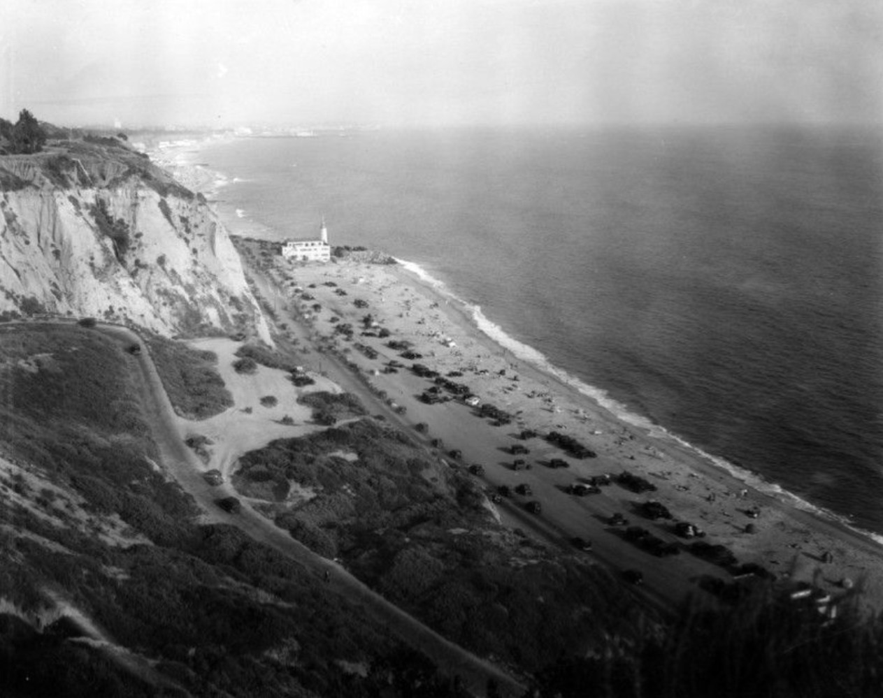
| (ca. 1920s)* - View looking south along Roosevelt Highway, later renamed Pacific Coast Highway, through Pacific Palisades. The ocean lies at right while the highway follows the base of the coastal bluffs. Visitors enjoy the beach below, and the lighthouse bathhouse appears in the middle distance near the point where the Santa Monica Mountains meet the shore. |
Historical Notes Roosevelt Highway, later renamed Pacific Coast Highway, became one of the defining transportation projects of early twentieth century Southern California. Running between the mountains and the ocean, it opened areas north of Santa Monica to increasing residential and recreational use. Pacific Palisades was founded in 1922 by Reverend Charles H. Scott and the Southern California Methodist Episcopal Church as a planned community centered on education, culture, and outdoor living. Early residents initially lived in tents while homes and infrastructure slowly took shape. The new highway helped connect the emerging community to the rest of Los Angeles and encouraged development along the canyon hillsides. Within a few decades, what began as a small planned settlement evolved into one of Southern California’s most recognizable coastal neighborhoods. |
 |
|
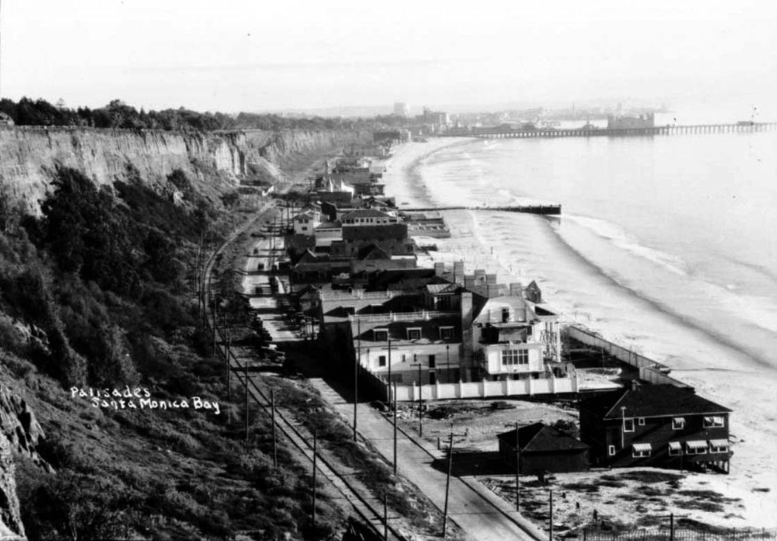
| (1920s)* - View looking south along Roosevelt Highway, later renamed Pacific Coast Highway, showing Santa Monica beachfront development. At center right, the Marion Davies estate is visible under construction. Railroad tracks run parallel to the road below the coastal bluffs, while a small wharf and a longer pier appear farther down the shoreline. |
Historical Notes During the 1920s, newspaper publisher William Randolph Hearst acquired beachfront property in Santa Monica to build an estate for actress Marion Davies. The stretch of coastline became known as part of Santa Monica’s Gold Coast and attracted prominent residents and visitors. Architect Julia Morgan later completed the design, creating one of Southern California’s most elaborate beachfront estates. The property included a grand mansion, guest houses, gardens, and an ornate swimming pool. After Davies sold the property in 1947, the estate was converted for hotel and club use before eventually becoming state property. Today only portions of the original development remain. |
 |
||
| (ca. 1920)^ - Hillside view looking toward Santa Monica and the coastline below. Santa Monica Pier and the La Monica Ballroom appear in the distance. |
| Historical Notes
This elevated view captures Santa Monica during the transition from rail oriented growth to automobile centered development. Roads and parking increasingly shaped how residents and visitors experienced the coast. The La Monica Ballroom opened in 1924 and became one of the largest dance venues on the West Coast, helping establish Santa Monica Pier as one of Southern California’s major entertainment destinations. The ballroom's prominence faded after the Depression, though the structure remained in use for decades under changing purposes. It served as a roller skating rink from 1955 until 1962, and was demolished in 1963 after falling into disrepair. No trace of the building remains on the pier today. |
 |
|
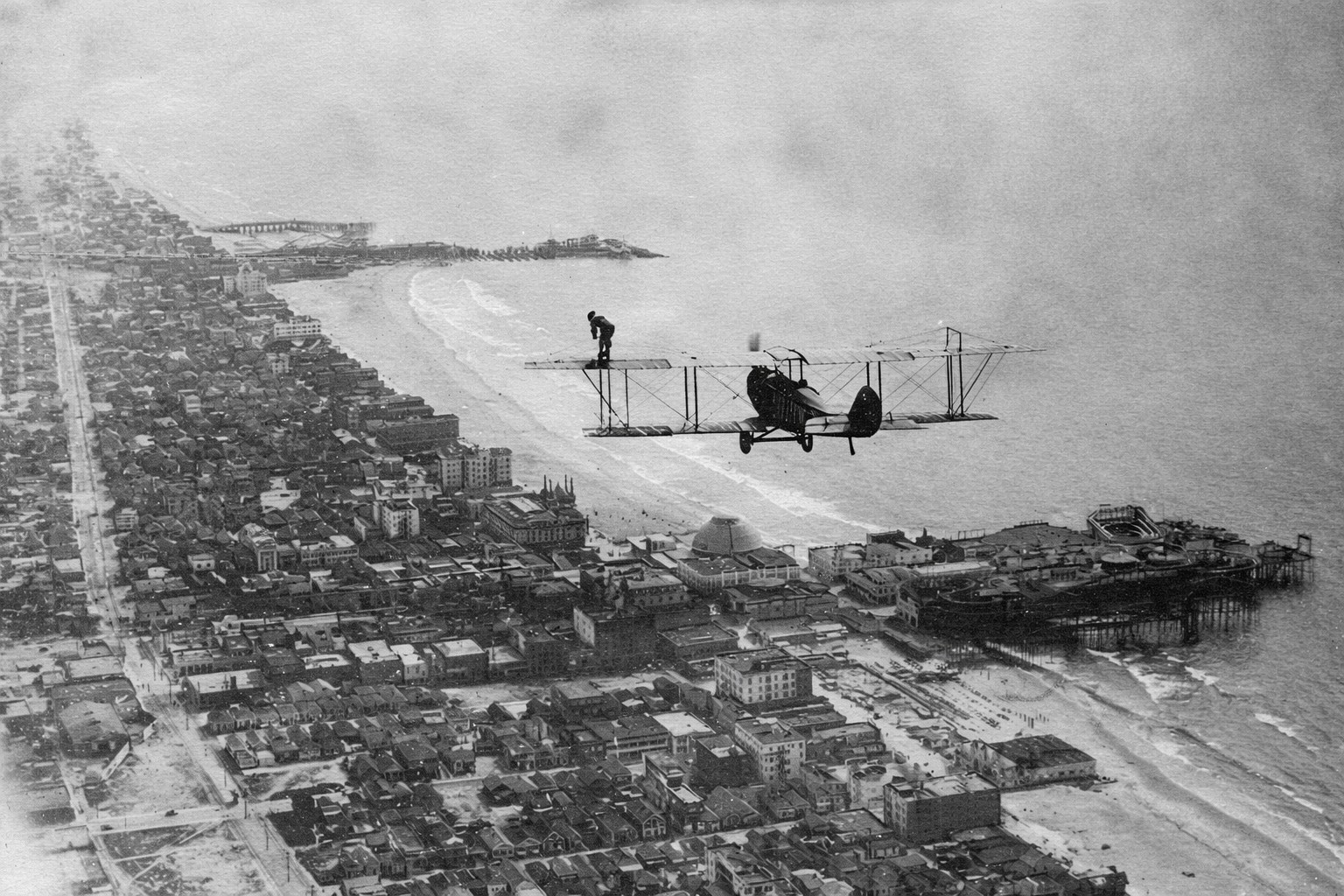
| (1918)* - A Curtiss JN biplane flies over Santa Monica Bay while aerial performer Babe Kalishek stands upright on the wing. Ocean Park Pier and Venice Pier appear below. |
| Historical Notes
Taken on August 14, 1918, this photograph captures the era of wing walking, an early aviation performance in which performers moved across aircraft in flight without safety equipment. Babe Kalishek became one of the best known female aerial performers of her time. Santa Monica Bay provided an ideal setting for these exhibitions. Large crowds gathered along Ocean Park and Venice to watch airplanes perform above the amusement piers, combining two symbols of modern excitement: aviation and seaside entertainment. The image also reflects a period when aviation was shifting from novelty to public spectacle and Southern California was beginning to build its identity around both innovation and recreation. |
* * * * * |
Piers of Santa Monica BayAmusement, Competition, and the Golden Age of the Coast |
From the early 1900s through the 1930s, Santa Monica Bay contained one of the greatest concentrations of piers on the West Coast. Built during a period of rapid growth in Southern California, these structures served many purposes. Some were created to attract crowds with rides, entertainment, and spectacle, while others supported fishing, boating, and everyday coastal activity.Together, they transformed the shoreline into a dense and highly competitive coastal landscape. Rail lines, roads, and growing populations turned the beaches into destinations and helped create an era when amusement piers became some of Southern California’s most recognizable landmarks. Most would not survive beyond the Depression era, leaving only a few reminders of what was once one of the most intensely developed recreational coastlines in the nation. |
 |
|
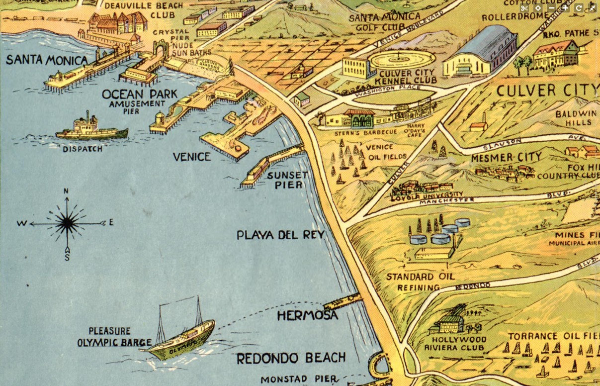
| (1932)* - Map showing the piers of Santa Monica Bay. The coastline is dotted with multiple piers extending from Santa Monica south toward Redondo Beach. A structure labeled Monstad Pier appears near Redondo Beach at lower right. |
| Historical Notes
The 1932 map captures Santa Monica Bay during the height of the pier era, when the coastline supported one of the densest collections of piers in the United States. The greatest concentration appeared around Santa Monica, Ocean Park, and Venice, where neighboring communities competed directly for visitors and investment. The map should be read as a snapshot of what was active and significant at the time rather than a complete record of every structure along the coast. Smaller working piers were often given less attention than amusement destinations that attracted large crowds and generated publicity. Near Redondo Beach, the map identifies Monstad Pier, built in the 1920s by Captain Hans C. Monstad. Unlike the larger amusement piers to the north, it served fishing boats and small craft. Although less well known today, portions of the structure are often described as having influenced or been incorporated into later Redondo pier development. |
 |
|
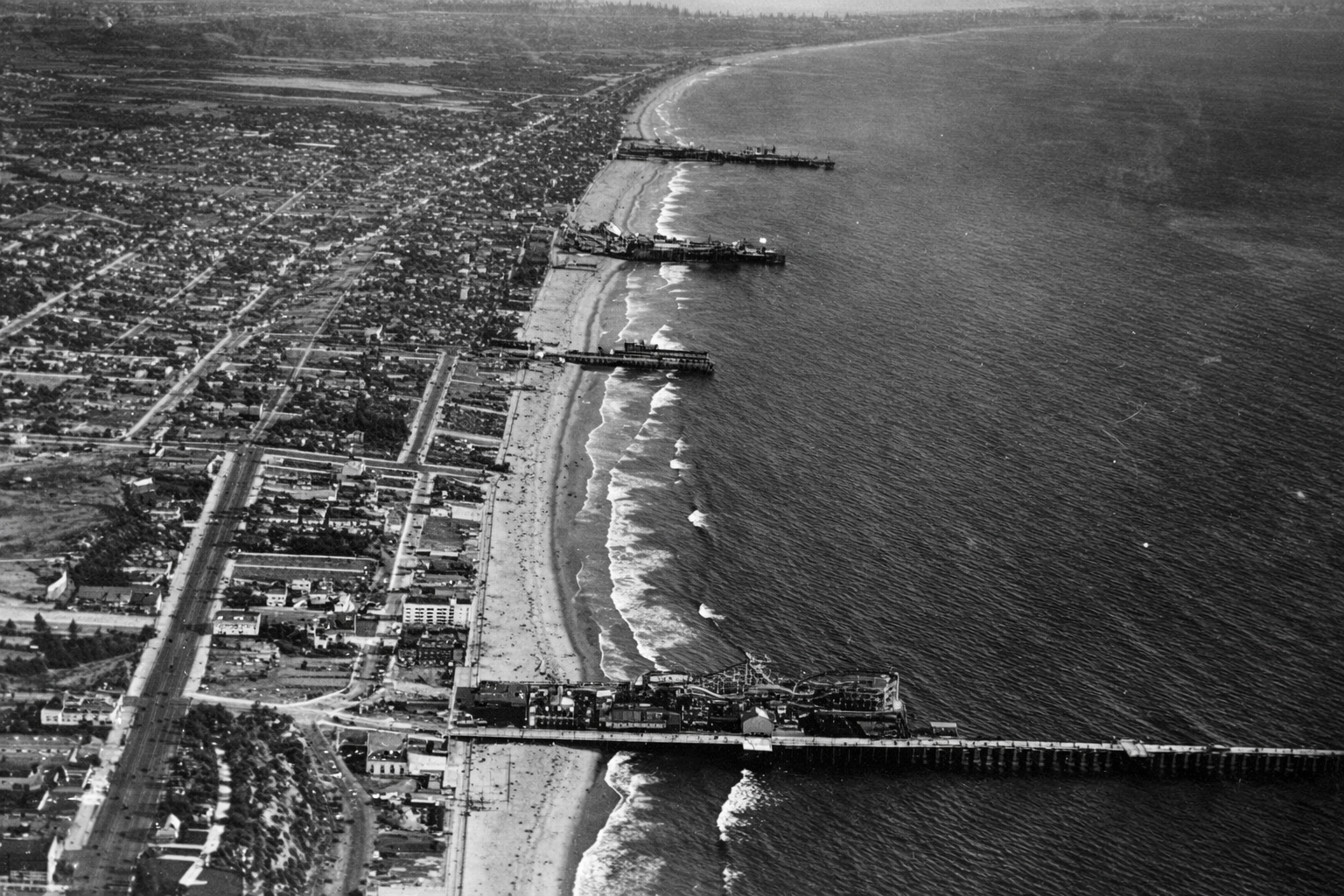
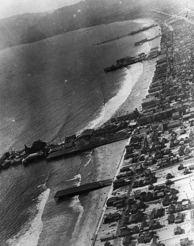
| (1919)* – Aerial view looking south showing four Santa Monica Bay piers. From bottom to top: Santa Monica Pier, Crystal Pier, Ocean Park Pier, and Venice Pier. |
| Historical Notes
This aerial view captures the height of the amusement pier era. Improved transportation, especially electric rail lines, allowed visitors from across the Los Angeles region to reach the coast with ease. Pier owners responded by competing for crowds through larger rides, brighter lights, and increasingly ambitious attractions. The close spacing of these piers created an almost continuous entertainment district along the shoreline. Fires, storms, and structural failures were common because most piers were built largely of wood, yet destruction rarely marked the end. Piers were often rebuilt larger and more elaborate than before, reflecting both optimism and sustained public demand. Not all of these piers survived. Crystal Pier, originally built as White Star Pier and later known as Bristol Pier before becoming Crystal Pier, remained smaller than its neighbors. After years of decline, it was condemned in 1943 and demolished in 1948, marking the gradual end of Santa Monica Bay’s most concentrated era of amusement pier development. |
 |
||
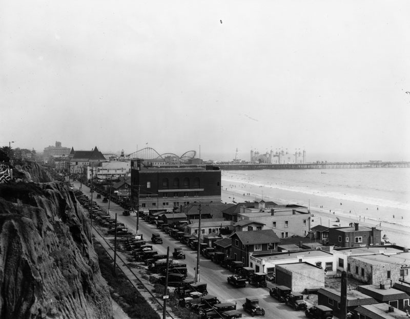
| (1920s)* - Aerial view looking north along the Santa Monica Bay coastline. At least 6 or 7 piers can be seen extending out into the ocean. Venice Pier and amusement park can be seen in the foreground. Ocean Park Pier, with its own amusement park, is the next pier over. Beyond that, the long pier at the top of the photo is Santa Monica Pier, which also developed into a major amusement destination. |
| Historical Notes
During the 1910s and 1920s, Venice, Ocean Park, and Santa Monica functioned less as separate beach towns and more as direct competitors for Southern California's growing tourist market. Each promoted its own mix of rides, entertainment, food, and attractions. Between 1904 and 1925, at least fourteen roller coasters operated along this stretch of coast. The shoreline became a constantly changing landscape of towers, lights, rides, and crowds, creating one of the most concentrated amusement districts in the nation. Visitors could move easily between attractions, producing an almost continuous recreational corridor along Santa Monica Bay. The density seen here would never again be repeated after the Great Depression. Changing economics, evolving entertainment patterns, and the cost of maintaining large wooden structures gradually brought an end to this extraordinary concentration of amusement piers. |
 |
|
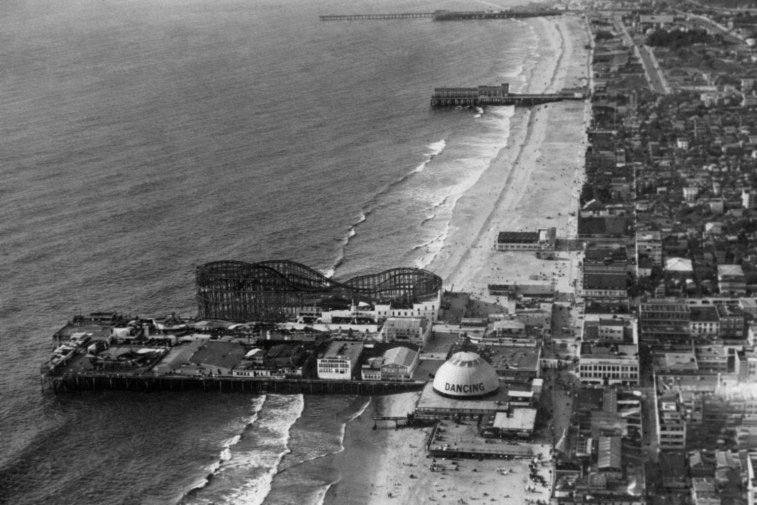
| (1920)* - Aerial view of Ocean Park Pier showing its large roller coaster. The longer pier to the north is Santa Monica Pier, which also developed into a major amusement destination. Between them stands Crystal Pier, originally known as White Star Pier and later Bristol Pier. |
| Historical Notes
Ocean Park Pier became one of the most heavily developed amusement destinations on Santa Monica Bay. Roller coasters were its most visible attraction, but arcades, concessions, and gathering spaces encouraged visitors to spend entire days along the waterfront. The close proximity of Santa Monica Pier, Crystal Pier, and Ocean Park created a layered entertainment landscape unlike anywhere else on the Southern California coast. Success depended not only on location but also on scale, novelty, and the ability to attract repeat visitors. Crystal Pier served as a smaller companion to the larger amusement complexes nearby and changed ownership several times during its history. As entertainment patterns shifted and maintenance costs increased, many of the bay’s early piers disappeared or were rebuilt, leaving Santa Monica Pier as the most recognizable surviving landmark of Santa Monica Bay’s amusement era. Click HERE to see more in Early Views of Southern California Amusement Parks |
 |
|
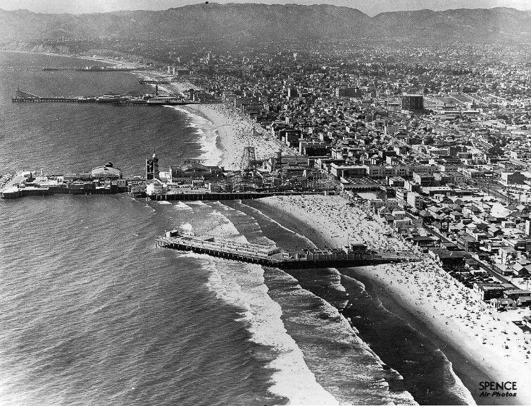
| (ca. 1930s)* – Aerial view showing the pleasure piers of Venice and Santa Monica. From bottom to top: Sunset Pier, Venice Pier, Ocean Park Pier, Crystal Pier, Santa Monica Pier…all that remains are the rocks of the breakwater behind the Venice Pier and the Santa Monica Pier. Photo taken by Spence Air Photos. |
| Historical Notes
This aerial view captures the final years of the great amusement pier era along Santa Monica Bay. Stretching from Venice north to Santa Monica, these five piers created one of the most concentrated recreational landscapes on the West Coast. By the time this photograph was taken, however, the period of rapid expansion and competition was already beginning to fade. Several of the piers shown here disappeared within the following decades. Sunset Pier and Venice Pier were among the earliest losses as changing conditions and expiring leases brought an end to their operations. Ocean Park later evolved into Pacific Ocean Park, a major amusement destination that operated from 1958 to 1967 before closing and eventually being demolished. Crystal Pier, visible between Ocean Park and Santa Monica, had already entered decline and was condemned in 1943 before being demolished in 1948. Of the five piers shown in this photograph, only Santa Monica Pier survives today as a functioning pier and direct continuation of the amusement era shown here. Its longevity owed less to amusement attractions than to its municipal role and later preservation efforts that prevented demolition during the 1970s. The original Venice amusement pier and the other recreational piers shown here have long since disappeared, leaving Santa Monica as the last standing reminder of one of Southern California’s most remarkable periods of coastal recreation and entertainment. |
 |
|
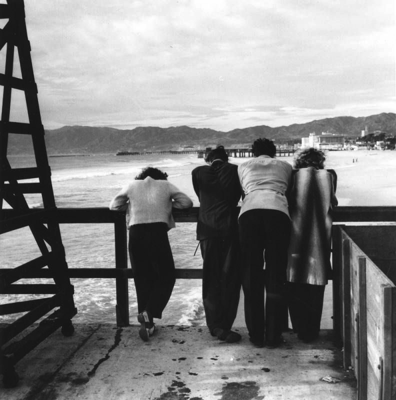
| (ca. 1940)* - Four people stand on Ocean Park Pier looking north toward Santa Monica, with Crystal Pier and Santa Monica Pier visible in the distance. Photograph by Ansel Adams. |
| Historical Notes
This quiet scene provides a striking contrast to the crowded amusement views that defined Santa Monica Bay during earlier decades. Rather than emphasizing rides, lights, and spectacle, the photograph focuses on atmosphere, distance, and the changing relationship between people and the shoreline. By around 1940, the great amusement pier era had begun to fade. Economic pressures, aging wooden structures, storms, and changing patterns of recreation gradually transformed the coastline. What had once been one of the most intensely developed recreational corridors on the West Coast was becoming quieter and less crowded. Photographed by Ansel Adams during his 1940 documentary work in Los Angeles, the image captures a moment of transition along a shoreline that had already begun its long transformation away from the amusement era. |
Click HERE to see more in Early Views of Santa Monica |
* * * * * |
Playa del Rey |
Long before it became the quiet coastal neighborhood tucked between Los Angeles International Airport and the Pacific Ocean, Playa del Rey was one of Southern California's earliest resort destinations. Its story begins with the land itself — a broad coastal lagoon formed where Ballona Creek reached the sea and where the Los Angeles River had once emptied centuries earlier. The area's calm waters, wetlands, and open shoreline attracted Native peoples, ranchers, fishermen, and eventually developers who saw opportunity along the coast.Those ambitions often arrived faster than nature would allow. In 1871, a man named Will Tell opened a small hunting and fishing retreat near the lagoon. Later, developers promoted an ambitious harbor project known as Port Ballona, hoping to create a major shipping center connected by rail to Los Angeles. Storms, tides, and shifting sands repeatedly damaged the improvements and brought those early ventures to an end.A more lasting vision emerged in 1902 when Henry Barbour's Beach Land Company purchased more than 1,000 acres and renamed the area Playa del Rey, meaning "The King's Beach." Supported by expanding rail connections and the growing popularity of seaside recreation, the lagoon became the centerpiece of a resort that featured hotels, a pavilion, boating, boardwalks, and later even automobile racing. For just over a decade, Playa del Rey became one of Southern California's most distinctive coastal destinations. |
.jpg) |
|
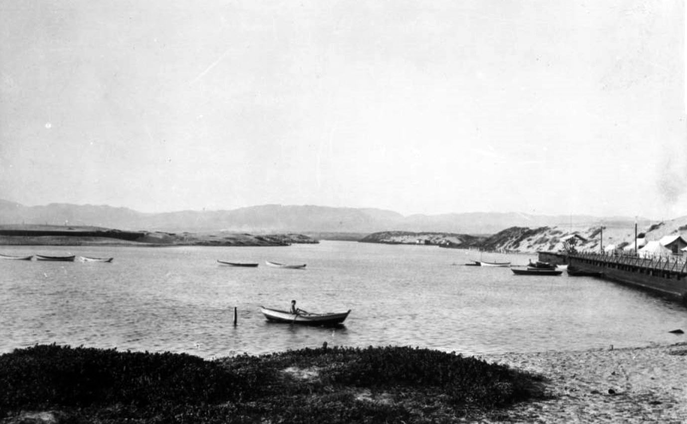
| (ca. 1902)* – A well dressed man holds his shoes while standing knee deep in the Playa del Rey lagoon, looking east toward the coastal bluffs. |
Historical Notes The Playa del Rey lagoon was part of a coastal estuary shaped over centuries by changing river channels and ocean tides. Before the Los Angeles River shifted eastward during the early nineteenth century, portions of its flow reached the ocean near this area. Ballona Creek continued carrying runoff from the western Santa Monica Mountains, helping sustain the lagoon as a shallow tidal wetland. When the Beach Land Company began developing Playa del Rey in 1902, the lagoon became the centerpiece of the entire resort. Its calm waters supported boating and recreation while its shallow shoreline invited visitors to experience the setting directly. The arrival of rail service later that year opened the area to thousands of visitors from Los Angeles. |
 |
|
| (ca. 1903)* - A photoprint titled "Quiet Waters and Quiet Days" shows the Playa del Rey lagoon looking north from its southern end. Several rowboats rest at anchor while a lone oarsman crosses the foreground. |
Historical Notes This peaceful scene reflects the beginning of Playa del Rey's resort era, but earlier efforts had already attempted to capitalize on Ballona's location. Around 1871, Will Tell established a modest hunting and fishing lodge near the lagoon's mouth. Later, developers launched the Port Ballona project in hopes of creating a harbor and transportation center. Those plans ultimately failed as storms and sand repeatedly overwhelmed the improvements. The tents visible along the shoreline in this photograph represent a more cautious beginning. Within only a few years, permanent hotels, boardwalks, and recreational facilities would transform the lagoon into a popular destination. |
 |
|
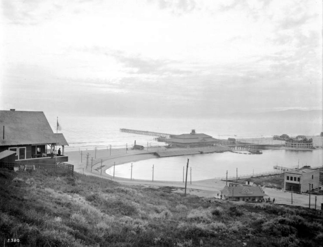
| (1902)* - Looking south across the Playa del Rey lagoon on November 12, 1902, a sailboat and numerous rowboats occupy the calm waters only months after the resort officially opened. |
Historical Notes Playa del Rey officially opened on July 16, 1902, drawing hundreds of prospective buyers and visitors arriving primarily by Santa Fe Railway. The Pacific Electric line had not yet reached full service but would soon provide easier access and dramatically increase attendance. As the resort matured, the lagoon evolved from a quiet anchorage into an organized recreation area. Boardwalks were constructed, boating facilities expanded, and improvements helped regulate the lagoon's connection to the ocean. Water activities soon became one of Playa del Rey's defining attractions. |
 |
|
| (1902)* – Looking south from the lagoon's edge, tents occupy the foreground while the newly built Hotel Playa stands at the base of the bluffs beyond. Horse drawn wagons wait nearby and a water tower rises above the development. |
Historical Notes Henry Barbour's Beach Land Company promoted Playa del Rey as a modern coastal resort tied to Southern California's expanding transportation network. Construction advanced quickly and by opening day accommodations, public facilities, and residential lots were already available. Approximately one hundred lots were reportedly sold during the opening celebration. The water tower visible in this photograph represented a critical piece of infrastructure, supporting resort operations before municipal services extended to the coast. |
 |
|
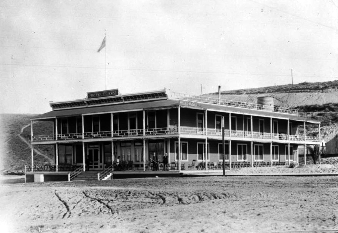
| (ca. 1905)* - Close view of the Hotel Playa showing its broad wrap around porch, second floor balcony, and rows of large windows designed to capture coastal views. |
Historical Notes Opened in 1902 and later known as the Hotel Del Rey, the hotel became the centerpiece of the resort. Together with the nearby Pavilion completed in 1904, it offered lodging, dining, entertainment, and social activities for visitors arriving by rail. The hotel stood along Speedway Boulevard, today's Culver Boulevard, near the present location of Tanner's Coffee Company. Although the resort itself disappeared long ago, the surrounding area still preserves connections to Playa del Rey's early development history. |
 |
|
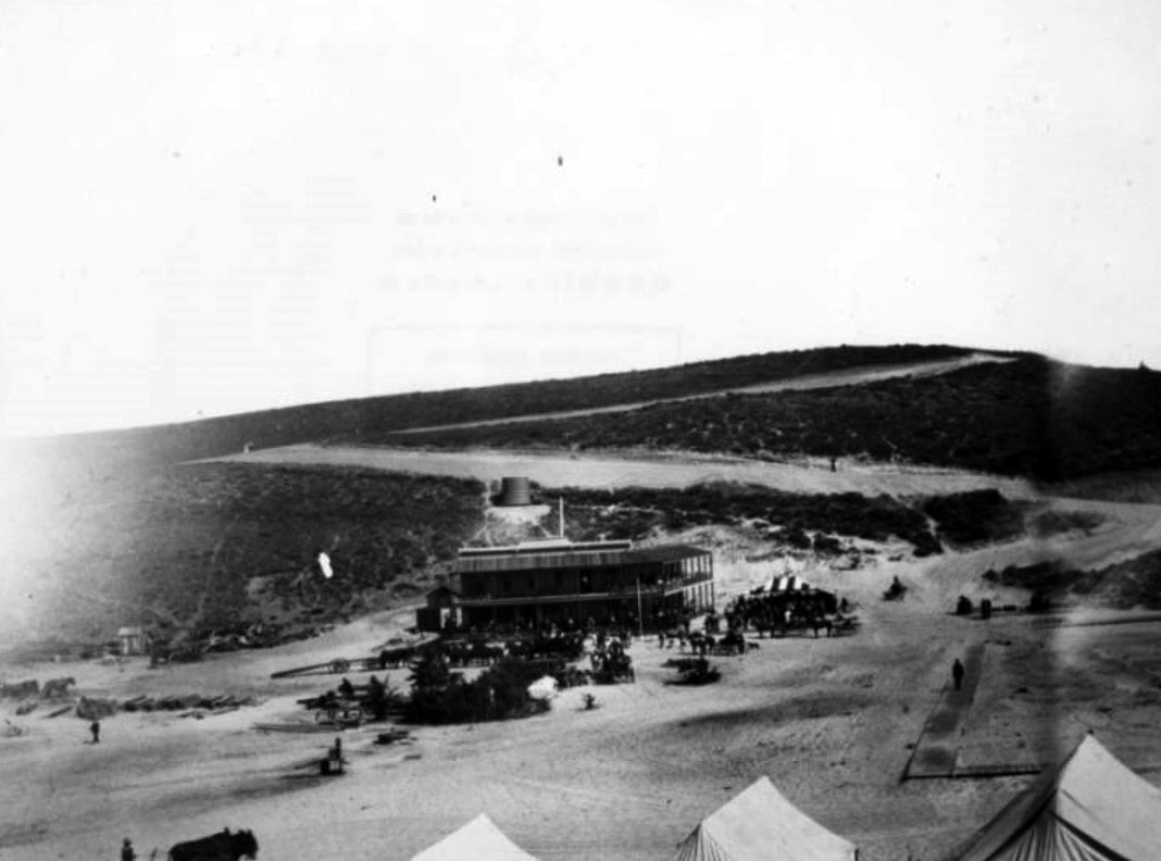
| (ca. 1908)* - From the balcony of a hillside home, a man looks down across the developed Playa del Rey lagoon. The Del Rey Hotel, Pavilion, pier, grandstands, and lagoon appear together in a view that captures the resort near its peak. |
Historical Notes The completion of the Los Angeles Pacific electric trolley line to Playa del Rey on October 19, 1902 transformed the resort's future. Direct rail service connected the coast with downtown Los Angeles and made Playa del Rey an increasingly popular destination for day visitors. By the middle of the decade, the lagoon had evolved into an organized recreation center. Grandstands surrounded portions of the shoreline to accommodate spectators watching boating events and regattas. The Pavilion, completed in 1904 in a Japanese inspired craftsman style, became the resort's social center with dining, entertainment, and public gathering spaces overlooking the water. |
 |
|
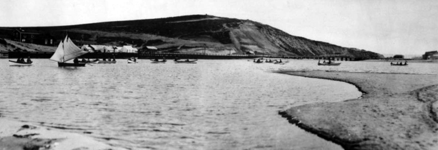
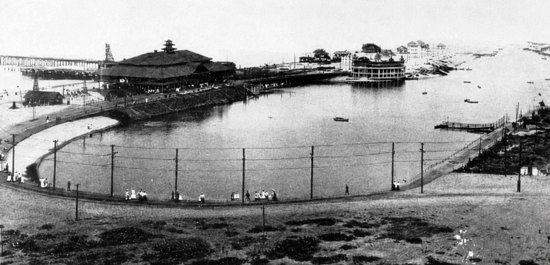
| (1907)* - A July 2, 1907 view shows the Playa del Rey resort at the height of its popularity, with the lagoon, pier, Pavilion, and Del Rey Hotel visible in a single scene. (Courtesy of the California Historical Society Collection) |
Historical Notes By 1907, Playa del Rey had assembled one of Southern California's most complete resort environments. Boardwalks lined the lagoon, a fishing pier extended into the Pacific, and improved circulation around the water connected visitors to the hotel, pavilion, and recreation facilities. Boat racing became one of Playa del Rey's signature attractions. What had appeared only a few years earlier as a quiet lagoon had become an organized venue for rowing events, sailing activities, and public exhibitions that regularly attracted visitors arriving by electric rail. |
 |
|
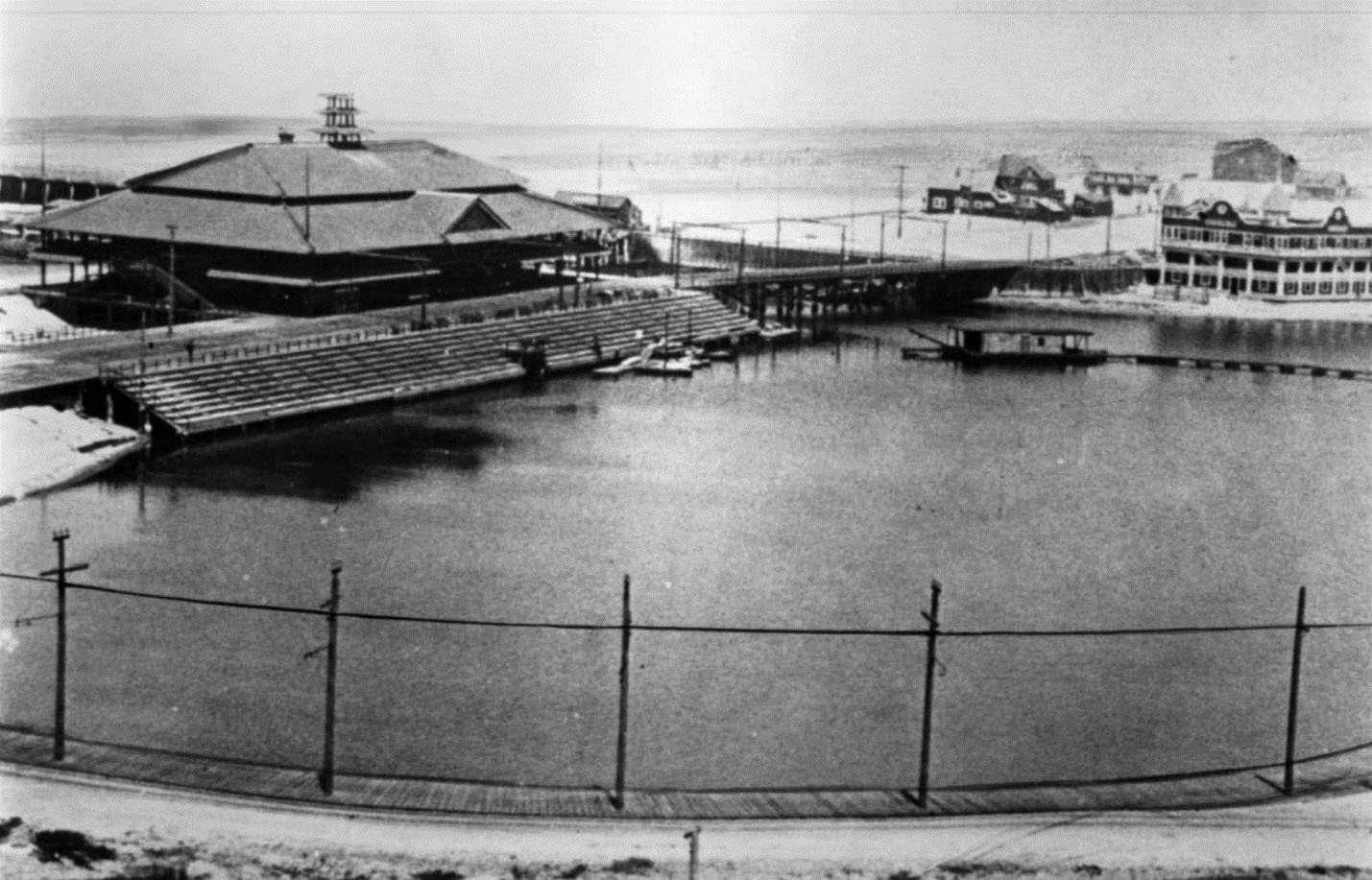
| (ca. 1904)* – The Playa del Rey Pavilion stands at left while the Del Rey Hotel rises in the background at right. Grandstands line the lagoon and several boats rest within the protected waters. |
Historical Notes Completed in 1904, the Pavilion became the heart of resort life at Playa del Rey. The three story structure reportedly included dining rooms, a restaurant, entertainment space, bowling alleys, and a large dance floor. Its architecture departed from the more common Mediterranean style found at other coastal resorts and gave Playa del Rey a distinctive identity. The adjacent Del Rey Hotel supported overnight tourism and encouraged visitors to stay beyond a single day excursion. Together, the two buildings established Playa del Rey as one of the region's most ambitious resort developments during the early twentieth century. |
 |
|
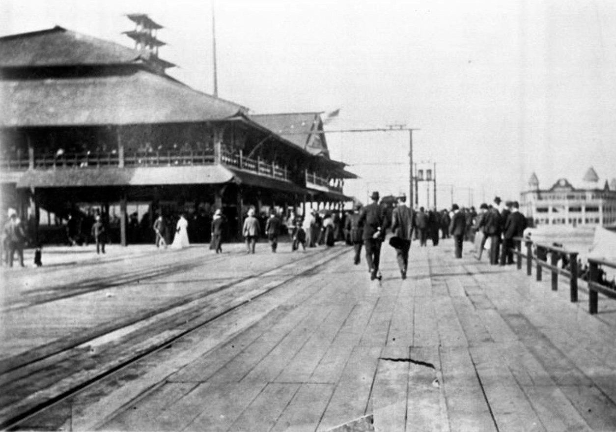
| (ca. 1908)* – Crowds gather along the boardwalk in front of the Playa del Rey Pavilion while visitors arriving from Los Angeles fill the waterfront with activity. The Del Rey Hotel appears in the distance. |
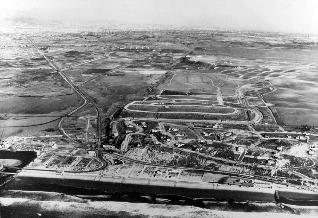
Historical Notes Excursion travel played a major role in Playa del Rey's success. Electric railway service brought increasing numbers of visitors from Los Angeles who spent the day boating, walking the boardwalk, attending events, and enjoying the ocean environment. Although Playa del Rey never reached the scale or fame later achieved by nearby Venice, it demonstrated the growing demand for planned coastal recreation and helped shape Southern California's early beach culture. The resort's active years ran from 1902 through the early 1910s. During the first decade of the twentieth century, a funicular railway carried visitors between the beach and the residential development above the bluffs. Its two cars became locally known as Alphonse and Gaston. In 1910, another attraction arrived nearby when the Los Angeles Motordrome opened at the present day intersection of Culver and Jefferson Boulevards. The steeply banked wooden raceway drew large crowds and nationally known drivers including Barney Oldfield and Ralph De Palma during the early years of automobile racing. The resort era gradually faded after a series of setbacks during the early 1910s. Fires and changing development patterns eventually brought Playa del Rey's brief but memorable period as a destination resort to an end. Development shifted toward permanent residential neighborhoods, and beginning in 1921 the Palisades del Rey community and later Surfridge introduced a new chapter to the bluffs overlooking the former lagoon. Among those who would later make the area home were film director Cecil B. DeMille and actor Charles Bickford. |
* * * * * |
Surfridge (Playa del Rey, originally Palisades del Rey) |
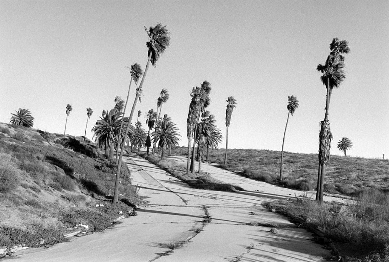
In 1921, the Minneapolis based firm Dickinson and Gillespie began promoting a three mile stretch of coastal dunes south of Venice as one of the last major undeveloped beach areas within easy reach of Los Angeles. Marketed as "The Last of the Beaches," the project envisioned an upscale residential community overlooking the Pacific.Under the direction of developer Fritz Burns, who later became one of Southern California’s most influential builders, roads were improved, palm trees lined approach routes, and building restrictions required homes to be constructed of stucco, brick, or stone. The result was a carefully planned seaside neighborhood intended to offer both exclusivity and permanence.In 1925, the southern portion of the development received a new name through a public contest: Surfridge. Although the Great Depression slowed construction, the neighborhood gradually matured into one of Southern California’s most desirable coastal communities.At nearly the same moment Surfridge was taking shape, open land to the east began attracting a very different kind of development. In 1928, a modest municipal airfield known as Mines Field opened nearby, a change that few residents could have imagined would one day redefine the future of the community. |
 |
|
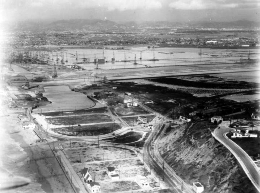
| (1921)* - Aerial view showing Playa del Rey, the coastal bluffs, and the broad sandy plain below. The open land at center-right would later become Mines Field and eventually Los Angeles International Airport. The beach area at lower-right would soon become the residential development known as Surfridge. |
Historical Notes This 1921 aerial view captures the Playa del Rey coastline before large scale residential and aviation development transformed the landscape. The coastal bluffs, dunes, and open lowlands visible here remained among the least developed stretches of shoreline near Los Angeles. Within only a few years, Dickinson and Gillespie would begin converting portions of this landscape into the planned residential community that became Surfridge, while open land farther inland would be selected for the municipal airfield later known as Mines Field. The image preserves a brief moment when the future Surfridge neighborhood and the future site of Los Angeles International Airport still existed only as open coastal terrain. |
 |
|
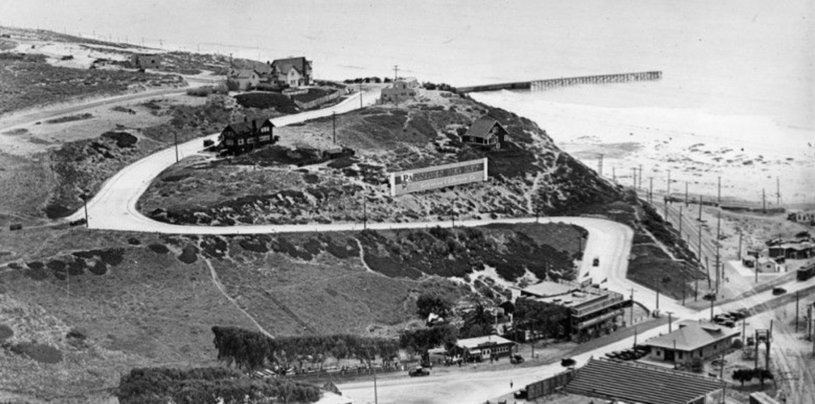
| (ca. 1920)* - On the winding road up the bluff, a billboard advertises the dream of life at Palisades del Rey overlooking the Pacific. |
Historical Notes Surfridge emerged during Southern California’s great land boom of the 1920s and 1930s and was promoted as an exclusive seaside retreat. In 1925, developers held a public contest to rename the southern portion of the community and awarded a $1,000 prize to the winning entry: Surfridge. The Los Angeles Times praised the name for its "brevity, euphony, ease of pronunciation ... but above all because it tells the story of this new wonder city." The elevated terrain, formed by ancient windblown dunes rising in places more than 100 feet above the shoreline, gave residents expansive ocean views and helped distinguish Surfridge from other beach communities developing across Los Angeles County. |
.jpg) |
|
| (ca. 1920)* - Aerial view showing activity around the Palisades del Rey beachfront development. A grandstand sits opposite the real estate office at lower right, while a nearby picnic area is busy with visitors and promotional events. A pier extends beyond the breakwater into the Pacific. |
Historical Notes To attract buyers, salesmen pitched tents directly on the sand dunes and promoted lots for $50 down and 36 monthly payments of $20. Strict deed restrictions prohibited wood frame construction and required exterior finishes of stucco, brick, or stone. The goal was to establish a high quality residential community rather than a temporary beach settlement. Development slowed during the Great Depression, but construction resumed in the 1930s as buyers began building larger custom homes overlooking the ocean. Over time, Surfridge developed into one of Southern California’s most desirable coastal neighborhoods. Palisades del Rey later became part of modern Playa del Rey. |
 |
|
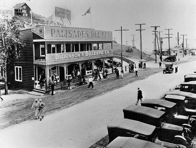
| (ca. 1920s)* – Close-up view showing the Dickinson & Gillespie Co. real estate office on Culver Boulevard near Vista del Mar promoting the new residential development. |
Historical Notes The Dickinson & Gillespie sales office occupied one of Playa del Rey’s earliest surviving resort era structures. Originally built in 1902 as the Hotel Playa, the building stood on Speedway Boulevard, today’s Culver Boulevard, near the present location of Tanner’s Coffee Co. In 1924, Dickinson and Gillespie moved their operation from Minneapolis to Los Angeles and established the building as headquarters for their Southern California activities and the promotion of Surfridge.##*^ Today, the structure remains one of the few surviving reminders of the original Palisades del Rey era. |
 |
|
| (ca. 1920s)* - Aerial view showing the Playa del Rey lagoon at lower left and the growing Surfridge community beyond. The Dickinson & Gillespie real estate office can be seen near lower center-left. |
Historical Notes This view captures Surfridge during its formative years, when homes were beginning to appear among the dunes and the surrounding landscape remained largely open. At the time this photograph was taken, few could have imagined that the broad undeveloped land to the east would soon become the airport whose growth would ultimately reshape and erase the community. Within only a few years, portions of the coastal plain visible here would begin transitioning into the municipal airfield that later evolved into Los Angeles International Airport. |
 |
|
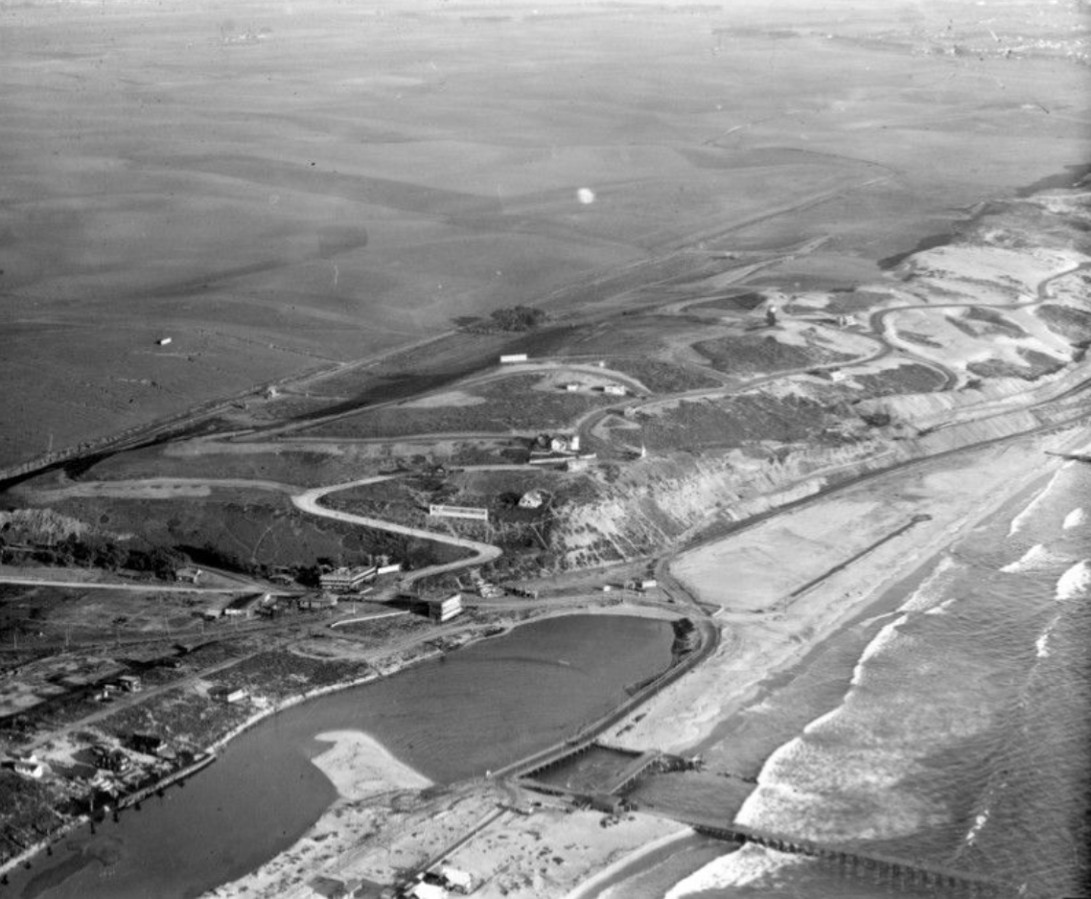
| (ca. 1929)* – Aerial view looking north over the Palisades del Rey and Surfridge area. At center-left is the Playa del Rey lagoon. In the distance can be seen the southern portion of the Venice-Del Rey Oil Field, land that would later become Marina del Rey. |
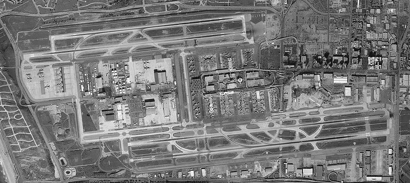
Historical Notes By the late 1920s, Surfridge had become an established residential district overlooking the coast. In 1928, a small municipal airfield opened just east of the neighborhood on former agricultural land. Known as Mines Field, it initially served local aviation activities and became popular for weekend air shows attended by nearby residents. Early exhibitions attracted nationally known aviators including Amelia Earhart and Charles Lindbergh. During its early years, few considered the airport a threat. Commercial aviation remained limited and aircraft noise was manageable. Over the decades that followed, however, Mines Field evolved into Los Angeles International Airport. The arrival of larger aircraft and expanding air traffic would eventually transform life beneath the flight paths and alter Surfridge forever. |
* * * * * |
Surfridge and the Jet Age |
For decades, residents of Surfridge lived beside what began as a modest municipal airport and gradually evolved into one of the busiest aviation centers in the world. During the propeller era, aircraft activity remained manageable and many residents accepted occasional noise as part of living near the coast.That changed rapidly after commercial jet service arrived in the late 1950s. Larger aircraft, expanding flight operations, and increasing airport activity transformed daily life beneath the departure paths.What had once been promoted as an exclusive seaside retreat would ultimately become one of Los Angeles’ most unusual lost neighborhoods. |
 |
|
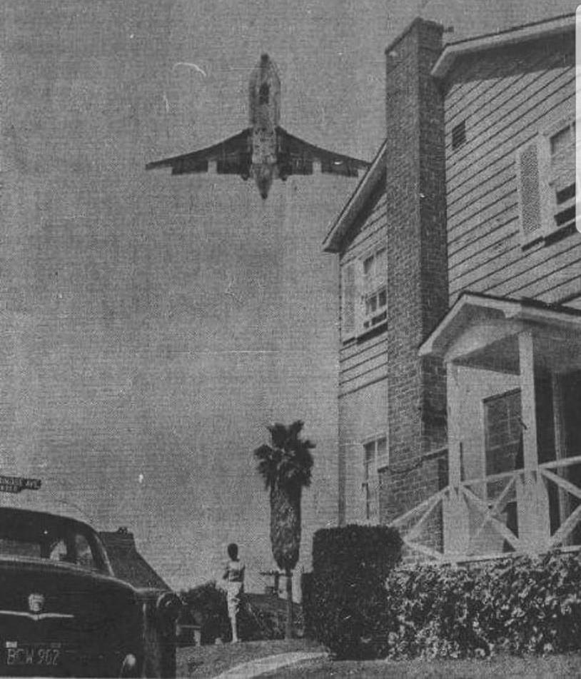
| (1960s)* – A Boeing 727 departs Los Angeles International Airport (LAX) and passes low over a house in the community of Surfridge. |
Historical Notes The arrival of commercial jet service transformed life in Surfridge. Residents who had long adapted to propeller aircraft suddenly found themselves beneath the departure paths of larger, faster, and significantly louder jet airplanes. Jet operations introduced new concerns over noise, vibration, and soot settling onto homes and yards. As one local historian later recalled, conversations often paused whenever aircraft departed overhead. As LAX expanded during the 1960s, residents increasingly questioned whether a residential neighborhood could continue to exist beside one of the nation’s busiest airports. |
 |
|
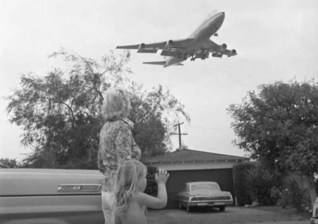
| (early 1970s)* – A woman and child stand outside a Surfridge home watching a Boeing 747 climb overhead. By this period, expanding jet traffic had become an increasingly dominant part of daily life in the neighborhood. |
| Historical Notes
Residents organized, petitioned, and challenged airport impacts through legal action, but broader airport expansion plans continued moving forward. Beginning in the 1960s, the City of Los Angeles initiated multiple phases of property acquisition and eminent domain tied to airport growth and aircraft noise mitigation. Families who remained often found themselves living among increasing numbers of vacant lots and relocated homes. For many longtime residents, the neighborhood that had once been built as a quiet coastal retreat was gradually becoming difficult to sustain. |
 |
|
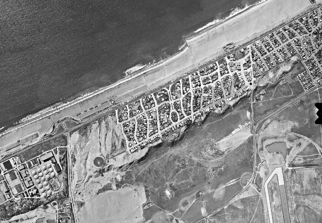
| (1960s)* - Aerial view over Surfridge (upper-right) showing the neighborhood near its fullest extent before large scale acquisition and demolition began. |
Historical Notes Despite growing impacts from airport activity, Surfridge remained a fully developed coastal neighborhood through much of the 1960s. Streets lined with custom homes reflected decades of investment, community life, and the vision first promoted during the 1920s. The community included a mix of modest homes and larger residences spread across the dunes overlooking the Pacific. For many residents, Surfridge remained an attractive place to live despite increasingly frequent aircraft activity overhead. This aerial view documents the neighborhood near its fullest extent, shortly before acquisition and demolition began reshaping the landscape. |
 |
|
| (1985)*– Looking inland toward the perimeter of LAX, this view shows the former Surfridge neighborhood years after homes were condemned and removed. The beach lies directly behind the camera. |
Historical Notes Beginning in the 1960s and continuing into the 1970s, the City of Los Angeles acquired Surfridge through a series of eminent domain actions tied to airport expansion and aircraft noise mitigation. Homeowners were required to sell their properties, although some challenged the acquisitions and remained for years after surrounding houses had been vacated. Homes were relocated, demolished, or removed until the neighborhood disappeared almost entirely. What had once been promoted as an exclusive seaside community gave way to vacant land surrounding LAX. |
 |
|
| (2004)* - Aerial view showing the former Surfridge neighborhood west of LAX. Portions of the original street grid remain visible. |
Historical Notes More than three decades after the last residents departed, Surfridge remained largely vacant. Streets, curbs, and fragments of infrastructure continued to mark where homes once stood. For years, portions of the abandoned neighborhood remained accessible and became known locally as one of Los Angeles' hidden landscapes. Following heightened airport security measures after 2001, public access became increasingly restricted. From the air, traces of the former community remained surprisingly visible, preserving the outline of a vanished coastal neighborhood. |
 |
|
| (2020)* - Aerial view looking down at the former Surfridge community showing vacant land and remnants of the original street network. |
Historical Notes Today the former Surfridge neighborhood forms part of the LAX Dunes, a protected coastal habitat west of Los Angeles International Airport. Native vegetation has gradually returned to portions of the former residential area, supporting species including the federally endangered El Segundo blue butterfly. As restoration efforts continue and portions of the remaining streets are removed, the landscape has slowly begun returning to something closer to the dunes that existed before Surfridge was ever built. |
* * * * * |
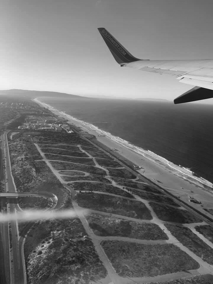
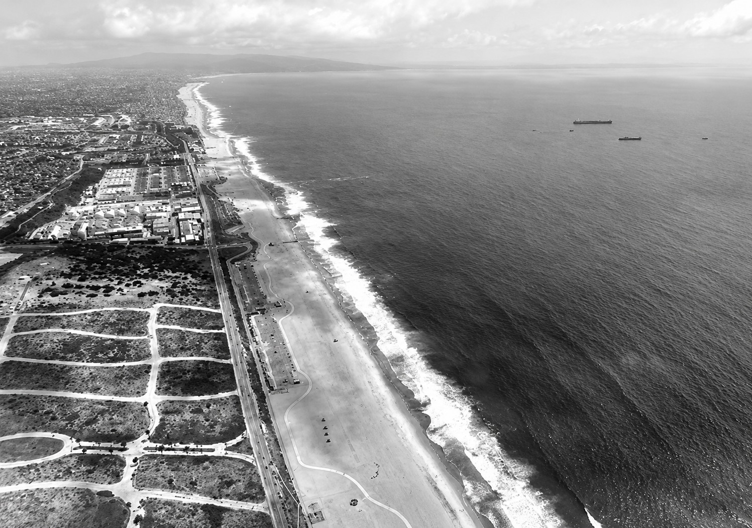
Dockweiler Beach |
Dockweiler State Beach stretches for nearly four miles along the Los Angeles coastline between Playa del Rey and El Segundo and remains one of the widest and most accessible public beaches in Southern California. Its broad shoreline, open views, and distinctive location beneath the departure corridor of Los Angeles International Airport (LAX) have made it a familiar destination for generations of Angelenos.Established in 1948 as part of Venice-Hyperion Beach State Park, the beach was renamed in 1955 in honor of Isidore B. Dockweiler, a prominent Los Angeles attorney and civic leader. Although part of the California state park system, Dockweiler is managed by the Los Angeles County Department of Beaches and Harbors.Unlike neighboring beaches shaped by boardwalks and commercial activity, Dockweiler developed a quieter identity centered on recreation, public access, and open space. Immediately inland once stood the residential community of Surfridge, removed during the expansion of LAX. Today the beach occupies the edge of a landscape reshaped by aviation, and its unusual relationship with aircraft remains one of its defining characteristics, with departing jets often climbing directly overhead. |
 |
|
| (2021)* - Dockweiler State Beach and El Segundo as seen shortly after departure from LAX. |
Historical Notes Dockweiler State Beach encompasses approximately 3.75 miles of shoreline across 91 acres of coastal land. Its broad sandy beach and open setting have made it one of Los Angeles County’s most recognizable public shorelines. Located directly beneath departure paths from LAX, Dockweiler offers one of the few places in Southern California where visitors can experience both open ocean views and close proximity to major international aviation activity. |
 |
|
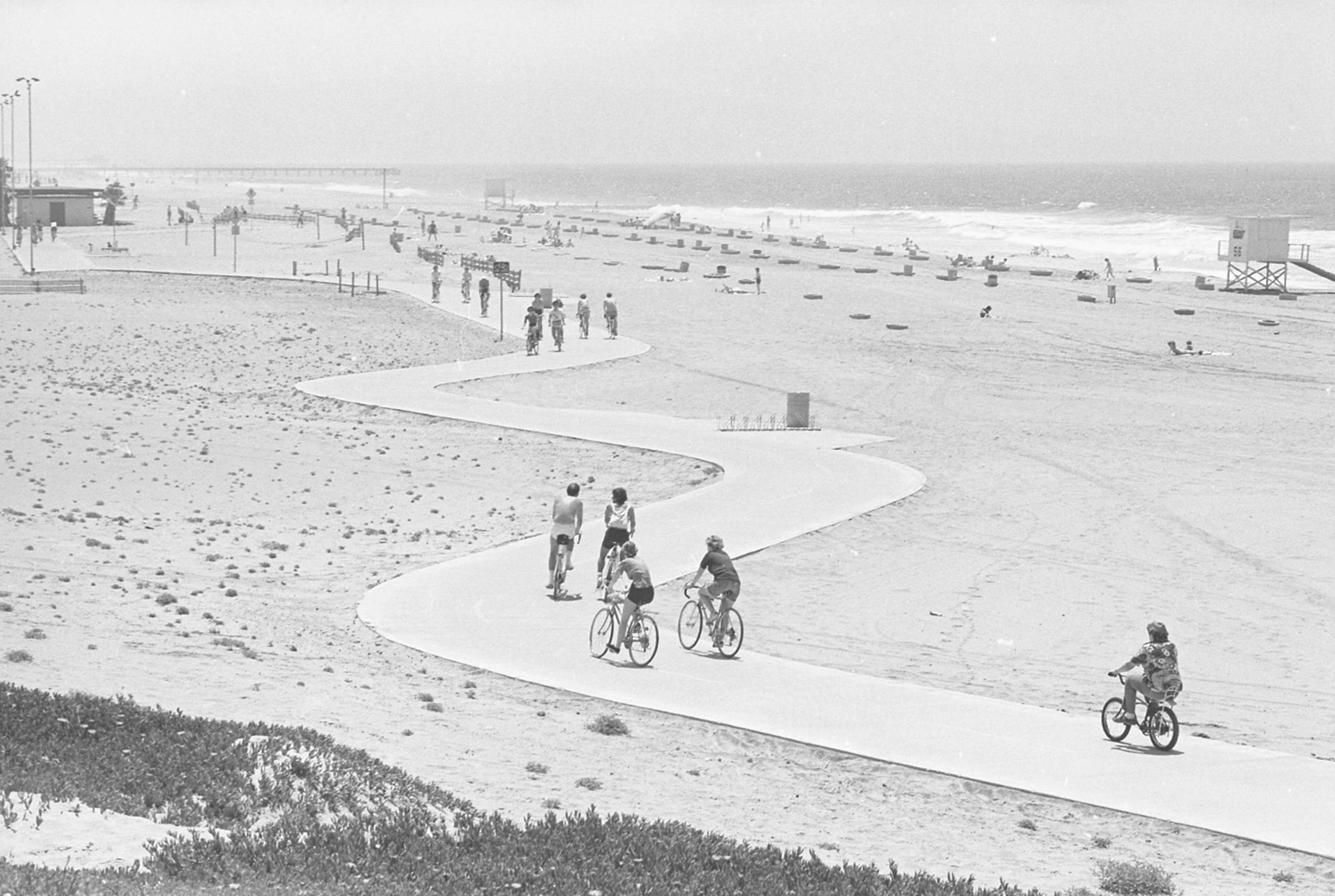
| (1976)* - Cyclists ride along the Dockweiler State Beach bike path on a hazy Southern California afternoon. |
Historical Notes The Dockweiler bicycle path extends from Ballona Creek south to the El Segundo city limit and connects with the larger coastal bicycle network. Today the route forms part of the 22-mile Marvin Braude Bike Trail, one of Southern California’s best known recreational corridors linking beaches across Santa Monica Bay. |
 |
|
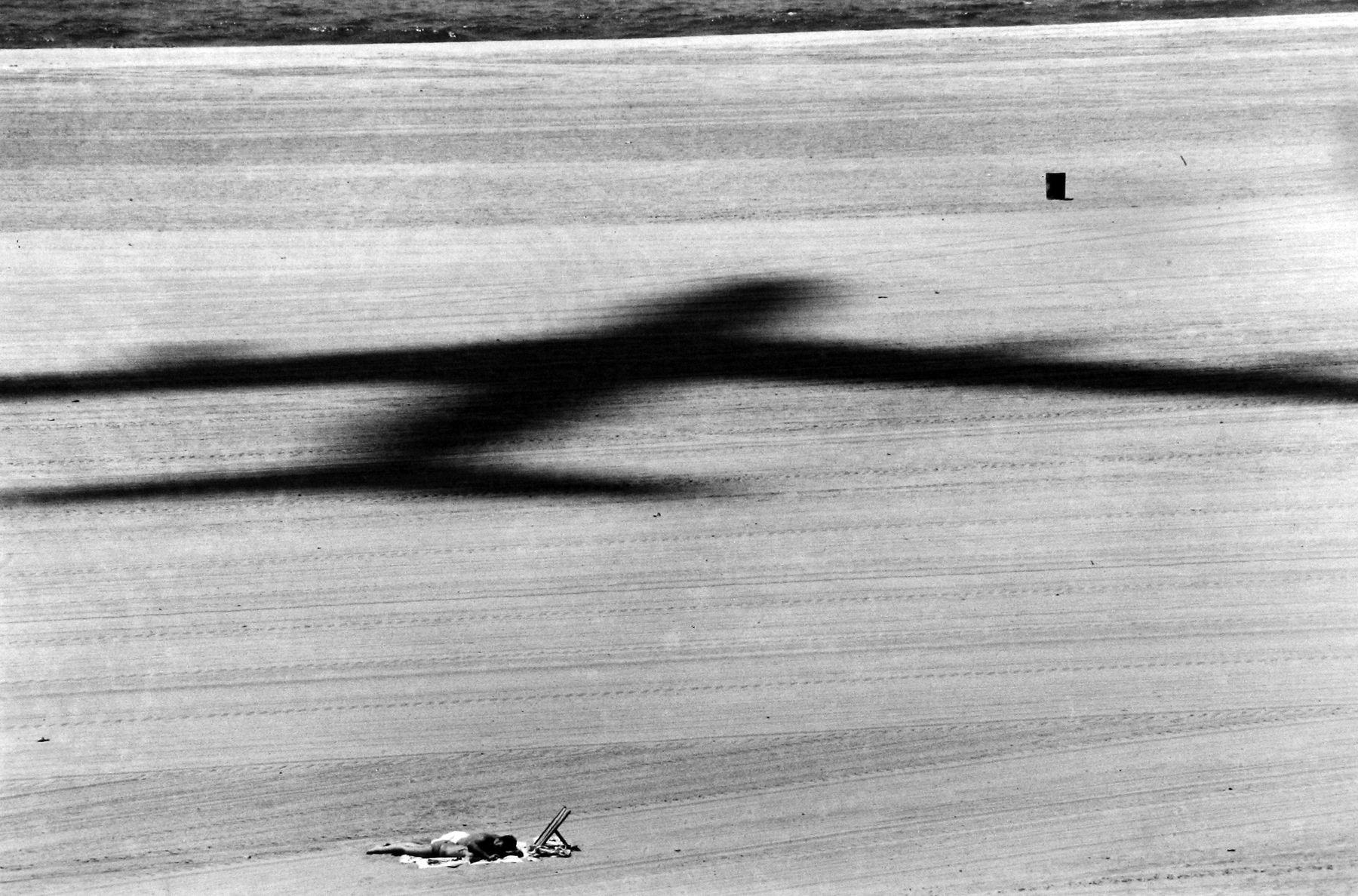
| (ca. 2000)* - A KLM Boeing 747 climbs after departing LAX and passes low over Dockweiler Beach. |
Historical Notes Departing aircraft follow a westbound route that carries them directly above portions of Dockweiler before turning toward their destinations. The unusual closeness of aircraft to the beach has made Dockweiler a favorite location for aviation enthusiasts and photographers and remains one of the beach’s defining visual experiences. |
 |
|
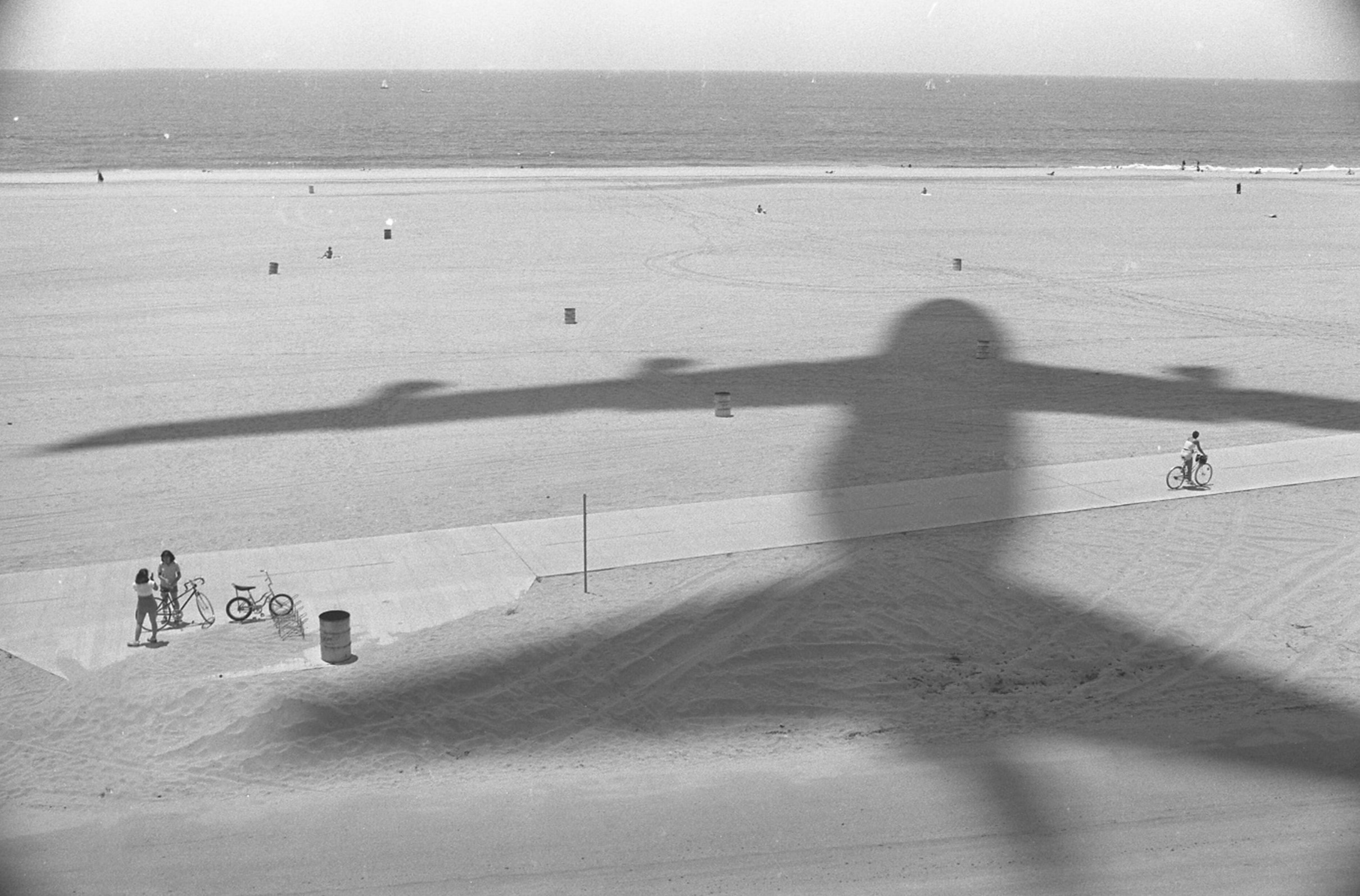
| (1979)* - The shadow of a departing Boeing 747 sweeps across the sand at Dockweiler Beach south of Playa del Rey. |
Historical Notes Few places in Los Angeles show the relationship between airport and coastline as vividly as Dockweiler. Large aircraft departing LAX create brief moments where sound, motion, and shadow become part of the beach experience itself. |
 |
|
| (1970s)* - A solitary moment at Dockweiler Beach before the crowds arrive. |
Historical Notes Despite its proximity to one of the busiest airports in the world, Dockweiler has long remained one of Los Angeles County’s more open and uncrowded beaches. Its broad shoreline and expansive setting continue to offer moments of solitude that contrast sharply with the urban landscape nearby. |
 |
|
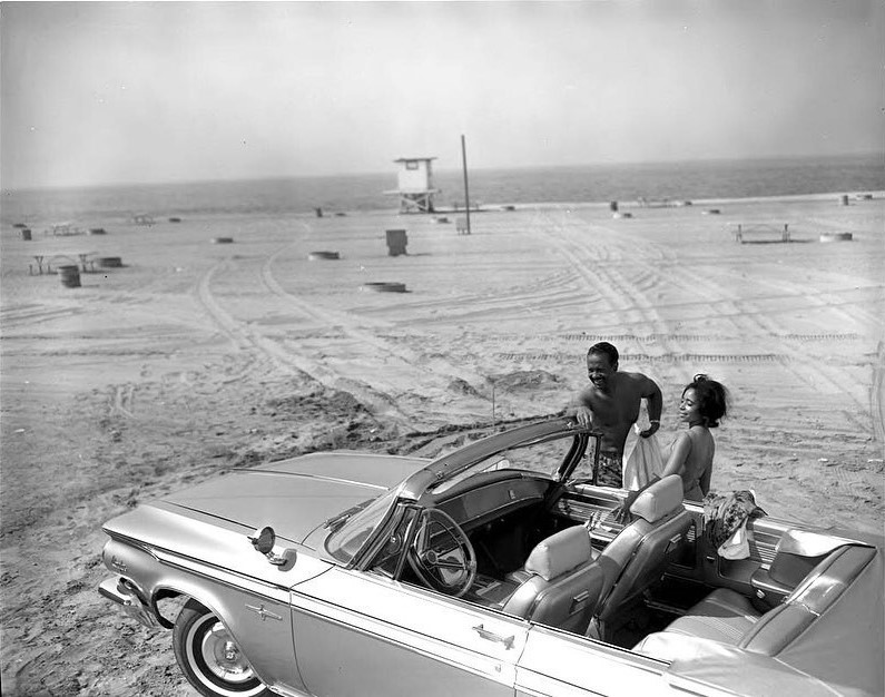
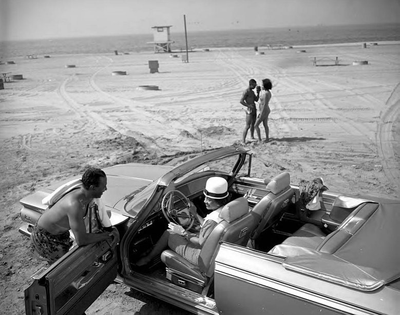
| (1963)* – A Chrysler 300 convertible takes center stage in this promotional photograph taken at Dockweiler Beach. Photo by Charles Williams. |
Historical Notes This image formed part of a broader shift in American advertising during the late 1950s and early 1960s as automobile companies began creating more inclusive campaigns for Black audiences. Photographer Charles Williams documented Black life, leisure, and civic activity throughout Los Angeles and left an important visual record now preserved at California State University, Northridge. |
 |
|
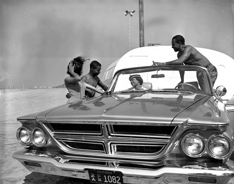
| (1963)* – Another promotional photograph taken at Dockweiler Beach. Photo by Charles Williams. |
Historical Notes The wide beach, open horizon, and uncluttered landscape made Dockweiler an appealing backdrop for photographers seeking a distinctly Southern California setting. |
 |
|
| (1963)* – Enjoying a day in the sun at Dockweiler Beach. Photo by Charles Williams |
Historical Notes Williams’ photographs captured moments of everyday recreation and community life often overlooked in mainstream publications of the period. Dockweiler’s broad shoreline and welcoming public setting helped make it a popular beach destination for many Los Angeles families. |
 |
|
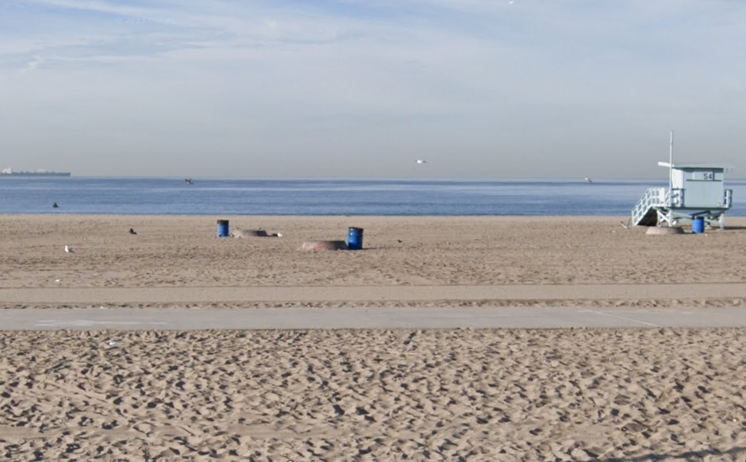
| (2022)* - Contemporary view of Dockweiler Beach. |
Historical Notes Dockweiler remains one of the few beaches in Los Angeles County where public fire rings continue to support beach bonfires, a tradition that attracts visitors year round. The beach also supports protected coastal habitat and continues to balance recreation, aviation, and environmental stewardship. Just inland, the restored dunes west of LAX now provide habitat for species including the federally endangered El Segundo blue butterfly, creating an unexpected connection between public recreation, modern aviation, and one of Los Angeles' lost coastal neighborhoods. |
* * * * * |
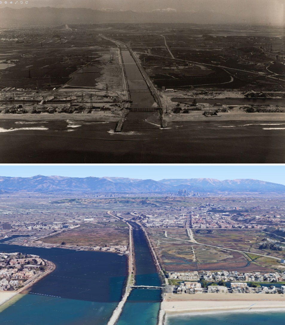
BALLONA CREEK AND MARINA DEL REY |
Long before sailboats filled the harbor and condominiums lined the waterfront, the land now known as Marina del Rey was a broad coastal wetland shaped by tides, seasonal flooding, and the flow of Ballona Creek into Santa Monica Bay. Salt marshes, freshwater ponds, and mudflats created one of Southern California's richest estuarine environments and supported abundant birdlife, fish, and seasonal migration across the Southern California coast.For much of the nineteenth and early twentieth centuries, the area remained largely undeveloped. Hunters, fishermen, and a small number of settlers used the wetlands while repeated flooding discouraged permanent construction. As Los Angeles expanded westward, new pressures emerged. Oil development spread across the coastal lowlands, flood control projects reshaped the creek and its banks, and transportation improvements gradually extended the city's reach toward the shore.By the middle of the twentieth century, the wetlands had become the site of one of Los Angeles County's most ambitious coastal projects. Through dredging, channelization, and large scale engineering, the former marshland was transformed into Marina del Rey, one of the world's largest man made small craft harbors. The remaining Ballona wetlands continue to serve as an important reminder of the landscape that once stretched across much of this coastline. |
Before Development
 |
|
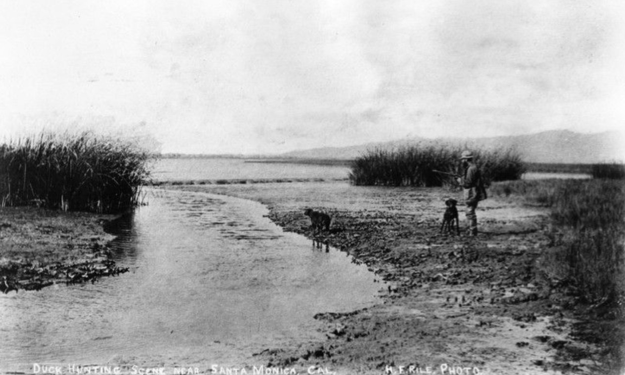
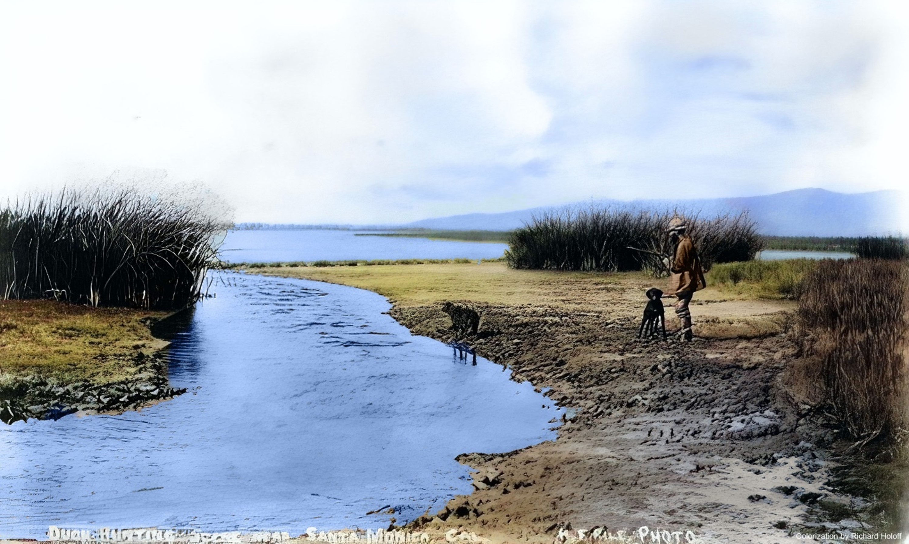
| (1890)* - Duck hunting in the Ballona wetlands near Santa Monica, in the area that would later become Marina del Rey. Photo by H. F. Rile. |
Historical Notes This rare photograph captures Ballona before modern development reshaped the coastline. In the late nineteenth century, the wetlands extended across a broad low lying plain near the mouth of Ballona Creek and formed one of Southern California's most productive estuarine environments. Freshwater flowing from inland watersheds mixed with tidal exchange from the Pacific, creating habitat that supported large seasonal populations of birds and wildlife. The wetlands attracted hunters, fishermen, and outdoor recreation while remaining largely beyond the reach of permanent development. Seasonal flooding and unstable ground discouraged construction, helping preserve the landscape well into the twentieth century. This image provides a rare record of the environment that existed before flood control, oil development, and harbor construction transformed the area. |
 |
|
| (1890)* - Duck hunting near Santa Monica on the Ballona lowlands; now Marina del Rey. Photo by H. F. Rile. Image enhancement and colorization by Richard Holoff. |
Historical Notes This colorized interpretation offers a modern perspective on the same landscape captured in H. F. Rile's original photograph. The added color helps reveal the openness of the marsh, the shallow water, and the broad horizon that characterized Ballona before major development altered the coastline. Within only a few generations, nearly everything visible here would change. Wetlands would be drained and portions of the landscape would support oil production. Ballona Creek would be channelized, and the harbor basin of Marina del Rey would eventually occupy land that had once been seasonal marsh and open water. |
Oil, Flood Control, and Transformation
 |
|
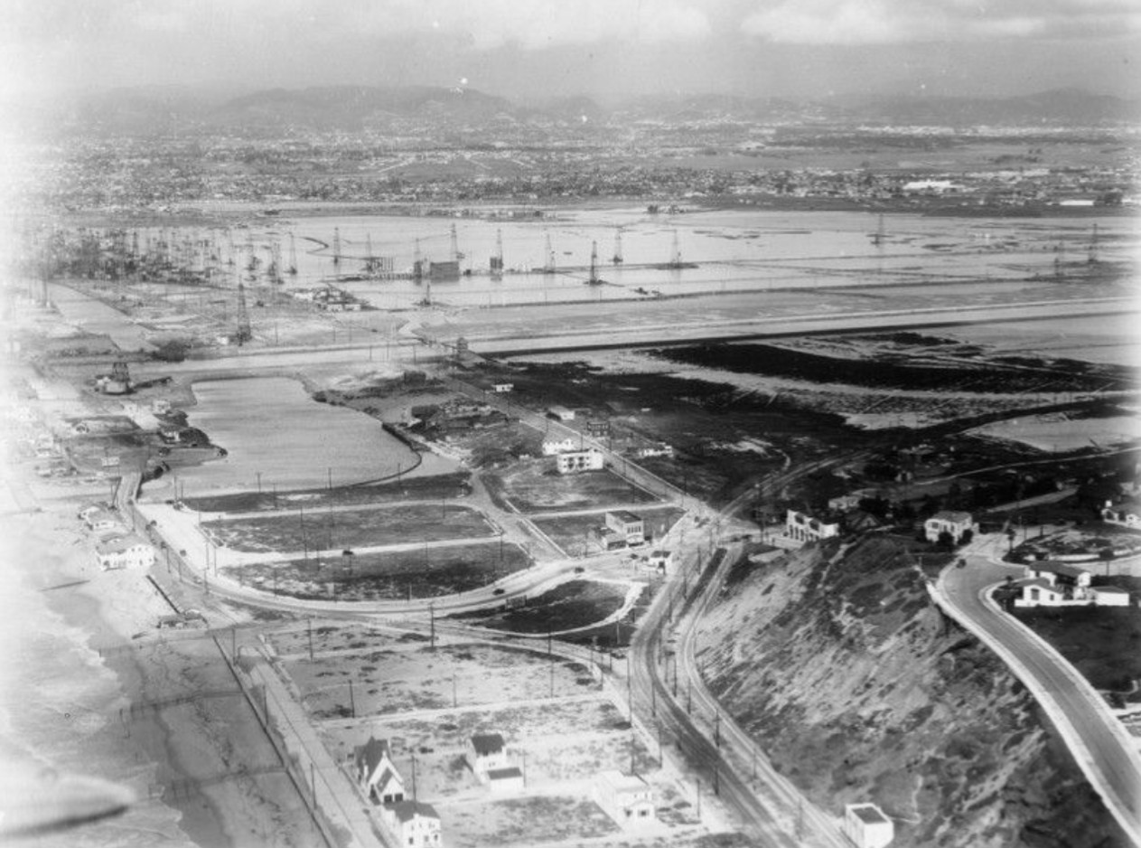
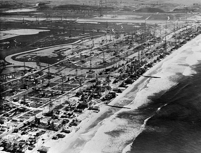
| (ca. 1929)* - Aerial view of Marina del Rey, with oil wells prevalent on the other side of Ballona Creek. Surfridge is visible at lower right. |
Historical Notes By the late 1920s, the coastal lowlands surrounding Ballona Creek had become part of Southern California's expanding oil industry. Derricks covered portions of the flat terrain that would later become Marina del Rey, while roads and support facilities extended across areas that had once been marshland and open water. The industrial landscape visible here helps explain why harbor proposals remained largely unrealized for decades. Oil production, existing infrastructure, and active leases made development of a recreational harbor difficult while petroleum extraction remained economically important. The Surfridge neighborhood visible at lower right would later become another chapter in the changing history of this coastline. |
 |
|
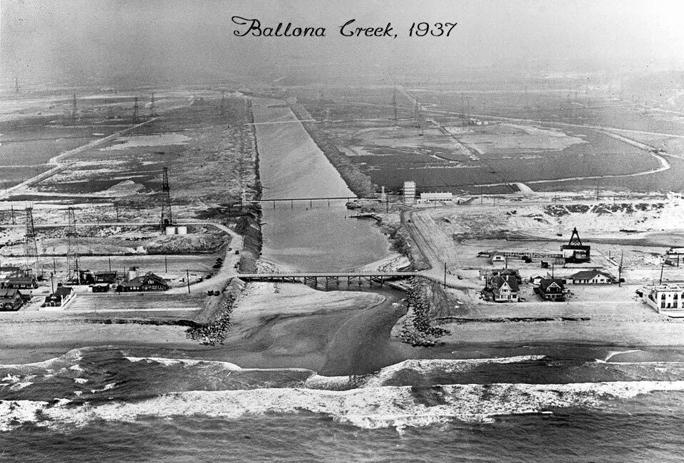
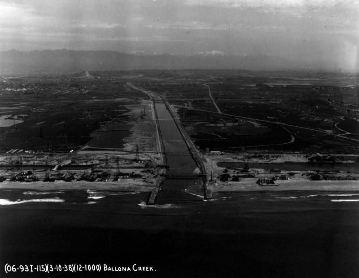
| (1937)* - View showing Ballona Creek as an enclosed flood control channel before its lower reaches were fully lined with concrete. The area at left would later become Marina del Rey. Photo Source: Marina del Rey Historical Society. |
Historical Notes For generations, Ballona Creek regularly overflowed during major storms, flooding nearby agricultural land and low lying coastal areas. As Los Angeles expanded westward, flood protection became increasingly important. This photograph captures a transitional moment before the creek assumed its modern form. The channel had already been reshaped and confined, but full concrete lining had not yet been completed. Within only a few years, Ballona Creek would become a controlled flood channel capable of moving stormwater quickly to the ocean and reducing the flooding that had long limited development across the surrounding lowlands. |
 |
|
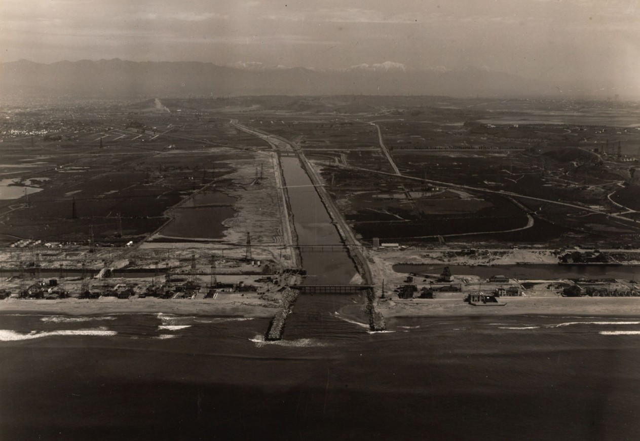
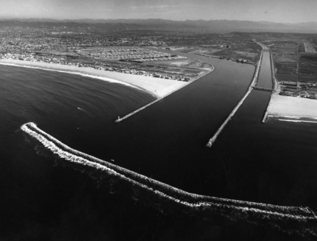
| (1938)* - Aerial view of the coastline centered on Ballona Creek lined with concrete walls as seen emptying into Santa Monica Bay near Marina del Rey. Oil rigs and bridges are visible on the beach and inland. |
Historical Notes This aerial records Ballona Creek shortly after its transformation into a concrete flood channel. The devastating Los Angeles floods of 1938 accelerated regional investment in flood control infrastructure and reinforced the push to manage waterways throughout the basin. At the same time, oil drilling remained active throughout the coastal zone visible here. The combination of flood control and declining industrial use gradually opened new possibilities for future land development. The engineered channel and altered landscape shown in this photograph created conditions that would later allow construction of Marina del Rey. |
 |
|
| (2022)* - Contemporary view of Ballona Creek, Marina del Rey, Playa del Rey, and surrounding area. |
Historical Notes Seen from above, the modern landscape reflects more than a century of deliberate transformation. The dredged harbor basin, channelized creek, residential neighborhoods, roads, and commercial development replaced what had once been a broad tidal wetland. Yet traces of the earlier environment remain. Portions of the Ballona Wetlands south of the creek continue to preserve fragments of the original estuary and have become the focus of ongoing restoration efforts intended to recover habitat and improve ecological function. |
Building Marina del Rey and the Modern Coast
 |
|
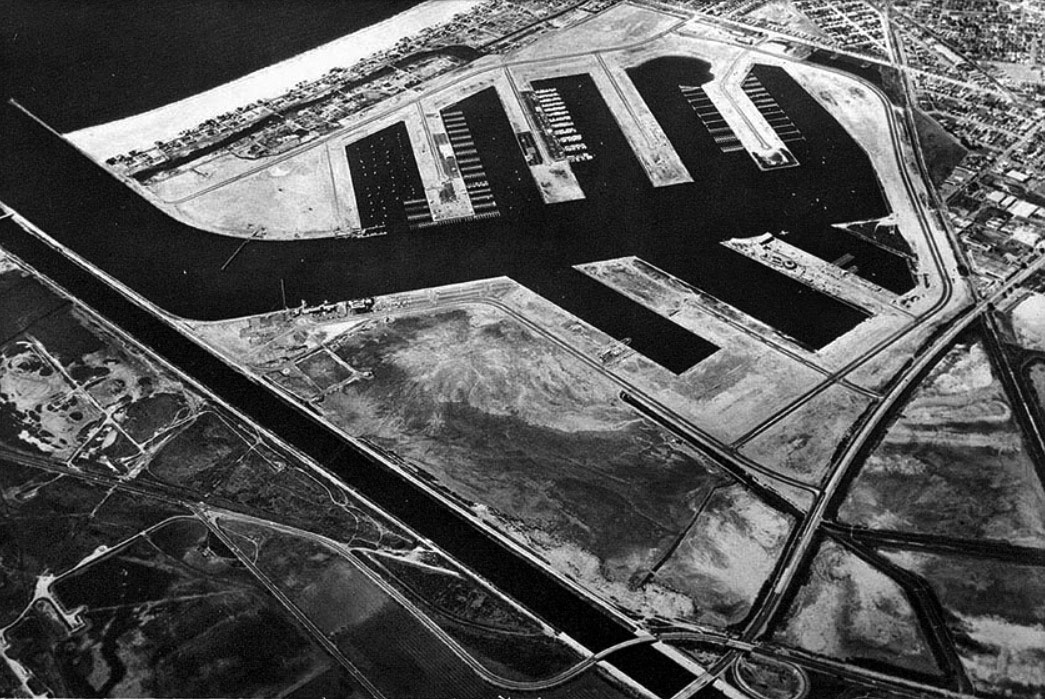
| (1938)* – Aerial view showing part of the Venice Oil Field and Playa del Rey. The area at center would become today's well known Marina del Rey harbor. Ballona Creek can be seen running horizontally from left to right at top. |
Historical Notes Before Marina del Rey was constructed, much of this land supported oil production. Derricks occupied the lowlands surrounding Ballona Creek and extended across terrain that had once been part of the broader wetland system. The eventual conversion of this industrial landscape into a recreational harbor reflected changing priorities in postwar Los Angeles. As oil production declined and demand for public waterfront access increased, Los Angeles County began planning for a marina that would combine boating, recreation, commercial activity, and residential development. |
 |
|
| (1964)* – Aerial view showing Marina del Rey with its first boats docked. Ballona Creek runs diagonally from lower center to upper left. |
Historical Notes After years of planning and construction, Marina del Rey began welcoming its first boats before the harbor was fully completed. The arrival of watercraft marked the beginning of a new identity for land that only a generation earlier had been occupied by wetlands and oil infrastructure. The project fulfilled a long standing vision of creating a harbor near the mouth of Ballona Creek, though in a form very different from earlier commercial port proposals. Instead of shipping and industry, the marina was designed around recreation and public access to the coast. |
 |
|
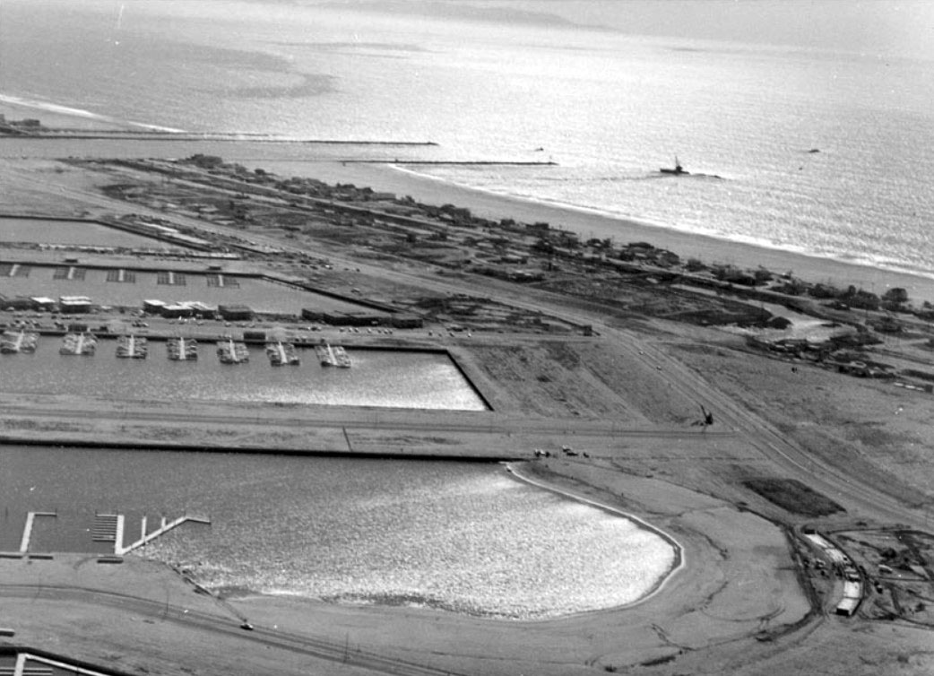
| (1965)* – View of Marina del Rey as it appeared in 1965 with the Inland Beach, now known as Mother's Beach, visible at lower right. |
Historical Notes Marina del Rey was formally dedicated in 1965 and quickly became a major destination for boating and recreation. The protected inland beach visible in this photograph was created as part of the original harbor design and became known as Mother's Beach. During construction, winter storms damaged portions of the developing marina and highlighted the need for greater protection from ocean conditions. Improvements made during this period helped stabilize the harbor and support its continued growth. |
 |
|
| (1968)* - Aerial view of Marina del Rey on October 16, 1968, showing the entrance to the marina and its breakwater. |
Historical Notes By 1968, Marina del Rey had matured from an engineering project into an active waterfront community. The completed breakwater protected the harbor entrance and made year round boating practical within the basin. Residential and commercial development expanded rapidly around the marina during the years that followed. Hotels, apartments, restaurants, and public spaces transformed the harbor into one of Southern California's most recognizable waterfront destinations. |
Before and After
 |
|
|
|
| (1938 vs. 1968) - Marina del Rey |
Historical Notes These two images show one of the most dramatic coastal transformations in Los Angeles County. In 1938, the area consisted primarily of oil fields, open lowlands, and the recently channelized Ballona Creek. By 1968, dredging, land reshaping, and harbor construction had created an entirely new landscape centered on recreation and public use. The comparison illustrates how quickly Southern California's coastline changed during the middle decades of the twentieth century. |
 |
|
| (2007)* - Aerial view showing Marina del Rey and Ballona Creek looking south. |
Historical Notes By 2007, Marina del Rey had evolved well beyond its original identity as a boating harbor. Residential towers, hotels, restaurants, and commercial development had become defining features of the waterfront while the marina continued to serve recreational boating. At the same time, attention increasingly shifted toward preserving and restoring nearby natural areas. The remaining Ballona wetlands became an important focus for environmental planning and habitat recovery. |
 |
|
| (ca. 2012)* - Aerial view showing the Marina del Rey as it appears today. |
Historical Notes Today, Marina del Rey reflects more than a century of changing priorities along the Los Angeles coast. Wetlands gave way to oil production, oil fields gave way to engineered infrastructure, and that infrastructure evolved into one of Southern California's most active recreational waterfronts. Although most of the original marshland disappeared, restoration efforts within the Ballona Wetlands preserve a visible connection to the landscape that existed before development transformed the shoreline. |
Then and Now
 |
|
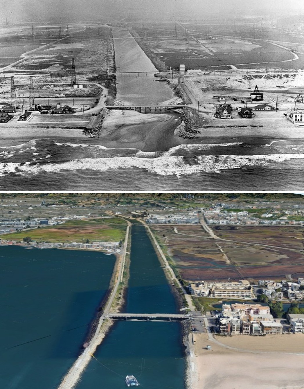
| (1938 vs. 2022)* – A then and now aerial view of Ballona Creek looking northeast from the Pacific. Photo comparison by Jack Feldman. |
Historical Notes Few places along the Los Angeles coast demonstrate change as clearly as these paired images. In 1938, open lowlands, oil production, and a newly engineered creek defined the landscape. By 2022, Marina del Rey occupied the same basin while residential communities and restored wetlands reshaped the surrounding shoreline. Together, these images bring the story full circle. What began as a broad coastal wetland became an industrial landscape, then a harbor, and now a place where recreation, urban development, and environmental restoration exist side by side. |
 |
|
| (1937 vs. 2025)* – Then and now aerial view of Ballona Creek looking northeast from the Pacific, showing the transformation of coastal wetlands into today's Marina del Rey and surrounding shoreline. Photo comparison by Jack Feldman. |
| Historical Notes
This comparison captures nearly ninety years of change at the mouth of Ballona Creek. In 1937, the landscape remained largely open despite early flood control work. Oil activity, scattered structures, and broad lowlands surrounded a creek that had only begun its transition from natural waterway to engineered channel. By 2025, the same view reveals a dramatically different coastline. Marina del Rey occupies land that was once part of the Ballona wetlands, while residential neighborhoods, roads, and recreational waterfront development extend across terrain that had historically flooded during winter storms and tidal cycles. Yet the transformation shown here is not simply a story of urban growth. Portions of the Ballona Wetlands remain visible south of the creek and continue to preserve fragments of one of Southern California's historic estuarine landscapes. Together, these images trace the evolution of the area from wetland to industrial corridor to recreational waterfront while reminding us that pieces of the original environment still endure. |
* * * * * |
Hyperion Treatment Plant |
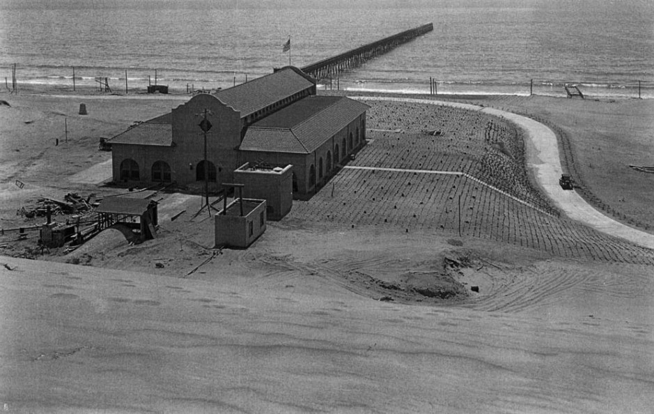
As Los Angeles grew from a small pueblo into a sprawling metropolis, the question of where the city's wastewater would go became increasingly urgent. In 1892, the city purchased 200 acres of oceanfront property at what is now Playa del Rey. Two years later, in 1894, it built an outfall pipe at this site and began discharging sewage directly into Santa Monica Bay. For the next three decades, wastewater flowed directly into the ocean with little or no treatment.By the early 1920s, rapid population growth and declining coastal water quality made a more permanent solution necessary. In response, the city built a screening plant in 1925 on the site that would become the Hyperion Treatment Plant. This early facility provided primary treatment, removing larger solids before the remaining wastewater continued offshore.What followed was a decades long evolution from a basic screening operation into one of the largest wastewater treatment facilities in the nation. The path included ambitious expansion plans during the Depression, the introduction of full secondary treatment in 1950, operational challenges brought on by continued growth, and major modernization efforts beginning in the 1980s. The photographs below trace this transformation. |
 |
|
| (ca. 1925)* - Initial Hyperion Treatment Plant (primary treatment only). Note the "sewage pier" with outfall pipe. |
Historical Notes This photograph shows Hyperion during its earliest years. The city had owned this coastal property since 1892 and selected it as the location for its ocean outfall system beginning in 1894. By the mid 1920s, growing concern over coastal water quality led the city to construct its first treatment facility. The screening plant shown here represented Los Angeles' first significant step beyond direct ocean disposal. Although treatment remained limited to basic screening and primary processes, the facility introduced a new approach to wastewater management. The long pier visible in the photograph carried treated discharge farther offshore. Even this modest facility required major supporting infrastructure including pipelines, pumps, and ocean discharge facilities. However, the plant would soon prove insufficient for a city whose population continued to grow rapidly. |
 |
|
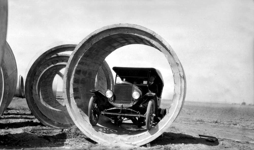
| (1920s)* - Concrete pipe for a segment of the North Outfall with a car inside. |
Historical Notes The scale of this concrete pipe, large enough to contain an automobile, illustrates the size of the infrastructure being built to support Los Angeles in the 1920s. This section formed part of the North Outfall Sewer, the major trunk line that collected wastewater from across the city and conveyed it to Hyperion. Photographs like this were often staged intentionally, placing a car or person inside the pipe to demonstrate scale to city officials and the public. Infrastructure of this size required substantial engineering, materials, and labor at a time when much of the surrounding area remained undeveloped. |
 |
|
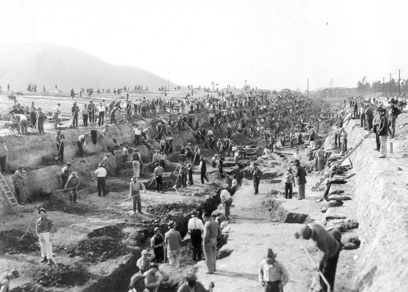
| (ca. 1937)* - View showing hundreds of workers moving sand behind the old Hyperion screening plant in preparation for a new sewage treatment plant planned by then City Engineer Lloyd Aldrich. |
Historical Notes This photograph captures an important transitional period in Hyperion's development. By the mid 1930s, City Engineer Lloyd Aldrich had developed plans for a much larger and more advanced treatment facility to replace the increasingly inadequate 1925 plant. The project coincided with the Great Depression, when public works projects also served as an important source of employment. Despite receiving approximately $7 million in federal funding, only a limited experimental facility was constructed and reports suggest it never entered full operation. As a result, Los Angeles entered the 1940s still relying largely on the original screening plant while more advanced treatment remained a future goal. |
 |
|
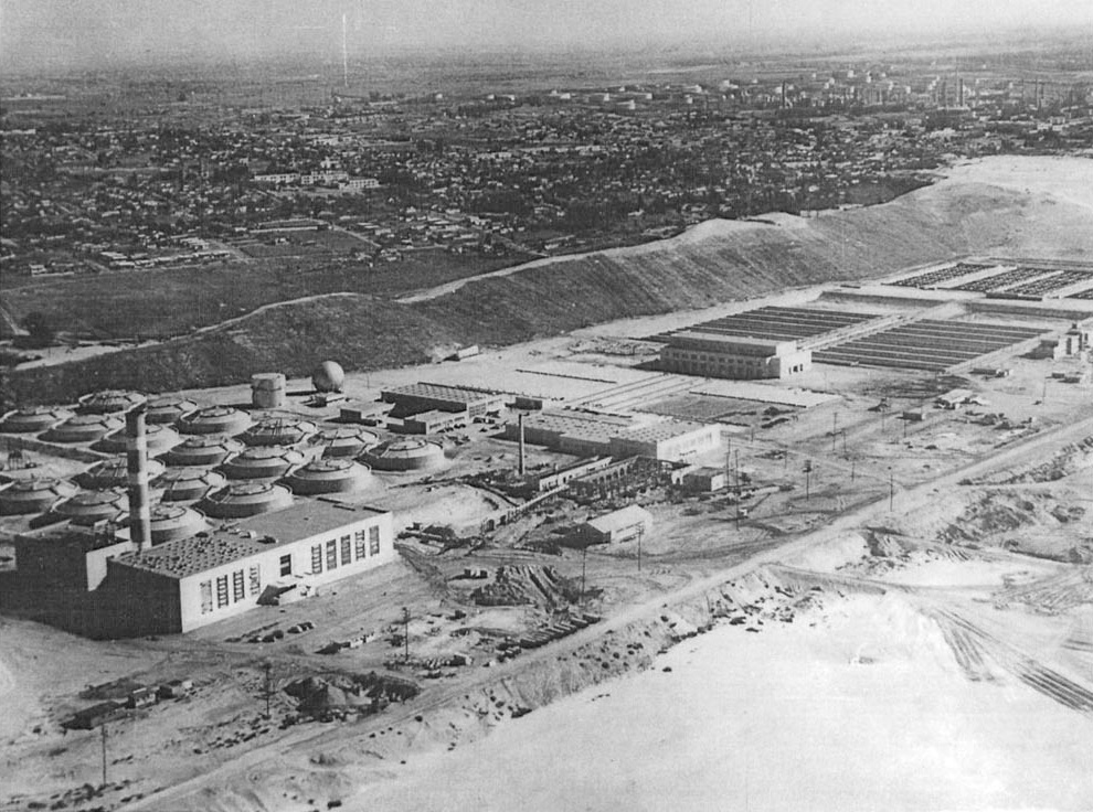
| (1952)* – View showing the Hyperion Sewage Treatment Plant located at 12000 Vista del Mar, Playa del Rey. |
Historical Notes This photograph shows Hyperion shortly after its major postwar expansion. In 1950, Los Angeles opened a full secondary treatment plant at the site, representing a major improvement over the earlier screening facility. The upgraded plant also captured biogas from anaerobic digesters and recovered useful materials from the treatment process. Rapid population growth soon challenged the plant's capacity. By 1957, treatment levels were reduced and a blend of primary and secondary effluent was discharged through a five mile outfall pipe, while digested sludge was transported offshore through a separate seven mile pipeline. Over time, decades of sludge disposal contributed to declining marine conditions in Santa Monica Bay. Studies later documented heavily affected seafloor conditions and continuing concerns about coastal water quality. These concerns ultimately led to regulatory action and major facility improvements. Beginning in 1980, Los Angeles launched the Hyperion Sludge Out and Full Secondary Treatment Program to eliminate ocean sludge disposal and improve treatment performance. The sludge out portion of the program was completed in 1987, marking an important turning point in the long recovery of Santa Monica Bay. |
* * * * * |
Hermosa Beach and Pier |
Hermosa Beach grew from open ranchland into one of Southern California’s most recognizable beach communities. Set along the southern curve of Santa Monica Bay, the city developed around residential life, recreation, rail access, and a close connection between downtown streets and the shoreline.The land that became Hermosa Beach was once part of the Rancho San Pedro land grant and later formed part of Rancho Sausal Redondo. In 1900, developers acquired approximately 1,500 acres of coastal land and organized the Hermosa Beach Land and Water Company to create a new seaside community.Unlike neighboring coastal towns that grew around ports, industry, or large amusement districts, Hermosa developed as a planned beach town. Streets were laid out, lots were subdivided, and transportation connections were developed to attract residents and visitors seeking ocean air, beach recreation, and convenient access from Los Angeles.Residents held the city’s first municipal election on December 24, 1906, and Hermosa Beach officially incorporated on January 14, 1907 as the nineteenth city in Los Angeles County. The name Hermosa comes from the Spanish word meaning beautiful, an appropriate name for a shoreline known for its broad sandy beach, ocean views, and outlook toward the Palos Verdes Peninsula. |
* * * * * |
Hermosa Beach |
From Ranchland to Seaside Community |
The earliest years of Hermosa Beach unfolded at a time when much of Southern California’s coastline remained lightly developed. Streets had only begun to appear, homes were scattered across the landscape, and the shoreline still retained much of its open character.These early photographs capture the physical beginnings of the community, the first homes, the original wooden pier, and the gradual shift from open coastal land into an identifiable town. Long before Hermosa became known for its beach culture and active waterfront, it began as a small collection of structures facing the Pacific. |
 |
|
| (ca. 1904)* - Early view of Hermosa Beach showing some of the city’s first homes, the Palos Verdes Peninsula in the distance, and the original wooden pier near the shoreline. |
Historical Notes This photograph captures Hermosa Beach while it was still in its earliest stage of development, with scattered homes rising above a mostly open coastal landscape. Developers Moses Sherman and Eli Clark, working through agents A. L. Burbank and Eugene Baker, acquired the land in 1900 and organized the Hermosa Beach Land and Water Company to sell lots and build the infrastructure needed for a new beach community. From the beginning, Hermosa Beach was promoted as a residential and recreational seaside town. Early planning emphasized orderly development, family-oriented living, and access to the beach. The wooden pier, completed in 1904, gave the young community a focal point and helped distinguish Hermosa as more than a real estate subdivision along the sand. |
 |
||
| (ca. 1904)* – The original wooden Hermosa Beach Pier extends into the Pacific, with early homes scattered across the dunes behind it. |
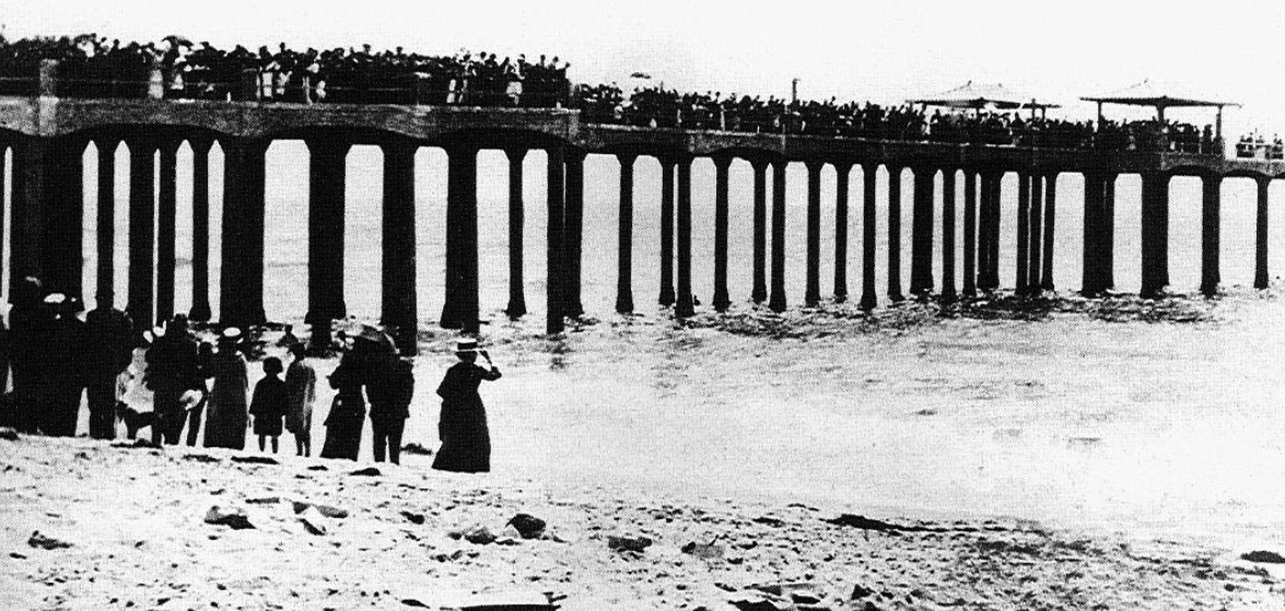
Historical Notes Hermosa Beach’s first pier was built in 1904, three years before the city incorporated. Constructed of wood and extending approximately 500 feet into the ocean, it served as an early gathering place for residents, fishermen, and visitors drawn to the new beach town. The wooden structure did not last long. In 1913, a powerful winter storm broke apart much of the pier and carried sections out to sea. The damage reflected a common challenge along the exposed South Bay shoreline, where wooden piers often struggled against heavy surf and winter storms. Its destruction led directly to the construction of a stronger concrete pier the following year. |
* * * * * |
Hermosa Beach |
The Pier and Downtown Hermosa |
When the storm of 1913 destroyed Hermosa Beach’s original wooden pier, the city responded with a more durable and ambitious replacement. Dedicated in 1914, the new concrete pier extended approximately 1,000 feet into the Pacific, twice the length of its predecessor, and was designed to better withstand the powerful winter surf that had damaged so many wooden piers along the South Bay coast.Soon after the new pier opened, an auditorium building rose at its foot, a structure that still anchors the entrance to Pier Avenue today. Over the decades it housed a changing mix of public functions including library services, the Chamber of Commerce, lifeguard operations, and community space, making the waterfront both a recreational and civic destination.For the next four decades, the short stretch of Pier Avenue leading to the shoreline formed the heart of downtown Hermosa Beach. As electric rail service gave way to buses and eventually the automobile, storefronts and civic buildings gradually adapted to changing patterns of travel. Through the Depression, the Second World War, and into the 1950s, Hermosa’s waterfront remained the city’s defining gathering place and most recognizable landmark. |
 |
|
| (1914)* – Crowds gather for the dedication of Hermosa Beach’s new concrete pier, filling the structure from shore to sea. |
Historical Notes Hermosa’s second pier replaced the storm damaged wooden structure completed just a decade earlier and represented a substantial investment in the city’s future. Built of concrete and paved with asphalt along its full 1,000 foot length, it was designed from the beginning to better withstand the winter storms that had destroyed its predecessor. Small tiled pavilions placed at intervals along the sides offered shade for fishermen and picnicking families, and a bait stand was eventually added at the far end. The dedication drew a crowd that filled the deck, a fitting beginning for a structure that would remain one of Hermosa Beach’s most recognizable landmarks for generations. |
 |
|
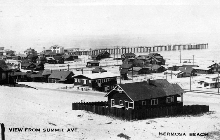
| (1914)* – Postcard view from Summit Avenue looking across rooftops toward the new concrete pier and the Pacific beyond. |
Historical Notes Postcards were among the most effective promotional tools available to Southern California beach communities during the early twentieth century, and Hermosa Beach was no exception. Elevated views like this one introduced prospective visitors and future residents to the shoreline and helped spread the city’s image far beyond Los Angeles County. Soon after completion of the new pier, an auditorium building was constructed near its entrance. Over time the structure housed public facilities including library services, lifeguard operations, visitor functions, and community gathering space. More than a century later, it remains part of the recognizable entrance to the pier district. |
 |
|
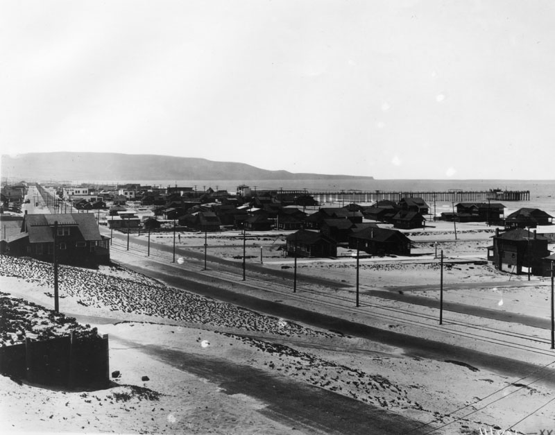
| (1918)* - Electric trolley tracks parallel the shoreline in this view of Hermosa Beach, with the Palos Verdes Peninsula stretching across the bay in the distance. |
Historical Notes The Los Angeles Pacific Railway introduced electric trolley service through Hermosa Beach in 1904, operating along Hermosa Avenue between Los Angeles and Redondo Beach. A few years later the route became part of the larger Pacific Electric Railway system, better known as the Red Cars. Reliable rail access transformed Hermosa from a relatively isolated shoreline into an easily reached beach destination and attractive residential community. The tracks running close to the sand, visible in this photograph, became one of the defining features of Hermosa’s early growth. |
 |
|
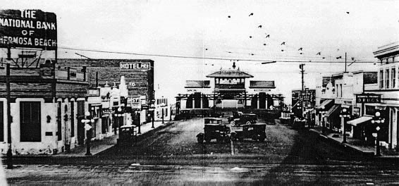
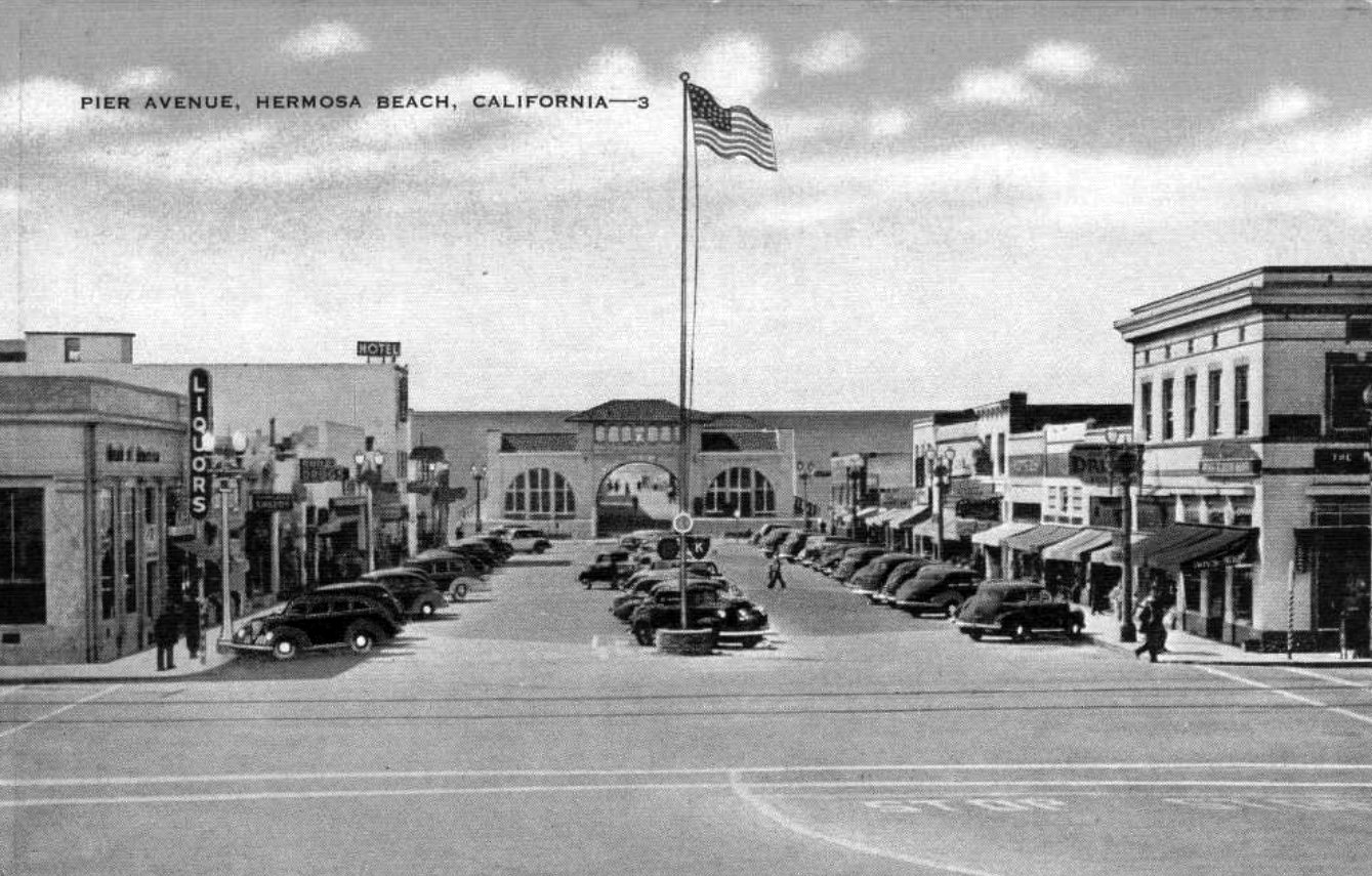
| (1920s)* – Looking west across Hermosa Avenue toward the entrance to Hermosa Beach Pier, now known as Pier Avenue Plaza. |
Historical Notes This view captures the traditional arrival experience for generations of visitors coming to Hermosa Beach. Overhead electrical lines powered Pacific Electric rail service while hotels, shops, and civic buildings framed the approach toward the ocean. Visible near the foot of Pier Avenue is the building that housed public functions including library services and lifeguard operations. The intersection of Hermosa Avenue and Pier Avenue remains one of the South Bay’s most recognizable gathering places and continues to serve as the symbolic center of Hermosa Beach. |
 |
|
| (ca. 1940)* - Small shops and a hotel line Pier Avenue looking toward the ocean, with a flagpole standing in the middle of the street and the pier entrance visible at the far end of the block. |
Historical Notes By 1940, Pier Avenue had evolved from a sandy access road into an established commercial street lined with businesses serving both year round residents and seasonal beach visitors. That same year, electric trolley service through Hermosa Beach came to an end when the Pacific Electric line was discontinued on May 12, 1940 and replaced by bus service. The flagpole standing in the center of the street reflects a civic design element common in small Southern California communities of the era. The waterfront beyond remained the city’s visual and social anchor as Hermosa gradually entered the automobile age. |
 |
|
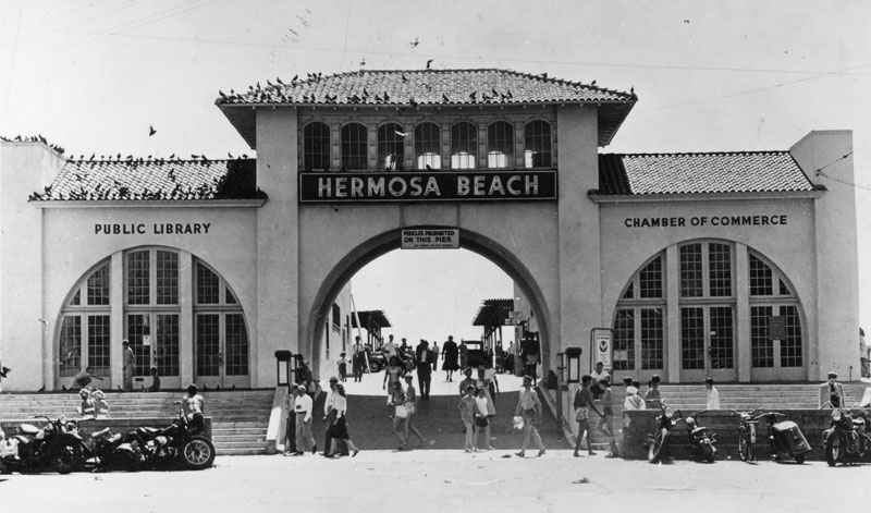
| (ca. 1947)* - Postcard view of the entrance to Hermosa Beach Pier with the Public Library on the left and the Chamber of Commerce on the right. |
Historical Notes The building at the foot of the pier, completed soon after construction of the concrete pier, had by the postwar years become one of Hermosa Beach’s most visible civic spaces. Housing a branch library alongside visitor and community functions, it reflected the city’s identity as both a residential community and a beach destination. By the late 1940s, the entrance area had become one of Hermosa Beach’s most active public spaces. Residents passed through to reach the library, visitors stopped for local information, and beachgoers moved between downtown and the shoreline. The scene reflects how closely civic life and recreation remained linked in Hermosa Beach through the middle of the twentieth century. |
 |
|
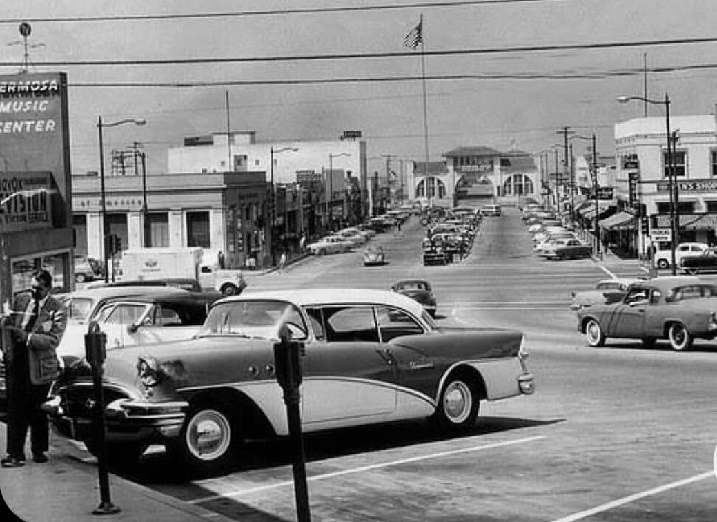
| (1955)* – A man inserts coins into a parking meter on Pier Avenue with Hermosa Beach Pier visible in the distance. |
Historical Notes Parking meters appeared in beach communities across Southern California during the 1950s as automobile ownership expanded and cities worked to manage increasingly crowded curb space. Where visitors once arrived by electric rail, most now came by car, changing both the appearance and daily rhythm of downtown Hermosa Beach. This photograph captures Hermosa during a period of transition, still anchored by the same pier and street layout established decades earlier, but increasingly organized around automobile traffic. The parking meter serves as a small but revealing symbol of how the city adapted to changing travel patterns. |
 |
|
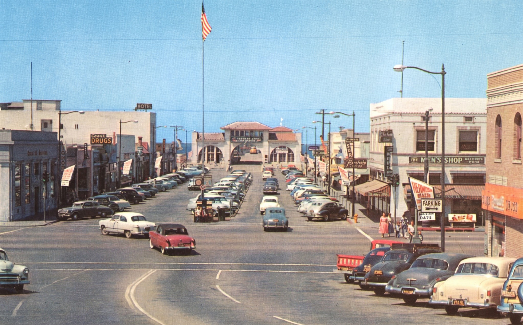
| (1956)* - Looking down Pier Avenue toward The Strand and the ocean beyond. Photograph by George Elton Watson. Color restored from the original postcard image. See original HERE. |
| Historical Notes
By 1956, Pier Avenue had become a fully developed commercial corridor serving a community that had grown far beyond its early resort town origins. Storefronts, sidewalks, and automobile traffic reflected a city increasingly oriented toward year round residential life. This image closes the pier’s first four decades as the center of downtown Hermosa Beach, carrying the city from its early concrete waterfront era through the Depression, the Second World War, and into the automobile age. Though resurfaced and modified over time, the pier remained the constant landmark tying these decades together. |
* * * * * |
Hermosa Beach |
Beach Culture and Resort Era |
While the pier and downtown gave Hermosa Beach its civic backbone, the sand itself remained the city’s greatest attraction. Through the 1920s and 1930s, Hermosa expanded its resort infrastructure along the Strand with facilities that made beach recreation easier and more comfortable for visitors and residents alike.Bath houses, small storefront businesses, and gathering places created a more complete seaside experience beyond simply swimming and sunbathing. Families arrived for the day, visitors came by rail and later by automobile, and seasonal crowds helped shape Hermosa Beach into one of Southern California’s most recognizable ocean communities.The most ambitious expression of this resort era came with development of the Surf and Sand Club. Though its original private club model proved relatively short lived, the project reflected Hermosa’s growing confidence and its attempt to combine public beach culture with a more refined coastal identity. Together, these images show a city evolving from a young beach town into a mature recreational destination. |
 |
|
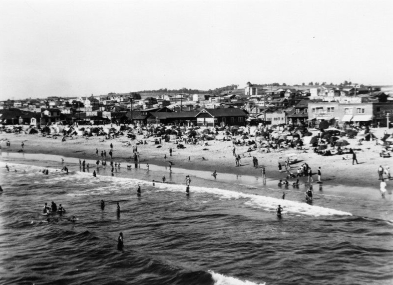
| (1923)* - Beachgoers crowd the shoreline at Hermosa Beach while swimmers and waders enjoy the surf on a busy summer day. |
Historical Notes This photograph captures Hermosa Beach during the early years of its development as a recreational destination. By the 1920s, improved transportation and growing regional popularity brought increasing numbers of visitors to the shoreline, turning summer weekends into lively public gatherings. The scene reflects a period before surfing and volleyball became defining parts of Hermosa’s identity. Beach activity centered on swimming, socializing, and simply spending time at the ocean, traditions that helped establish the relaxed coastal culture that still defines Hermosa Beach today. |
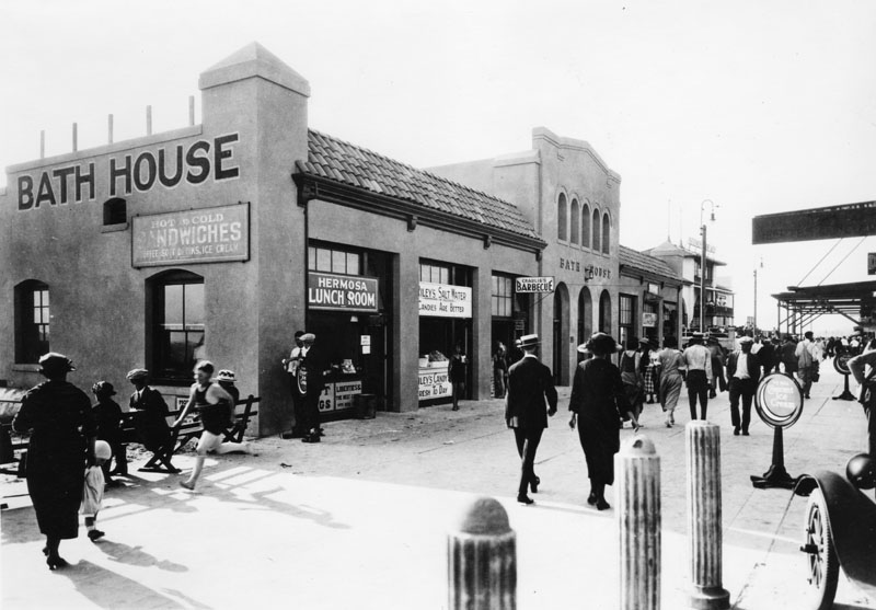 |
|
| (1923)* - The Strand Bath House anchors a small commercial strip that includes the Hermosa Lunch Room, Riley’s Salt Water Candies, and Charlie’s Barbecue. |
Historical Notes This closer view shows the modest scale of Hermosa’s early beachfront business district, where a handful of family operated establishments served visitors arriving for a day at the beach. Similar combinations of food stands, candy shops, and recreation facilities became common throughout Southern California coastal communities. The Bath House also served a practical purpose at a time when many visitors did not have convenient places to change or rinse off after swimming. As Hermosa matured into a larger residential city, structures like these gradually disappeared and gave way to newer forms of development. |
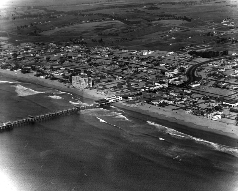 |
|
| (1924)* - An aerial view looking northeast shows Hermosa Beach’s oceanfront filling in with homes, the pier extending into the surf, and construction activity associated with the future Surf and Sand Club visible near the shoreline. |
Historical Notes This aerial view captures Hermosa Beach during a period of steady growth as residential development concentrated near the ocean while large areas inland remained comparatively open. The city’s expansion reflected both improved transportation access and the growing popularity of Southern California’s beach communities. Construction of the Surf and Sand Club had begun by this period. Designed in 1923 by the Pasadena architectural firm Hunt and Chambers, the project represented one of Hermosa Beach’s most ambitious resort developments and reflected the city’s growing confidence as a coastal destination. |
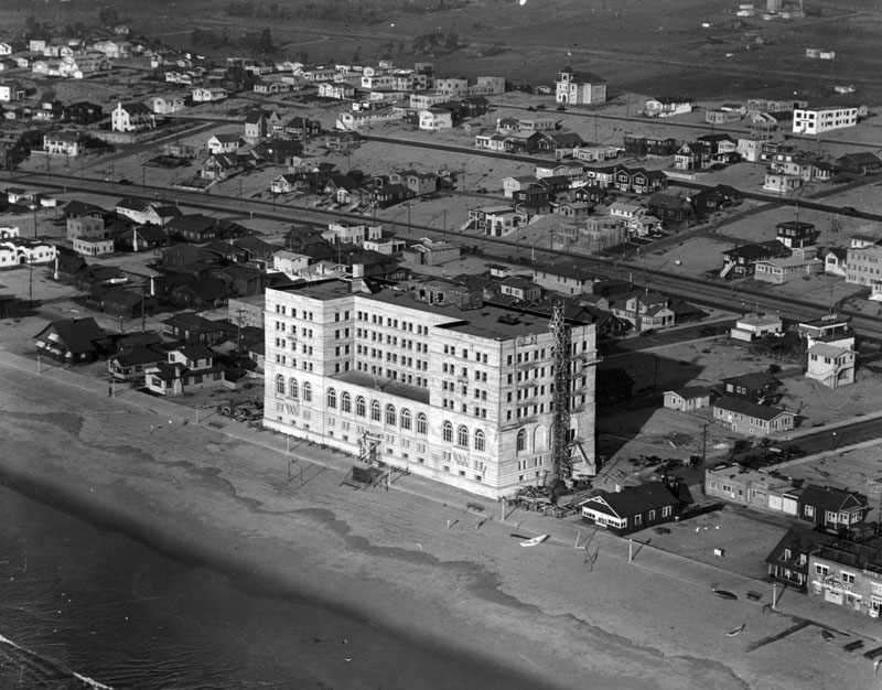 |
|
| (1924)* - A closer aerial view shows construction of the future Surf and Sand Club along the Hermosa Beach oceanfront, with surrounding residential development continuing nearby. |
Historical Notes Construction on the Surf and Sand Club was underway by 1924, with the cornerstone laid in May of that year. The large oceanfront project would open in stages beginning in 1925 and reached completion by 1926, becoming one of Hermosa Beach’s most prominent resort era landmarks. Though developed as a private club, the project stood directly beside an active public shoreline and reflected Hermosa’s effort to expand beyond a simple beach town into a more developed recreational destination. |
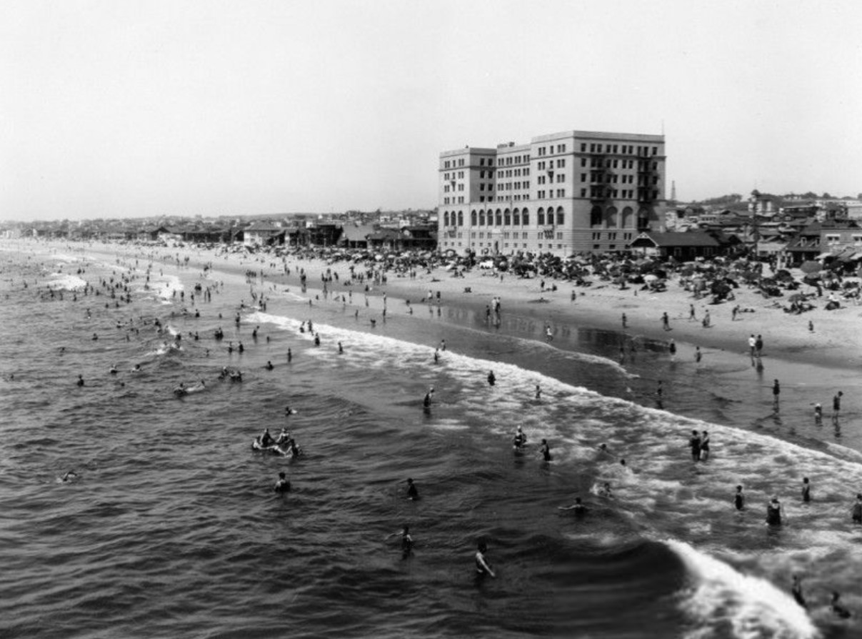 |
|
| (ca. 1930)* - Crowds relax beneath beach umbrellas and wade into the surf with the Surf and Sand Club rising behind them. |
Historical Notes By 1930, the Surf and Sand Club had become one of Hermosa Beach’s most recognizable oceanfront landmarks. Though intended as a private membership club, it stood directly beside an active public beach filled with families and day visitors. The contrast visible here reflects an important part of Hermosa’s character during this period. Exclusive recreational spaces and open public shoreline existed side by side, helping create a beach culture that appealed to a broad range of visitors. |
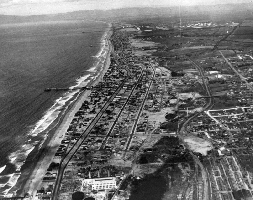 |
|
| (1925)* - An aerial view stretches from Hermosa Beach south into Redondo Beach, with the Pacific Light and Power Corporation plant visible near the bottom of the frame. |
Historical Notes The power plant visible in this photograph was originally built in 1902 to help supply electricity for the growing electric railway system serving Los Angeles and surrounding communities. Southern California Edison later acquired the facility and expanded operations at the site. This broader aerial view shows that Hermosa Beach developed alongside the infrastructure that powered regional growth. Recreation, transportation, and industry existed together across the South Bay landscape. Click HERE to see more in Early Power Generation. |
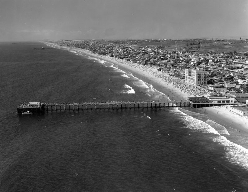 |
|
| (1932)* - An aerial view centers on Hermosa Beach Pier and the Surf and Sand Club along the oceanfront. |
Historical Notes By 1932, the Surf and Sand Club had already moved beyond its original private membership model as operators struggled to sustain an exclusive private beach club during the early years of the Great Depression. Ownership changed several times and the property gradually shifted toward hotel use, eventually becoming known as the Hermosa Biltmore Hotel. The building remained a prominent landmark on Hermosa’s shoreline for decades afterward. During World War II it briefly served as a federal youth training facility before later returning to private use. The structure was ultimately demolished in the late 1960s and the site later became public open space. |
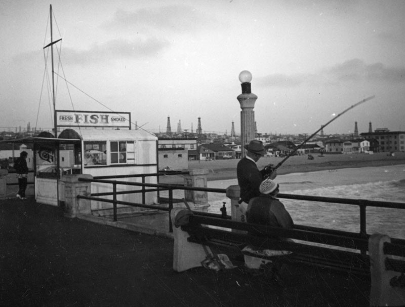 |
|
| (ca. 1937)* - A fisherman casts a line from Hermosa Beach Pier while a small stand behind him sells smoked fish. |
Historical Notes Photographer Herman Schultheis documented everyday scenes throughout Los Angeles during the 1930s and 1940s, and this quiet fishing moment captures one of the pier’s most enduring roles as a place for recreation and simple routine. Oil derricks visible in the distance reflect the broader industrial landscape of the South Bay during this era. Although the exact field visible in this image has not been confirmed, scenes like this illustrate how recreation, industry, and coastal life often existed side by side along the Southern California shoreline. |
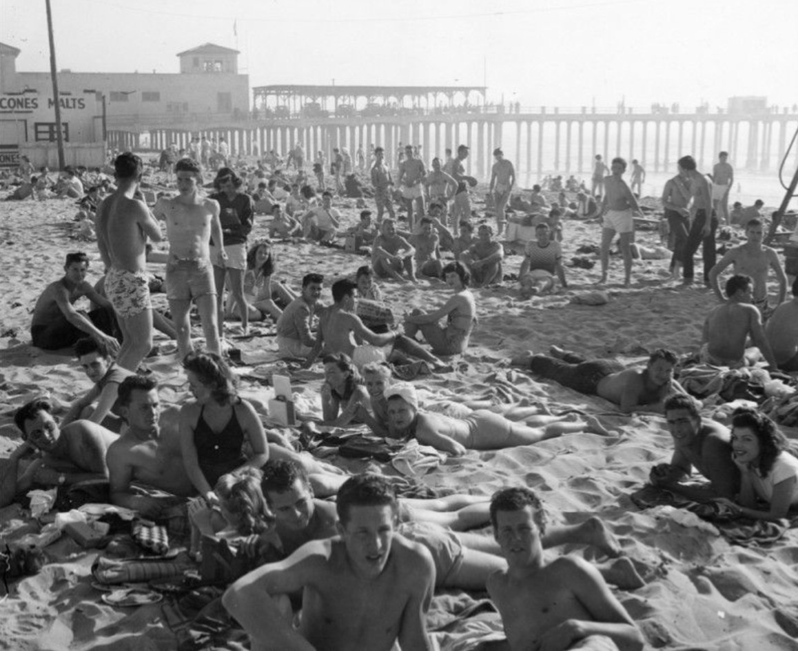 |
|
| (ca. 1950)* - Young adults gather on the sand near Hermosa Beach Pier on a busy beach day. |
Historical Notes This photograph captures Hermosa Beach during the height of Southern California’s postwar beach culture, when growing prosperity and increased automobile ownership brought larger crowds to coastal communities throughout the region. The pier and surrounding beachfront remained the center of activity. Details visible in the image, including automobiles, clothing styles, and beach activity, support a late 1940s to early 1950s date and help illustrate how rapidly Southern California’s recreational culture expanded after the Second World War. |
* * * * * |
Hermosa Beach |
The Strand and Changing Coastline |
By the second half of the twentieth century, Hermosa Beach had largely completed its transition from a seasonal resort town into a year round residential community centered on its shoreline. While the beach remained the city’s defining attraction, daily life increasingly revolved around permanent neighborhoods, local businesses, and a growing identity shaped by recreation and outdoor living.The Strand evolved along with the city. Early wooden walkways and modest beachfront buildings gradually gave way to paved promenades, denser residential development, and a more active public waterfront. Surf culture, beach volleyball, walking, cycling, and casual outdoor gathering became increasingly associated with Hermosa Beach during these decades.The images in this chapter show that while buildings, transportation, and patterns of recreation continued to change, the relationship between the city and the ocean remained remarkably consistent. More than a century after Hermosa’s founding, the shoreline still serves as the center of community life. |
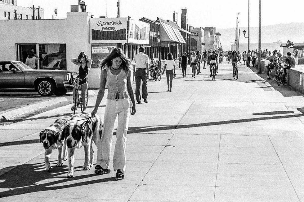 |
|
| (1970s)* - Pedestrians and cyclists move along the Strand as Hermosa Beach takes on the relaxed recreational identity familiar today. |
Historical Notes By the 1970s, the Strand had evolved into a paved public promenade linking neighborhoods, beaches, and commercial areas along the South Bay coastline. What began as a more modest beachfront walkway became one of Hermosa Beach’s defining public spaces. The city’s beach culture had also changed. Surfing, beach volleyball, cycling, and a more informal outdoor lifestyle increasingly shaped the public image of Hermosa Beach, replacing many of the organized resort amenities and private clubs that characterized earlier decades. |
Then and Now (1970s)
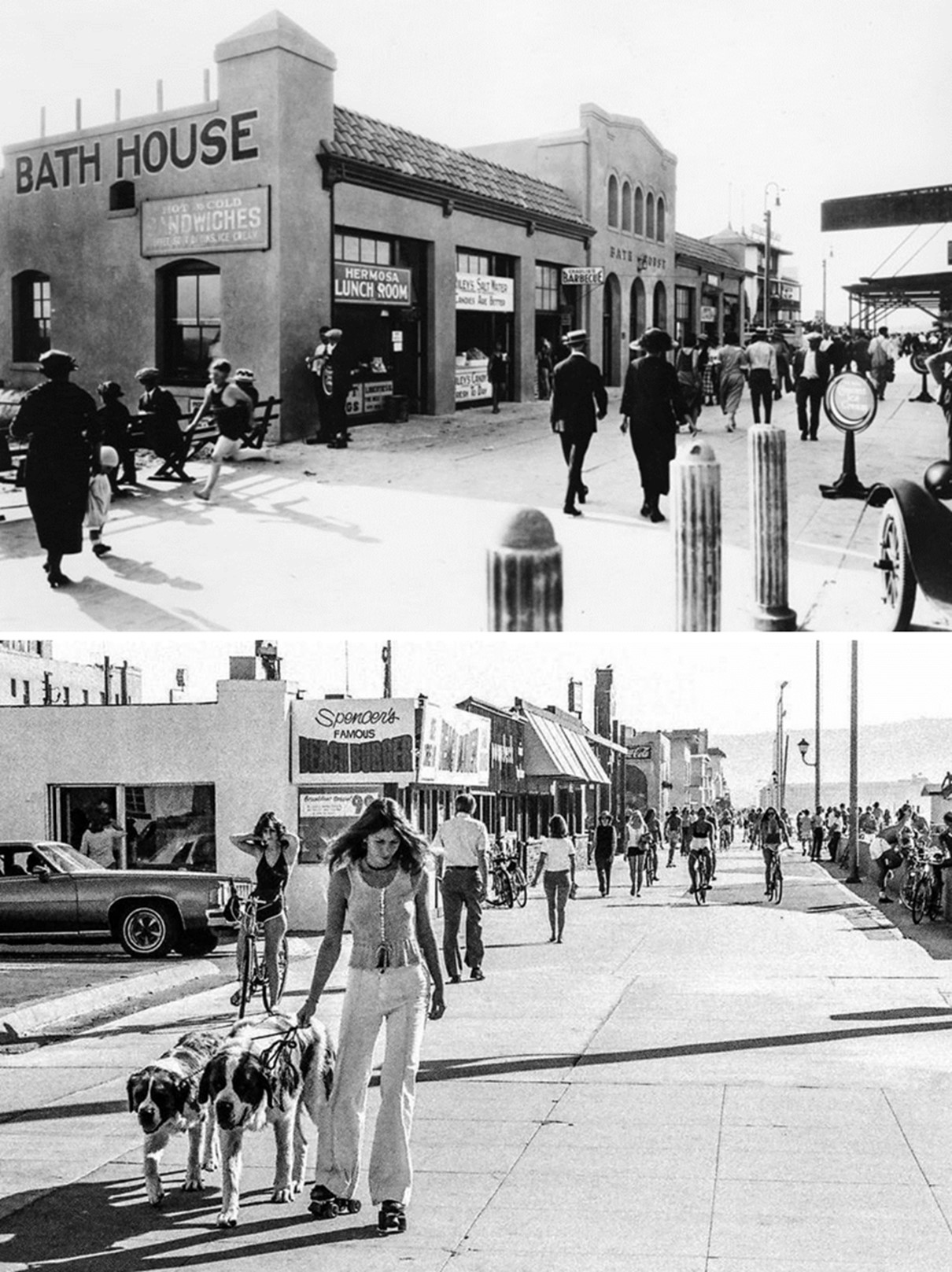 |
|
| (1920s vs 1970s)* – Then and now comparison of the Hermosa Beach Strand across roughly fifty years. Photo comparison by Jack Feldman. |
Historical Notes The earlier image shows a Strand still closely tied to its resort era origins, with modest development and a simpler relationship between buildings and the beach. By the 1970s, the shoreline had become more intensely developed while remaining publicly accessible. Comparisons like this reveal that change in Hermosa Beach occurred gradually rather than through dramatic redevelopment. Small decisions repeated over decades shaped the modern coastline while preserving its connection to the ocean. |
Then and Now
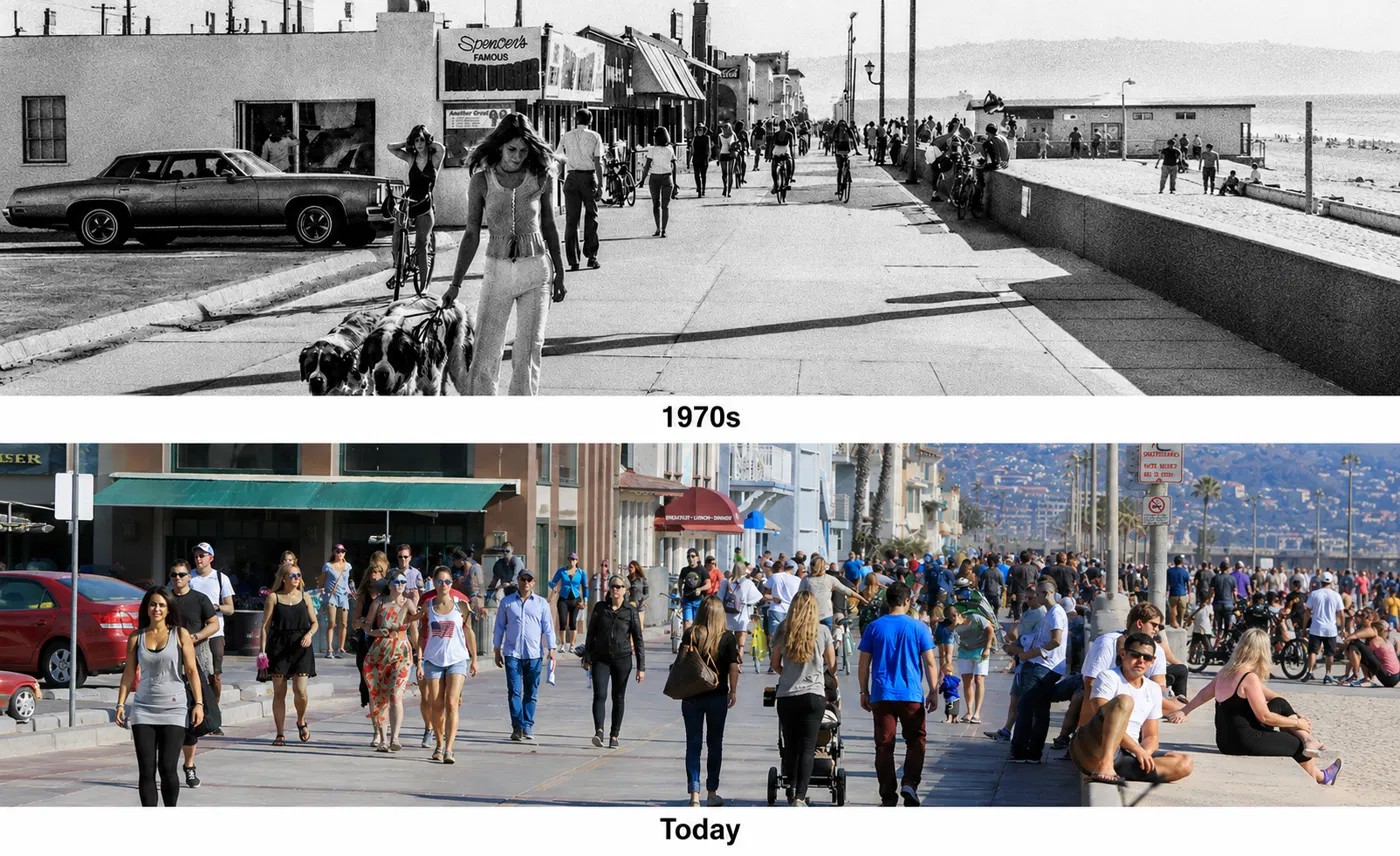 |
|
| (1970s vs 2016)* – A second then and now comparison carries the story forward another half century along the Hermosa Beach shoreline. The modern image was prepared from contemporary source imagery and lightly enhanced for visual continuity and comparison. Click HERE for the original image. Photo comparison by Jack Feldman. |
Historical Notes The more recent comparison shows a different kind of transformation. Instead of broad structural change, the differences appear in architecture, landscaping, density, and changing patterns of everyday life along the Strand. Taken together, these paired views span roughly a century of Hermosa Beach history. The details continue to evolve, but the essential relationship remains unchanged: homes facing the ocean, people gathering outdoors, and the shoreline serving as the city’s defining public space. |
* * * * * |
Redondo Beach |
Early Resort, Port, and Waterfront |
Long before Redondo Beach became known for its pleasure piers and recreational coastline, the city emerged as one of Southern California's most ambitious seaside developments. In 1889, the Redondo Beach Improvement Company purchased 433 acres from the Dominguez family and set in motion the rapid transformation of the shoreline. Within a year, the grand Hotel Redondo opened, rail connections extended to the waterfront, and the first wharves were built to support commerce and tourism.During the late 19th and early 20th centuries, the district centered around Pacific Avenue and the beach below became one of Southern California's busiest coastal destinations. Schooners unloaded timber at the piers while visitors arrived by Santa Fe Railway and later by electric streetcar. Hotels, pavilions, restaurants, boardinghouses, and recreational attractions created a lively waterfront that briefly positioned Redondo Beach as both a resort community and an aspiring commercial port.This section traces Redondo Beach through its formative decades with photographs documenting the Hotel Redondo, early wharves, the A.R. Schafers Casino, waterfront businesses, and the Pacific Light and Power steam plant. Together these images capture the period when Redondo Beach evolved from an ambitious coastal development into one of Southern California's defining seaside communities. |
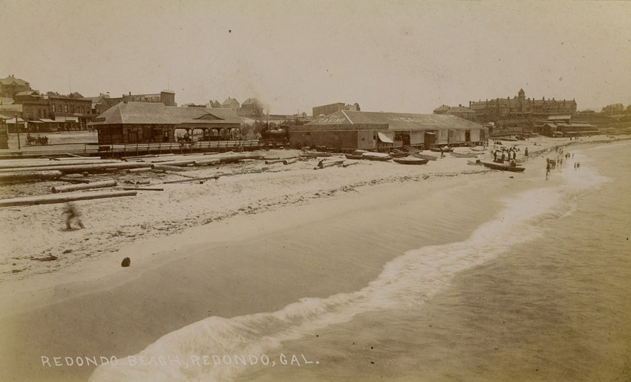 |
|
| (ca. 1896)* - Image of people, boats, and lumber on the beach with the Redondo Beach Hotel (also known as Hotel Redondo), on the hill at right, and a restaurant, boardinghouse, and market on Pacific Avenue in the background in Redondo Beach, California. Signs on the buildings read "Casino" and "John Weilands lager draught." A passenger train depot for the Santa Fe Railway is visible on the beach at right, with a locomotive and signs "Redondo" and "Santa Fe Route." Photo from the Ernest Marquez Collection. |
Historical Notes This photograph captures Redondo Beach during its earliest years of organized development, when the shoreline functioned as both a resort destination and a working waterfront. Boats, lumber operations, rail service, and beachfront businesses illustrate the multiple roles the young community played in Southern California's growing economy. The transformation began in 1889 when the Redondo Beach Improvement Company acquired approximately 433 acres from the Dominguez family and launched plans for a new seaside community. The opening of the Hotel Redondo in 1890 established the city as an upscale resort destination, while rail connections and the deep offshore submarine canyon encouraged ambitions of creating a major commercial harbor. Although Redondo ultimately evolved into a recreation focused coastal city rather than Los Angeles' principal port, these early years established the foundations of the community that followed. |
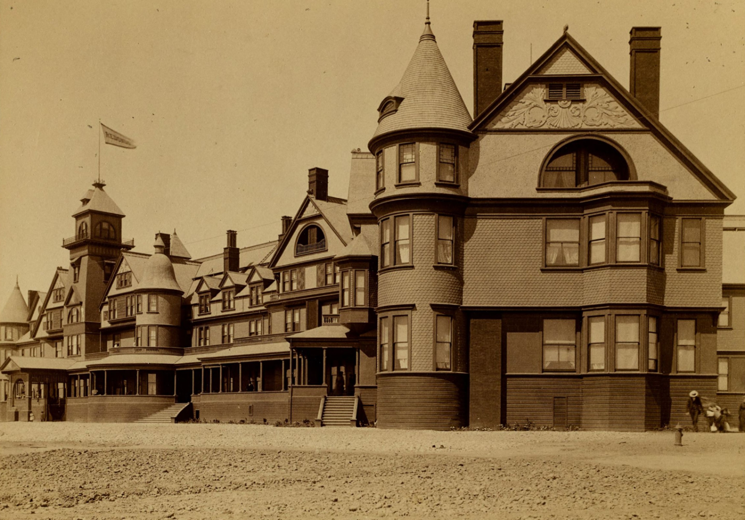 |
|
| (ca. 1890)* – View of the south side of the Redondo Beach Hotel, also known as Hotel Redondo. Photo from the Ernest Marquez Collection. |
Historical Notes The Hotel Redondo opened on May 1, 1890, as one of the grandest resort properties on the Southern California coast. Situated on a 22 acre tract overlooking the ocean, the Victorian style structure offered 225 rooms and modern conveniences for its era, including a bath on each floor. The hotel was designed to establish Redondo Beach as a destination capable of attracting visitors from throughout Southern California. Developed by the Redondo Beach Improvement Company, the hotel anchored a broader vision for the city that included rail connections, pier construction, and commercial development along Pacific Avenue. The Santa Fe Railway heavily promoted the property, and the combination of luxury accommodations and convenient train access helped make Hotel Redondo a centerpiece of early South Bay tourism. |
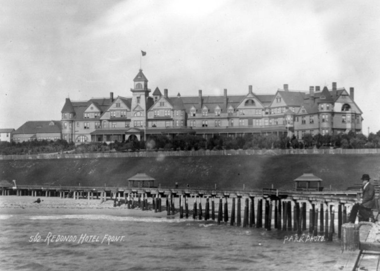 |
|
| (ca. 1890s)* – A man is seen standing on the pier in front of the Redondo Hotel. |
Historical Notes Standing before the Hotel Redondo, this pier view illustrates the close relationship between waterfront access and resort hospitality that defined Redondo Beach during its earliest decades. The hotel's location near the beach and wharves made it a gathering point for visitors who came not only for recreation but also to experience the activity of a growing coastal community. Despite its early success, Hotel Redondo's fortunes declined as San Pedro Harbor expanded and became the region's dominant commercial port. The economic effects of Prohibition further weakened tourism, and the hotel closed in 1925 before eventually being dismantled for scrap lumber. Its brief but influential run helped shape the recreational identity that Redondo Beach would carry forward. |
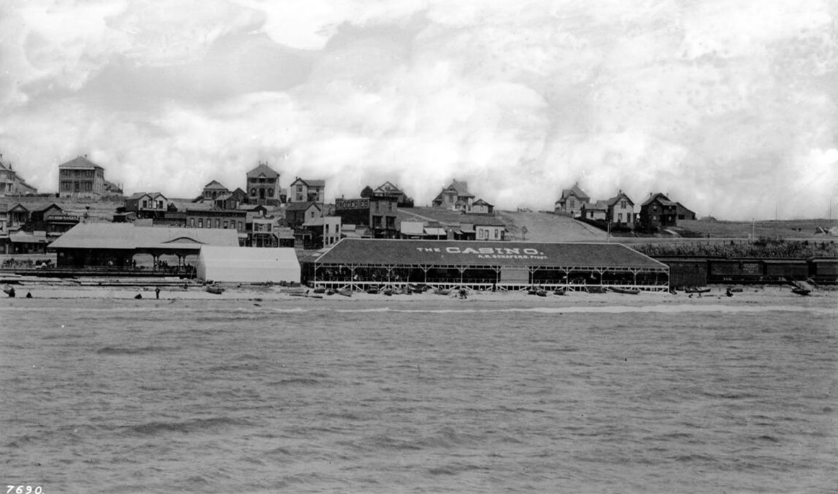 |
|
| (1890s)* - Photograph of Redondo Beach from its first pier, featuring the A.R. Schafers Casino. |
Historical Notes In the early development phase from 1889 through the 1920s, three successive wharves played important roles in supporting industry and tourism. Wharf No. 1, constructed in 1889, served as a transfer point for timber shipments before being destroyed by storms. Wharf No. 2, built in 1895 with its distinctive Y shaped design, supported rail service, fishing, and freight activity until severe storm damage led to its removal. Wharf No. 3, completed in 1903, became the longest lasting of Redondo's commercial piers. Visible near the waterfront was the A.R. Schafers Casino, an open air seaside pavilion that reflected the growing recreational appeal of Redondo Beach during this period. Alongside hotels, train service, restaurants, and beachfront attractions, gathering places like this helped transform the shoreline from a working waterfront into one of Southern California's early resort destinations. |
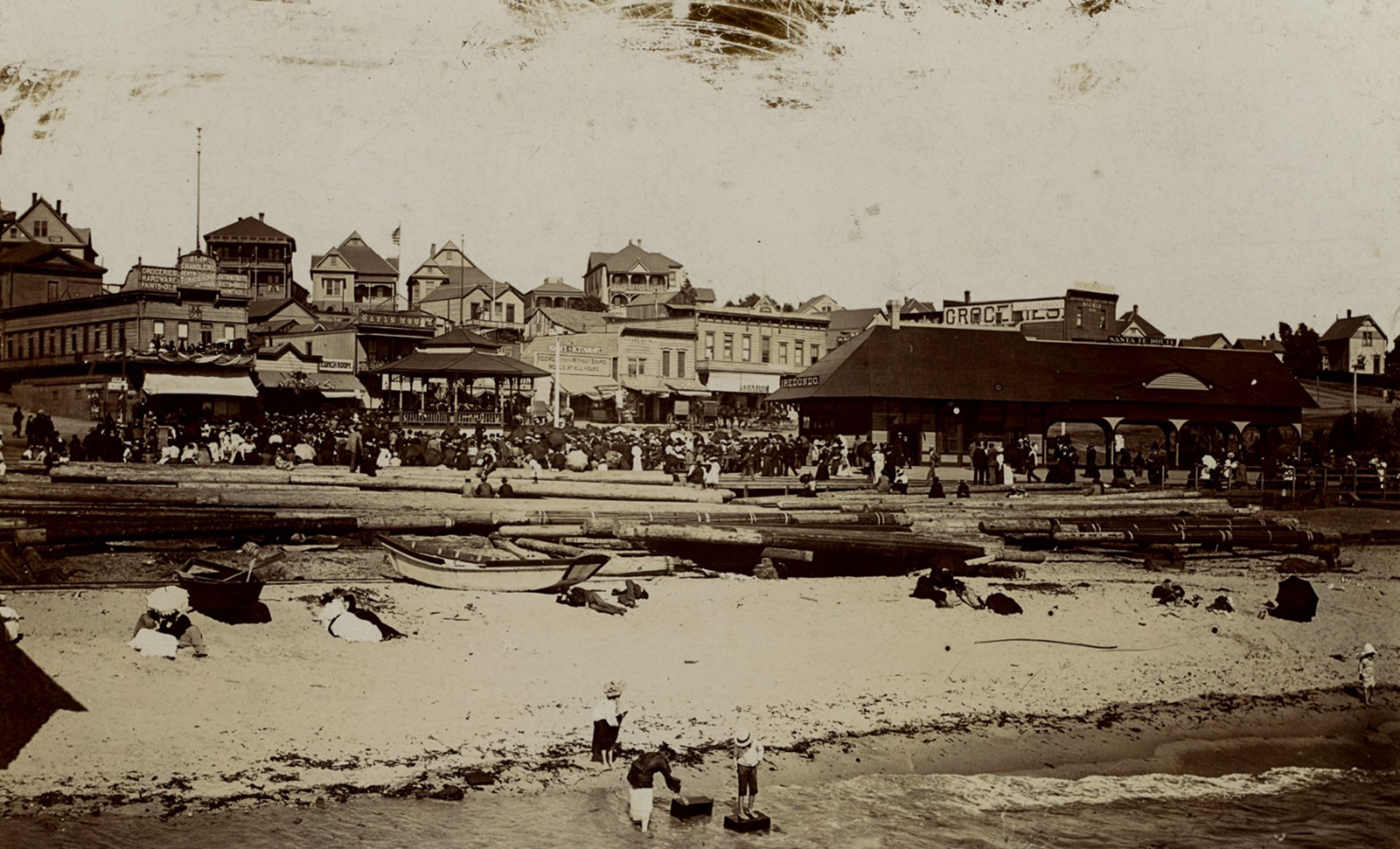 |
|
| (ca. 1890s)* - Image of a crowd gathered around a pagoda style pavilion, with boats and lumber on the beach and storefronts on Pacific Avenue in the background. |
Historical Notes This view of the beach pavilion and Pacific Avenue storefronts illustrates the variety of activity that made early Redondo Beach one of Southern California's most popular coastal destinations. Visitors arriving by Santa Fe Railway encountered a lively mix of maritime commerce, recreation, dining, and beach life concentrated within a compact waterfront district. The pavilion served as a visual landmark and gathering place along the shoreline. Nearby businesses offered lodging, groceries, fishing supplies, and restaurants that supported both visitors and the growing local population. The energy captured in this scene reflects Redondo Beach during the height of its first resort era. |
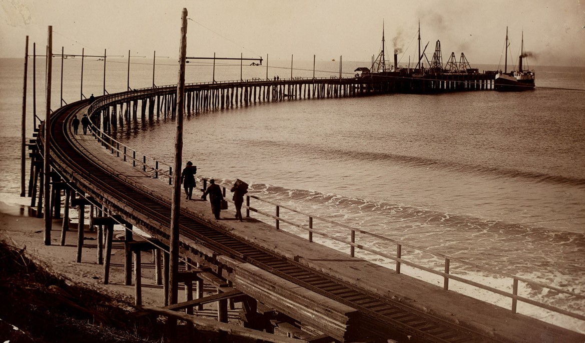 |
|
| (1910)* - Image of Redondo Beach Wharf with people and railroad tracks on the wharf in Redondo Beach. A couple of schooners are seen docked at the end of the pier. Photo from the Ernest Marquez Collection. |
Historical Notes By 1910, Redondo Beach had constructed three successive wharves in its effort to become a major commercial port. The first, built in 1889, supported the lumber trade until storms destroyed it. Wharf No. 2 followed in 1895 and incorporated railroad tracks to move freight directly between ships and rail cars. Wharf No. 3, completed in 1903, continued serving maritime commerce and became the longest surviving commercial pier. The presence of Santa Fe Railway tracks extending onto the wharf reflected the city's serious commercial ambitions. Despite these efforts, storm damage and changing economic conditions ultimately shifted Redondo's focus away from freight activity and toward recreation, tourism, and pleasure piers. |
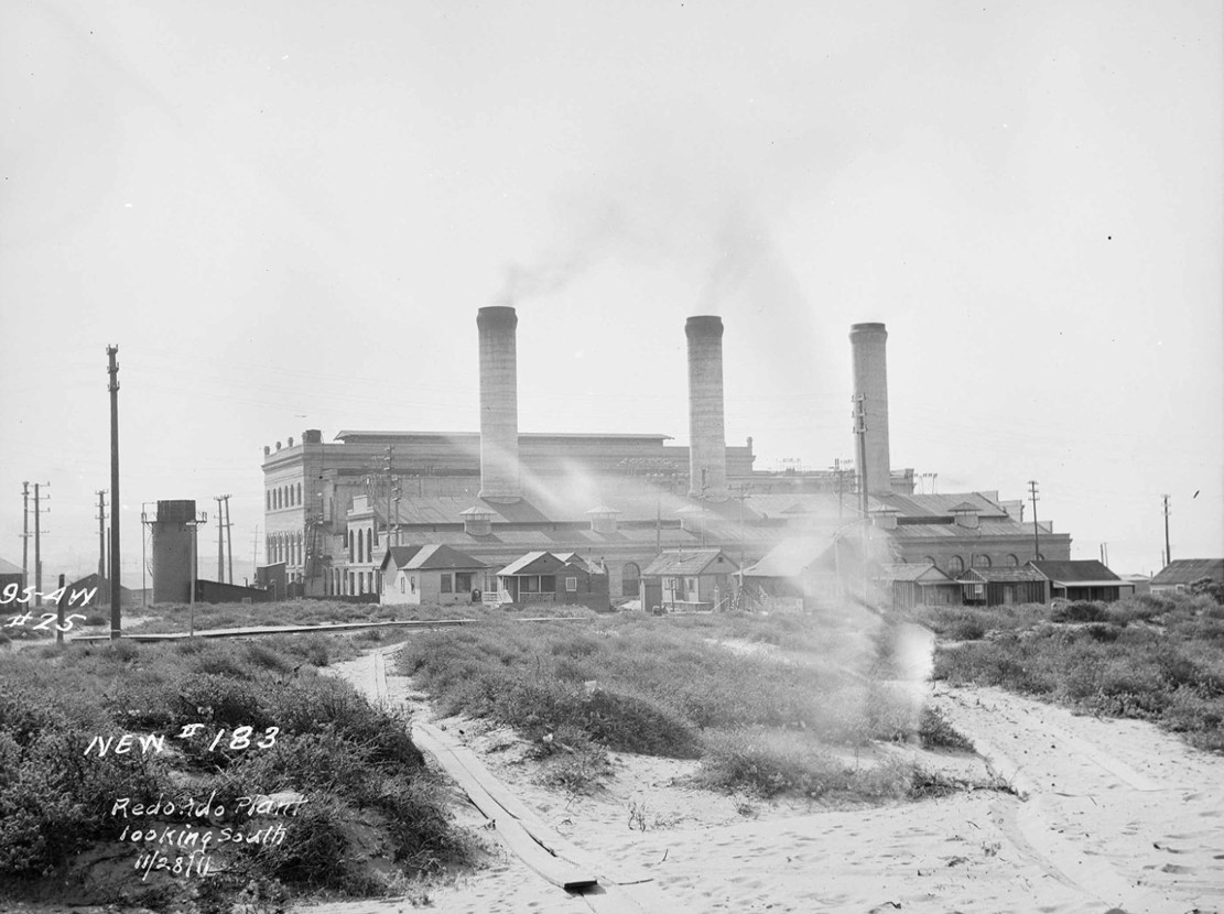 |
|
| (1911)* - Redondo Beach Steam Plant looking South. |
Historical Notes The Pacific Light and Power Corporation (PLPC), established by Henry Huntington in 1906, built a concrete and metal steam plant in Redondo Beach, strategically located for access to clean water and local oil for fuel. By 1911, the plant had doubled in size and become the fourth largest generating facility in the United States. Following acquisition by Southern California Edison in 1917, the plant gradually declined and was eventually abandoned during the Great Depression. Postwar growth brought a new generating station to the site in 1948, and later modernization continued under AES Southland Energy. After more than a century of power generation on the waterfront, the Redondo Beach Generating Station permanently ceased operations on December 31, 2023. The future of the site remains under discussion as the community considers redevelopment and new uses for this prominent stretch of the coastline. |
* * * * * |
Pacific Avenue, Redondo Beach |
Long before Redondo Beach became known for its modern waterfront and harbor, Pacific Avenue served as the heart of the city's commercial and transportation life. Running through the center of town and linking the waterfront with hotels, shops, rail service, and entertainment, the street became one of the defining corridors of early Redondo Beach.During the late 19th and early 20th centuries, visitors arrived by steam railroad, electric streetcar, horse drawn carriage, and eventually automobiles. Along Pacific Avenue they found bustling storefronts, resort hotels, real estate offices, amusement attractions, and access to one of Southern California's most popular coastal destinations.This section traces the evolution of Pacific Avenue and the surrounding waterfront through rare photographs and historical notes that document Redondo Beach's transformation from a growing seaside resort into a thriving coastal community. |
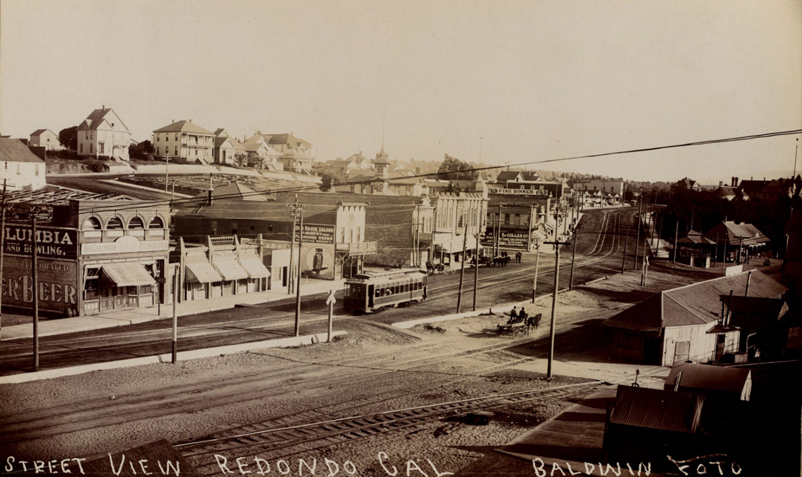 |
|
| (1902)* – Businesses along Pacific Avenue in Redondo Beach, California, are depicted, with a streetcar on tracks and horse drawn wagons. Visible signs on the buildings include "The Columbia," "Bowling," "Rainier Beer," "The Pool Room," "Our House Saloon, Murphy Prop., Furnished Rooms, Tea Kettle Whiskey," "Fish Dinner," and "The Culler Co." A pagoda style pavilion and a passenger train depot for the Santa Fe Railway are seen at the far right, with houses visible on the hill in the background. Photo from the Ernest Marquez Collection. |
Historical Notes Pacific Avenue played a central role in the early development of Redondo Beach, serving as one of the city's principal commercial corridors during the late 19th and early 20th centuries. Founded in 1887, Redondo Beach quickly emerged as a popular seaside resort destination. Pacific Avenue became the heart of the waterfront district, lined with hotels, saloons, shops, restaurants, and recreational attractions that catered to both visitors and local residents. Electric railway service arrived in Redondo Beach in 1902, greatly improving access from Los Angeles and accelerating the city's growth. The line later became part of the expanding Los Angeles Pacific system before ultimately being absorbed into the Pacific Electric Railway network in 1911, strengthening Redondo Beach's connection to the region. |
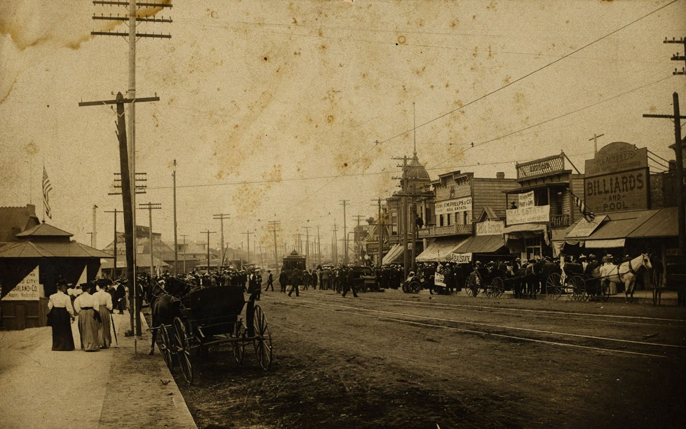 |
|
| (ca. 1905)* - Looking north on Pacific Avenue in Redondo Beach, with an electric streetcar, horse drawn wagons, and crowds of people in front of a real estate office. Signs on the storefronts read "Garland & Co.," "F.M. Phelps & Co. Real Estate," "Business Property Hart & Copps," "Billiards and Pool," and "Laundry." Photo from the Ernest Marquez Collection. |
Historical Notes By the first decade of the 1900s, Pacific Avenue had become one of Redondo Beach's busiest streets. Real estate offices, hotels, entertainment venues, and transportation services reflected the city's rapid growth during Southern California's early land boom era. Streetcars running along Pacific Avenue brought visitors directly into the downtown district, while horse drawn wagons and early automobiles continued to share the streets. Nearby attractions including the Redondo Pavilion and Santa Fe Railway Depot helped establish Redondo Beach as one of Southern California's leading coastal destinations. |
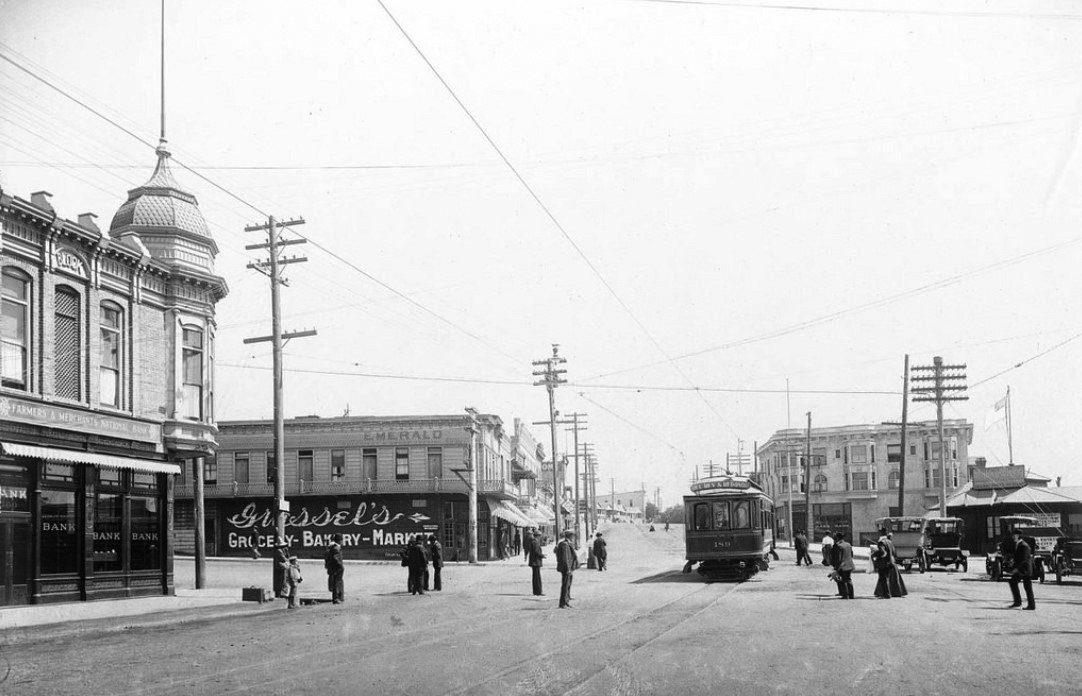 |
|
| (ca. 1908)* – View looking south on Pacific Avenue at Emerald Street in Redondo Beach showing an approaching electric streetcar, with the English Block at left and the Garland Hotel visible farther down Pacific Avenue. |
Historical Notes By the early 1900s, Pacific Avenue had become one of Redondo Beach’s principal transportation and commercial corridors. Electric railway service connected the beach city with Los Angeles and neighboring South Bay communities, helping establish Redondo as one of Southern California’s leading seaside destinations. The line visible here formed part of the Los Angeles Pacific Railroad coastal system and later became part of Pacific Electric’s famous Red Car network. This photograph captures Redondo Beach during a period of transition when electric streetcars, pedestrians, horse drawn vehicles, and early automobiles shared the roadway while commercial development expanded around the downtown district. Hotels, stores, banks, and transportation infrastructure combined to create a lively urban center serving both residents and visitors. Prominent at left is the English Block at the northeast corner of Pacific Avenue and Emerald Street. Constructed in 1893, the building became one of downtown Redondo Beach’s best known early commercial landmarks and remained a recognizable feature of the streetscape for decades before being demolished in the early 1970s. Visible farther south is the Garland Hotel, one of Redondo’s notable early hotels that reflected the city’s growing appeal as both a resort and residential community. The approximate dating of this photograph is supported by architectural details, period commercial development, and the appearance of the electric railway operating during the years immediately preceding Pacific Electric’s acquisition of the Los Angeles Pacific system in 1911. |
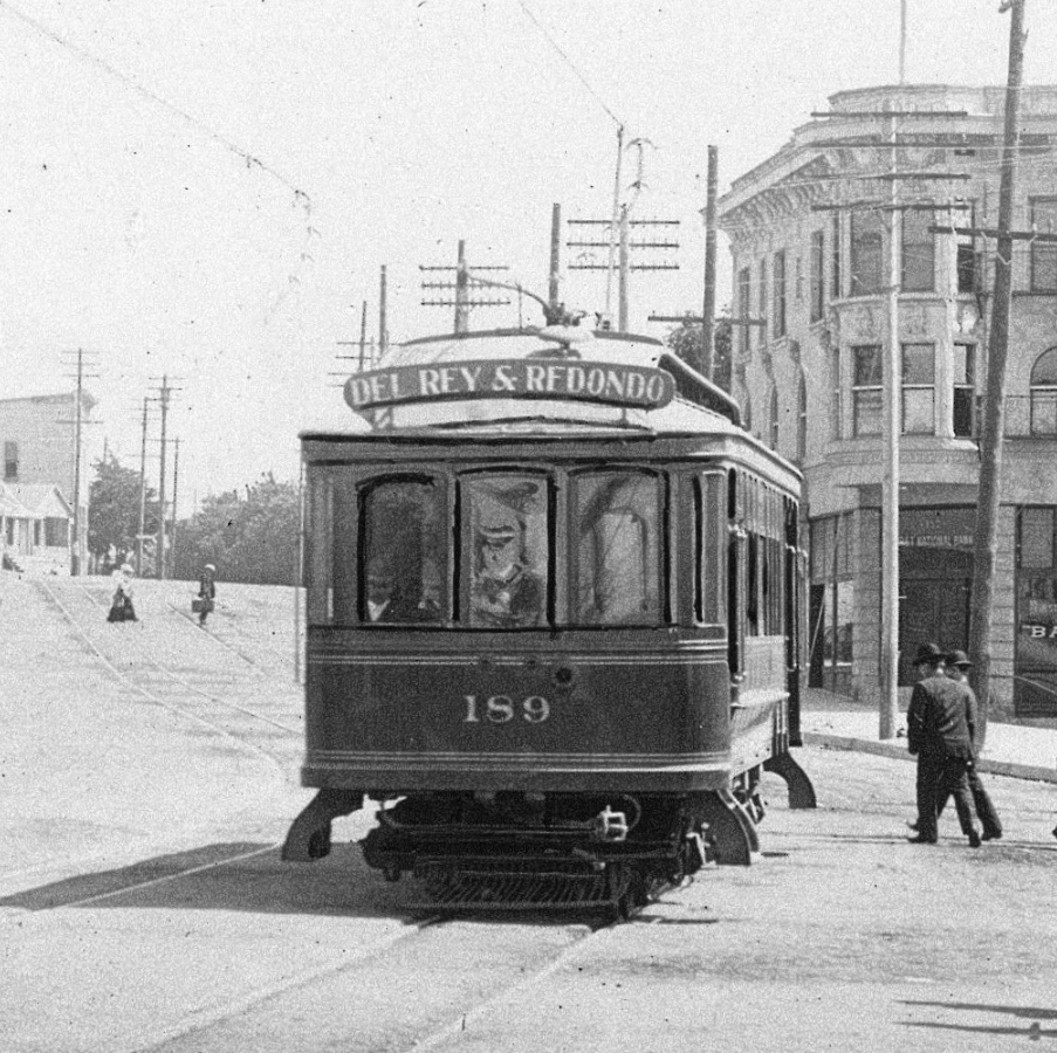 |
|
| (ca. 1908)* - Zooming in on the approaching Red Car from the previous photo. Destination: Del Rey & Redondo. |
| Historical Notes
The destination sign reading “Del Rey & Redondo” offers a close look at one of Southern California’s earliest coastal electric railway routes. At the time this photograph was taken, the line was operated by the Los Angeles Pacific Railroad (LAP) and connected downtown Los Angeles with Playa del Rey, El Segundo, Manhattan Beach, Hermosa Beach, and Redondo Beach. The route played an important role in opening the South Bay to residential growth and seaside tourism. Service along the route began in stages beginning in 1902, with the coastal connection reaching Redondo Beach in 1903. Originally constructed as a narrow gauge electric railway, the line was rebuilt to standard gauge in 1908 as part of broader modernization efforts across the regional rail network. That conversion provides one of the strongest clues supporting the approximate date of this photograph. Pacific Electric absorbed the Los Angeles Pacific system in 1911, and the route later became part of the region’s famous Red Car network. This image preserves an earlier chapter in South Bay transportation history and captures the line at a transitional moment just before that change occurred. The enlarged view also reveals details often missed in the wider photograph, including the destination sign, overhead trolley wire, rail alignment, and the close interaction between streetcars and everyday life along Pacific Avenue more than a century ago. |
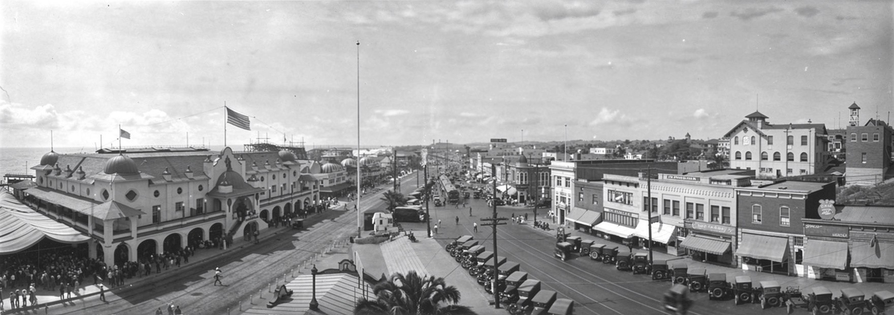 |
|
| (1923)* - Panoramic view of Redondo Beach as seen from the Garland Hotel. |
Historical Notes By the 1920s, Redondo Beach had evolved from a resort centered largely around rail excursions into a more established coastal community. Improved roads and increased automobile ownership gradually shifted how visitors arrived and experienced the city. Viewed from the Garland Hotel, this panorama captures Redondo Beach during a period of transition when tourism, local commerce, and residential growth continued to shape the waterfront and surrounding neighborhoods. |
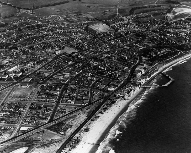 |
|
| (1924)^ - Aerial view of Redondo Beach showing its pleasure pier. |
Historical Notes During the 1910s and 1920s, Redondo Beach gradually shifted from industrial wharves toward recreational and tourism focused waterfront attractions. The Endless (later known as the Pleasure Pier) was a V shaped reinforced concrete structure built by George W. Harding for fishing and strolling. Despite its popularity, the pier was condemned for safety reasons in 1928. Captain Hans C. Monstad constructed the Monstad Pier in 1925, originally extending 300 feet and serving as a center for fishing and pleasure boat landings. It remains in use today. The Horseshoe Pier, completed in 1929 after demolition of the Pleasure Pier, became one of Redondo Beach's defining landmarks and remained a central community feature until it was destroyed by fire in 1988. Following the fire, the southern remnant remained open until a new concrete pier opened in 1995. |
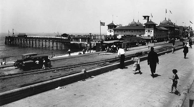 |
|
| (ca. 1925)* - View of Redondo Beach's Endless Pier as seen from the shoreline. |
Historical Notes Completed during the 1910s, the Endless Pier represented Redondo Beach's growing emphasis on recreation and tourism rather than commercial shipping. Built as a reinforced concrete structure extending into the ocean, the pier became a popular destination for walking, sightseeing, and fishing. Unlike the earlier industrial wharves that supported freight and maritime commerce, the Endless Pier reflected changing public tastes and the rise of leisure culture in Southern California. Visitors arriving by streetcar and automobile helped transform Redondo Beach into one of the region's most visited seaside communities during the 1920s. |
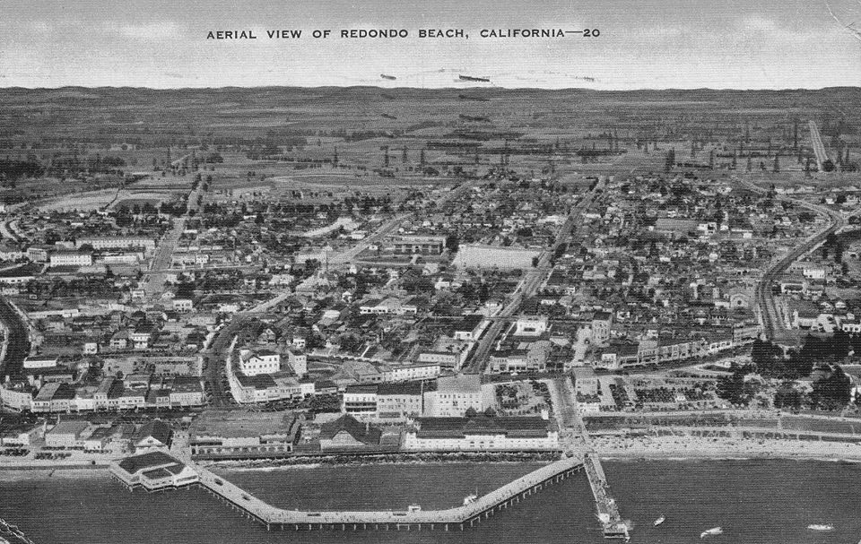 |
|
| (ca. 1920s)* - Aerial postcard view of Redondo Beach and the Endless Pier. Oil fields are visible in the distance. |
Historical Notes This aerial view captures the contrasting forces shaping Redondo Beach during the 1920s. Along the waterfront, hotels, beaches, pleasure piers, and recreational attractions drew visitors seeking the Southern California coastal experience. In the distance, oil development reflected another powerful economic force transforming the region. The coexistence of tourism and petroleum development became a defining characteristic of many Southern California coastal communities during this period, illustrating the rapid and often overlapping growth occurring throughout the Los Angeles area. |
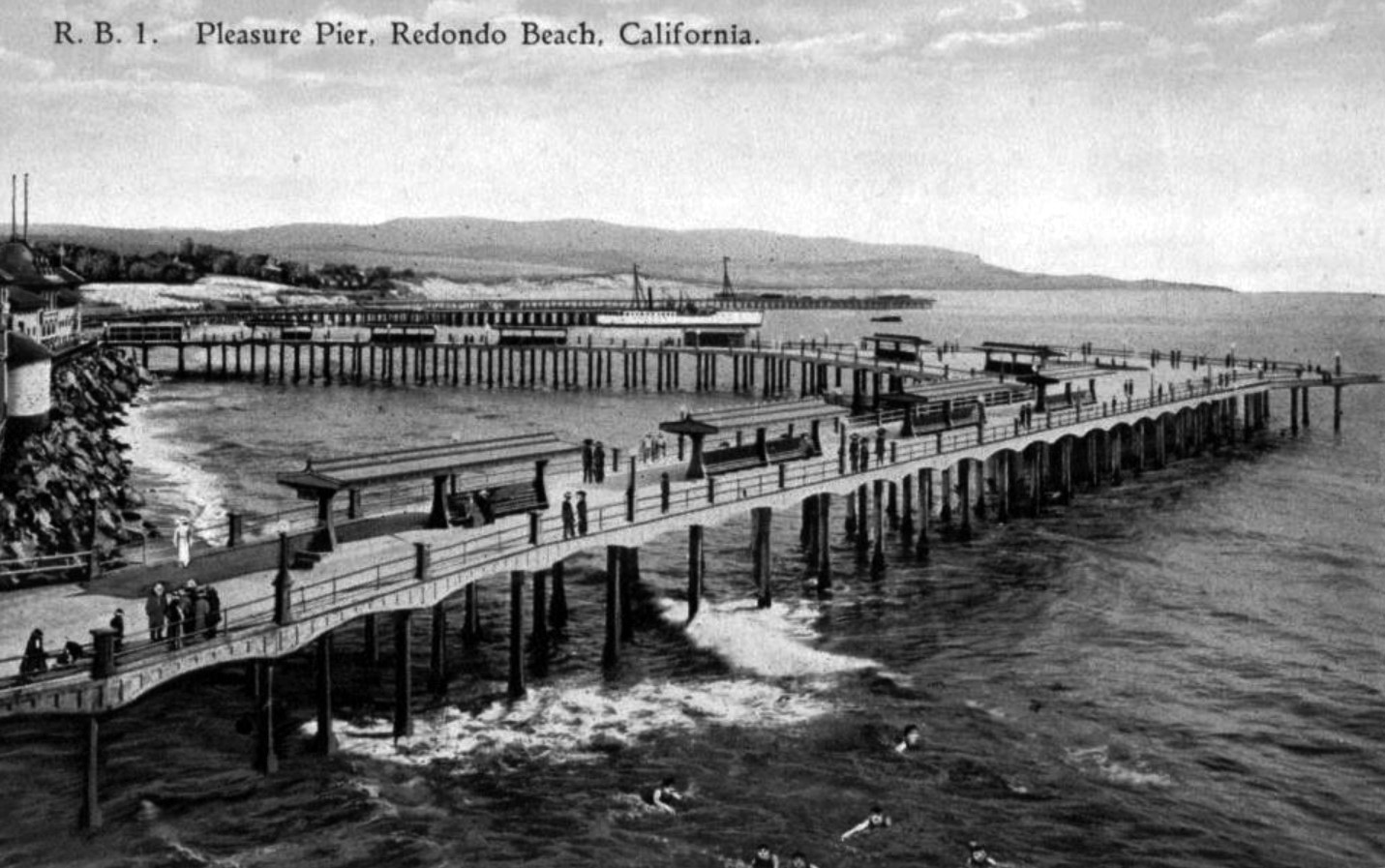 |
|
| (ca. 1920s)* – Postcard view looking south along the coast of Redondo Beach. Visitors stroll along the Endless Pier while swimmers enjoy the surf below. The Pavilion, Bath House, and Wharfs No. 2 and 3 can also be seen. |
Historical Notes By the 1920s, Redondo Beach had become one of Southern California's premier seaside destinations. Visitors arrived throughout the year to enjoy swimming, fishing, boating, dancing, and oceanfront recreation. The Pavilion and Bath House became iconic landmarks that helped define Redondo's identity as a resort community, while the surviving wharves reflected the city's earlier maritime roots. Scenes like this illustrate the transition from a working waterfront to a recreation focused coastline. |
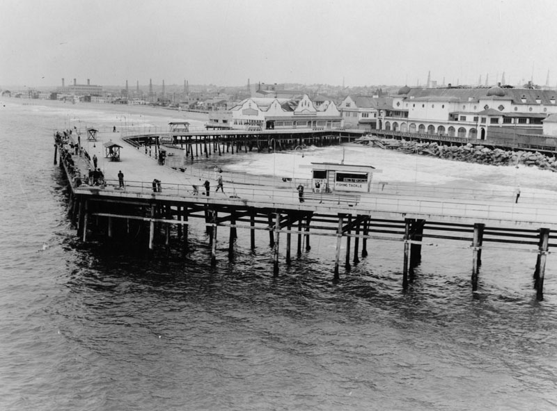 |
|
| (1937)^ - View of the main pier at Redondo Beach on May 27, 1937. Oil derricks can be seen in the background. |
Historical Notes Redondo Beach's pier evolved over several decades from a collection of independent wharves into a more unified recreational destination serving both residents and visitors. Storm damage, rebuilding efforts, and changing recreational needs continually reshaped the waterfront throughout the early 20th century. By the late 1930s, the pier had become one of the city's defining landmarks, offering fishing, boating, ocean recreation, and panoramic coastal views. The oil derricks visible in the distance reflect the continued influence of petroleum development across the South Bay region. |
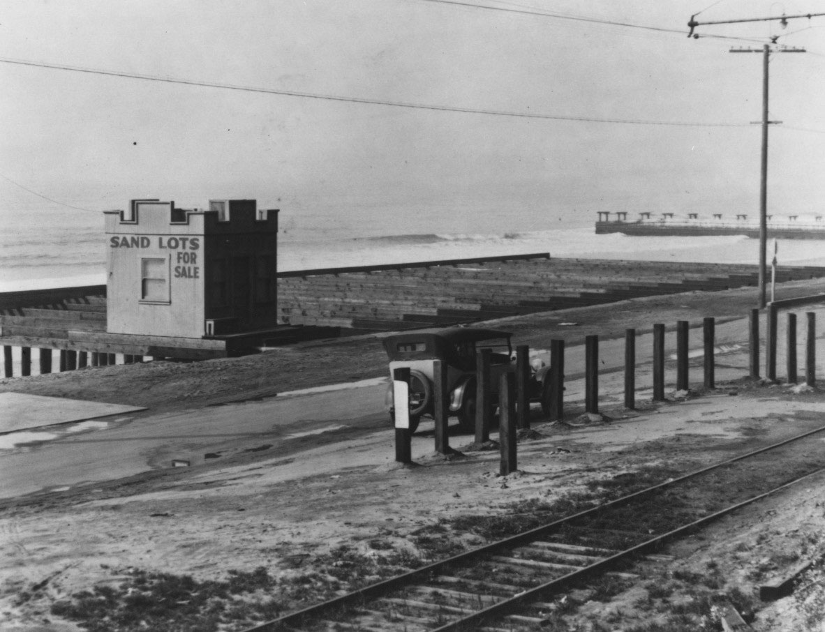 |
|
| (1930s)* – "Sand Lots for Sale" painted on the side of a real estate office in Redondo Beach. Streetcar tracks are visible in the foreground. |
Historical Notes Even during the 1930s, real estate remained closely tied to Redondo Beach's identity and continued development. Painted building advertisements such as this were a common marketing technique used to attract investors, businesses, and homebuyers seeking opportunities near the Southern California coast. The streetcar tracks visible in the foreground serve as a reminder that electric rail transit continued to influence development patterns and connect Redondo Beach with surrounding communities during a period when automobiles were becoming increasingly dominant. Scenes like this capture an important transitional period in the city's history, when older forms of transportation and traditional land promotion continued to coexist with the rapid modernization taking place across the Los Angeles region. |
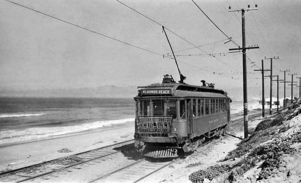 |
|
| (ca. 1930s)* - Redondo Beach trolley. Photo: Pacific Electric Railway Historical Society. |
Historical Notes Streetcars remained an important part of daily life in Redondo Beach well into the 1930s, providing reliable transportation for workers, residents, and beach visitors. Pacific Electric's extensive rail network helped make coastal communities more accessible and supported continued residential growth. As automobile ownership increased throughout Southern California, however, streetcar ridership gradually declined. Within a few decades, many of the region's once extensive electric railway lines would disappear. |
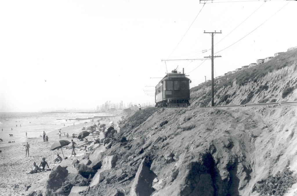 |
|
| (1939)* - A Redondo Beach via Del Rey streetcar climbs the grade above the shoreline while sun bathers enjoy the beach below. Parked automobiles line the bluff and oil derricks appear in the distance. |
Historical Notes This image captures several defining elements of Southern California at the end of the streetcar era: electric rail transportation, growing automobile use, expanding beach recreation, and industrial development existing side by side. By the late 1930s, Pacific Electric still provided an important connection between coastal communities and Los Angeles, but changing travel patterns increasingly favored the automobile. Within the following two decades, most of the famous Red Car lines serving the South Bay would be gone, marking the end of an era in regional transportation. |
* * * * * |
Hollywood Riviera Beach Club(Torrance and Redondo Beach) |
The Hollywood Riviera occupies a distinctive stretch of coastline between Redondo Beach and the Palos Verdes Peninsula. Developed beginning in the late 1920s, the community reflected Southern California’s growing fascination with planned coastal living, Mediterranean architecture, and resort style recreation.Developer Clifford Reid envisioned the area as a Southern California version of the French Riviera and hired landscape architect Mark Daniels to shape the community. Streets followed the natural contours of the hills to emphasize ocean views and create a neighborhood with a strong visual identity.At the center of Reid’s vision was the Hollywood Riviera Beach Club, which opened in 1931 above Torrance Beach. Originally built as a private amenity for residents, the club became one of the South Bay’s best known seaside destinations before being destroyed by fire in 1958. Today the site survives as Miramar Park. |
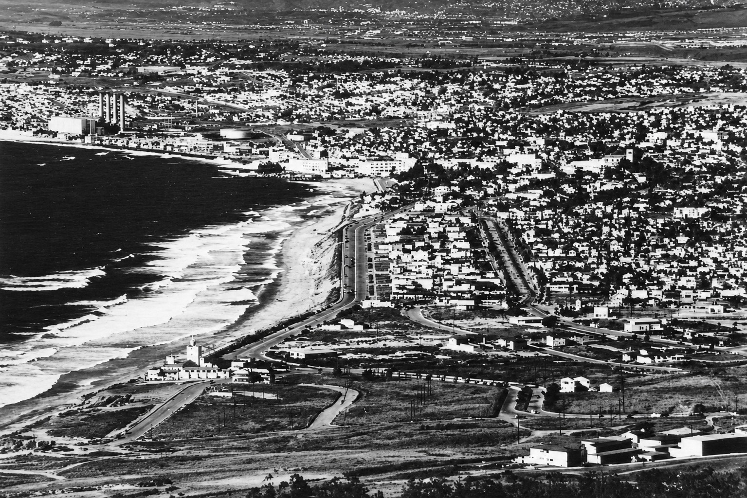 |
|
| (ca. 1950)* – View looking north from Palos Verdes toward Redondo Beach. At lower left can be seen the Hollywood Riviera Beach Club which straddled the city limit between Torrance and Redondo Beach. |
Historical Notes This aerial view from the ca. 1950 looks north from the Palos Verdes Peninsula toward Redondo Beach and captures the Hollywood Riviera during its early years of development. At lower left sits the Hollywood Riviera Beach Club, positioned prominently above Torrance Beach and directly along the city boundary between Torrance and Redondo Beach. Ground was broken for the club in 1930 and it opened on June 27, 1931. Designed by landscape architect Mark Daniels, the facility featured a 75 foot swimming pool, dining facilities, and social spaces intended to help establish the identity of the new community and attract buyers. Residents of the Hollywood Riviera automatically became members, although dues were required for use of club amenities and special events. While Clifford Reid hoped to attract Hollywood buyers, the Depression slowed growth, and restrictive covenants prevented some of the very film industry figures he hoped to attract, including Louis B. Mayer and Sam Goldwyn, from purchasing property. |
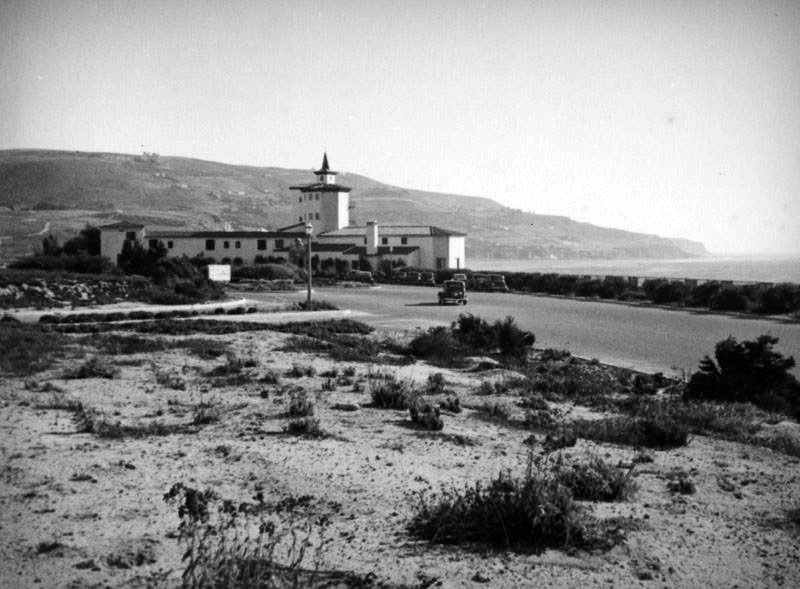 |
|
| (1930s)* – View looking south showing the Hollywood Riviera Beach Club with the Palos Verdes Peninsula seen in the distance. Photo by Herman Schultheis |
Historical Notes This photograph captures the Hollywood Riviera Beach Club during its most active years. Positioned directly above Torrance Beach, the club occupied one of the South Bay’s most dramatic coastal settings, with the Palos Verdes Peninsula rising beyond. Photographer Herman Schultheis is best remembered for his later work documenting special effects production during the making of Disney’s Fantasia and Pinocchio, but he was also an accomplished photographer whose images provide an important visual record of Southern California during the late 1930s and early 1940s. Schultheis later disappeared during a photographic expedition in Guatemala in 1955, and his remains were discovered approximately eighteen months later. Not long after Pearl Harbor, military activity transformed the surrounding hills. Anti aircraft batteries were installed nearby and repeated target practice reportedly caused structural damage to the club. Operations ceased in 1942, ending its original chapter as a private coastal retreat. |
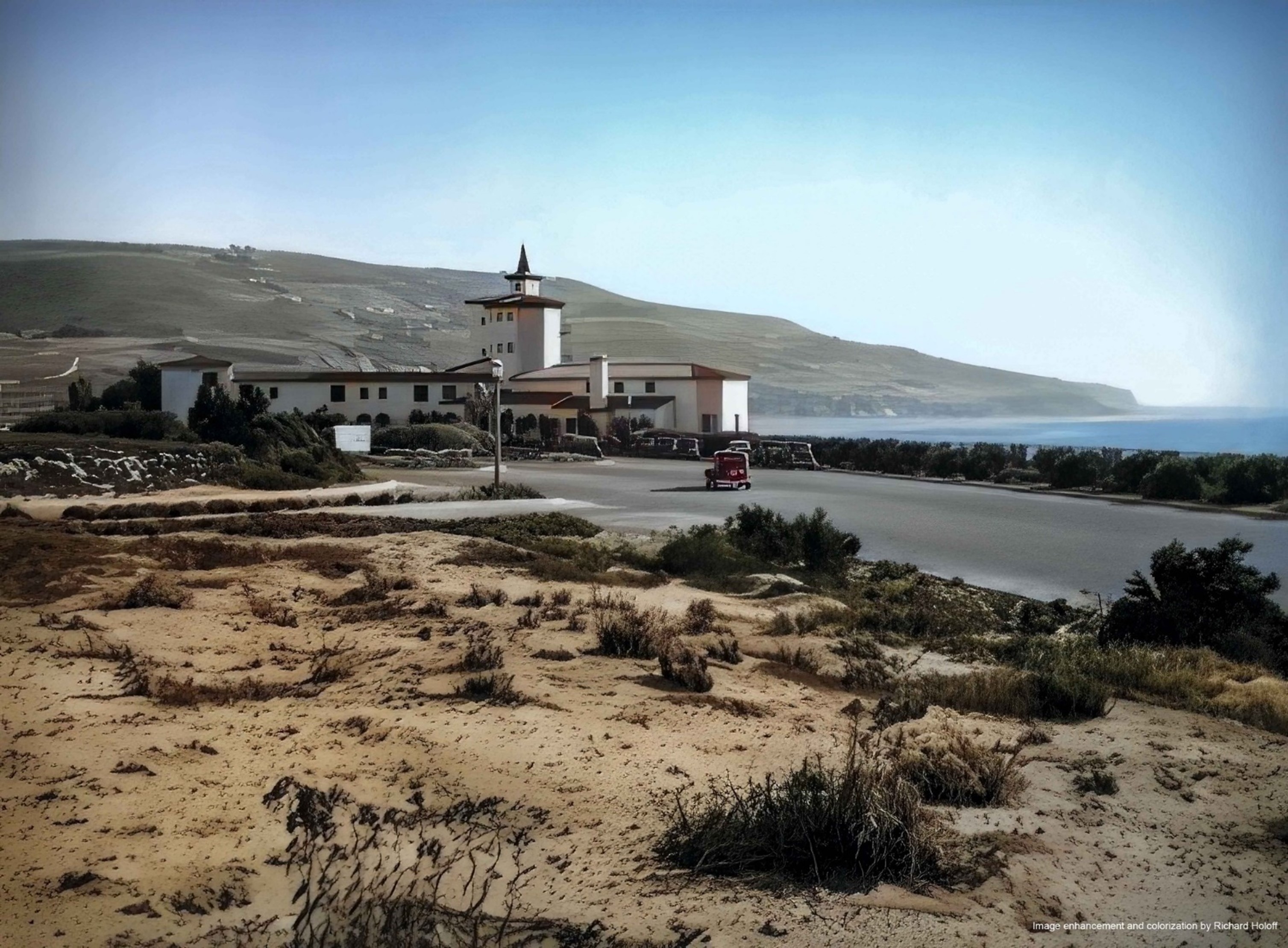 |
|
| (1930s)* – View looking south showing the Hollywood Riviera Beach Club with the Palos Verdes Peninsula seen in the distance. Photo by Herman Schultheis; Image enhancement and colorization by Richard Holoff. |
Historical Notes This colorized version offers a closer impression of how visitors may have experienced the Hollywood Riviera Beach Club during the late 1930s. Details of the architecture, landscaping, and relationship between the bluff and shoreline become more visible than in the original black and white photograph. Although the Hollywood Riviera never fully developed into the exclusive seaside community Reid had envisioned, the club remained an important gathering place and became one of the South Bay’s best known beachfront destinations. |
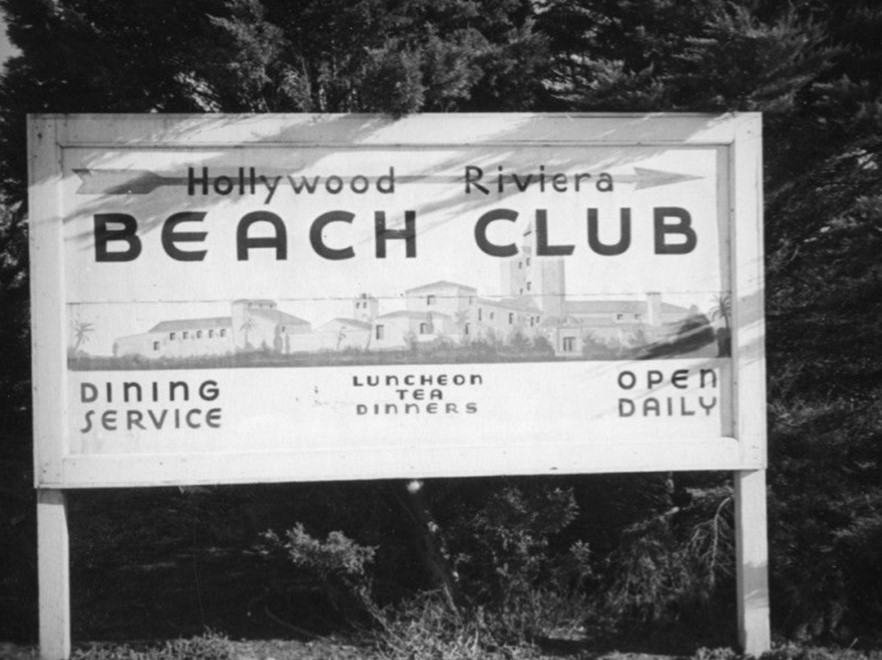 |
|
| (ca. 1937)* - Sign for the Hollywood Riviera Beach Club featuring an architectural rendering and indicating that the originally private club was open for lunch and dinner every day. |
Historical Notes This promotional sign reflects the changing identity of the Hollywood Riviera Beach Club. Originally intended as an exclusive private amenity for Riviera homeowners, by the late 1930s the club had already begun opening portions of its operations to the broader public. The rendering presented an idealized vision of coastal living and helped market both the beach club and the surrounding community during years when development was progressing more slowly than expected. |
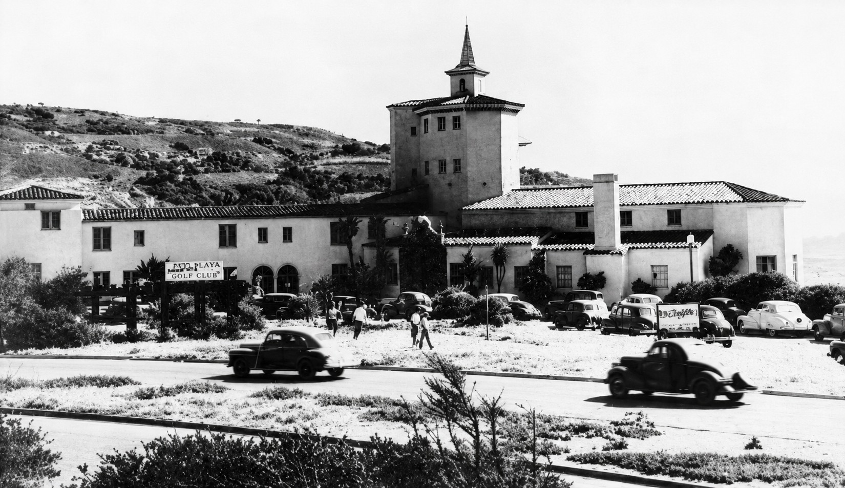 |
|
| (1940s)* – Postcard view of the Hollywood Riviera Beach Club with Palos Verdes in the background. Writing on postcard bottom (not seen) reads: “Riviera Beach Club, one of California’s most beautiful seaside resorts – REDONDO BEACH, CALIFORNIA” |
Historical Notes Following World War II, the club reopened under new ownership and shifted from an exclusive private retreat to a public destination. Its atmosphere became less formal and more closely associated with Southern California beach culture during the postwar years. Actress Rosemary DeCamp, who purchased a home in the Hollywood Riviera in 1945 with her husband, Torrance Superior Court Judge John Shidler, later recalled that when they moved in, the beach club was virtually the only structure between their home and the ocean. Because the property straddled the Torrance and Redondo Beach city line, local stories claimed patrons moved from one side of the building to the other to remain in compliance with differing liquor regulations. Storm damage in 1955 and 1957 weakened the aging structure. On the night of September 25, 1958, a fire broke out and destroyed the club completely. For years afterward, redevelopment proposals were introduced, including plans for a high rise apartment complex, but strong local opposition prevented construction. A 1972 court ruling determined that the property had effectively been dedicated for public use, clearing the way for creation of Miramar Park. Dedicated by the City of Torrance in 1984, Miramar Park preserves the site today. The Torrance Historical Society and Redondo Beach Historical Society later placed a commemorative plaque on the site, and surfers still refer to the shoreline below as Burnout Beach. |
* * * * * |
PALOS VERDES PENINSULA AND SOUTH BAY AREA |
Few places in Southern California illustrate the region’s transformation more clearly than the South Bay and Palos Verdes Peninsula.During the late nineteenth and early twentieth centuries, this area evolved in very different ways. Along the coast, resort communities emerged in Hermosa Beach, Manhattan Beach, and Redondo Beach. Near the harbor, San Pedro and Wilmington developed into major industrial and shipping centers. Inland communities such as Torrance, Gardena, Hawthorne, and Inglewood grew through agriculture, transportation, manufacturing, and eventually aviation.Palos Verdes followed another path.Rather than expanding rapidly through subdivision and industry, the peninsula was developed under one of Southern California’s earliest comprehensive planning visions, emphasizing natural contours, open space, architectural consistency, and carefully designed village centers.The images below follow that transformation from open ranchland to one of the region’s most distinctive coastal communities. |
* * * * * |
South Bay Before Modern Development
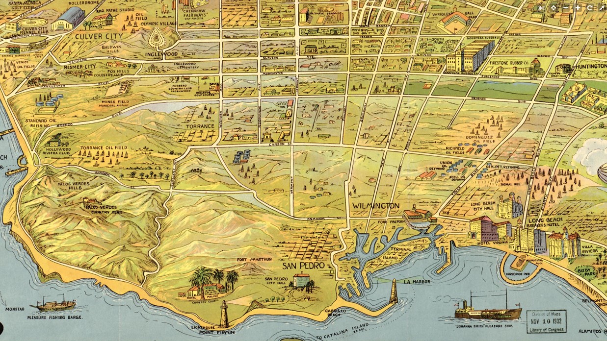 |
|
| (1932)* – Map highlighting key points of interest in the South Bay area of Los Angeles County. |
Historical Notes This 1932 map captures the South Bay at a moment when its modern identity was still taking shape. Inland communities including Torrance, Gardena, Hawthorne, and Inglewood were growing steadily, while agriculture remained an important part of the local economy. Fields producing beans, strawberries, and other crops still occupied large areas of land that would later become urban neighborhoods. At the same time, different parts of the South Bay were developing in dramatically different ways. San Pedro and Wilmington expanded as industrial harbor communities, while Hermosa Beach, Manhattan Beach, and Redondo Beach continued growing as coastal destinations. Palos Verdes stood apart, developing as a carefully planned residential community shaped more by landscape than industry. |
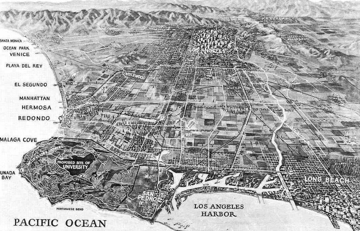 |
|
| (1923)* – Bird’s eye view of the Southland showing the beachfront communities between Santa Monica and Long Beach. |
Historical Notes This remarkable 1923 bird’s eye view shows how lightly developed the Southern California coastline remained during the early twentieth century. Large stretches of open land separate the growing city from the ocean, while roads and communities appear only as scattered clusters of development. Visible at the left edge of the illustration is one of the region’s great historical what ifs. In 1925, local supporters proposed the Palos Verdes Peninsula as the permanent home of the Southern Branch of the University of California, offering approximately 1,000 acres for a future campus. Accessibility and transportation concerns ultimately shifted the campus to Westwood, shaping both UCLA’s future and the residential character that would later define Palos Verdes. |
* * * * * |
Palos Verdes PeninsulaA Peninsula Apart |
Unlike much of Southern California, which expanded rapidly through railroads, industry, and subdivision, Palos Verdes developed under an unusually deliberate vision. Roads followed the contours of the hills, open space was preserved, and village centers were designed to foster community life.Nearly a century later, many of those original ideas remain visible. |
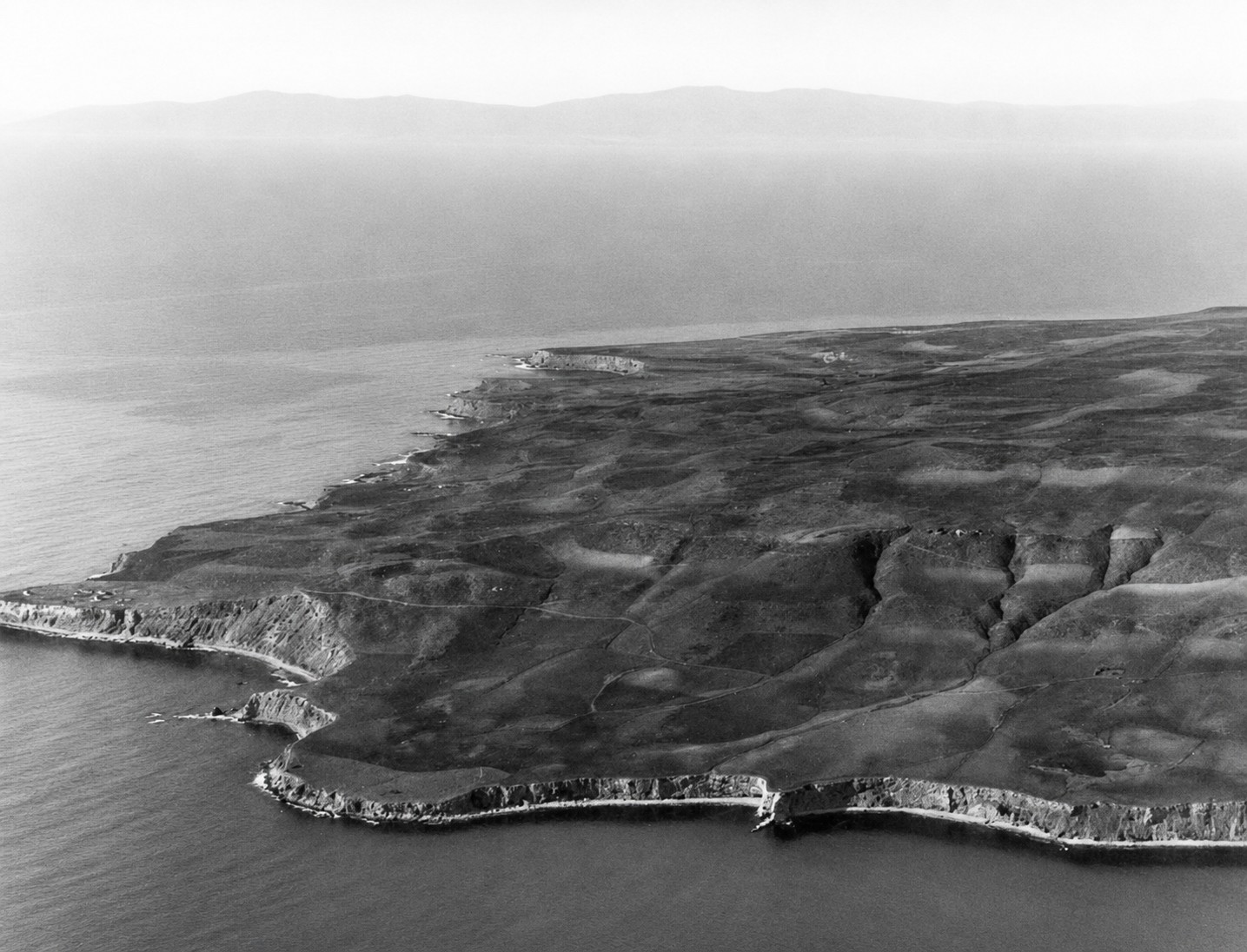 |
|
| (ca. 1920)* - Aerial view looking north across the Palos Verdes Peninsula. |
Historical Notes The Palos Verdes Peninsula derives its name from Spanish words meaning green sticks, a reference to the vegetation noted by early explorers. Long before European settlement, the peninsula formed part of the homeland of the Tongva Gabrielino people, who occupied the region for thousands of years. Archaeological evidence in the region suggests human presence extending back roughly 8,000 years. This early aerial view shows the peninsula largely untouched by modern development. Its steep coastal bluffs and relative isolation preserved its natural character and later made it attractive to planners seeking something different from the increasingly urbanized Los Angeles Basin. |
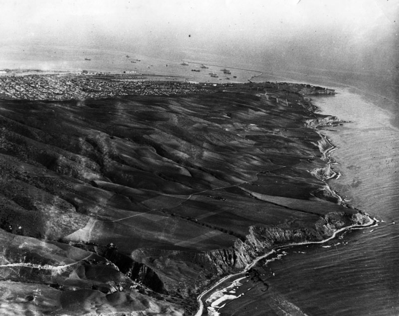 |
|
| (1924)* - Aerial view of the Palos Verdes Peninsula looking southeast toward Point Fermin, with San Pedro Harbor in the distance. |
Historical Notes By 1882, ownership of Rancho de los Palos Verdes had passed to Jotham Bixby, who used much of the land for cattle operations while leasing portions to Japanese farmers. In 1894, Bixby’s foreman Harry Phillips constructed the first permanent residence and planted eucalyptus trees that still influence the peninsula’s appearance today. A major turning point came in 1913 when Frank A. Vanderlip and a group of investors purchased approximately 25 square miles of land for $1.5 million. Inspired in part by Italy’s Amalfi Coast, Vanderlip envisioned one of America’s earliest master planned coastal communities and assembled planners, architects, and landscape designers to shape that vision into reality. Development in Malaga Cove began in the early 1920s, and in 1923 La Venta Inn became the first completed structure on the peninsula and remains an enduring symbol of that early period. |
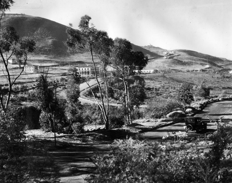 |
|
| (1923)* - Panoramic view from Palos Verdes Drive North looking southwest toward early construction at Malaga Cove. |
Historical Notes This panoramic view captures the earliest stages of development at Malaga Cove, envisioned as the civic and cultural heart of the future community. Roads curve naturally with the terrain rather than imposing a rigid grid, reflecting planning principles introduced by the Olmsted Brothers. Development controls, landscaping requirements, and architectural review helped preserve a unified identity. Early buildings housed many of the functions needed by a growing community and established Malaga Cove as the peninsula’s first true village center. |
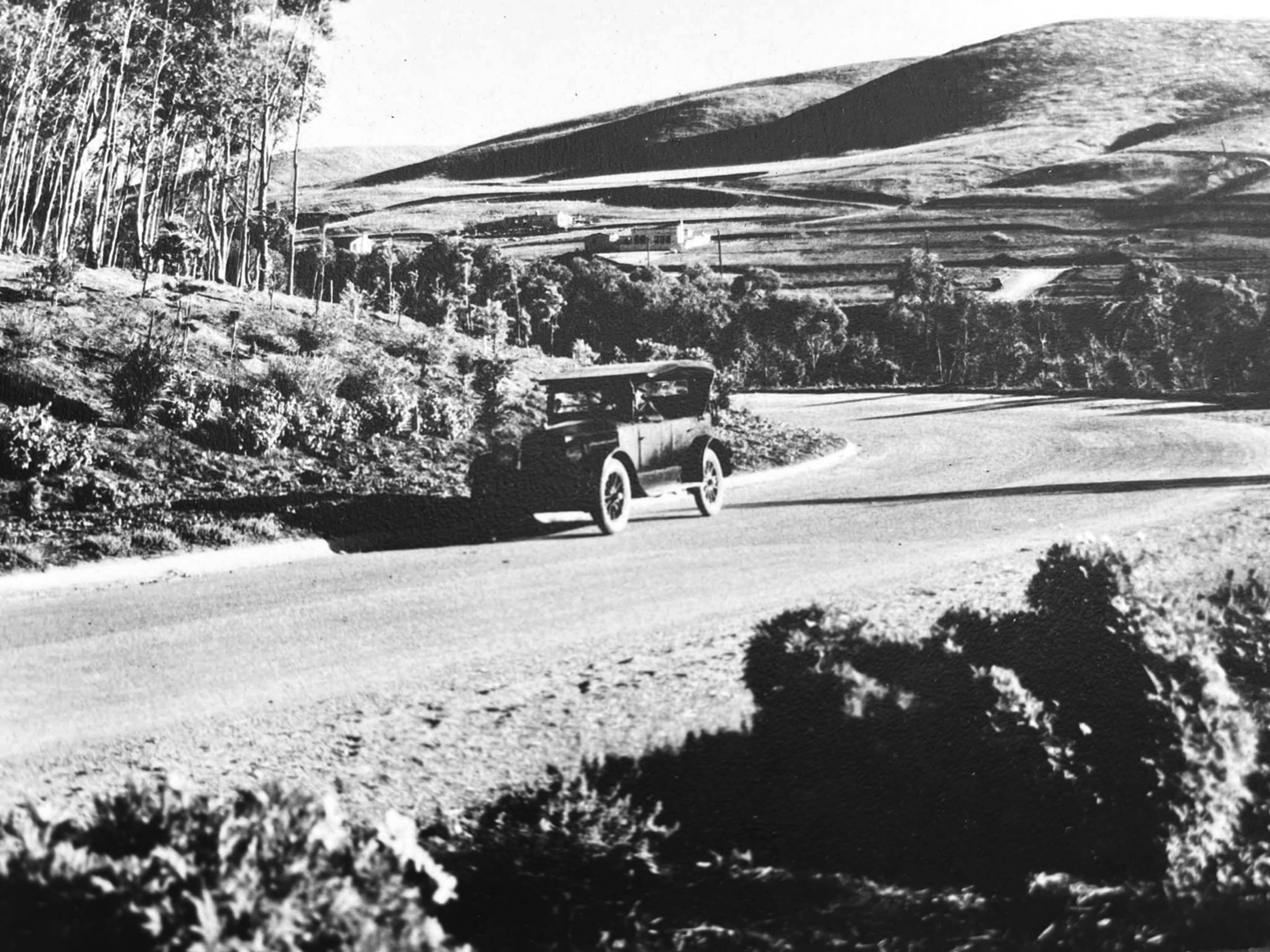 |
|
| (ca. 1925)* - View toward the Malaga Cove Plaza area from the origin of Palos Verdes Drive North. |
Historical Notes By the mid 1920s, Malaga Cove had emerged as the peninsula’s focal point. Schools, churches, shops, public gathering spaces, and community institutions were concentrated within walking distance, reinforcing the vision of a self contained village rather than a conventional suburb. Architectural consistency became one of the area’s defining features and helped distinguish Palos Verdes from most Southern California commercial districts. |
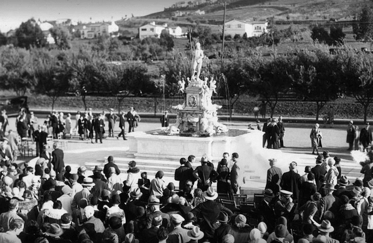 |
|
| (ca. 1928)* - Dedication ceremony for the Neptune Fountain at Malaga Cove Plaza. |
Historical Notes The dedication of the Neptune Fountain represented more than the installation of a civic monument. It symbolized the identity Palos Verdes hoped to create. Located at the center of Malaga Cove Plaza, the fountain became both a gathering place and visual anchor for the growing community. Its European origins reinforced the planners’ intention to create a sense of permanence and character from the beginning. Development slowed during the Great Depression and World War II, but the fountain remained the symbolic heart of the plaza. |
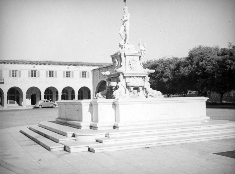 |
|
| (ca. 1937)* - Close up view of the marble fountain at the center of Malaga Cove Plaza. |
Historical Notes The fountain is a historic European replica of Bologna’s famous Neptune Fountain, originally designed in 1563. Carved from white Carrara marble and dedicated in 1930, it became one of the peninsula’s most recognizable landmarks and remains the symbolic centerpiece of Malaga Cove. Community efforts over many decades helped restore and preserve the monument so it could continue serving as one of the peninsula’s defining gathering places. |
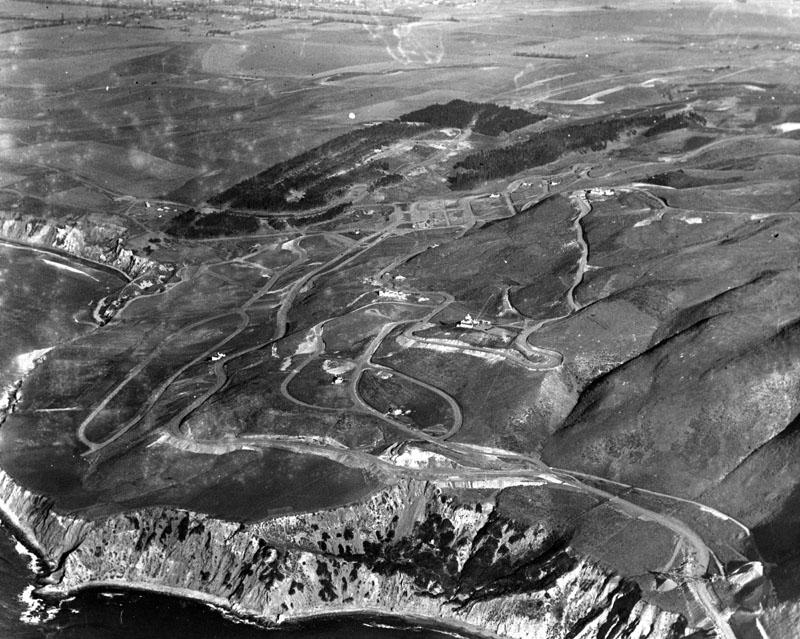 |
|
| (1925)* - Aerial view of the Palos Verdes Peninsula showing limited development. |
Historical Notes This 1925 aerial photograph emphasizes how little of the peninsula had been developed just a few years after construction began. Vast areas of open land dominate the scene, with only a handful of roads and buildings visible. The image reflects the deliberate pace of development imposed by planners, who sought to avoid overbuilding and preserve views, open space, and the natural relationship between land and sea. |
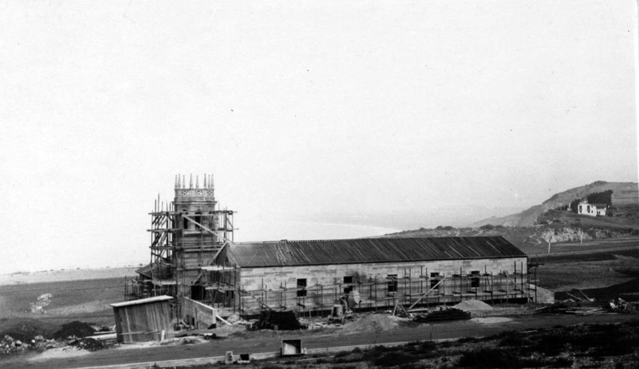 |
|
| (1926)* – Panoramic view showing construction of Malaga Cove School at 385 Via Almar. |
Historical Notes Malaga Cove School opened on April 5, 1926, serving as both an educational facility and community center. At opening, the school accommodated 35 students and three teachers and included classrooms, an auditorium, offices, and shared gathering spaces. From the beginning, the school was designed to be more than a place of instruction. It functioned as a center for meetings, performances, and civic life, a role it continues to serve today. |
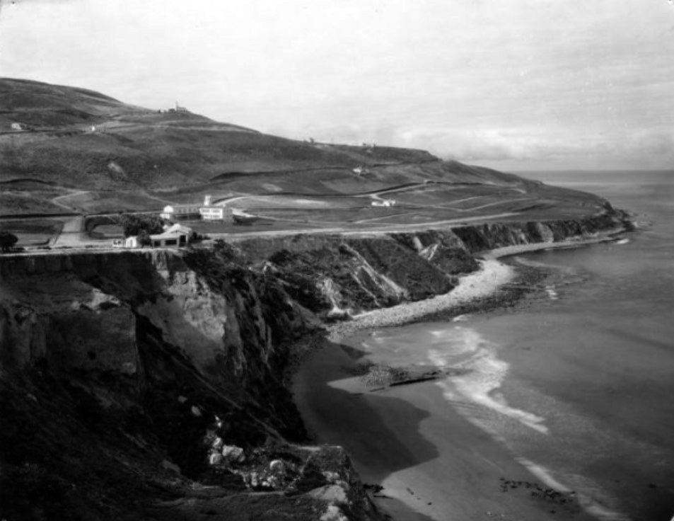 |
|
| (1925)* – Elevated view looking south with the Frederick Law Olmsted Jr residence at left, Malaga Cove School beyond, and La Venta Inn on the hilltop. |
Historical Notes The residence of Frederick Law Olmsted Jr stood prominently on Rosita Place overlooking the cliffs of Malaga Cove. Olmsted, one of America’s leading landscape architects and planning consultants, lived on the peninsula for more than two decades while helping shape its long term planning philosophy. The house was demolished in 1971 due to bluff erosion, a reminder that natural forces continue to influence even carefully planned landscapes. |
* * * * * |
Malaga Cove Plaza (Then and Now)
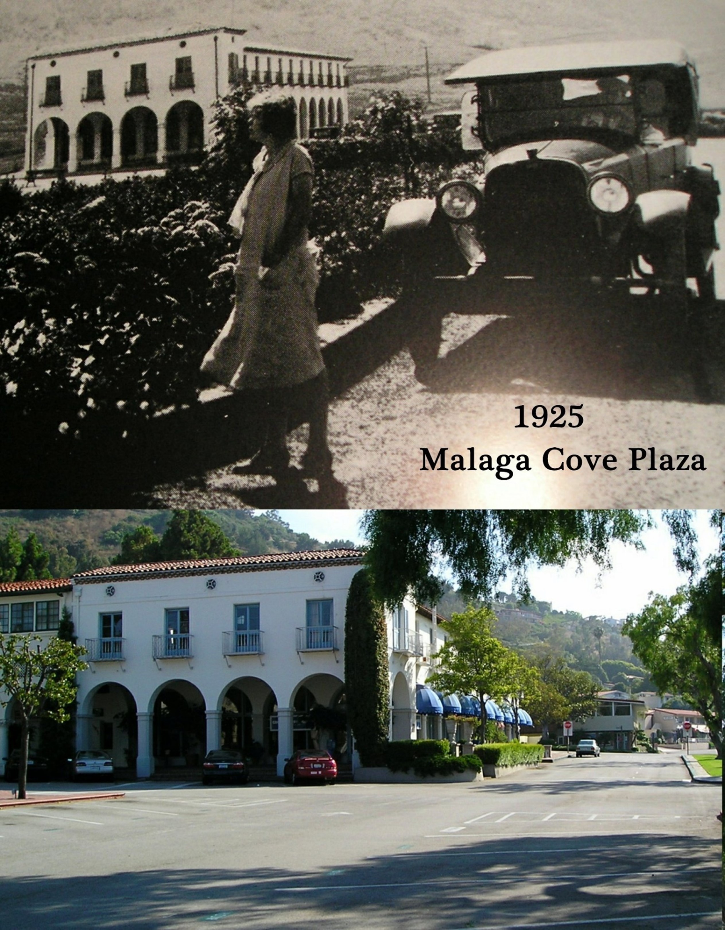 |
|
| (Then and Now)* - Malaga Cove Plaza |
Historical Notes In the early view, Malaga Cove appears as a community still finding its final form. Roads, buildings, and public spaces suggest ambition more than completion. The modern view reveals a fully realized village center. Mediterranean architecture, mature landscaping, and the Neptune Fountain continue to define the space. What stands out most is not change but continuity. Nearly a century later, the plaza still functions much as its planners intended. |
* * * * * |
Palos Verdes Peninsula (Then and Now)
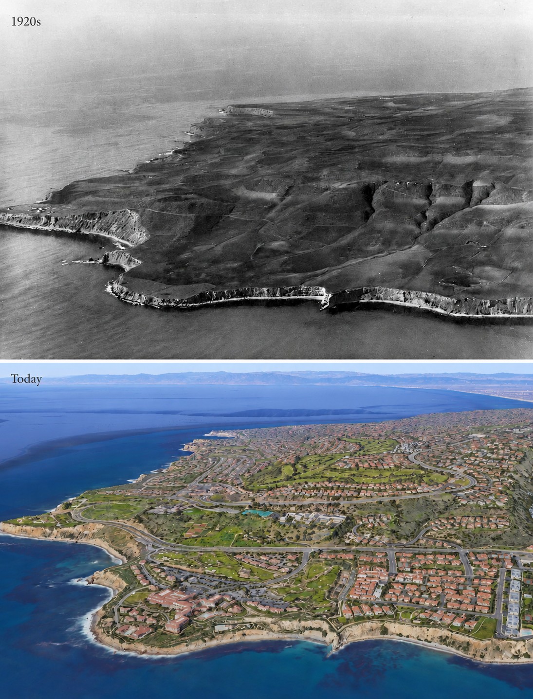 |
|
| (1920 vs. 2021) - Palos Verdes Peninsula. Photo comparison by Jack Feldman |
Historical Notes The 1920 image shows open hillsides, minimal construction, and clear separation from the Los Angeles Basin below. Today, residential development occupies much of the peninsula, yet open space, trails, and protected views remain visible. Early planning decisions emphasized preservation alongside growth, allowing the landscape to evolve without losing its original character. |
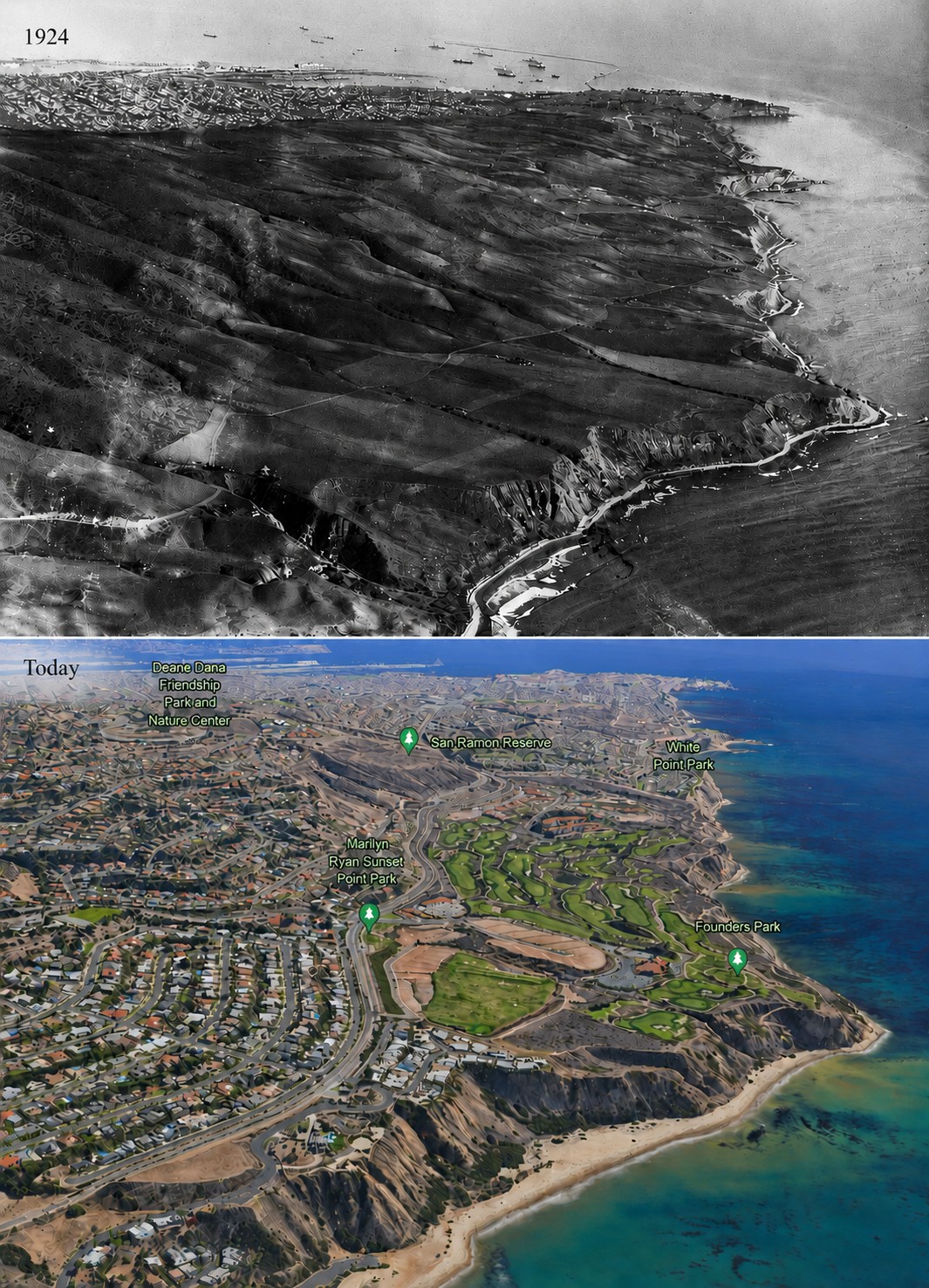 |
|
| (1924 vs 2023)* - Palos Verdes Peninsula, looking southeast towards Point Fermin with San Pedro Harbor seen in the distance. Portuguese Bend is at lower right. Photo comparison by Jack Feldman. |
Historical Notes The early photograph shows sweeping open land descending toward San Pedro Harbor with Portuguese Bend visible in the foreground. Although development expanded dramatically, the peninsula’s geology remains an active force. Major land movement accelerated during the 1950s, but the underlying landslide system predates modern development by thousands of years. The land continues to shape the community as much as the community shapes the land. |
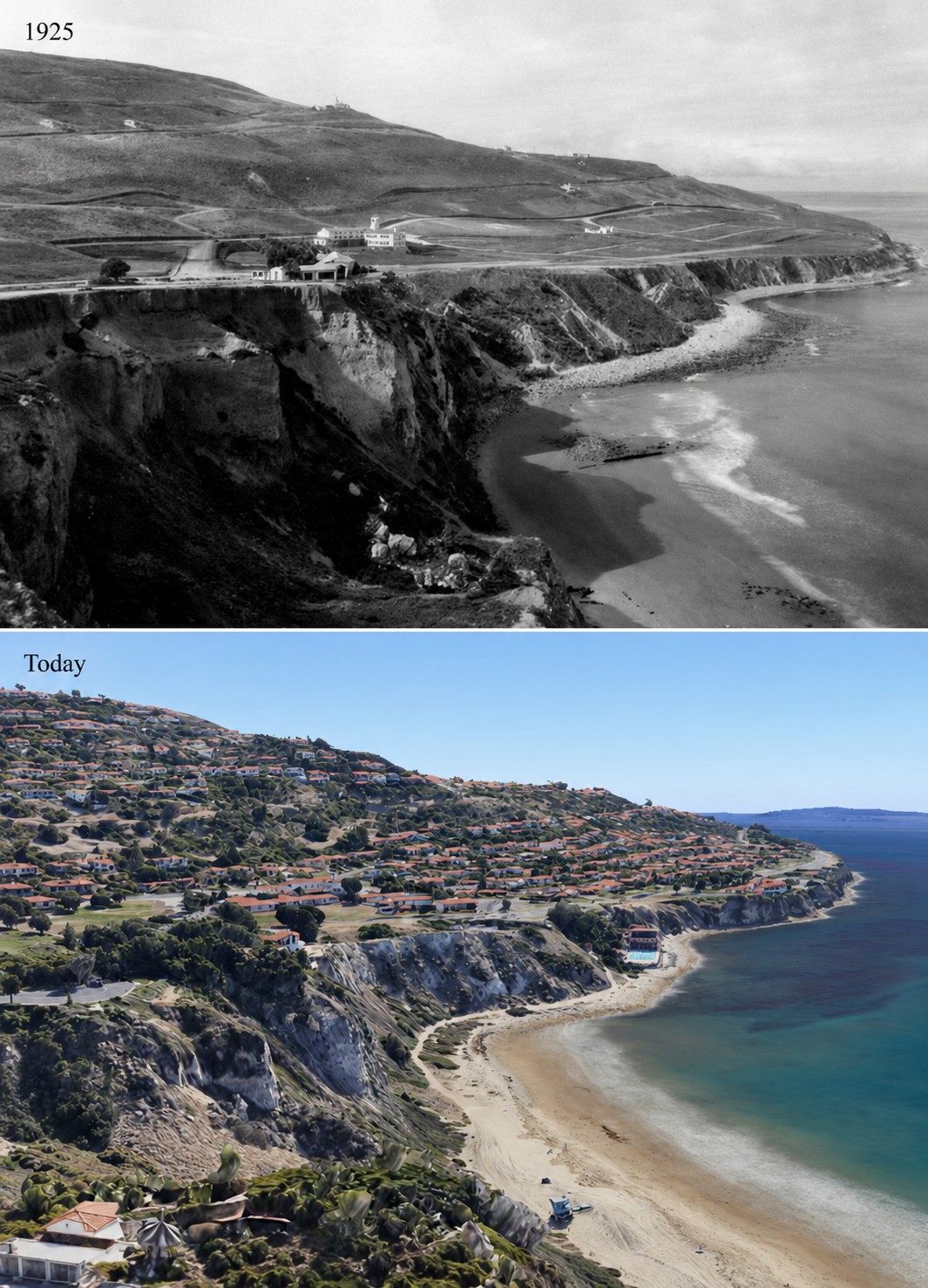 |
|
| (1925 vs 2023)* - Looking southwest toward the cliffs of Malaga Cove. Photo comparison by Jack Feldman. |
Historical Notes The earlier image shows the cliffs largely undisturbed, with the residence of Frederick Law Olmsted Jr visible above the shoreline. Olmsted lived on the peninsula for more than two decades while helping shape its long term planning philosophy. His residence was eventually lost to bluff erosion in 1971. The modern landscape reflects both continuity and change, with mature development above cliffs that remain remarkably recognizable after a century. The land endures even as the community above it continues to evolve. |
* * * * * |
La Venta Inn – Palos Verdes Peninsula |
Long before neighborhoods spread across the Palos Verdes Peninsula, one landmark stood alone atop the coastal bluff overlooking Santa Monica Bay. More than a hotel, La Venta Inn served as the gateway to the new community, introducing prospective residents to the architecture, landscape, and lifestyle envisioned by Frank A. Vanderlip and the Palos Verdes Project.Nearly a century later, La Venta remains one of Southern California's most recognizable historic landmarks and a lasting symbol of the peninsula's original vision |
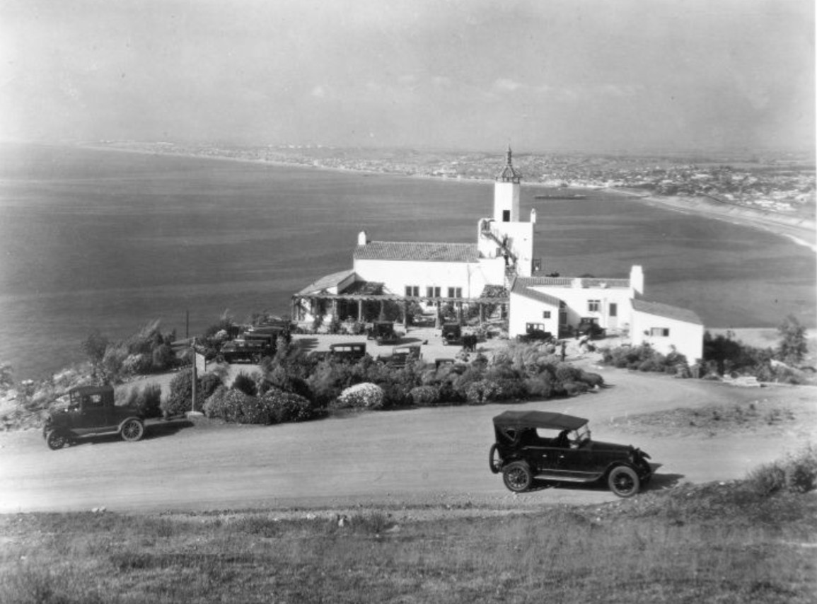 |
|
| (1926)* - Scenic view of La Venta Inn and the coastline stretching toward Redondo Beach and beyond. |
Historical Notes Completed in 1923 as the first completed structure on the Palos Verdes Peninsula, La Venta was built as the promotional clubhouse and sales center for the Palos Verdes Project. Designed by architect brothers Walter and Pierpont Swindell Davis, with gardens planned by the Olmsted Brothers, it welcomed prospective buyers before most of the peninsula had been developed. Its name, "La Venta," Spanish for "the sale," reflected its original purpose. Perched high above the Pacific, La Venta showcased the vision for Palos Verdes as much as the land itself. Visitors arrived by automobile, enjoyed refreshments, then often toured future home sites on horseback before returning to the clubhouse or spending the night. La Venta did not simply sell lots. It sold a vision of coastal living that helped define the peninsula from the very beginning. |
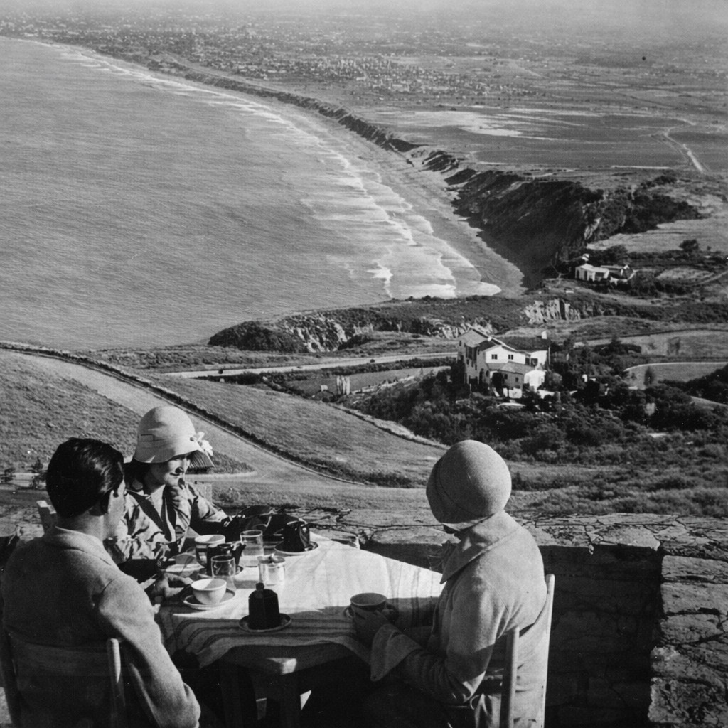 |
|
| (ca. 1926)* - View looking north from the patio of La Venta Inn. |
Historical Notes By the late 1920s, La Venta had become one of Southern California's premier social destinations. The first wedding was held there in 1924, followed by elegant dinners, dances, weekend retreats, and community gatherings. Hollywood stars including Charlie Chaplin, Greta Garbo, Cary Grant, and Joan Crawford, along with aviator Charles Lindbergh, were among the many visitors drawn by the inn's spectacular setting and privacy. The sweeping panorama from the patio became one of the inn's defining attractions. Looking north across Santa Monica Bay toward Redondo Beach and beyond, visitors experienced the same dramatic coastal landscape that had convinced Frank A. Vanderlip this bluff would become the showcase of the new Palos Verdes community. |
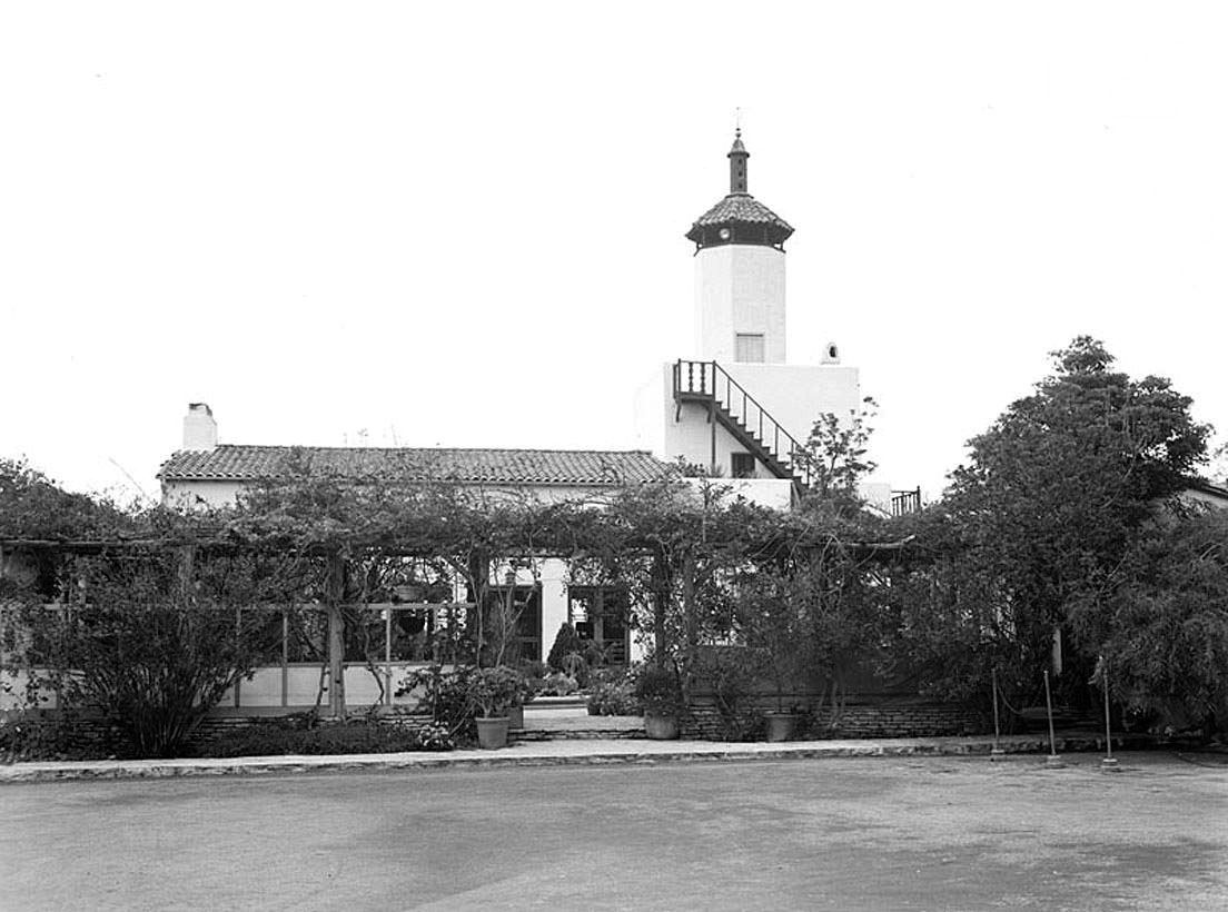 |
|
| (1930s)* – Close-up daytime view of the La Venta Inn. |
Historical Notes During World War II, La Venta's tower served as a twenty four hour lookout for the U.S. Coast Guard, while the lower level hosted USO gatherings for military personnel. On Christmas Day 1941, only weeks after Pearl Harbor, a lookout reported what appeared to be a Japanese submarine offshore, prompting heightened military readiness along the nearby coastline. The object was later identified as a ship's chimney lost during a recent storm, but the incident reflected the uncertainty felt along the Southern California coast during the opening months of the war. Following the war, La Venta briefly became a private residence before returning to public use. Over the decades it evolved into one of Southern California's best known wedding and special event venues, preserving its historic architecture while allowing new generations to experience one of the peninsula's earliest landmarks. |
 |
|
| (1930)* - Exterior view of the La Venta Inn at night, Palos Verdes, April 1930. |
Historical Notes Illuminated against the dark coastline, La Venta embodied the promise of early Palos Verdes—elegant, secluded, and unlike anything else in Southern California. Although the inn contained only a handful of guest rooms, its fine dining, distinctive architecture, and breathtaking setting earned it a reputation far beyond the peninsula. More than any other building, La Venta introduced visitors to the vision of Palos Verdes. Long before surrounding neighborhoods were completed, it stood as the peninsula's defining landmark. Nearly one hundred years later, it continues to occupy the same dramatic bluff where generations of guests first discovered the beauty of the South Bay. |
* * * * * |
San Pedro Harbor (LA Harbor) |
The growth of San Pedro and the Los Angeles Harbor transformed Southern California from a relatively isolated coastal region into an international gateway for trade, industry, immigration, and naval activity.What began as a small natural harbor beneath the cliffs of Point Fermin evolved during the early twentieth century into one of the great harbors of the Pacific. Massive engineering projects, including extensive dredging and the construction of protective breakwaters, created a deep water harbor capable of handling growing commercial shipping and the expanding Pacific Fleet.By the 1920s, the harbor had surpassed San Francisco as the busiest seaport on the West Coast and had become a vital economic engine for Southern California. Shipyards, warehouses, rail lines, fishing fleets, canneries, and naval facilities reshaped the waterfront and helped define the character of the communities surrounding the harbor.The photographs below capture this period of extraordinary growth, showing the expanding port, the protective breakwaters, the arrival of the United States Battle Fleet, and everyday life in the harbor communities that developed alongside one of America's great maritime centers. |
* * * * * |
Outer Harbor and Breakwaters
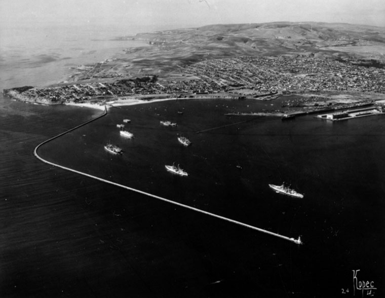 |
|
| (ca. 1924)^ - Aerial view of Point Fermin, Palos Verdes and hills, government breakwaters and the outer harbor. Ships can be seen in the harbor. |
Historical Notes This aerial view looks across Point Fermin toward the outer harbor and the growing network of breakwaters that protected ships from the open Pacific Ocean. The rugged shoreline of the Palos Verdes Peninsula can be seen in the distance as vessels move through the harbor entrance. Together, these improvements transformed the harbor into one of the Pacific Coast's principal shipping centers. |
Harbor and Coastline
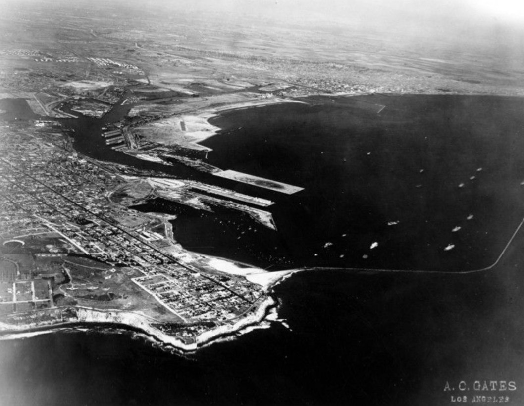 |
|
| (1929)* - Aerial view of San Pedro, the LA Harbor, and the coastline. |
Historical Notes By the late 1920s, San Pedro had become one of the busiest waterfront communities on the Pacific Coast. This aerial view captures the growing relationship between the city, the harbor, and the surrounding coastline as industrial development spread along the waterfront. Railroads, warehouses, ship terminals, and commercial districts developed together as the harbor continued its rapid expansion. |
The Battle Fleet Arrives
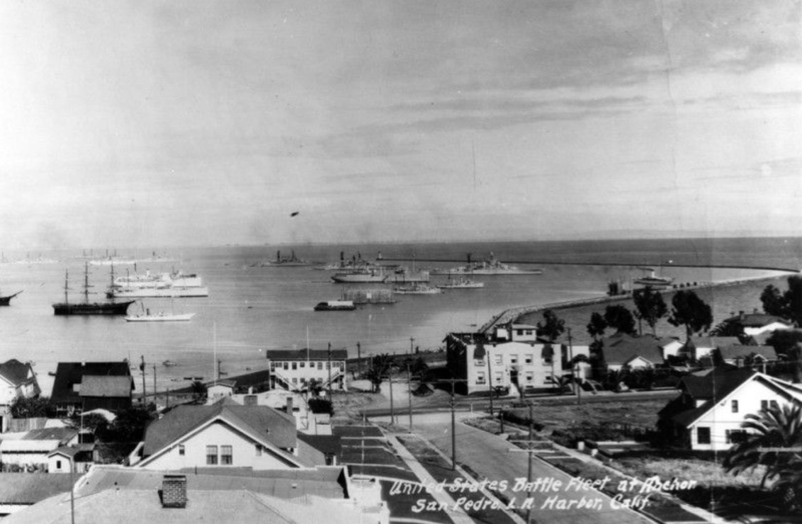 |
|
| (1926)* - Panoramic photo of San Pedro Harbor. The United States Battle Fleet is anchored in the harbor. |
Historical Notes Anchored across the harbor is the United States Battle Fleet, whose presence reflected the growing strategic importance of the Pacific following the First World War. The fleet became a familiar sight in the harbor during the 1920s, bringing thousands of sailors and officers to local communities and reinforcing the harbor's role not only as a commercial center but also as one of the nation's most important naval ports. |
Expanding Harbor Facilities
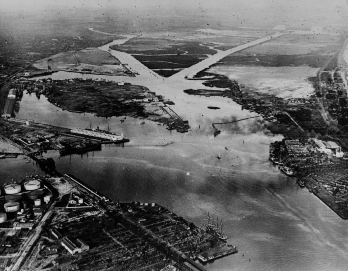 |
|
| (1921)* - Aerial view of San Pedro Harbor. The port continued to expand and would become the busiest seaport on the west coast. |
Historical Notes This aerial view captures the harbor during a period of remarkable growth and construction. New docks, warehouses, rail connections, and shipping facilities were being added almost continuously to accommodate increasing maritime traffic. Few places in Southern California changed more dramatically during the early twentieth century than the harbor waterfront. |
Loading the Automobile Age
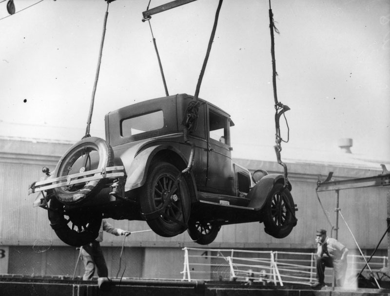 |
|
| (ca. 1926)* - An early model auto is being loaded onto a ship in the San Pedro Harbor. |
Historical Notes An early automobile is loaded onto a ship in the harbor, illustrating the increasingly important role maritime transportation played in Southern California's growing economy. The harbor connected local businesses and manufacturers to markets around the world while bringing imported goods and raw materials into the rapidly expanding region. |
Downtown San Pedro
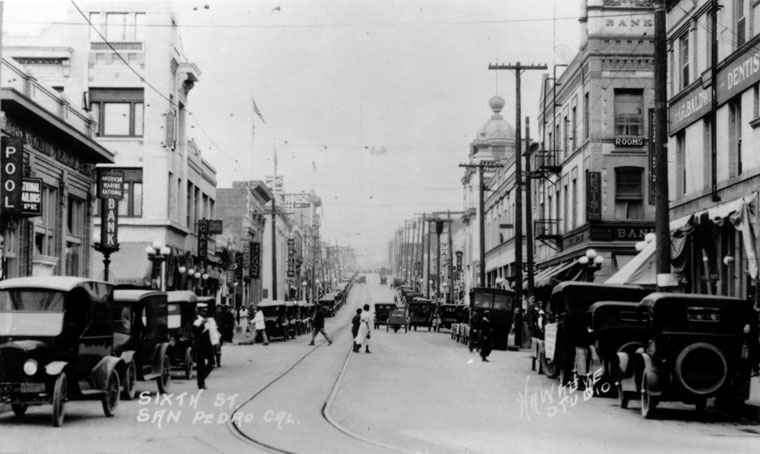 |
|
| (ca. 1915)* - Scenic view of 6th Street in San Pedro. This street is a busy area with many retail stores on both sides of the street. There are two banks, two pool halls, a cafe, shoe store, drug store, a dentist, and even rooms for rent. Automobiles can be seen parked up and down the street. |
Historical Notes This view along 6th Street captures everyday life in downtown San Pedro during the harbor's boom years. Banks, cafes, shops, pool halls, and professional offices lined the street while automobiles filled the curbs. Behind the bustling business district stood a diverse community of longshoremen, fishermen, merchants, sailors, and immigrants whose cultures and traditions helped shape the unique identity of the harbor area. |
Click HERE to see more in Early Views of San Pedro and Wilmington |
* * * * * |
Long Beach |
Long Beach takes its name from the broad stretch of sandy shoreline that first drew visitors and settlers to the coast south of Los Angeles during the 1880s.What began as a modest seaside town established on portions of Rancho Los Cerritos and Rancho Los Alamitos quickly evolved into one of California's largest and most important coastal cities. Drawn by broad sandy beaches, ocean breezes, and convenient rail connections to Los Angeles, visitors and new residents arrived in ever increasing numbers during the late nineteenth and early twentieth centuries.Long Beach soon became known for its elegant hotels, pleasure piers, bathhouses, and the famous Pike amusement district, which attracted visitors from throughout Southern California. The discovery of oil at nearby Signal Hill in 1921, combined with the growth of harbor facilities, industry, transportation networks, and an expanding naval presence, transformed the city into a major center for commerce, shipping, military activity, aviation, and petroleum production.The photographs in this section capture Long Beach during these formative years, when amusement piers, bustling streets, expanding neighborhoods, and growing commercial districts reflected the energy and optimism of a city coming of age along the Southern California coast. |
 |
|
| (ca. 1924)* – View looking south on American Avenue (later Long Beach Boulevard) in Long Beach. To the right, traffic seems to be backed-up while a bus in the distance makes a turn in front of a nearby highrise building. At left, the road appears to be relatively free, one lane of traffic moving by the parked cars at left and the streetcar tracks at center. A number of commercial buildings with canopy-shaded windows can be seen to either side, lining the blocks. |
Historical Notes American Avenue took its name from the "American Colony," the original subdivision laid out by developer William Willmore when he platted the town in 1882. Willmore arranged his main north-south streets to mirror the geography of the United States, with Pacific Avenue to the west and Atlantic Avenue to the east. The avenue served as Long Beach's commercial spine and, from 1902 onward, carried the Pacific Electric Railway's interurban Red Cars south from Los Angeles. The tracks running down the center of the street visible in this photograph made American Avenue simultaneously a shopping corridor and the city's main transit artery. By the mid-1920s, oil money from the Signal Hill discovery of 1921 was pouring into downtown construction. The signs visible in this view, including hotels, pharmacies, automobile dealerships, and radio shops, reflect a city in rapid transition from a modest seaside resort to a regional commercial center. The Pacific Electric's American Avenue Line continued operating until 1935. American Avenue retained its name until 1959 when Long Beach Boulevard was extended south to the waterfront and the corridor was unified under a single name. |
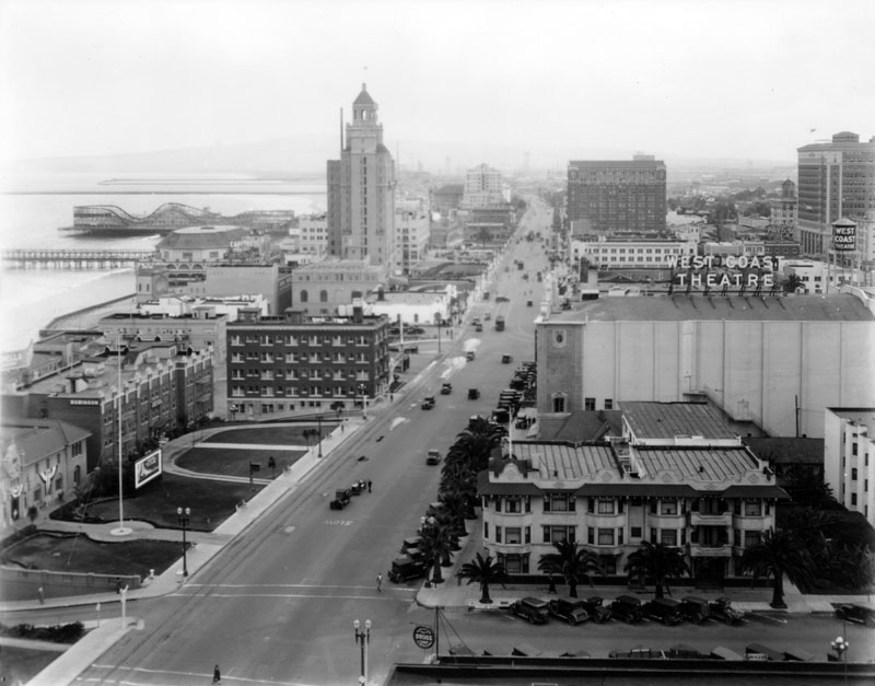 |
|
| (ca. 1920s)^ - Ocean Boulevard winds its way north following the shore in this aerial view of Long Beach. It passes the Municipal Auditorium at the end of Pine Avenue by the pier and The Pike amusement park just north of the auditorium. The roller coaster at the amusement park is on a pier that juts out into the ocean. |
Historical Notes The Municipal Auditorium visible at the foot of Pine Avenue opened in 1905 and served as Long Beach's principal civic gathering place for concerts, conventions, and public events for more than two decades. The structure was eventually replaced by the larger Municipal Auditorium built in conjunction with Rainbow Pier in 1932. Dominating the skyline is the Breakers Hotel, which opened in September 1926 as one of Southern California's grand seaside hotels. Designed by the Los Angeles architectural firm Walker and Eisen in the Spanish Renaissance Revival style, its fifteen story tower quickly became one of the defining landmarks of the Long Beach waterfront. Together with theaters, department stores, and the Pacific Electric Red Cars that connected Long Beach directly with Los Angeles, Ocean Boulevard emerged as one of the region's premier entertainment districts and helped establish Long Beach as one of Southern California's favorite resort destinations. |
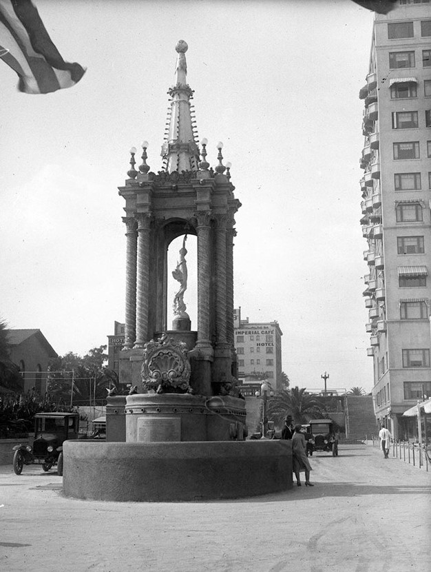 |
|
| (1926)* - The Victory Fountain was a new addition to the north end of the Pike at Chestnut Place in September 1926 in remembrance of World War I veterans. |
Historical Notes The Victory Fountain was financed entirely by residents of West Long Beach and dedicated to the American Legion in memory of those who served during World War I. Dedicated in 1926, the monument stood at the western entrance to the Pike and marked the transition between the amusement zone and the city's commercial district. Its engineering was as elaborate as its appearance. A basement chamber beneath the monument housed a 600 gallon water storage tank and the pump system that powered its cascades and sprays. Color coded flasher lights illuminated the water displays after dark, while a mirrored globe at the top reflected the lights across the surrounding area. The Victory Fountain became one of Long Beach's most distinctive landmarks of the late 1920s. The fountain disappeared along with much of the Pike during redevelopment efforts of the late twentieth century. |
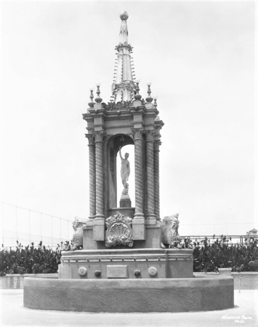 |
|
| (1926)* - Close-up view showing the Victory Fountain, located at the intersection of Chestnut Place near the "Walk of a Thousand Lights" attraction at The Pike in Long Beach. |
Historical Notes This close-up view reveals the fountain's tiered basin structure and the architectural detailing that helped make it one of Long Beach's most distinctive landmarks. The monument stood near the western entrance to the Pike's famous Walk of a Thousand Lights, the illuminated midway that defined the amusement district for much of the early twentieth century. Positioned at one of the busiest entrances to the Pike, the fountain served as both a civic memorial and a gateway feature for visitors arriving from downtown Long Beach. Its location ensured that thousands of visitors passed it each day during the height of the amusement district's popularity. |
 |
|
| (ca. 1920s)^ - The Pike and Pleasure Pier, center, jut out into the ocean from the shore. The ornate bathhouse with its portico sits in the midway. Advertisements for the various attractions at The Pike are on the side of the pier underneath the roller coaster. Portions of the Virginia Hotel and its tennis courts are just beyond The Pike and breakwaters and ocean vessels are on the horizon. |
Historical Notes The Pike began as a simple boardwalk and bathhouse complex in 1902 but quickly grew into the largest and most famous amusement district on the West Coast. The arrival of Pacific Electric Red Car service from Los Angeles the same year immediately gave the waterfront access to millions of potential visitors. By the 1920s, dance halls, theaters, arcades, bathhouses, restaurants, and amusement rides stretched along the waterfront beneath thousands of electric lights. The Pike became one of Southern California's defining entertainment destinations and helped shape Long Beach's identity as a resort city. |
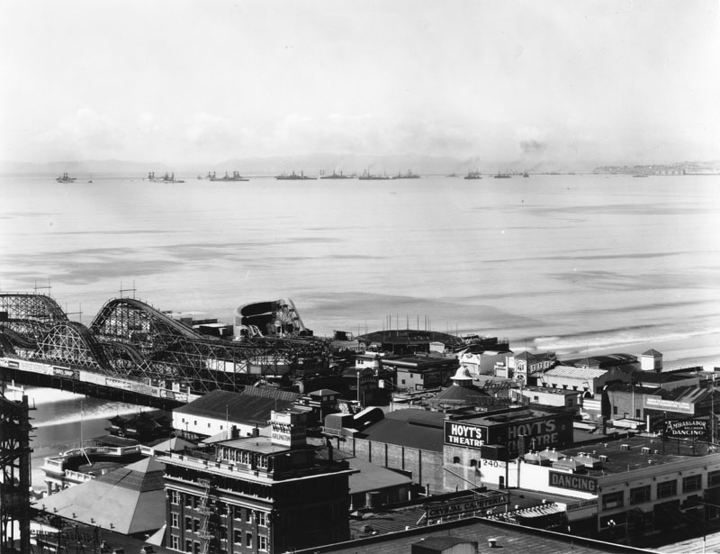 |
|
| (ca. 1920)^ - A view of The Pike amusement park in Long Beach. The roller coaster extends down the pier; underneath it is the Long Beach bath house. The Hotel Arlington is bottom, left. Next to the hotel is the Crystal Cafeteria and next to the cafeteria is the Ambassador ballroom dancing establishment. Hoyt's Theatre abuts the Ambassador. On the horizon are several naval or Coast Guard ships. |
Historical Notes This photograph captures the Pike during its golden age, when theaters, dance halls, restaurants, and hotels lined the midway and visitors arrived daily by Pacific Electric trains from Los Angeles. Long Beach's more relaxed regulations regarding Sunday entertainment helped distinguish the Pike from many competing destinations and contributed to its reputation as one of Southern California's liveliest waterfront districts. The growing presence of sailors and military personnel from nearby harbor facilities added to the area's energetic atmosphere and helped shape the entertainment culture that would define the Pike for decades. |
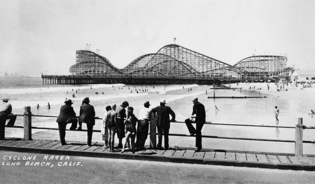 |
|
| (1930)* - A group of people look across the beach toward the Cyclone Racer at the Pike Amusement Park. A lone sailor is looking in a different direction toward perhaps some different scenery. |
Historical Notes The Cyclone Racer opened on Memorial Day, May 30, 1930, at a construction cost of $140,000. Designed by noted roller coaster engineer Frederick Church and built by contractor Harry Traver, it replaced the earlier Jack Rabbit Racer on Silver Spray Pier and quickly became the Pike's signature attraction. Its dual track design allowed two trains to race side by side above the ocean, giving the ride its name and helping make it one of the most celebrated roller coasters in America. The sailor visible in this photograph reflects Long Beach's close relationship with the United States Navy and the Pacific Fleet, which brought thousands of servicemen to Long Beach and San Pedro during the interwar years. The Pike became one of Southern California's best known liberty destinations, and many of its dance halls, cafes, arcades, and eventually tattoo parlors catered directly to visiting sailors. The Cyclone Racer operated until September 15, 1968, when it was dismantled to make way for redevelopment associated with the arrival of the Queen Mary and proposed shoreline improvements that ultimately evolved in different directions. Click HERE to see more in Early Views of Southern California Amusement Parks |
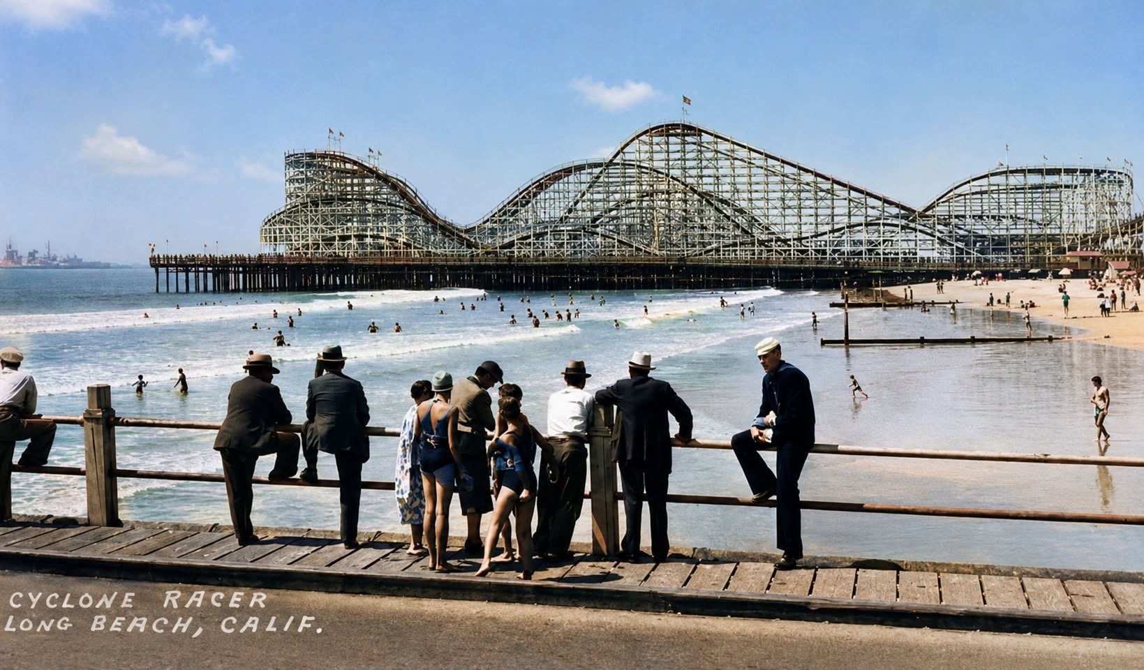 |
|
| (1930))* - Visitors standing on Pine Avenue Pier look across the beach toward the Cyclone Racer and the Pike amusement district beyond. AI-enhanced and colorized from the original photograph. |
Historical Notes Colorization brings this familiar Long Beach scene to life in a way that black-and-white photography sometimes cannot. The warm sand, blue sky, and crowds gathered along the shoreline help modern viewers imagine what a summer day at the Pike may actually have felt like during the early 1930s, when Long Beach stood among Southern California's premier seaside destinations. The image also captures an interesting contrast between leisure and duty. While families and visitors enjoy the beach and amusement park, the lone sailor gazing elsewhere serves as a reminder of the growing military presence that was becoming part of Long Beach's identity during the interwar years. For many servicemen stationed in Southern California, the Pike became a favorite destination during shore leave, blending the worlds of recreation, tourism, and military life along one of the West Coast's most famous waterfronts. |
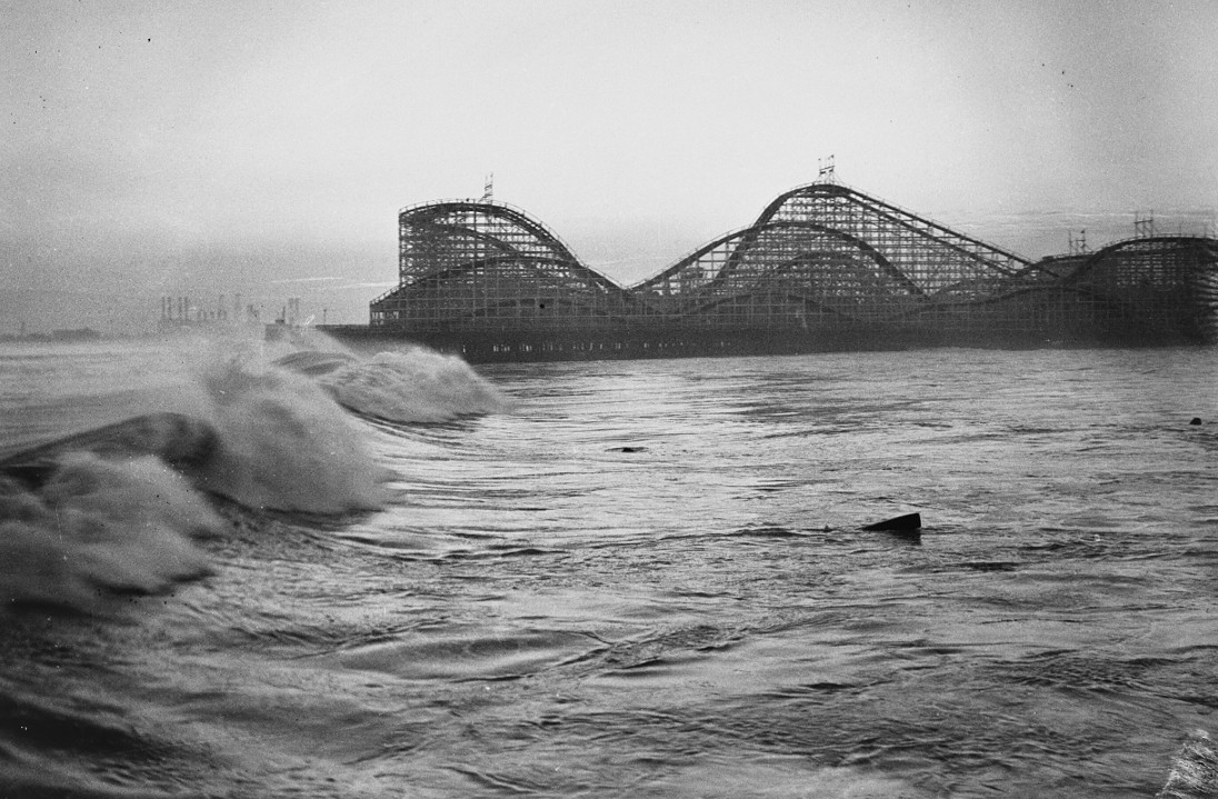 |
|
| (1934)* - Cyclone Racer roller coaster seen from location of destroyed Pine Avenue Pier. |
Historical Notes This photograph was taken shortly after heavy surf destroyed the Pine Avenue Pier in September 1934. Originally opened in 1904, the pier had served as one of Long Beach's principal landmarks and recreational destinations for three decades. Visible in the background is the Cyclone Racer, then still in its early years of operation and rapidly becoming the Pike's signature attraction. The following day's Los Angeles Times reported the destruction under the headline "Raging Seas Wreck Pier and Undermine Homes," documenting one of the most damaging storms ever to strike the Long Beach waterfront. |
Click HERE to see more in Early Views of Long Beach. |
* * * * * |
Return to Los Angeles |
After exploring the growth of Southern California's coastal communities, we return to Los Angeles itself, where the city was rapidly evolving into the commercial, transportation, and civic center of the region.The streets of downtown reflected that transformation. Streetcars shared the road with automobiles, commercial districts expanded south and west from the Plaza, and ambitious engineering projects such as tunnels, bridges, and public buildings reshaped both the city and its skyline.The images that follow capture Los Angeles during the dynamic years between World War I and the Great Depression, when the historic pueblo was giving way to a modern metropolis. Much of the nineteenth century city visible in these photographs would disappear within a generation. |
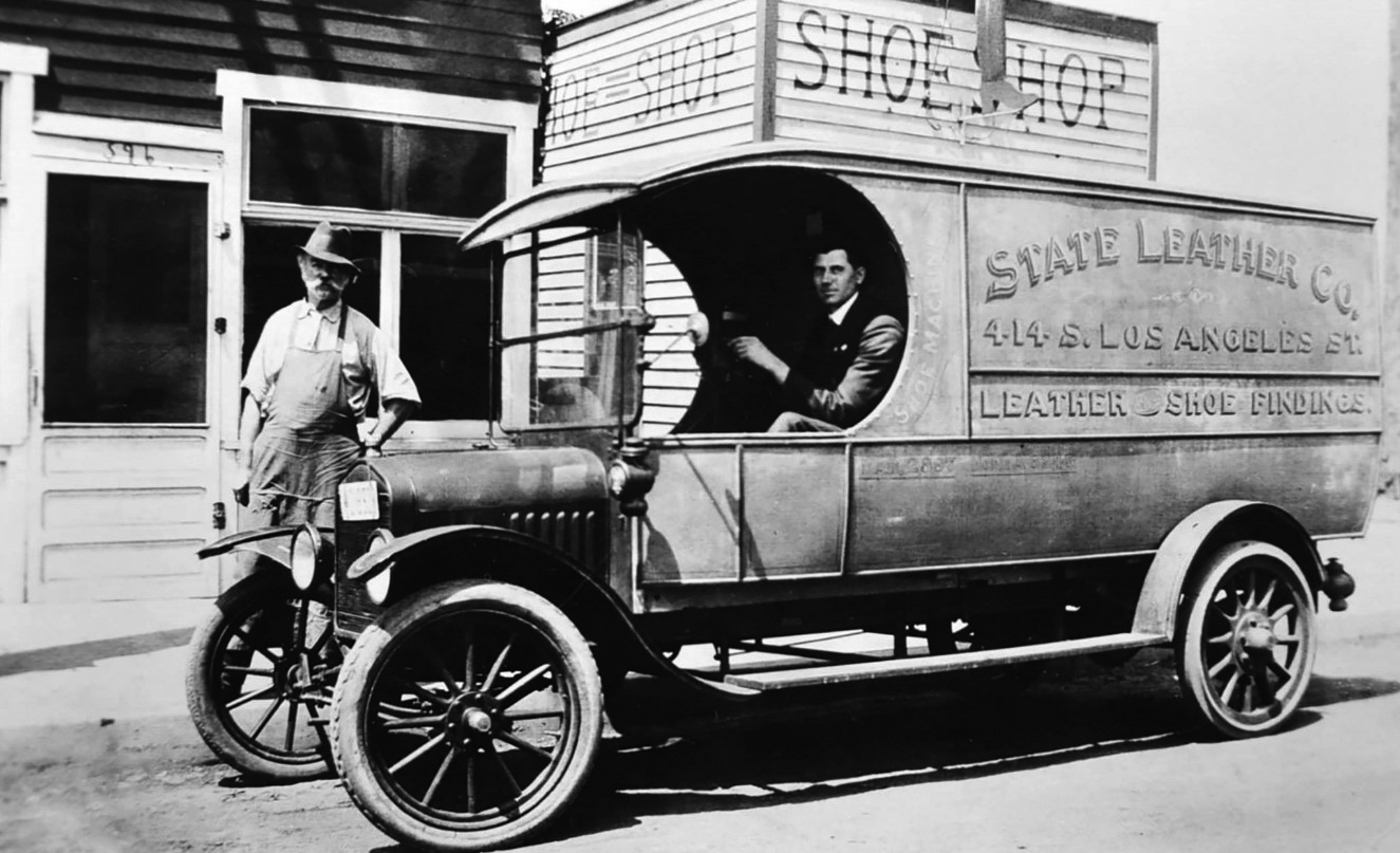 |
|
| (ca. 1918)* - View showing a service vehicle for the State Leather Co. at 414 S. Los Angeles Street. |
Historical Notes By the late 1910s, Los Angeles Street had become one of downtown's principal wholesale and warehouse corridors, lined with produce houses, manufacturing firms, jobbers, and suppliers serving the rapidly growing city and surrounding region. Commercial vehicles such as the State Leather Company truck seen here were becoming an increasingly common sight on downtown streets as businesses adapted to the automobile age. Only a decade earlier, most deliveries would have been made by horse-drawn wagons. The transition from horses to motorized trucks transformed the speed and scale of commerce in Los Angeles during the years following World War I. |
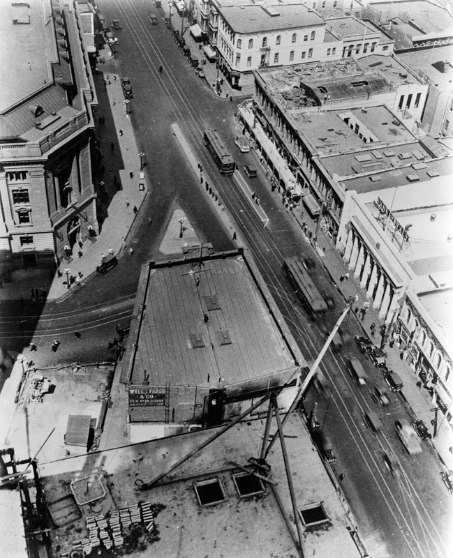 |
|
| (ca. 1920)* - Aerial view looking north of the intersection of Main, Spring and Temple Streets, with Commercial Street in the upper right. Main extends from top to bottom of the photograph. In the center is the Temple Block. |
Historical Notes This aerial view captures the historic heart of Los Angeles, where the city evolved from a small pueblo into the commercial center of Southern California. Main Street, Spring Street, and Temple Street formed the core of the city's business and financial districts during the late nineteenth and early twentieth centuries. At center stands Temple Block, one of early Los Angeles' most important landmarks and the longtime headquarters of many of the city's leading businesses, law offices, and civic institutions. Within a few years the entire block would disappear, cleared for construction of Los Angeles City Hall, which opened in 1928. Click HERE to see From Temple Block to Today's City Hall. |
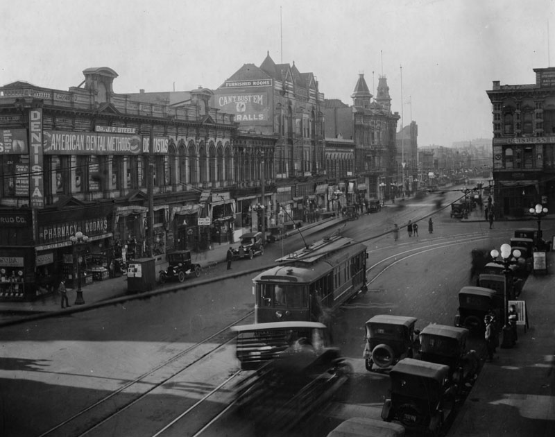 |
|
| (ca. 1920)* - View looking south on Main Street. At left is the southeast corner of commercial Main Street; street car tracks bend at right, to Temple Street. The building at left is the former home of the Farmers and Merchants Bank. At upper-right can be seen one of LA's most historic blocks, Temple Block. This would become the location of today's City Hall. |
Historical Notes Few locations in Los Angeles contained more of the city's early history than the intersection of Main and Temple Streets. The former Farmers and Merchants Bank building, Temple Block, and neighboring commercial structures stood at the center of the city's financial and civic life for decades. By the 1920s, however, downtown Los Angeles was already shifting south and west as new office buildings, department stores, and financial institutions followed the city's rapidly growing population. Within less than a decade, much of the historic landscape visible here would be replaced by the construction of City Hall and the expanding Civic Center. |
* * * * * |
Inside the Yellow Cars and Red Cars |
By the 1920s, two electric railway systems dominated transportation in Los Angeles. The Los Angeles Railway's Yellow Cars provided frequent local service throughout the city and its surrounding neighborhoods, while the Pacific Electric's Red Cars connected Los Angeles with communities across Southern California.Though they served different purposes, both systems became part of daily life for millions of Angelenos. Workers rode downtown each morning, shoppers traveled to Broadway's department stores, students commuted to school, and families boarded weekend excursions to beaches, parks, and amusement resorts throughout the region. For many residents, the streetcar was one of the few places where office workers, laborers, students, and businessmen shared the same public space each day.These streetcars were operated by two-man crews consisting of a motorman at the controls and a conductor responsible for collecting fares and assisting passengers. The photographs in this section offer a rare glimpse inside the cars themselves — at the passengers, the interiors, and the men who operated one of the world's largest electric railway networks. |
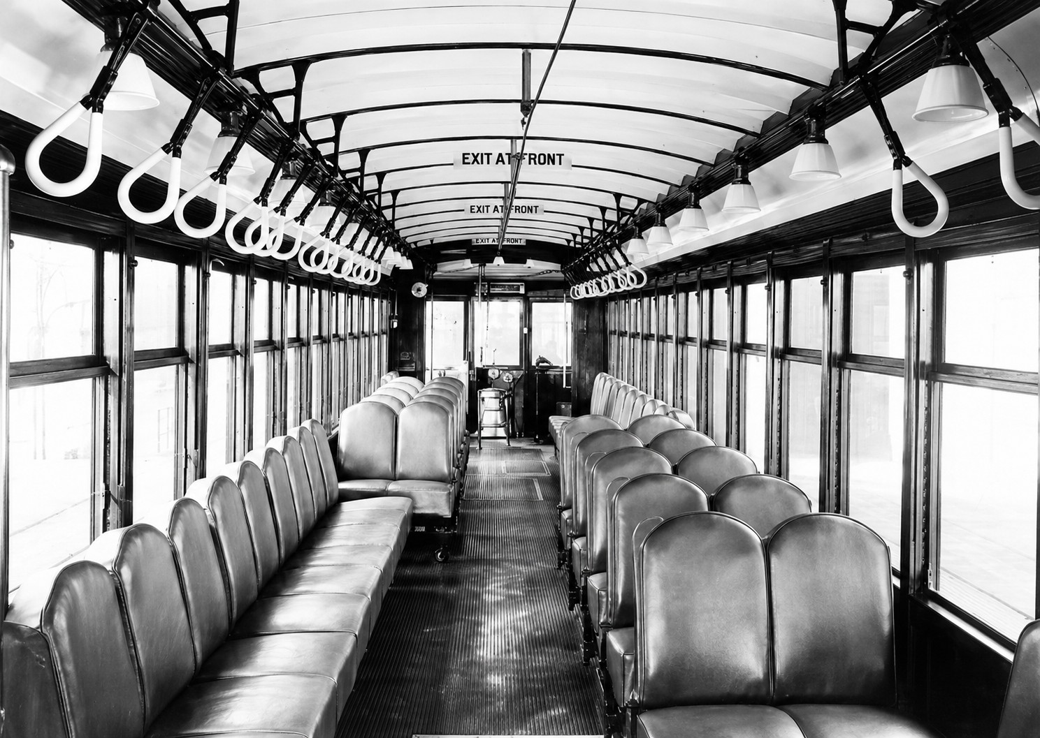 |
|
| (1920s)* - Interior view of an empty Los Angeles Railway (LARy) street car. Signs read: "Exit at Front". Image AI enhanced. |
Historical Notes The "Exit at Front" sign visible in this view reflects the standard passenger flow on Los Angeles Railway Yellow Cars during the 1920s. Riders typically boarded through the rear entrance, paid their fare to the conductor stationed there, and exited through the front doors near the motorman. The interior of a Yellow Car was designed for practicality and durability. Large windows provided natural light and ventilation, while wooden seats, varnished woodwork, overhead straps, and advertising cards above the windows created an environment that became instantly familiar to generations of Angelenos. The clean, unoccupied interior shown here captures what a car looked like at the beginning of a run — before the rush of passengers, the fare-box clicks, and the constant bell signals exchanged between conductor and motorman that punctuated every working day. |
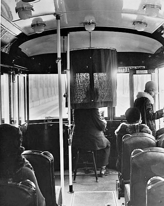 |
|
| (1920s)* - Interior view of a LARy streetcar showing the driver sitting on a stool with a partial curtain separating him from the passengers. |
Historical Notes The partial curtain visible behind the motorman provided a modest separation between the operating controls and the passenger compartment without fully isolating the operator from the car's interior. Unlike modern transit vehicles with enclosed cabs, early streetcar crews worked in close proximity to the passengers they served. The Los Angeles Railway carried more passengers than the larger Pacific Electric system because its routes served the city's densely populated neighborhoods. At its peak, the Yellow Car network operated more than twenty lines serving communities such as Echo Park, Westlake, Hancock Park, Exposition Park, West Adams, Boyle Heights, Lincoln Heights, and Vernon. By the mid-1920s, the system was carrying hundreds of millions of passengers each year, placing enormous demands on motormen as they navigated crowded streets filled with pedestrians, wagons, automobiles, and other streetcars. |
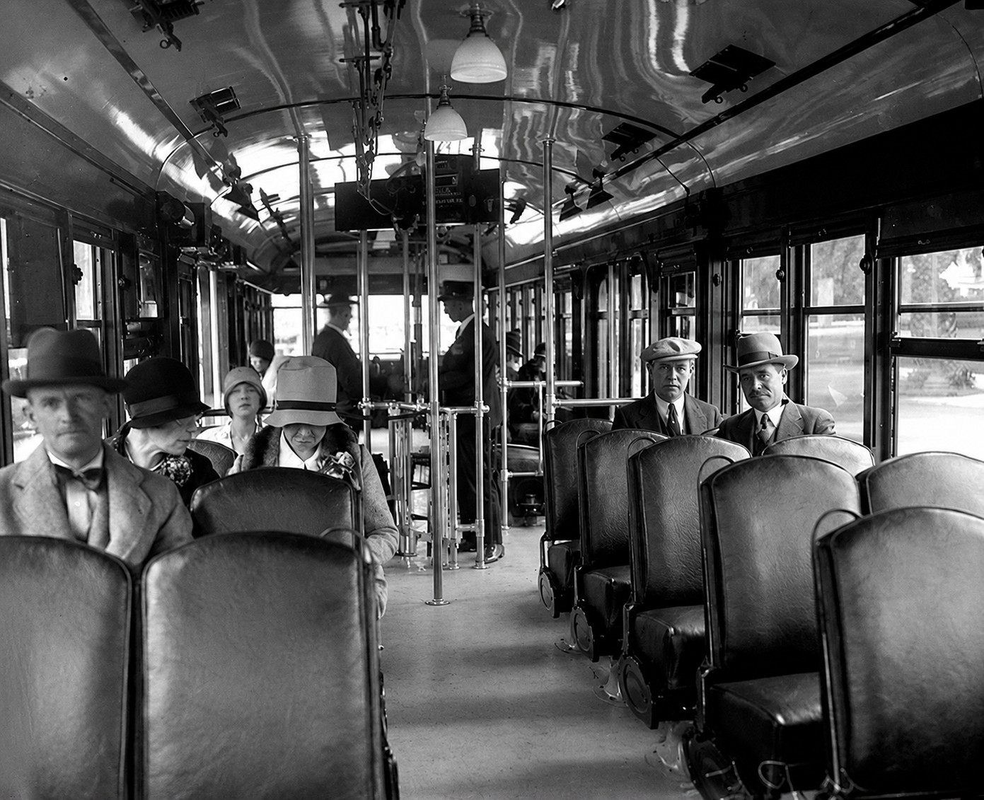 |
|
| (1920)* - Inside view of a Pacific Electric streetcar showing passengers and conductor. |
Historical Notes The conductor seen here was often the public face of the Pacific Electric system. In addition to collecting fares, conductors assisted passengers, communicated with the motorman, managed the flow of passengers at busy stops, and helped keep cars operating on schedule. Unlike the Yellow Cars, which specialized in short urban trips, Pacific Electric's Red Cars were designed for longer journeys between cities and suburbs. Riders traveled from places such as Pasadena, Long Beach, Santa Monica, Redlands, and San Bernardino into downtown Los Angeles, often spending an hour or more aboard the same car. The passengers visible in this photograph represent a cross section of Southern California life during the early twentieth century. Office workers, laborers, students, tourists, and shoppers all shared the same seats as they moved across what had become the largest electric railway system in the world. |
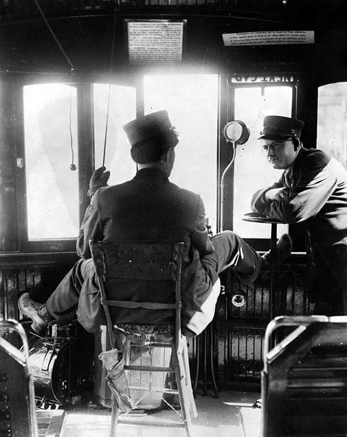 |
|
| (ca. 1920s)* - Inside the cab of a Pacific Electric Red Car, where a motorman and fellow crew member pause for conversation between stops. Photographs of railway employees at work are relatively uncommon and provide a rare glimpse into the daily life of the men who operated Southern California's vast electric railway network. |
Historical Notes The cab view seen here captures a moment rarely preserved in photographs — two crew members pausing for conversation between stops while surrounded by the controls and instruments that governed the operation of the car. Motormen were responsible not only for operating the cars safely but also for maintaining schedules and navigating increasingly congested city streets. Unlike automobiles, streetcars could not steer around obstacles and depended entirely on the skill and judgment of their crews to safely negotiate traffic, pedestrians, grade crossings, and busy intersections. By the 1920s, Pacific Electric had become the largest electric railway system in the world. The men who operated it spent their working lives in cabs like this one, carrying millions of passengers each year across a rapidly growing Southern California. |
* * * * * |
Mercantile Place |
Downtown Los Angeles in the early twentieth century was a place of constant growth and reinvention, but few of its commercial experiments were as innovative as Mercantile Place. Hidden between Spring Street and Broadway just south of Fifth Street, this narrow private thoroughfare opened on October 29, 1904 and offered something unlike anything else in the city: the intimacy of a European arcade combined with the open air of a Southern California street.Only 22 feet wide and 325 feet long, Mercantile Place was lined with matching two story brick storefronts that created a cozy pedestrian environment in sharp contrast to the increasingly busy commercial streets surrounding it. The project occupied the former site of Spring Street School, Los Angeles' first elementary school, which had stood here since 1883 and served generations of children from the growing city.Developer C. Westley Roberts transformed the long, narrow parcel by cutting a street through its center, more than doubling the available storefront frontage and creating one of downtown's most successful shopping destinations. In many respects, Mercantile Place anticipated many of the ideas that would later define Southern California shopping destinations, including pedestrian oriented design, mixed use space, and outdoor retail environments.For nearly two decades, Mercantile Place attracted shoppers, merchants, street vendors, office workers, and curiosity seekers looking for an alternative to the larger and busier retail districts nearby. Its popularity ultimately led to its demise. In 1923 the buildings were demolished and replaced by the Broadway Spring Arcade Building, whose glass covered passageway still follows the route of the original street and preserves the spirit of one of Los Angeles' most charming lost places. |
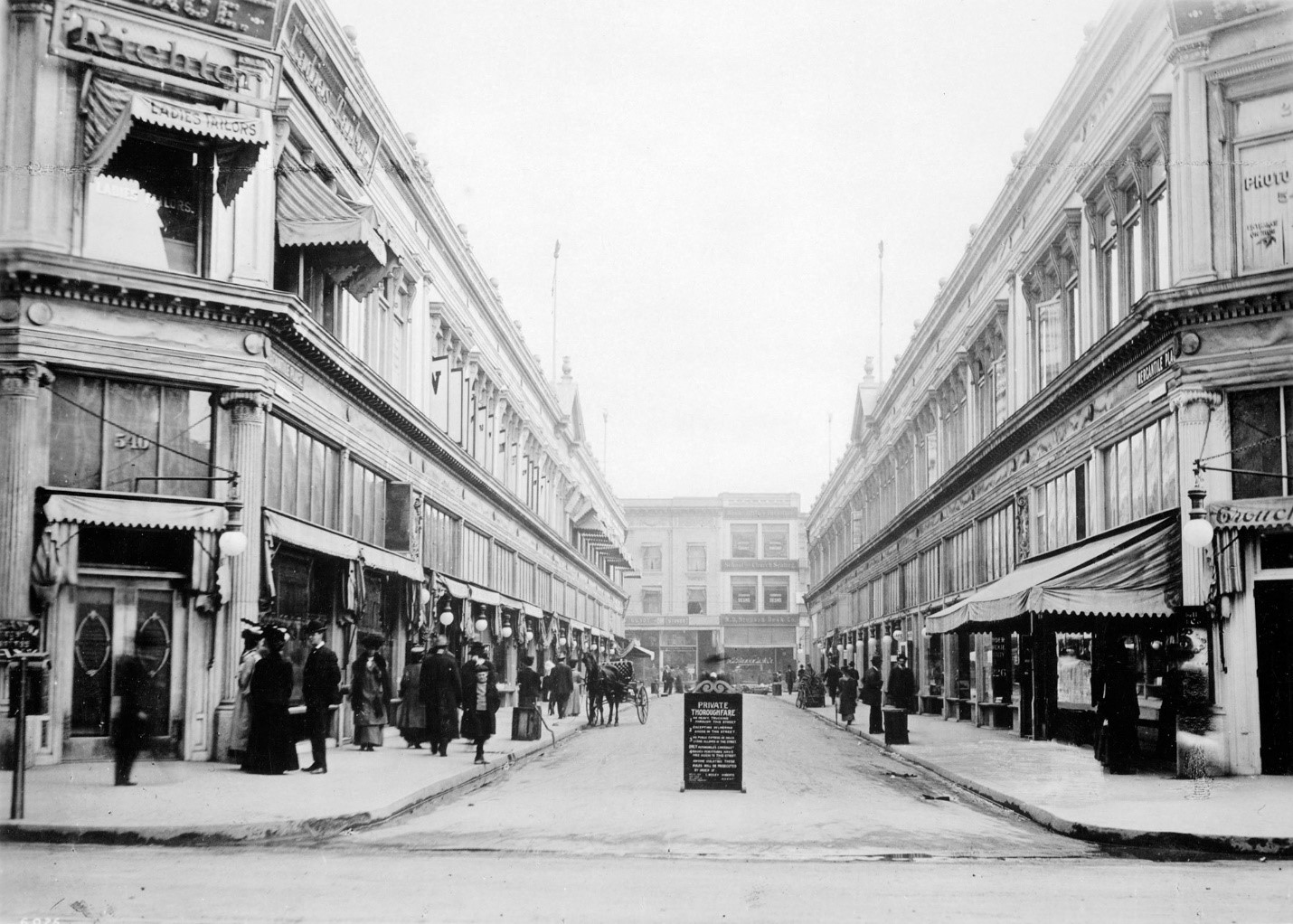 |
|
| (1907)* - A private, open air shopping street, Mercantile Place stretched 325 feet between Spring Street and Broadway in downtown Los Angeles. Signs at either end reminded visitors that despite its appearance, this bustling commercial lane remained a "Private Thoroughfare." |
Historical Notes Mercantile Place occupied a legal gray zone that its owners carefully guarded. Though it looked and functioned like a public street, complete with paved roadway, concrete sidewalks, and open access from both ends, it cut through privately leased land while the Los Angeles School Board retained ownership of the underlying parcel. To preserve those ownership rights, signs declaring the passageway a "Private Thoroughfare" were prominently displayed, reminding visitors that this busy shopping street existed entirely at the pleasure of its lessees. Developer C. Westley Roberts opened Mercantile Place to the public in 1904 after demolishing the Spring Street School that had occupied the site since 1883. His design transformed a real estate liability into an asset. By threading a street through the center of the long parcel, Roberts more than doubled the available commercial frontage from approximately 240 feet to nearly 600 feet. The identical two story brick buildings lining both sides created a symmetry that made the alley feel deliberate and prosperous, a planned commercial district in miniature rather than an afterthought between two larger blocks. |
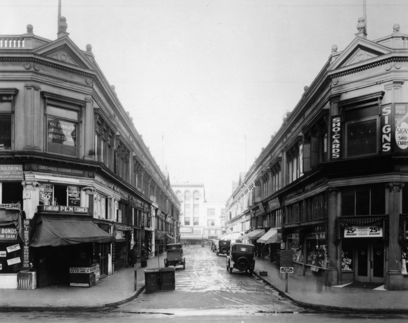 |
|
| (ca. 1920)* - Mercantile Place looking west from Spring Street toward Broadway, just south of Fifth Street. The site originally housed Los Angeles' first elementary school, Spring Street School. |
Historical Notes Before Mercantile Place existed, this ground occupied one of the most important locations in the city's educational history. The Los Angeles School Board acquired the mid block parcel between Spring Street and Broadway in 1883 for $12,500 and constructed Spring Street School, the city's first elementary school. For more than twenty years, children from the surrounding downtown neighborhood passed through its doors as Los Angeles grew from a frontier town into a modern city. When downtown expansion pushed the school elsewhere, developer C. Westley Roberts secured a ten year lease from the school board, purchased the materials of the old school building, and replaced it with Mercantile Place in 1904. Newspapers described the project as "something entirely new in Los Angeles development." By the time this photograph was taken, the value of the property had increased dramatically, reflecting both the success of the development and the explosive growth of downtown Los Angeles during the early twentieth century. |
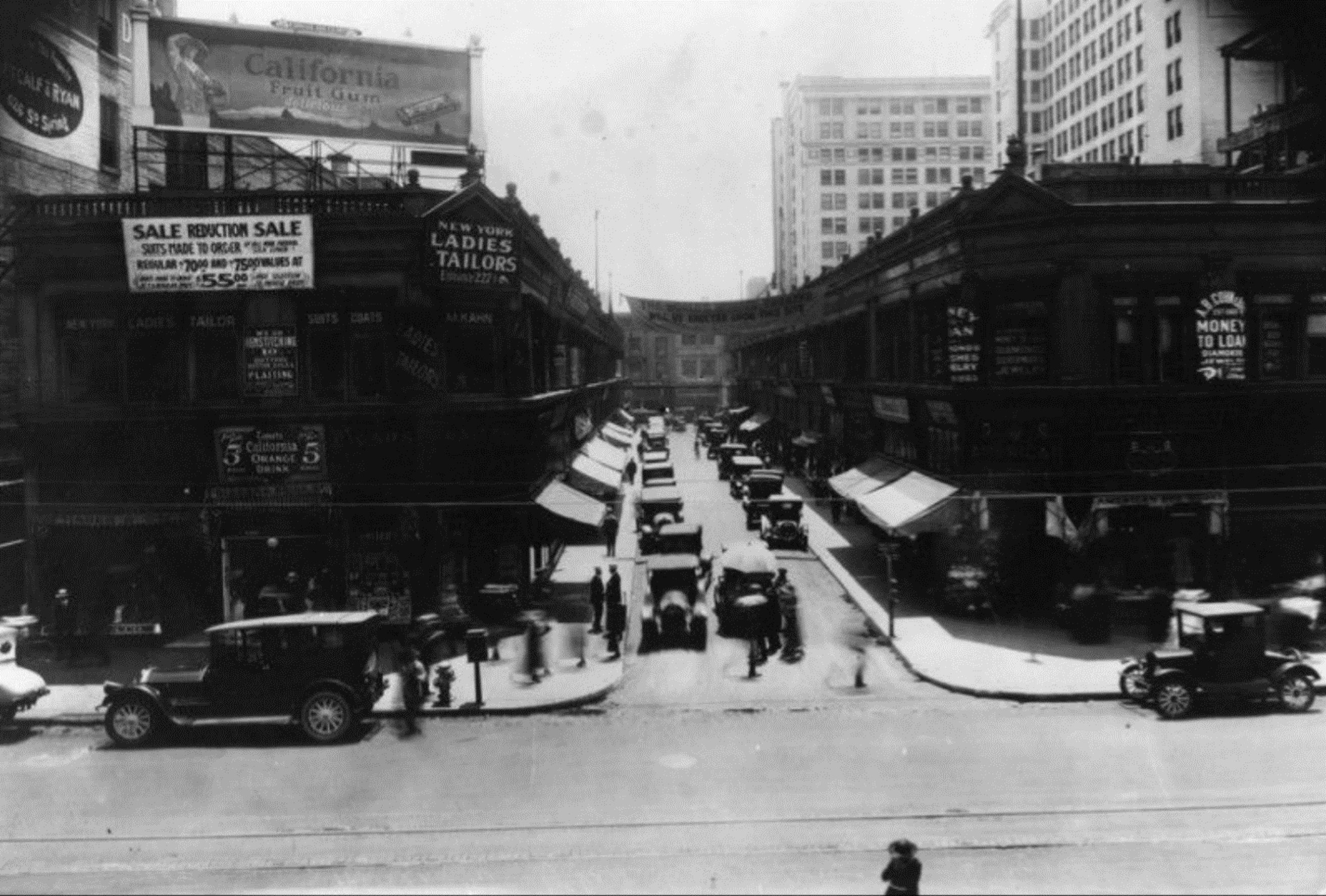 |
|
| (1920s)* – View looking east on Mercantile Place from Broadway. Visible signs advertise tailors, loans, restaurants, and specialty shops, including New York Ladies Tailors, Adams California Fruit Gum, and A.B. Cohn, Money to Loan, established in 1869. |
Historical Notes The signs crowding the walls of Mercantile Place in this view reveal a commercial street that had evolved well beyond its original vision. What began as an orderly collection of merchants had grown into something more organic and democratic, a downtown bazaar where tailors, pawnbrokers, curio dealers, and specialty shops competed for the attention of passersby. Contemporary accounts described farmers' trucks selling produce directly from the roadway while flower vendors, newsstands, and pedestrians filled the narrow passageway throughout the day. The sign for A.B. Cohn, Money to Loan, established in 1869, connected Mercantile Place to the older commercial traditions of nearby Spring Street and the city's financial district just beyond. Despite its intimate scale and pedestrian friendly atmosphere, Mercantile Place was not exclusively reserved for foot traffic. As a private thoroughfare, it remained open to automobiles, delivery vehicles, and occasional parking, creating an early example of the shared street environments that would become popular many decades later. Shoppers, office workers, vendors, and vehicles occupied the narrow passageway together throughout the day. By the early 1920s, the modest two story buildings no longer represented the highest use of such valuable downtown real estate. New investors envisioned something larger and grander for the property, and in 1923 demolition crews arrived to erase one of downtown's most distinctive streets. |
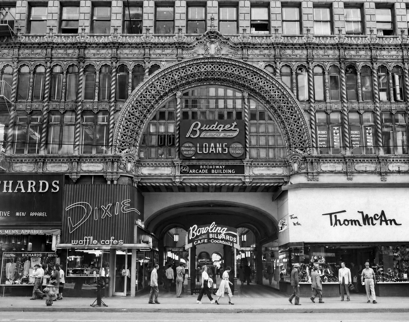 |
|
| (1953)* - The Broadway entrance of the Mercantile Arcade Building, looking north toward Fifth Street. Completed in 1924, the building replaced Mercantile Place with two twelve story office towers connected by a three story glass-roofed shopping arcade that followed the same path as the original street. |
Historical Notes When the Mercantile Arcade Building opened in February 1924, it was promoted as a "City Within a City." The new complex contained offices, ground-floor shops, restaurants, and services, all organized around a covered pedestrian arcade running between Broadway and Spring Street. Architects Kenneth A. MacDonald Jr. and Maurice C. Couchot designed the building with a glass-covered interior passage inspired by London's Burlington Arcade, giving downtown Los Angeles one of its most distinctive shopping interiors. By the time this photograph was taken in 1953, the building had already served downtown Los Angeles for nearly three decades. Although the original open-air Mercantile Place had disappeared, the new arcade preserved its most important idea: a mid-block pedestrian passage lined with shops on both sides. The building was later listed on the National Register of Historic Places and converted to loft apartments following a major restoration completed in 2010. |
Then and Now
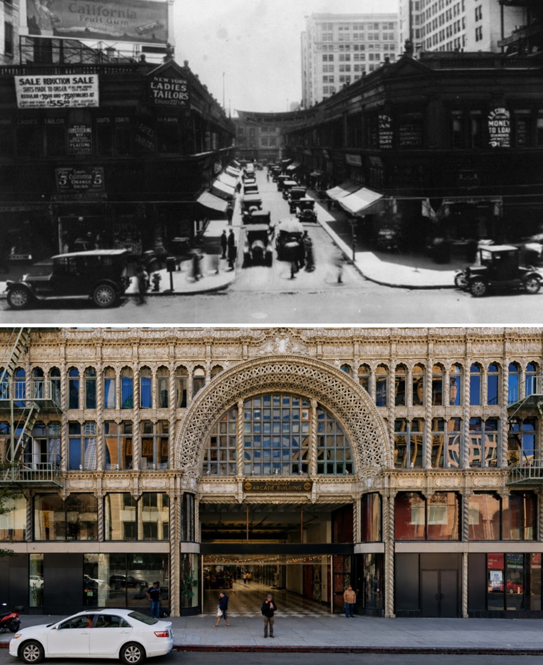 |
|
| (1920s vs 2024)* - View looking east on Mercantile Place from Broadway, compared with the same vantage point today showing the Broadway entrance of the Mercantile Arcade Building. The two story brick storefronts of Mercantile Place were demolished in 1923 to make way for the twelve story towers and glass-roofed arcade that now occupy the site. Photo comparison by Jack Feldman. |
Historical Notes The 1920s view captures Mercantile Place near the end of its life as an open-air shopping street. The crowded signs for tailors, money lenders, restaurants, and specialty shops reflect a lively commercial passage that had grown more varied and informal than developer C. Westley Roberts may have imagined when he opened the street in 1904. Farmers' trucks, flower vendors, newsstands, shoppers, and office workers all helped give Mercantile Place the feeling of a small downtown marketplace tucked between two major streets. The modern view shows the Broadway entrance of the Mercantile Arcade Building, completed in 1924 on the same parcel. The change in scale is dramatic, with twelve stories rising where two-story storefronts once stood. Yet the basic idea survived. The arcade still runs east to west between Broadway and Spring Street, still follows the line of the original 325-foot street, and still serves as a pedestrian shortcut through the middle of the block more than a century after Roberts first cut the path through the old schoolyard. |
Then and Now
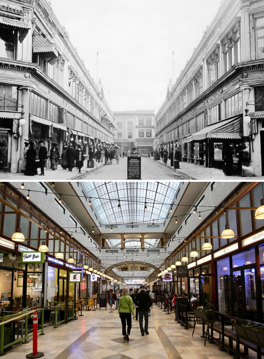 |
|
| (1910 vs 2020s)* - Mercantile Place, today occupied by the Broadway Spring Arcade Building. Photo comparison by Jack Feldman. |
Historical Notes Demolition of Mercantile Place began on May 1, 1923. Within months, the open air street had disappeared and construction had begun on an entirely new development. Architects Kenneth A. MacDonald Jr. and Maurice C. Couchot designed a pair of office towers connected by a grand shopping arcade inspired by London's Burlington Arcade. Although larger and more elaborate than its predecessor, the new building preserved the essential idea behind Mercantile Place: a pedestrian passage connecting Spring Street and Broadway and lined with shops on both sides. The Broadway Spring Arcade Building opened in February 1924 with offices and shops organized around the central pedestrian arcade. Following a major restoration completed in 2010, the building continues to serve residents and visitors while preserving the route first established by C. Westley Roberts more than a century ago. |
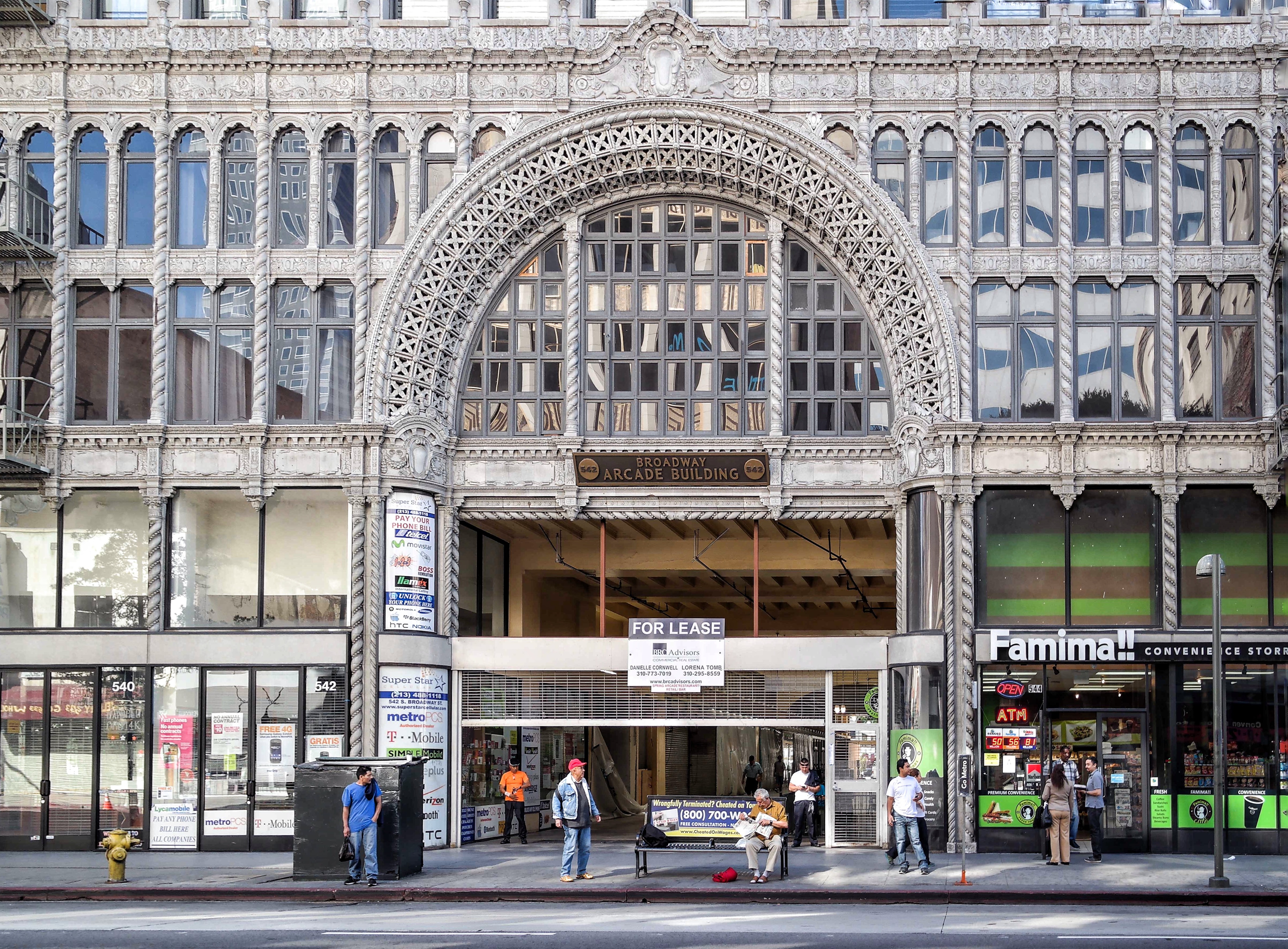 |
|
| (2014)* – The Broadway entrance to the Broadway Spring Arcade Building, completed in 1924 on the site of the former Mercantile Place. The elaborate entrance arch became one of downtown Los Angeles' most distinctive architectural features and marked the entrance to the glass-covered shopping arcade beyond. Photo by 'Visitor 7' / Wikipedia. |
| Historical Notes
The Broadway entrance became the public face of the Broadway Spring Arcade Building that replaced Mercantile Place in 1924. Designed by architects Kenneth A. MacDonald Jr. and Maurice C. Couchot, the elaborate façade blended Beaux Arts, Renaissance Revival, and Moorish influences into one of downtown Los Angeles' most recognizable commercial landmarks. The enormous ornamental arch announced the entrance to the glass covered shopping arcade beyond, transforming what had once been a modest open air street into a grand indoor commercial passage. Although the scale and architecture had changed dramatically, the route through the block remained exactly where C. Westley Roberts had established Mercantile Place two decades earlier. The buildings changed, the scale changed, and the architecture changed, but the path first cut through the old Spring Street School grounds in 1904 endured. |
* * * * * |
Broadway and Sixth Street |
By the 1910s, the stretch of Broadway between Mercantile Place and Sixth Street stood at the center of downtown Los Angeles commercial life. Streetcars, automobiles, delivery wagons, and crowds of shoppers moved along a corridor lined with department stores, specialty shops, theaters, restaurants, and photography studios. The block reflected a city in transition, with horse drawn wagons still sharing the pavement with early automobiles while electric streetcars carried residents in from the rapidly growing suburbs.By this time, Broadway had overtaken Spring Street as Los Angeles' principal shopping and entertainment corridor, a role it would retain for nearly half a century. Two of the most prominent names on this stretch were H. Jevne and Company, whose six story flagship grocery store anchored the southwest corner of Sixth and Broadway, and Bullock's, whose flagship department store stood a block south at Seventh Street. Between them stood smaller enterprises such as the Hartsook photography studio, clothiers, dry goods merchants, and specialty retailers that made this section of Broadway one of the busiest shopping destinations in Southern California.The final two images in this group capture a different kind of crowd. On November 11, 1918, word reached Los Angeles that fighting in Europe had ended. Broadway filled with automobiles, flags, and celebrating residents as the city marked what was then called Peace Day, a spontaneous outpouring that came a full year before the first formal Armistice Day observance in 1919. |
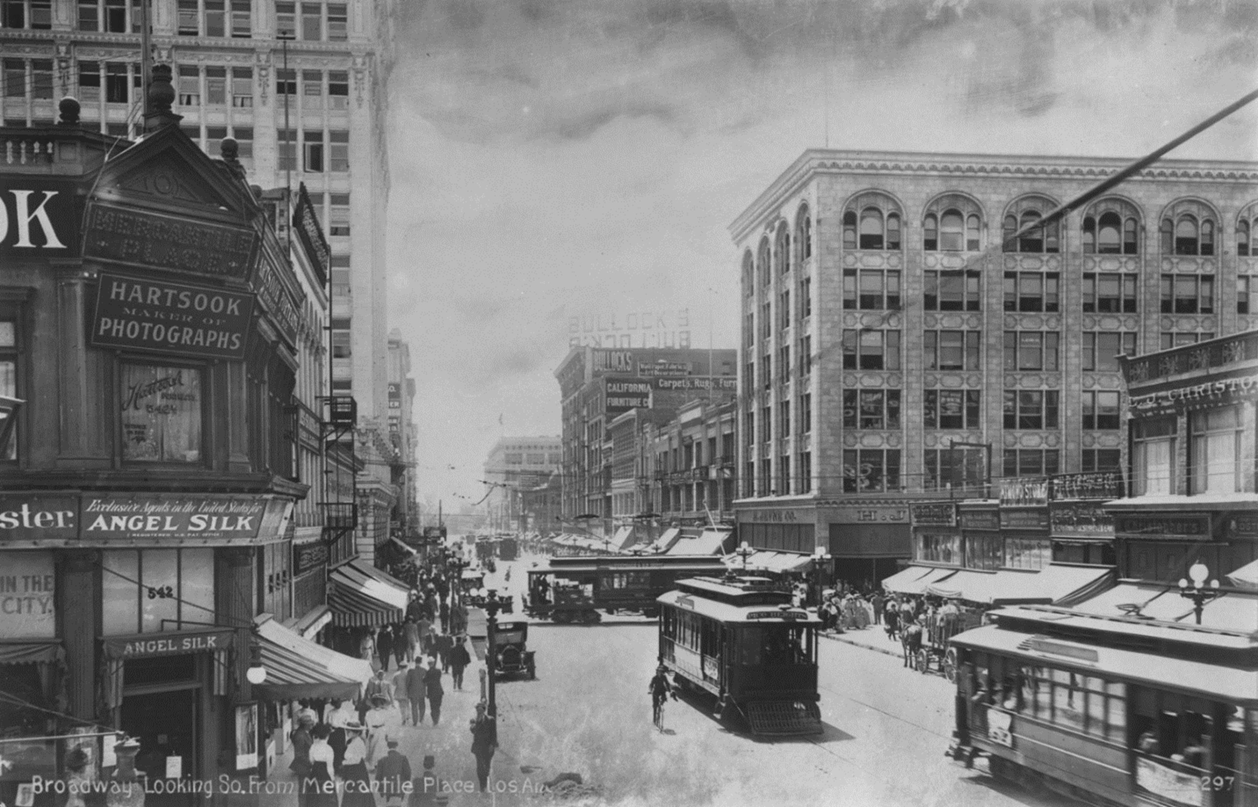 |
|
| (ca. 1910)* - Broadway Street, looking south toward Sixth Street from Mercantile Place, showing busy sidewalks filled with pedestrians, streetcars, automobiles, and a horse drawn wagon. In the distance, Bullock's and the H. Jevne Building are visible, with stores including Hartsook and Angel Silk on the left and Christopher's on the right. |
Historical Notes This view captures Broadway during the years when the street was becoming the commercial and entertainment heart of Los Angeles. Department stores, theaters, restaurants, and specialty shops lined the sidewalks between Third and Ninth streets, drawing shoppers from across the rapidly growing city. Few photographs better capture this moment of transition than this one, where electric streetcars, automobiles, and a horse drawn wagon share the same roadway. The scene reflects a city rapidly embracing new technology while older forms of transportation remained part of everyday life. Within little more than a decade, horses would largely disappear from Broadway, leaving streetcars and automobiles to dominate the street. The businesses visible along Broadway reflected the growing sophistication of Los Angeles consumers during the early twentieth century. Photography studios, clothing merchants, specialty retailers, and department stores transformed the corridor into the city's premier shopping district and helped establish Broadway as the commercial heart of Southern California. |
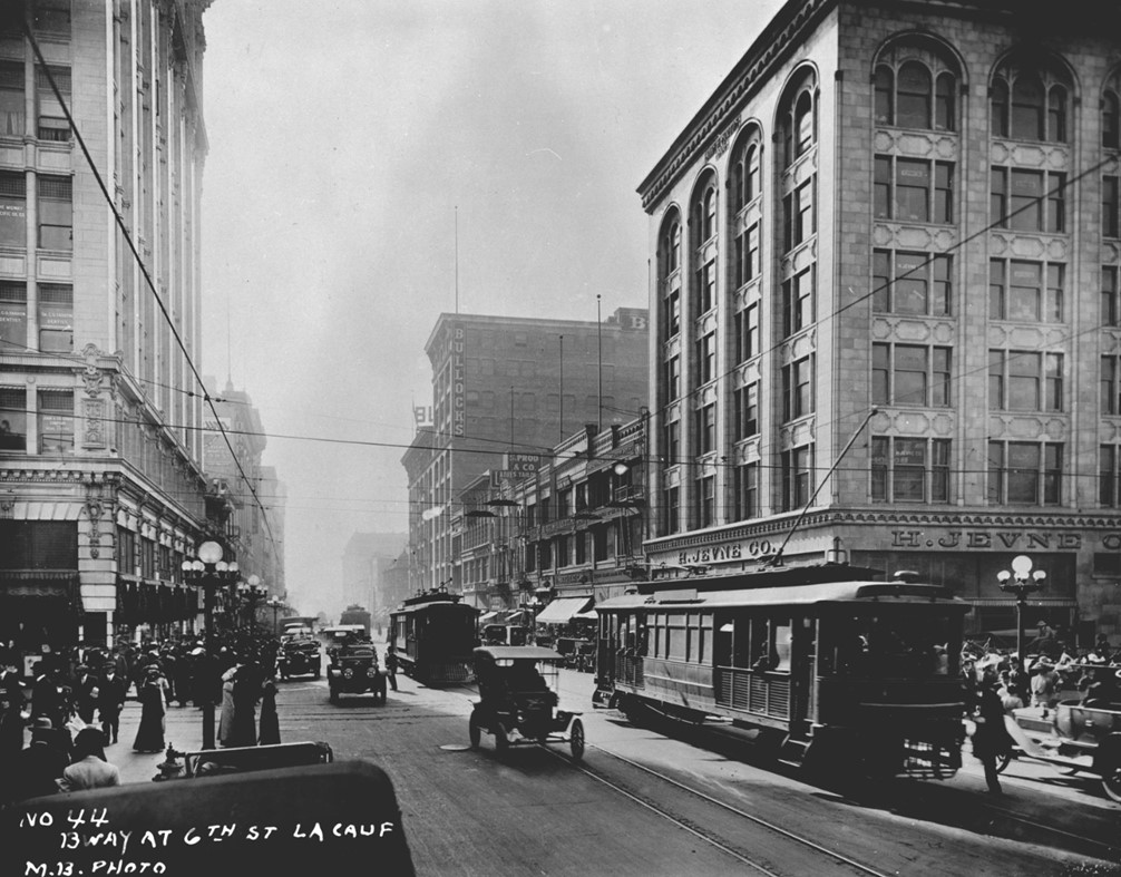 |
|
| (1915)* – Looking south on Broadway at Sixth Street, with the H. Jevne Company building on the southwest corner and Bullock's buildings visible further down the street. Streetcars and automobiles fill the roadway while pedestrians crowd the sidewalks. |
Historical Notes Hans Jevne arrived in Los Angeles from Chicago in 1882 and opened a small grocery store on North Spring Street. Over the following decades his business grew steadily as his reputation for fine imported foods spread throughout Southern California. In 1906 and 1907, H. Jevne and Company constructed its magnificent six story flagship store at the southwest corner of Sixth Street and Broadway. The new store quickly became one of the city's premier retail destinations. Customers could purchase imported delicacies, wines, cigars, specialty foods, and products from Jevne's native Norway, while contemporary observers described it as one of the finest grocery stores in America. Some even called it the finest retail grocery store in the world because of its elaborate equipment, elegant interior, and distinguished clientele. Bullock's, visible further south in this photograph, opened its flagship department store at Seventh and Broadway in 1907. Together, the two businesses helped establish Broadway as the center of upscale shopping in Los Angeles and accelerated the southward movement of the city's commercial district away from the older business center near the Plaza. |
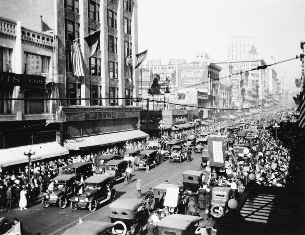 |
|
| (November 11, 1918)* - View looking north on Broadway toward Sixth Street as automobiles crowd the roadway during celebrations marking the end of World War I. The H. Jevne Company building stands prominently on the southwest corner. |
| Historical Notes
News that fighting in Europe had ended reached Los Angeles during the early morning hours of November 11, 1918, and residents poured into the streets almost immediately. Broadway quickly became the center of the celebration as automobiles filled the roadway, flags appeared from windows and storefronts, and thousands gathered to mark the end of what many believed would be "the war to end all wars." The spontaneous celebration became known locally as Peace Day, since the first official Armistice Day observance would not occur until the following year. For residents who had experienced nearly two years of American involvement in the conflict, the news brought relief, joy, and optimism for the future. For much of the day, normal business activity came to a halt as office workers, shoppers, merchants, and visitors abandoned their routines and joined the celebration. Broadway had become the city's great public stage, and on this historic day it served as Los Angeles' collective gathering place. |
.jpg) |
|
| (November 11, 1918)* - Cars decorated with American flags jam Broadway and Sixth Street during a Peace Day celebration marking the end of World War I. |
| Historical Notes
As word of the armistice spread through Los Angeles, residents decorated automobiles with American flags and drove them into the crowded downtown streets. Broadway became the center of the celebration, with vehicles moving slowly through throngs of pedestrians who had left offices, stores, factories, and homes to participate in the historic event. The scene reflected both relief and pride. More than 116,000 Americans had died during the war, and thousands of Southern Californians had served overseas or supported the war effort at home. The celebration represented not simply victory, but the return of peace after one of the deadliest conflicts in human history. For one unforgettable day, Broadway ceased to function merely as a transportation corridor and became the city's living room, where Angelenos gathered to celebrate peace and the promise of a new era. Many who witnessed the events of November 11, 1918 would remember them for the rest of their lives. |
* * * * * |
Hill and Fifth Streets: The Willoughby Corner and Pershing Square |
The intersection of Fifth and Hill Streets stood at the edge of one of downtown Los Angeles' most important public spaces during the early twentieth century. On the southeast corner stood the Willoughby Hotel, housed within the ornate A.L. Bath Building, while the green expanse of Central Park, later renamed Pershing Square, occupied the block immediately to the west. The corner linked two of the city's defining districts of the era: the hotel corridor that stretched along Fifth Street and the rapidly growing civic and commercial center developing along Hill and Broadway.By the 1910s and into the 1920s, this stretch of Fifth Street had filled with hotels, cafeterias, office buildings, and retail storefronts that reflected the remarkable growth of downtown Los Angeles. The Boos Bros. cafeteria chain, which by 1915 reportedly served nearly 40,000 meals daily across Southern California, maintained several downtown locations nearby, while the Metropolitan Building at Fifth and Broadway housed the Los Angeles Public Library from 1913 until the opening of the new Central Library in 1926, explaining the "Public Library Free to All" signage visible in some period photographs of the area.The park across the street carried its own layered history. Established in 1866 as a public square, it was known over the years as La Plaza Abaja, Sixth Street Park, Los Angeles Park, and Central Park before the Los Angeles City Council renamed it Pershing Square in November 1918, just one week after the armistice that ended World War I, in honor of General John J. Pershing, commander of the American Expeditionary Forces. The photographs in this section span that transition, capturing the neighborhood during the final years of Central Park and the early years of Pershing Square. |
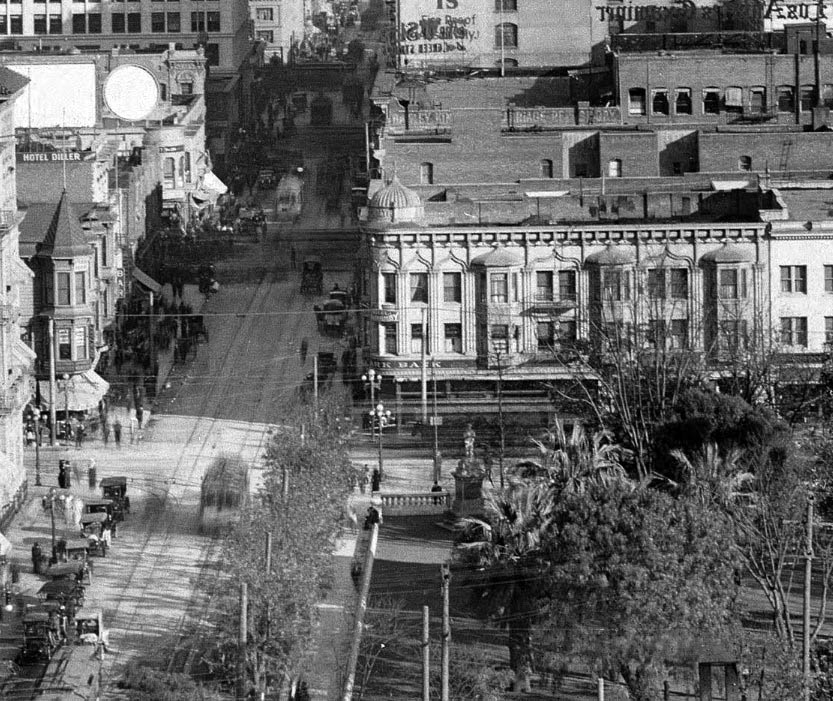 |
|
| (ca. 1913)* - Looking east on Fifth Street toward Hill Street, with the Willoughby Hotel prominently located on the southeast corner. The distinctive dome and bay windows of the A.L. Bath Building anchor the intersection, while Central Park, later renamed Pershing Square, occupies the foreground at right. Streetcars have largely replaced horse drawn transportation as downtown Los Angeles continues its rapid growth. |
Historical Notes The A.L. Bath Building was developed by Nova Scotia native Albert Leander Bath and designed by architect Robert B. Young, one of the most prolific architects of early Los Angeles. Bath named the hotel for his mother's maiden name, Willoughby. Completed in 1898, the building's Moorish Revival design, featuring a corner spire, arched windows, and elaborate decorative detailing, stood apart from most commercial buildings of the period and quickly became one of the most recognizable landmarks overlooking Central Park. Contemporary records associate the Willoughby Hotel with Mrs. E. Hollingsworth, who was connected with the property during its early years. The hotel contained approximately thirty guest rooms. At the turn of the century, the building stood among several important neighboring landmarks, including Hazard's Pavilion, completed in 1887, and St. Paul's Episcopal Cathedral, completed in 1883, as the east side of the park remained largely residential and institutional in character. By the 1910s, however, the neighborhood was rapidly changing. The Willoughby shared its block with the Portsmouth Hotel, the Lillie Hotel, and a growing collection of shops, restaurants, and commercial businesses as the east side of the park evolved into a district serving downtown workers, visitors, and shoppers. The Willoughby ceased operating as a hotel in 1917, although the building continued to house offices and businesses on its upper floors for many decades afterward. |
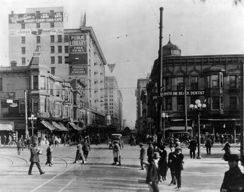 |
|
| (1920)* - Looking east on Fifth Street at Hill Street. The Bath Building, Spinks Building, and Metropolitan Building can be seen, along with storefront businesses including Dr. Beach, Dentist. Automobiles, pedestrians, and streetcars crowd the busy intersection while a sign on one building reads, "Public Library Free to All." |
Historical Notes By 1920, Fifth Street near Hill had become one of downtown Los Angeles' busiest commercial corridors. Office workers, shoppers, hotel guests, and theater patrons moved constantly between Broadway, Hill Street, and Pershing Square as downtown continued to expand southward and westward from its earlier commercial core around the Plaza. The "Public Library Free to All" sign visible in this scene pointed toward the Metropolitan Building at Fifth and Broadway, where the Los Angeles Public Library occupied the upper three floors between 1913 and 1926 while the city planned and constructed its new Central Library building on Flower Street. Automobiles had by this date largely replaced horse drawn traffic on downtown streets, although streetcars remained the primary means of transportation for most Angelenos. The mixture of electric streetcars, private automobiles, delivery trucks, and pedestrians visible in this photograph captures Los Angeles during a brief transitional period when several generations of transportation technology shared the same streets. |
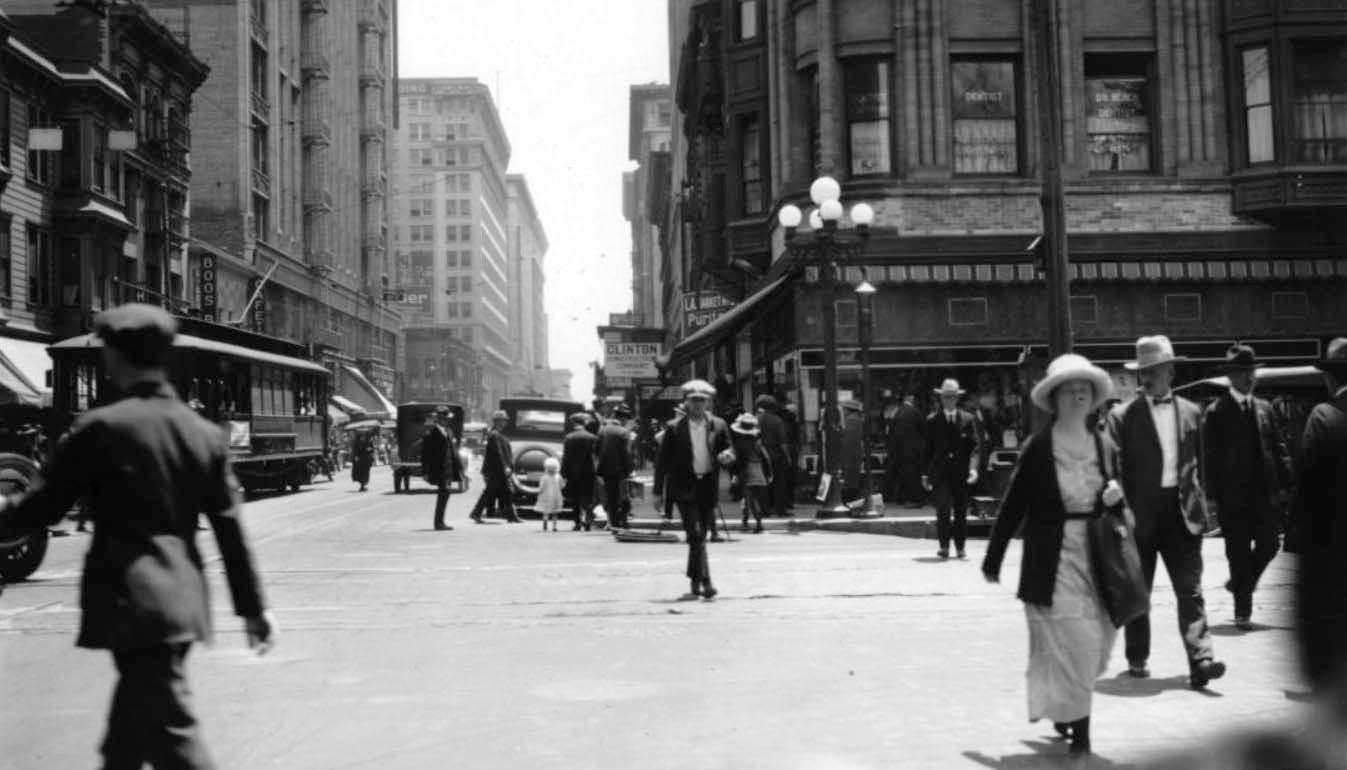 |
|
| (1922)* – View looking east on Fifth Street at Hill Street. Streetcars, automobiles, and pedestrians share the roadway at one of downtown Los Angeles' busiest intersections. The building on the right is the Willoughby Hotel on the southeast corner of Fifth and Hill. Pershing Square lies just out of view across the street to the right. |
| Historical Notes
By the time this photograph was taken, the park across from the Willoughby had carried the name Pershing Square for four years, having been renamed in November 1918 in honor of General John J. Pershing following the end of World War I. The change symbolized Los Angeles' growing connection to national and international events as the city emerged as one of America's major metropolitan centers. Although the Willoughby Hotel had ceased operating five years earlier, the Bath Building remained a familiar landmark overlooking Pershing Square and continued to house offices and businesses on its upper floors. The intersection itself reflected the changing character of downtown Los Angeles, where electric streetcars, private automobiles, and growing pedestrian traffic shared streets that had only recently belonged to horse drawn wagons and carriages. |
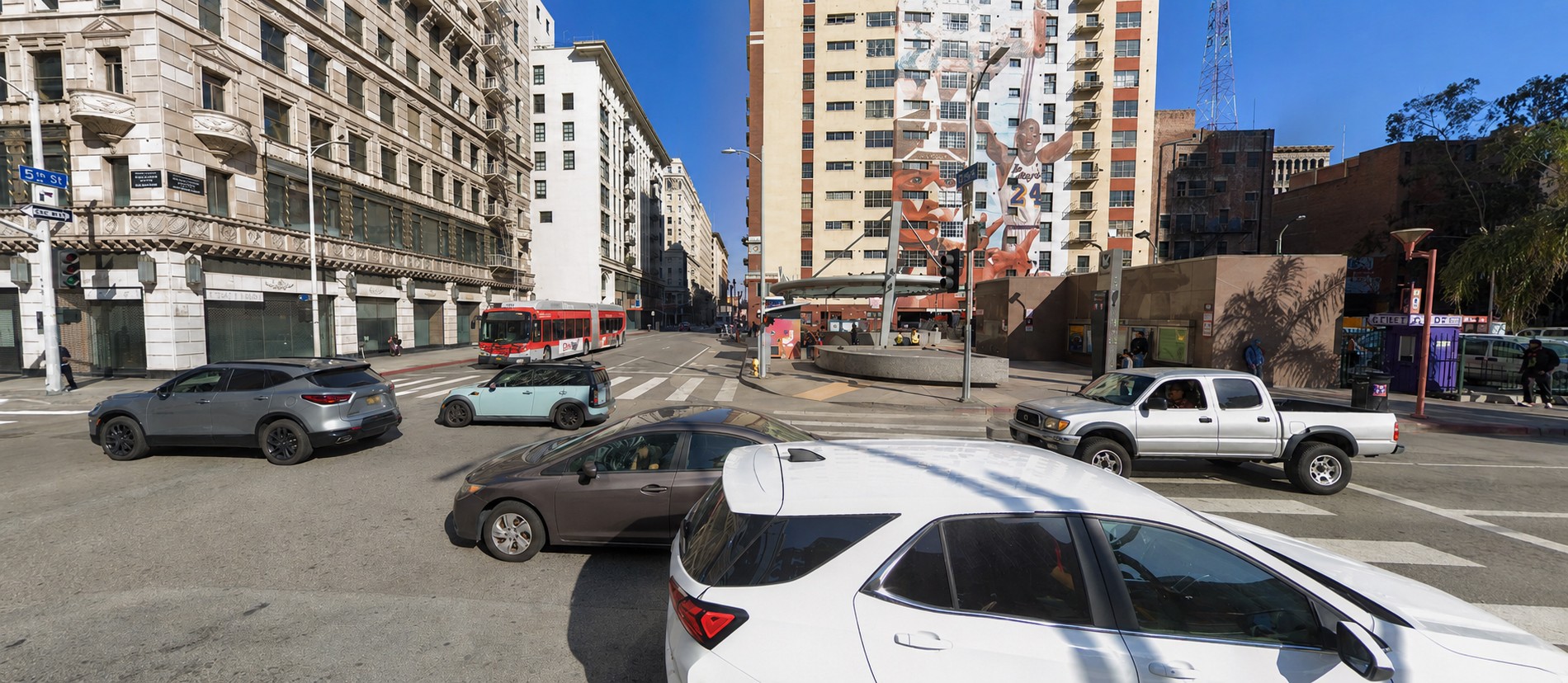 |
|
| (2025)* - Looking east on Fifth Street at Hill Street, where the entrance to Metro's Pershing Square Station now occupies the southeast corner once occupied by the Willoughby Hotel and the A.L. Bath Building. |
Historical Notes The southeast corner of Fifth and Hill bears little resemblance to the streetscape that greeted visitors a century earlier. The ornate A.L. Bath Building and the Willoughby Hotel disappeared in 1982, ending an eighty four year presence overlooking Pershing Square and removing one of downtown Los Angeles' last surviving Victorian era commercial landmarks. Today the corner serves a very different role in the life of the city. Since opening in 1991, Pershing Square Station has become one of the busiest transit hubs in the Metro Rail system, connecting downtown riders with destinations throughout Los Angeles County. In an interesting historical parallel, the intersection continues to function as a transportation crossroads, much as it did during the streetcar era when electric rail lines converged around Pershing Square. The surrounding skyline reflects the changing priorities of downtown Los Angeles over the past century. Hotels and low rise commercial buildings have given way to office towers, apartments, transit infrastructure, and new development projects, while Pershing Square remains the neighborhood's defining public space, continuing a civic role it has held since the nineteenth century. |
Then and Now
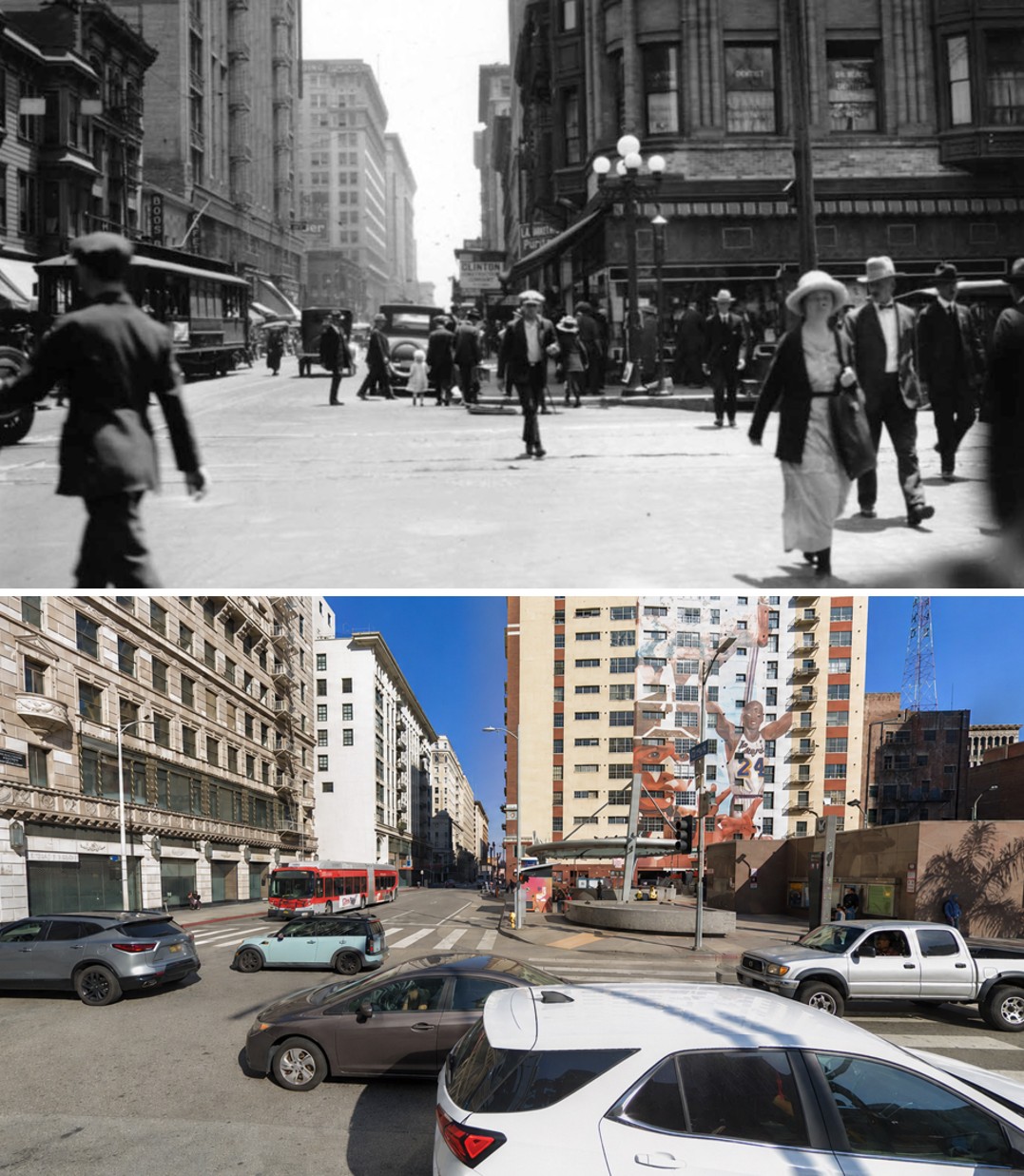 |
|
| (1922 vs. 2025)* - Looking east on Fifth Street at Hill Street. More than a century later, only a handful of buildings survive to connect the modern streetscape with the busy intersection seen during the streetcar era. Photo comparison by Jack Feldman. |
| Historical Notes
The changes visible in this comparison illustrate one of the most dramatic transformations in downtown Los Angeles. The Willoughby Hotel and the distinctive A.L. Bath Building that once dominated the southeast corner disappeared in 1982, replaced first by surface parking and later by the Pershing Square Station entrance. Yet not everything vanished. Several early twentieth century buildings remain visible along the north side of Fifth Street, helping anchor the modern scene to its historic predecessor. The basic street grid established during the nineteenth century also survives largely unchanged, allowing photographs separated by more than one hundred years to be aligned with surprising accuracy. Cities constantly reinvent themselves, but they rarely erase their past completely. More than a century separates these two views, yet the alignment of the streets, the surviving buildings, and the enduring presence of Pershing Square still connect today's downtown with the Los Angeles of the streetcar era. |
* * * * * |
Los Angeles Early 1920s Video
 |
|
| (1920s)* - Click HERE to see a rare film of Los Angeles from the early 1920s, including scenes showing Downtown traffic, Pershing Square, Angels Flight, Hill Street Tunnels, LA Aqueduct, and LA/Belmont Oil Field. |
* * * * * |
Hill Street Tunnels: The Southern Portal |
The southern mouth of the Hill Street Tunnels, opening onto First Street, was where most Angelenos encountered the tunnels in daily life — the gateway between downtown proper and the streetcars, automobiles, and buses threading north through Court Hill toward Temple Street. The first bore, built by the Los Angeles Pacific Railway for streetcars, opened in 1909. A second parallel bore for automobiles, wagons, and pedestrians followed in 1913 as a municipal project.For more than four decades the twin tunnels were among downtown Los Angeles' defining landmarks, carrying generations of Angelenos beneath Court Hill, the northeastern extension of Bunker Hill that many contemporary sources treated as a distinct hill in its own right. By the mid 1950s, however, both the tunnels and the hill itself would disappear as Los Angeles reshaped its landscape to create the modern Civic Center. The story of the Hill Street Tunnels is ultimately the story of a city that first tunneled through its hills and later chose to remove them altogether. |
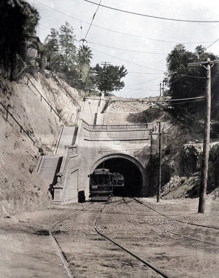 |
|
| (ca. 1910)* - Looking north from First Street toward the south portal of the original Hill Street Tunnel beneath Court Hill. Opened in 1909 by the Los Angeles Pacific Railway, the tunnel provided streetcars with a direct route between downtown and Hollywood. A second parallel tunnel for automobiles and pedestrians would open in 1913. |
Historical Notes The original Hill Street Tunnel opened on September 15, 1909, as a project of the Los Angeles Pacific Railway. By tunneling beneath Court Hill rather than climbing over it, the railway eliminated one of downtown's steepest grades and shortened travel times between downtown Los Angeles and Hollywood by approximately fifteen minutes. The tunnel quickly became one of the most important links in the growing interurban rail network serving Hollywood, Sherman, and the San Fernando Valley. Its success soon convinced city officials that a second tunnel would be needed to accommodate the rapidly increasing number of automobiles, wagons, and pedestrians using Hill Street. |
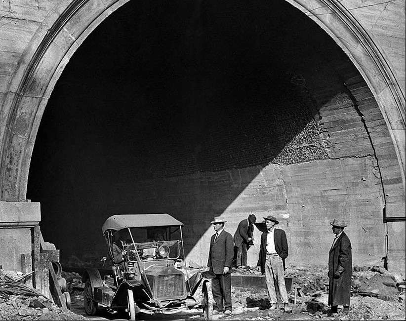 |
|
| (1913)* - Contractors drive the first automobile out of the new Hill Street roadway tunnel at First Street moments after a steam shovel removed the final section of earth on March 23, 1913. The original streetcar tunnel can be seen alongside the new bore. |
Historical Notes The second Hill Street Tunnel was built immediately east of the original rail tunnel as a municipal project for automobiles, horse drawn wagons, and pedestrians. It became the second of the twin bores driven through Court Hill, connecting Temple Street with First Street and creating one of downtown Los Angeles' most distinctive transportation landmarks. The completed tunnel was considered a showpiece of civic engineering for its day. Its roadway was paved with creosoted wood block while its interior walls were lined with white enamel tile designed to reflect light from the tunnel's electric lamps, creating a brighter and safer passage beneath the hill. |
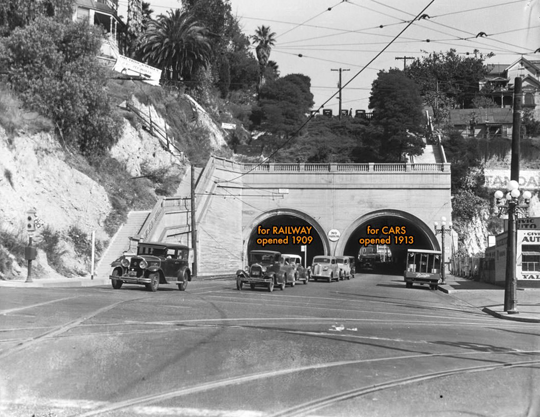 |
|
| (ca. 1923)* - Looking north from First Street toward the twin south portals of the Hill Street Tunnels beneath Court Hill. |
Historical Notes Few locations better illustrated Los Angeles' transportation transition during the 1920s than the Hill Street Tunnels. Streetcars, interurban trains, automobiles, delivery trucks, and pedestrians all moved through adjacent passageways beneath the hill as the city balanced older transportation systems with the rapidly growing automobile age. Above the tunnels rose Court Hill, the northeastern extension of Bunker Hill that had long complicated travel between downtown and neighborhoods to the north and west. The twin tunnels transformed what had once been a steep obstacle into one of downtown's busiest transportation corridors. |
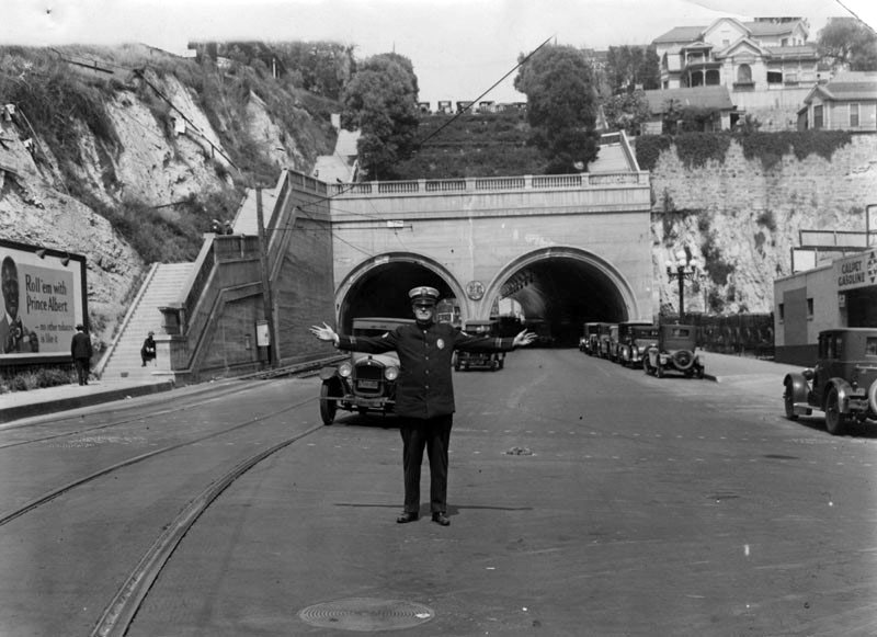 |
|
| (1928)* - Sergeant E.R. Gouldin directs traffic at the south portal of the Hill Street Tunnels at First Street. |
Historical Notes Scenes like this became increasingly common during the 1920s as automobile ownership exploded and the Los Angeles Police Department assigned officers to direct traffic at major downtown intersections. The tunnel portals formed one of the city's busiest choke points, where streetcars, automobiles, trucks, and pedestrians converged in growing numbers. The Hill Street Tunnels represented an unusual moment in Los Angeles transportation history when electric railways and automobiles shared the city on nearly equal terms. Within only a few decades, however, the automobile would come to dominate the streets that streetcars had once ruled. |
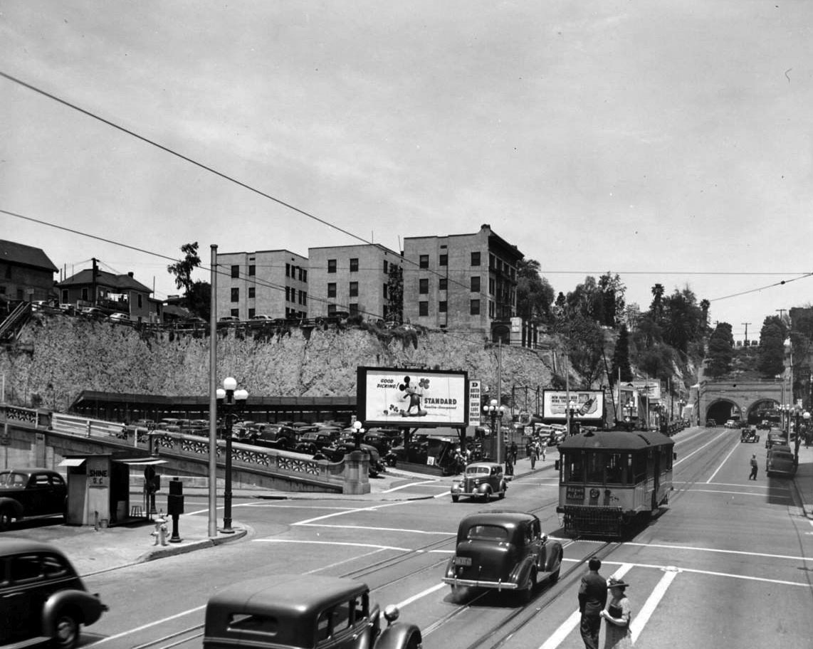 |
|
| (1930s)* – View looking north from the intersection of Second and Hill streets showing the Hill Street Tunnels in the distance. Photo by Dick Whittington. |
Historical Notes By the 1930s the Hill Street Tunnels had become a familiar landmark at the northern edge of downtown's commercial district. Visible from blocks away, the tunnel portals marked the transition from the busy business streets of downtown to the neighborhoods climbing the hills to the north. The Great Depression slowed construction activity across Los Angeles, but traffic through the tunnels continued to grow as automobiles became increasingly central to daily life in Southern California. |
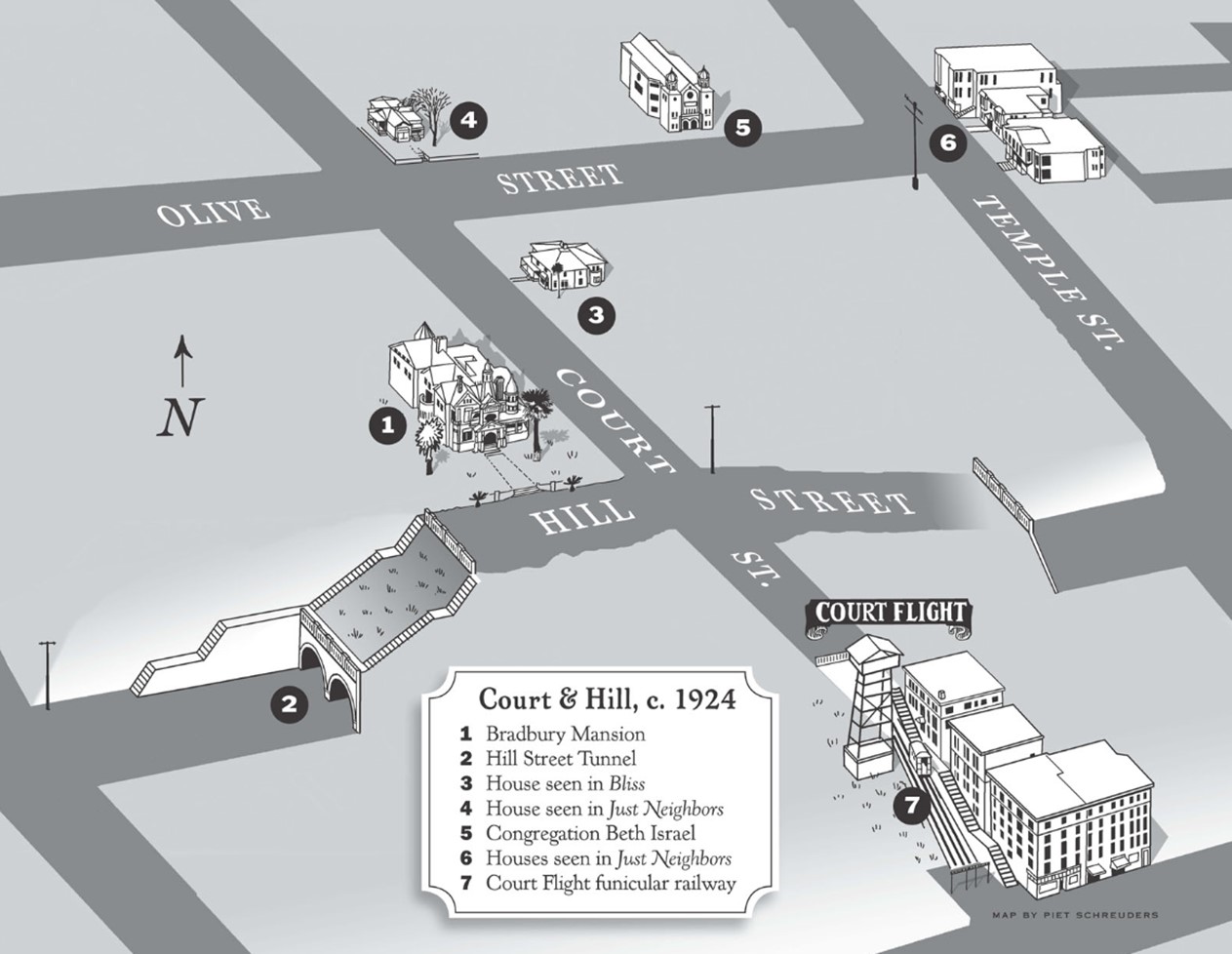 |
|
| (ca. 1924)* - Map of Bunker Hill showing the Hill Street Tunnels between Temple and First Streets with Court Flight visible at lower right. Map by Piet Schreuders. |
Historical Notes This map illustrates how dramatically the hills once shaped the geography of downtown Los Angeles. Court Hill, the northeastern extension of Bunker Hill, separated the main mass of Bunker Hill from Fort Moore Hill and forced major streets such as Hill Street and Broadway to pass through tunnels rather than over steep grades. Court Flight, shown at lower right, provided another solution to the same problem. The incline railway carried courthouse workers, residents, and visitors up and down the steep slope between Broadway and Hill Street from 1905 until 1943. Click HERE to see more Early Views of the Court Flight. |
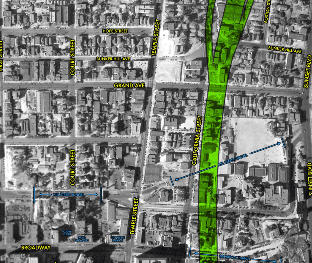 |
|
| (1933)* – Aerial view over Bunker Hill, Court Hill, and Fort Moore Hill, annotated to show the locations of both the Hill Street Tunnel and the Broadway Tunnel. The green shaded area is where the Hollywood Freeway would be constructed in the early 1950s. Photo Courtesy of Scott Charles. |
Historical Notes This remarkable aerial view shows how closely downtown Los Angeles was once shaped by its hills. Court Hill, the northeastern extension of Bunker Hill that many Angelenos regarded as a separate hill, joined Bunker Hill and Fort Moore Hill in creating barriers that engineers overcame with tunnels, cuts, stairways, and funicular railways. The image also foreshadows the enormous changes soon to come. During the following two decades, much of the landscape visible here would disappear beneath freeway construction, Civic Center expansion, and large scale redevelopment projects. |
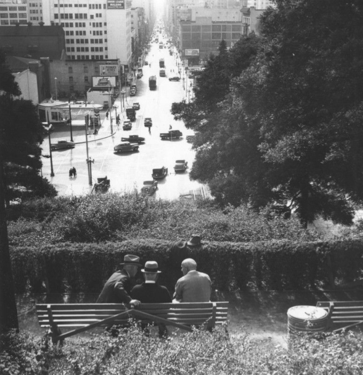 |
|
| (ca. 1940)* - Three elderly gentlemen socialize on a bench atop the Hill Street Tunnel, looking south. Cars and streetcars move beneath them through the tunnels hidden below. Photo by Ansel Adams. |
Historical Notes Ansel Adams captured a quiet human moment above one of downtown Los Angeles' busiest transportation corridors. Beneath the three men seated on the bench, thousands of passengers and vehicles passed daily through the tunnels hidden beneath Court Hill. The image preserves a landscape on the verge of disappearance. Within fifteen years the tunnels, the hill beneath them, and much of the surrounding neighborhood would be removed during construction of the modern Civic Center. |
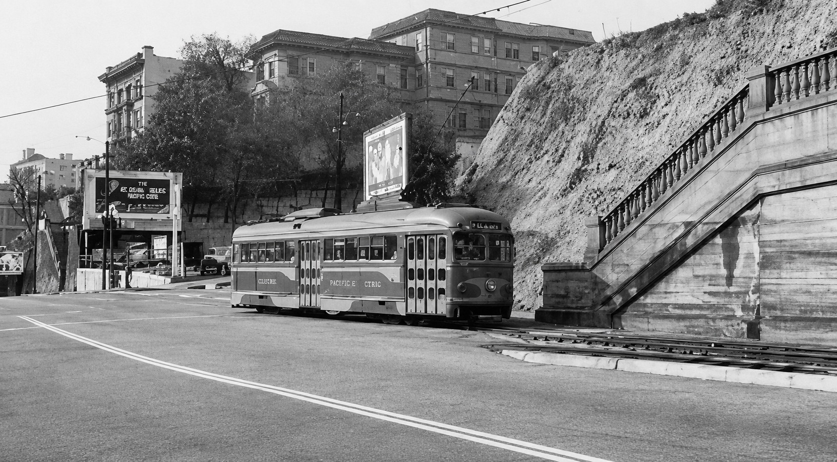 |
|
| (1949)* - View of a streetcar running inbound on the Hollywood Boulevard line through Court Hill toward downtown Los Angeles. Image enhanced. |
Historical Notes By the late 1940s streetcar service through the Hill Street rail tunnel was nearing its end. Buses and automobiles increasingly dominated transportation in Los Angeles while the rail systems that had once defined the city gradually disappeared. The photograph also illustrates the geography of old downtown Los Angeles. First Street occupied a natural valley between Bunker Hill to the west and Court Hill to the east, a landscape that would soon be dramatically reshaped by redevelopment projects of the 1950s. |
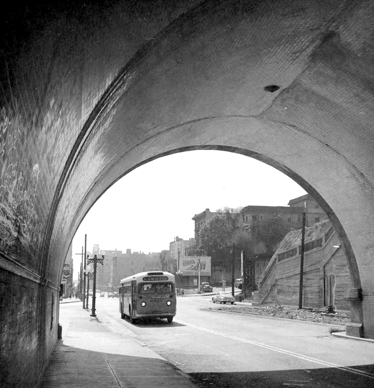 |
|
| (1953)* - The Number 11 Temple Street bus enters the Hill Street Tunnel heading north. |
Historical Notes With streetcar service through the tunnel ending only a few years earlier, buses quickly assumed the role once held by electric rail. The Number 11 line represented the changing face of public transportation in postwar Los Angeles as buses increasingly replaced streetcars throughout the city. Ironically, the tunnels that had once represented cutting edge transportation engineering were themselves becoming obsolete as planners prepared to remove Court Hill entirely rather than continue routing traffic beneath it. |
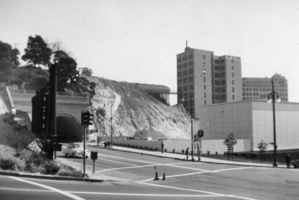 |
|
| (ca. 1953)* - Looking northeast across the intersection of First and Hill streets showing the Los Angeles County Law Library and neighboring buildings near the tunnel portal. Much of the surrounding neighborhood would soon disappear beneath Civic Center expansion. |
Historical Notes This image captures the final years of the landscape created by the Hill Street Tunnels. Government offices, commercial buildings, and transportation infrastructure shared a hillside that had evolved gradually over more than half a century. Within only a few years the tunnel, the hill above it, and much of the surrounding neighborhood would disappear as Los Angeles undertook one of the largest earthmoving projects in its history. |
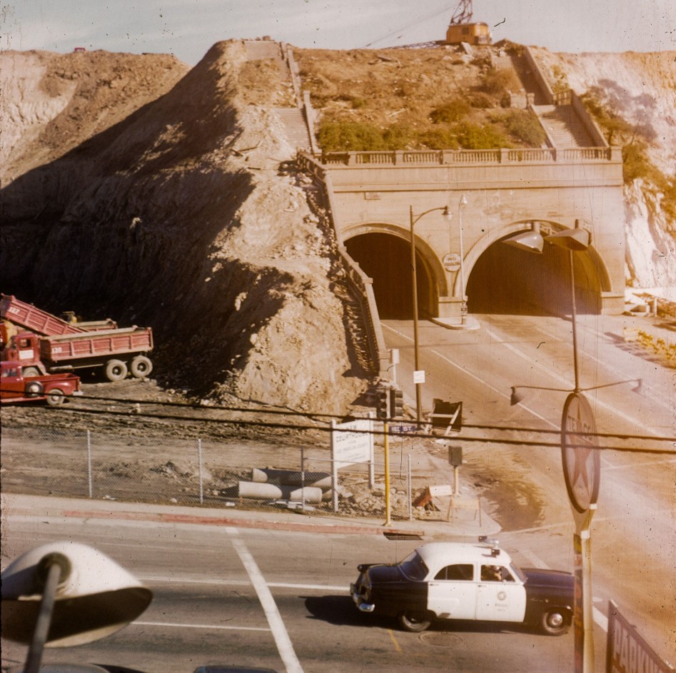 |
|
| (1954)* - Ground preparation for the new Los Angeles County courthouse at the northwest corner of First Street and Hill Street. A crane works atop the hill while dump trucks below haul dirt. Photo by Conner Palmer. |
Historical Notes Construction equipment atop Court Hill signaled the beginning of the end for the Hill Street Tunnels. Crews had begun removing enormous quantities of earth to create building sites for new county facilities that would become part of the expanding Civic Center. The decision represented a dramatic shift in planning philosophy. Rather than tunnel through hills as earlier generations had done, postwar Los Angeles chose to remove the hills altogether. |
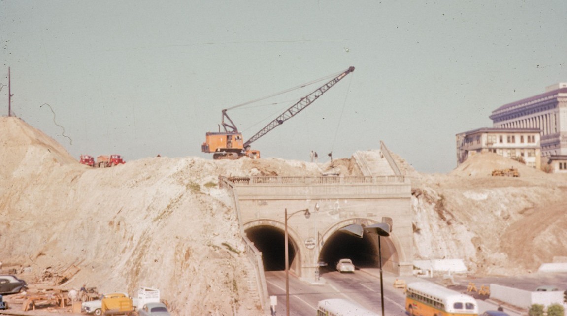 |
|
| (1955)* - Panoramic view showing the Hill Street Tunnels during the early stages of demolition. Traffic continues to flow through the tunnels even as the surrounding hill disappears. Photo by Conner Palmer. |
Historical Notes Few photographs better capture the extraordinary transformation taking place in downtown Los Angeles during the mid 1950s. Even as excavation crews dismantled Court Hill above them, automobiles and buses continued passing through the tunnels below. The image captures the unusual sight of a transportation corridor remaining in operation while the landscape supporting it was literally being removed overhead. |
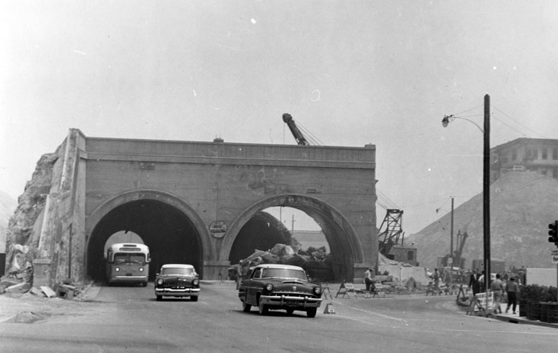 |
|
| (1955)* - View of the side by side Hill Street Tunnels looking north from First Street. Two automobiles and a bus exit the left tunnel even though the entire surrounding hillside has already been removed. |
Historical Notes By June 1955 the Hill Street Tunnels and the hill above them had disappeared completely, clearing the site for expansion of the Los Angeles Civic Center. More than forty years after transforming transportation through downtown Los Angeles, the tunnels themselves had become obstacles to a new generation of planners and engineers. The demolition of Court Hill formed part of a larger reshaping of downtown topography that also affected portions of Bunker Hill and Fort Moore Hill during the mid twentieth century. |
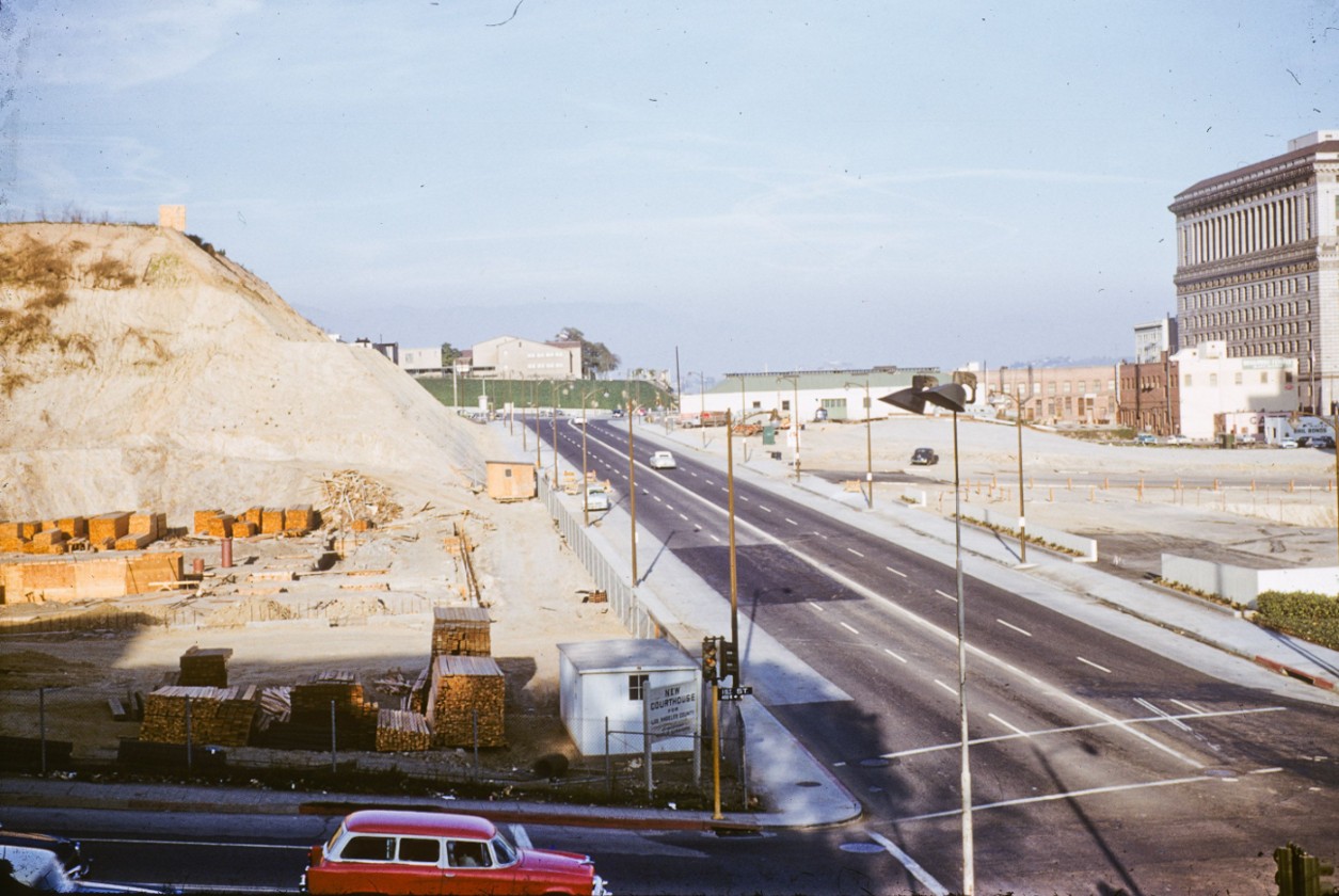 |
|
| (1956)* - Looking north on Hill Street from First Street. There is no trace of the former Hill Street Tunnels nor of the buildings that once stood above them. Photo by Conner Palmer. |
Historical Notes Only a year after demolition began, virtually no trace remained of the twin tunnels that had once carried thousands of passengers and vehicles each day beneath Court Hill. The disappearance of the tunnels formed part of a broader transformation that reshaped downtown Los Angeles during the 1950s and 1960s, replacing hills, tunnels, hotels, and Victorian neighborhoods with the government buildings and broad civic spaces of the modern Civic Center. |
* * * * * |
Hill Street Tunnels — Then and Now |
Constructed in 1909 for streetcars and expanded in 1913 with a second parallel tunnel for automobiles and pedestrians, the Hill Street Tunnels served as one of downtown Los Angeles' most important transportation corridors for more than four decades.By 1955, however, both tunnels and the hill above them had disappeared beneath the expanding Civic Center and one of the largest earthmoving projects in downtown history.The comparisons below show the former tunnel portals and surrounding landscape during the tunnels' final years and as the same locations appear today. Together they tell the story of a city that first tunneled through its hills and later chose to remove them altogether. |
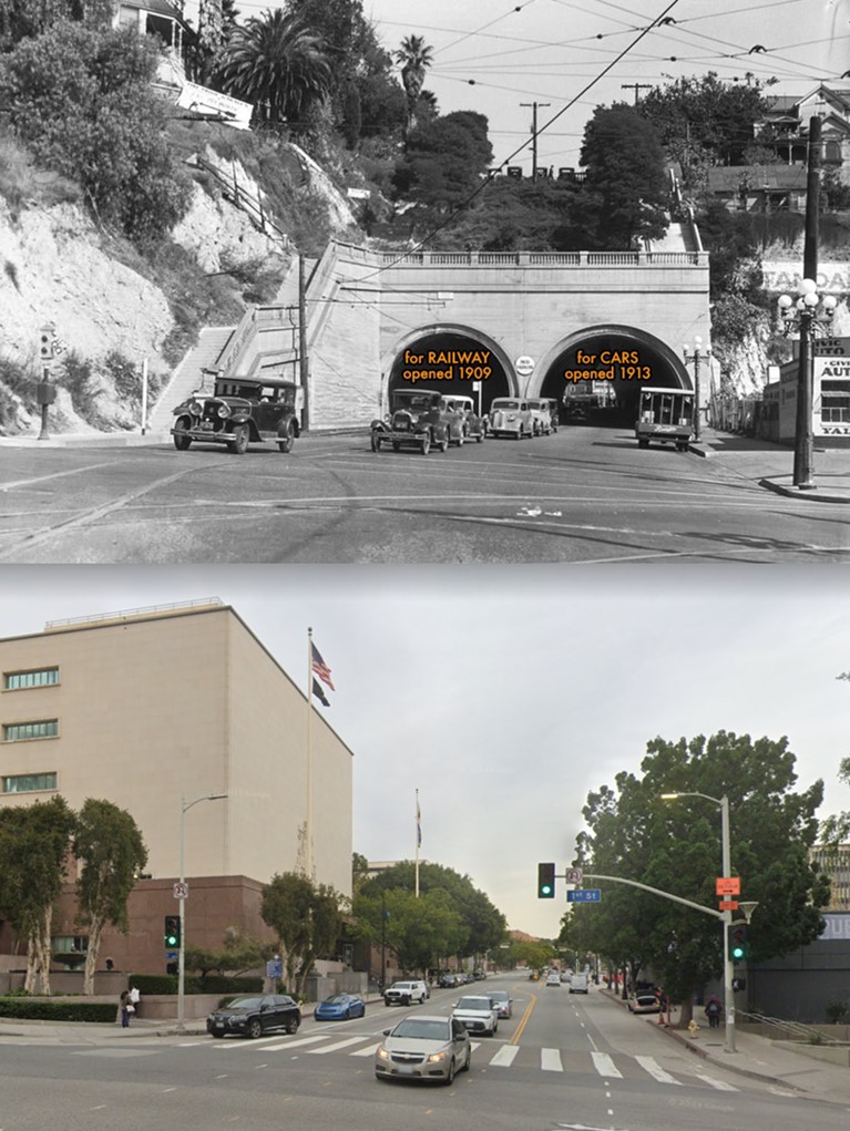 |
|
| (1923 vs 2023)* – Looking north on Hill Street at First Street, once the location of the Hill Street Tunnels. Note how much the hill has been shaved away. Photo comparison by Jack Feldman. |
Historical Notes Few places in Los Angeles better illustrate the scale of the city's physical transformation than this comparison. The tunnels, the hill above them, and much of the surrounding streetscape disappeared during construction of the Civic Center, leaving little evidence that one of downtown's most important transportation landmarks ever existed. What vanished was more than a pair of tunnels. Court Hill itself disappeared from the map, joining portions of Bunker Hill and Fort Moore Hill among the many downtown landforms reshaped in the name of urban growth and redevelopment. Click HERE to see the Construction and Opening of the First Hill Street Tunnel |
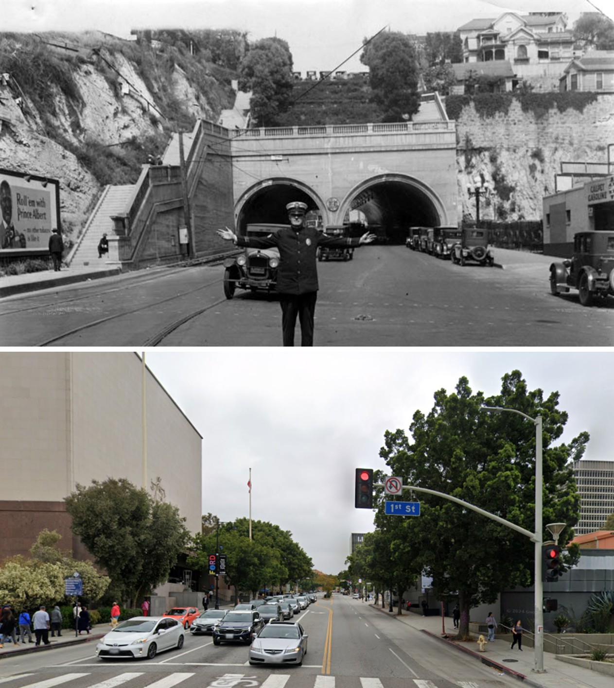 |
|
| (1928 vs 2024)*- Then and Now - Hill Street looking north at First Street. Photo comparison by Jack Feldman. |
| Historical Notes
The traffic officer, tunnel portals, and steep hillside that dominated the 1928 scene have all vanished. Yet the alignment of Hill Street and First Street remains largely unchanged, allowing the two photographs to be matched with surprising precision despite nearly a century of change. The comparison serves as a reminder that Los Angeles did not simply grow over time. In many places, the city literally rebuilt its geography to accommodate new transportation systems, government buildings, and an expanding population. |
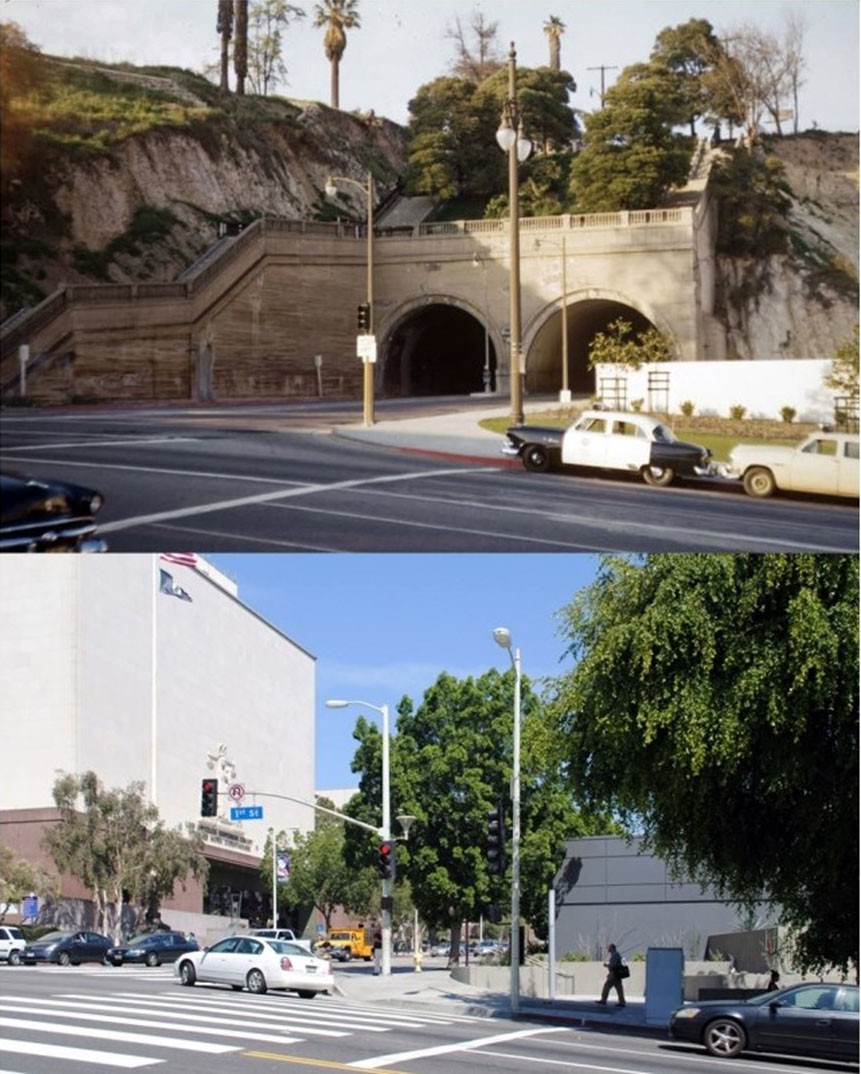 |
|
| (1954 vs. 2014)* - The intersection of Hill and First streets looking north. Early photo by Conner Palmer. Contemporary photo courtesy of Brian Hsu. Early photo by Conner Palmer. |
Historical Notes The 1954 photograph captured the beginning of Court Hill's disappearance. The modern view shows the completed result: a flattened landscape occupied by courthouses, government offices, and broad civic spaces. Few locations demonstrate more clearly the extent to which twentieth century Los Angeles reshaped its own topography in pursuit of growth, efficiency, and modernization. |
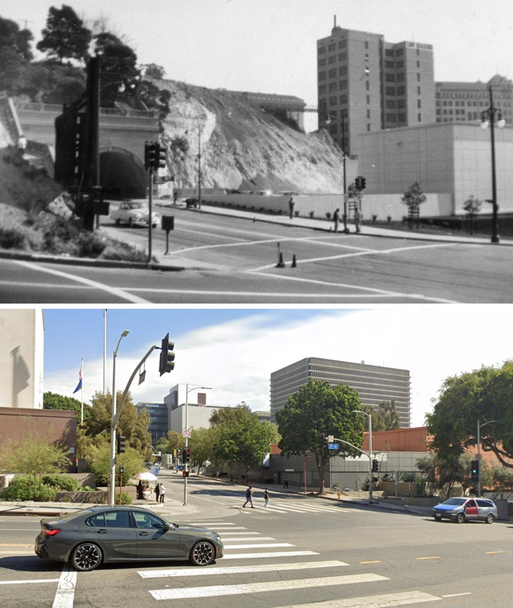 |
|
| (1953 vs. 2025)* - Looking northeast across the intersection of First and Hill Streets toward the twin portals of the Hill Street Tunnels and the eastern face of Court Hill, compared with the same location as it appears today. Photo comparison by Jack Feldman. |
Historical Notes The 1953 photograph captured the Hill Street Tunnels during the final years of their existence. Both portals remained in service beneath the exposed eastern face of Court Hill, while redevelopment associated with the expanding Civic Center was already beginning to reshape the surrounding landscape. The modern view reveals the full extent of that transformation. The tunnels were demolished, Court Hill was excavated, and even the grade of First Street was lowered as portions of Court Hill and nearby Bunker Hill were cut away. The intersection visible today sits noticeably lower than it did in 1953. Few locations illustrate more clearly that Los Angeles did not simply grow over time. In many places, the city literally rebuilt its own landscape. |
* * * * * |
From Agricultural Park to Exposition Park |
Long before the rose garden and the Coliseum, the 160 acres bounded by Figueroa Street and Exposition Boulevard served a very different Los Angeles. The Southern District Agricultural Society established Agricultural Park in 1872, setting aside the land as a fairground where the region's new farming class could exhibit livestock, produce, and farm equipment.The site made sense at the time. It sat just beyond the southwestern edge of the city, surrounded by open country, and was served by one of Los Angeles's first street railways, the Main Street and Agricultural Park Railroad, which began running horse-drawn cars to the park in 1875. Over the next four decades the park hosted agricultural fairs, thoroughbred horse races, camel and dog contests, some of the first bicycle competitions in Southern California, and eventually the earliest organized automobile speed runs in the region. By 1910 the racing era had ended. A new chapter was beginning, centered on museums, a rose garden, and civic ambition rather than betting windows and grandstand saloons. |
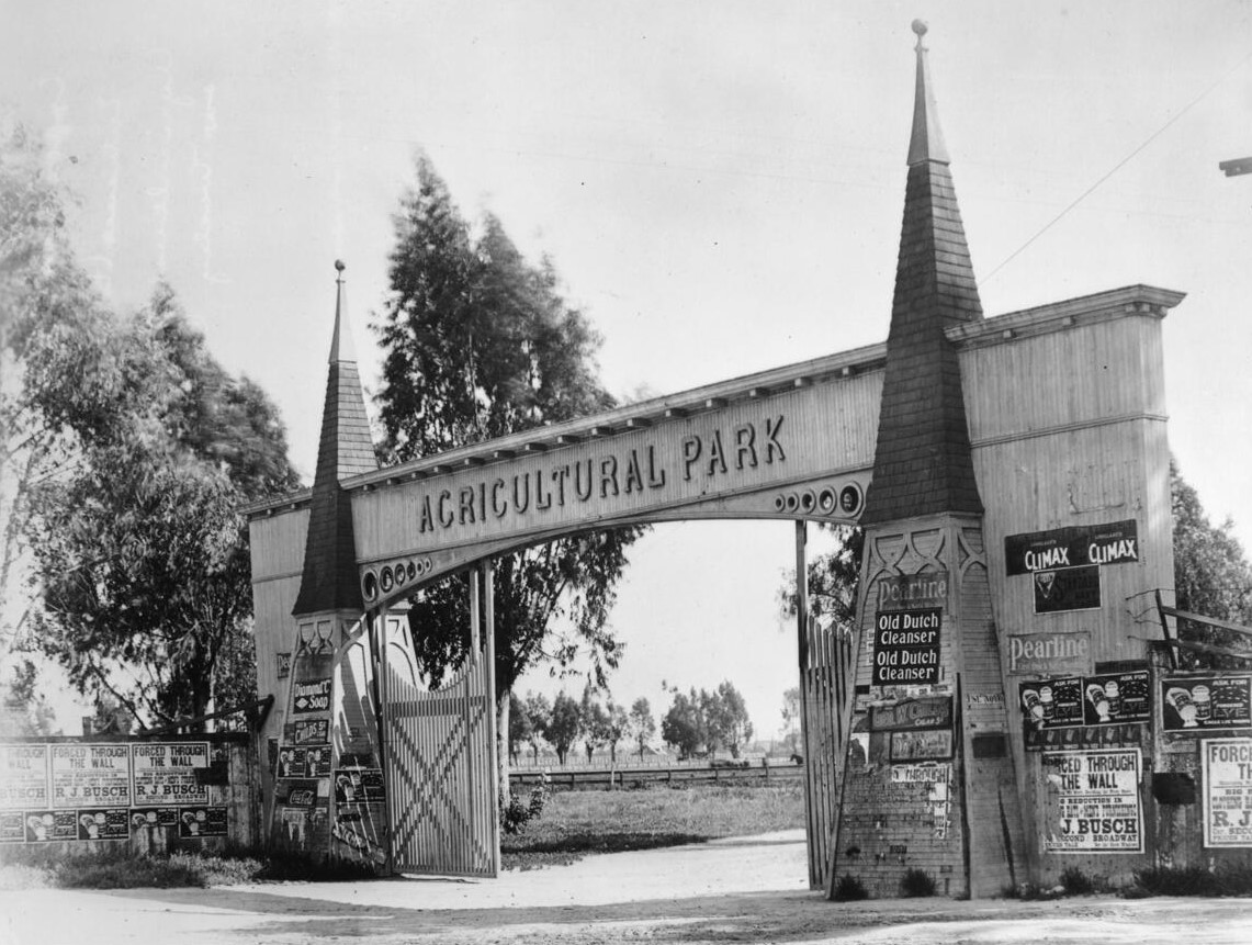 |
|
| (ca. 1910)* - The Wesley Avenue entrance to Agricultural Park, photographed shortly before the grounds were transformed into Exposition Park. The gate marked the boundary between the growing residential neighborhood and a place that had served Los Angeles as fairground, racetrack, and public gathering space for nearly four decades. |
Historical Notes The Southern District Agricultural Society purchased the 160-acre site in 1872 to promote commercial farming as the old rancho system gave way to American land ownership. Mortgage creditors foreclosed on the property in 1879, and the State of California acquired it in 1880. The City of Los Angeles annexed both Agricultural Park and the neighboring University of Southern California campus in June 1899, bringing them inside city limits for the first time. Civic advocates William M. Bowen and USC President George F. Bovard led the campaign that eventually transformed the grounds into a public cultural center, renamed Exposition Park in 1913. |
Fair Days |
Racing and gambling defined Agricultural Park's reputation, but they were never the whole story. The Southern District Agricultural Society founded the park to serve the region's farmers, and on fair days the grounds looked exactly as intended — families moving through livestock exhibits, tents pitched across the open fields, animals on display, and children exploring the grounds on foot and on bicycle. These quieter gatherings kept alive the park's original mission even as the racetrack and grandstand saloon drew the headlines and the reformers' complaints.The agricultural fairs attracted exhibitors from across Southern California who came to show prize livestock, seasonal produce, and horticultural specimens. For many visitors, particularly those who came with children, the fair was the park, a public space that belonged to the community in a way the racetrack and its gambling culture did not. It was this side of the park's identity that reformers pointed to when they argued the grounds could be reclaimed for a higher civic purpose. |
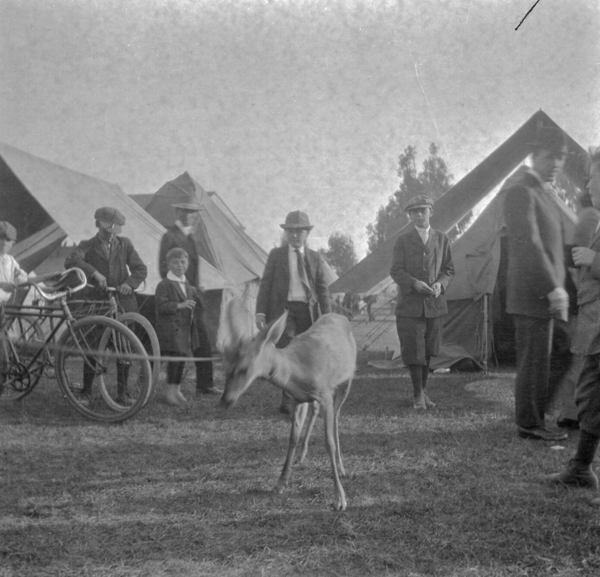 |
|
| (1900)* - Boys walk their bicycles through Agricultural Park while onlookers gather around a deer on a lead. Tents visible in the background suggest a fair or exhibition day. The image captures the park as the Southern District Agricultural Society originally envisioned it — a public fairground where families came to see animals, exhibits, and the open grounds. |
| Historical Notes
Agricultural Park served a dual identity throughout its history. On race days it was a gambling venue with a grandstand saloon and a packed hotel. On fair days it was a public fairground where families came to see livestock exhibits, horticultural displays, and novelties such as the deer shown here. The Southern District Agricultural Society had always intended the site to promote farming and agriculture in Southern California, and it was this original mission that reformers cited when they argued the grounds could be reclaimed for a higher civic purpose. |
The Racetrack |
The racetrack was the engine of Agricultural Park's daily life. Because the park sat outside city limits until 1899, gambling on races was beyond the reach of Los Angeles law enforcement, and operators took full advantage. The grandstand drew the crowds that made the park financially viable. A saloon operated underneath it, and a hotel in the park's interior catered to those who came for the races and not just an afternoon's entertainment. Horses dominated the early program, but the track also hosted dog races, camel races, and animal fights staged for gambling purposes, the last of which drew condemnation from anti-cruelty organizations.As the surrounding neighborhood developed and the University of Southern California opened across the street in 1880, pressure mounted on park operators. Officers who attended the meets could observe but had little authority over the gambling taking place. That changed when annexation brought the park inside city limits in 1899 — though the racing and betting continued for another decade before state law finally shut it down. |
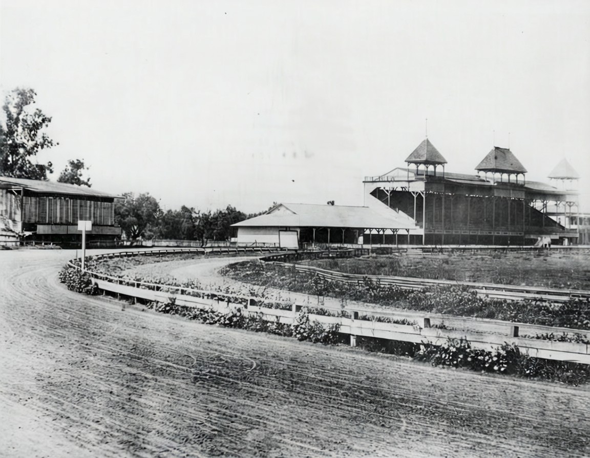 |
|
| (ca. 1900)* - A partial view of the Agricultural Park racetrack. The grandstand with its three open towers dominates the background; a smaller structure to the left may have served as a concession stand. This mile-long dirt oval hosted horse races, bicycle contests, and the first automobile speed runs in Southern California before being demolished around 1911. |
Historical Notes The grandstand shown here held a saloon on its lower level, one of the principal attractions for gamblers who came to the park for the races. The hotel that operated inside the park's grounds catered to racing enthusiasts who stayed overnight. Both structures were demolished after the state acquired the property in 1908 and reformers took control of the site. The grounds were eventually redesigned as part of the 1910 Exposition Park plan, which included the sunken garden to the north of the oval, designed by landscape architect Fred H. Howard. That garden became the Exposition Park Rose Garden, listed on the National Register of Historic Places in 1991. |
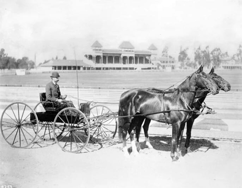 |
|
| (1895)* - Captain Pierce of the Los Angeles Police Department poses with his carriage and horse team during the Agricultural Park Horse Show. The grandstand and spectator seating are visible behind him. The park's location outside city limits at the time meant officers who attended had little authority to intervene. |
| Historical Notes
Horse shows at Agricultural Park ran alongside the race meets and drew a somewhat different crowd — one more interested in breeding stock and carriage horses than in wagering. The park's dual identity as both a legitimate fairground and a gambling venue made it a complicated target for reformers, who had to argue that the racing culture had overtaken the agricultural mission the site was founded to serve. Attorney William M. Bowen began his public campaign to annex and reform the park in 1898, one year after this photograph was taken. |
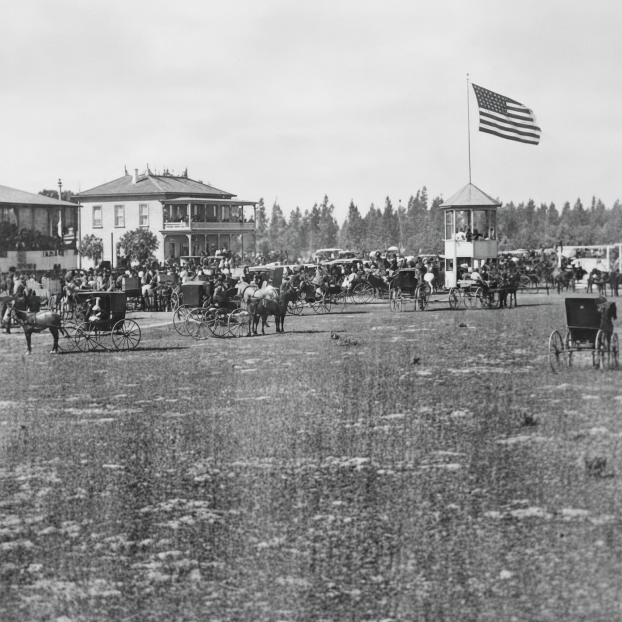 |
|
| (ca. 1895)* - Race day at Agricultural Park before 1900, with the Club House visible in the background. Crowds arrived on the Main Street and Agricultural Park Railroad, one of the city's first street railway lines, which ran horse-drawn cars directly to the park entrance. |
| Historical Notes
Race days at Agricultural Park drew spectators from across the city and beyond. In its early years the park offered horses, dogs, and camels on the oval, a combination that reflected the carnival atmosphere operators cultivated to maximize crowds and betting. California's Walker-Otis Law of 1909 banned racetrack gambling statewide, effectively ending horse racing at Agricultural Park and at venues across the state, including the original Santa Anita track in Arcadia, which closed the same year. |
The Bicycle Era |
By the late 1880s the bicycle had joined the horse as a fixture at Agricultural Park. Racing on two wheels had begun on the oval as early as 1883, using the same dirt track as the horse meets, but it was the arrival of the chain-driven safety bicycle in the late 1880s that turned cycling into a citywide movement. Organized clubs formed across Los Angeles, and the park's established grandstand and oval became their primary racing ground. The clubs were also central to the Good Roads movement, lobbying for paved streets at a time when most roads in the region were rutted dirt. The racers at Agricultural Park were in this sense making an argument about infrastructure as much as they were competing for prizes.The October 3, 1893 race meeting documented in several of the photographs below was among the most organized cycling events Southern California had yet seen. Teams arrived with uniforms, support men, and formal starting procedures. The 25-mile race drew entrants from the East Side Club, the Los Angeles Athletic Club, a squad from Riverside, and others. Prizes sometimes included pianos, a reflection of the sport's broad social appeal and the showmanship of the park's promoters. |
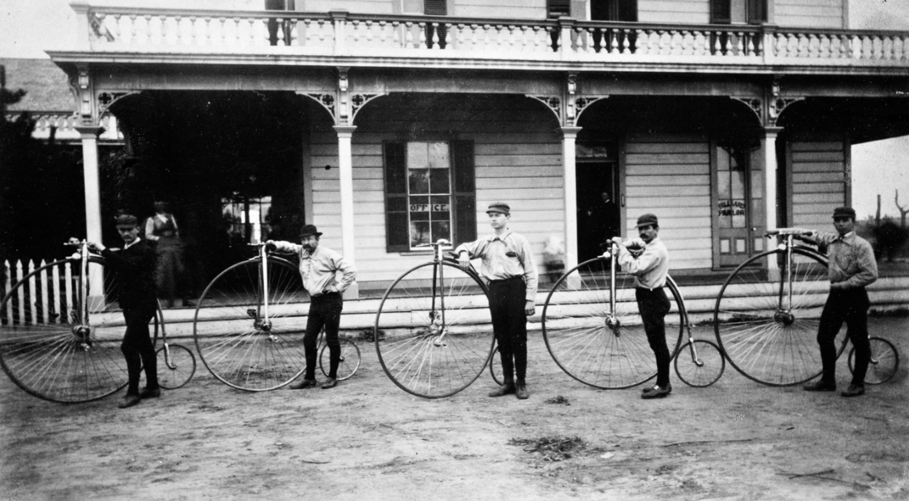 |
|
| (1887)* - Members of the Los Angeles Bicycle Club at Agricultural Park, photographed by C.C. Pierce. This image predates the full cycling craze by several years, capturing a period when organized bicycle clubs were still a novelty in Southern California. Within a decade the park would host teams from across the region competing on its mile-long oval. |
| Historical Notes
The Los Angeles Bicycle Club was one of the earliest organized cycling groups in the city. The high-wheeled penny-farthing bicycles common in the early 1880s had given way by the late 1880s to the chain-driven safety bicycle, which was lower, more stable, and far more accessible to a general public. The change in technology drove a rapid expansion in both recreational cycling and competitive racing. By the early 1890s, Los Angeles had multiple active clubs competing at venues including Agricultural Park. |
.jpg) |
|
| (October 3, 1893)* - The mass start of the 25-mile bicycle race at Agricultural Park, photographed from the grandstand. Horse-drawn carriages parked on the inside of the track serve as a reminder that the oval still served the horse racing world on most days. |
Historical Notes The October 3, 1893 race meeting was one of the largest organized cycling events in Southern California to that point, drawing teams from across the region. The grandstand that regularly hosted horse racing crowds was filled for the occasion. Horse-drawn carriages visible inside the oval reflect the track's dual identity — still a horse racing venue on most days, but increasingly shared with the new sport of cycling throughout the 1890s. |
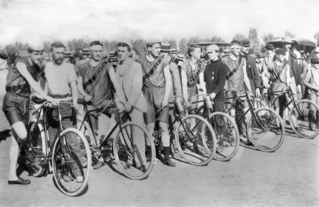 |
|
| (October 3, 1893)* - Six members of the East Side Cycling Club at the start of the 25-mile race. From left, Fox, the mile champion, and Casey Castleman, third from left. A support man stands beside each cyclist, ready to steady the bicycle at the starting signal. |
| Historical Notes
The East Side Club was based in Boyle Heights and was among the most active cycling organizations in Los Angeles in the early 1890s. Club races at Agricultural Park were formal affairs, with each rider assigned a support man to hold the bicycle steady before the starting signal. The dark sash worn over the left shoulder identified East Side Club members on the starting line and in the grandstand crowd. |
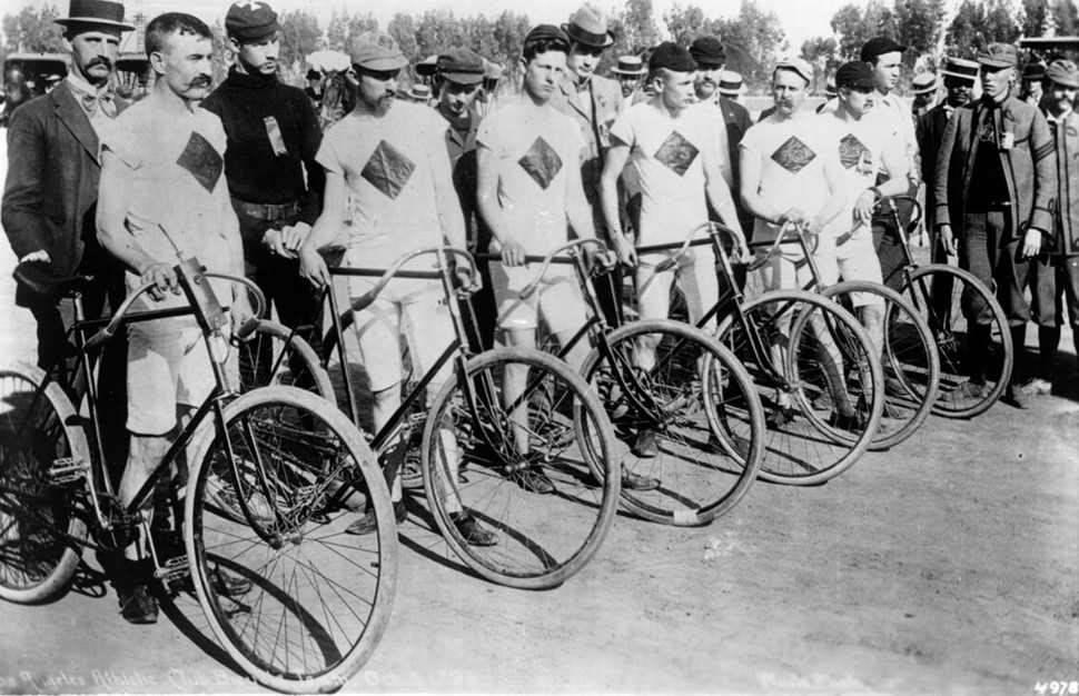 |
|
| (October 3, 1893)* - The Los Angeles Athletic Club Bicycle Team at the Agricultural Park race. Members include McAleer, the mayor's brother; Ray Faulkner of the city offices; Teddy Holbrook; and Will Jenkins. Their white uniforms with a dark diamond on the chest identify them as club competitors on the starting line. |
| Historical Notes
The Los Angeles Athletic Club, founded in 1880, was one of the city's most prominent civic organizations and fielded teams in multiple sports. The presence of the mayor's brother and a city department official among its bicycle team entrants reflects how thoroughly the cycling movement had penetrated middle- and upper-class Los Angeles life by the early 1890s. Athletic club racing at Agricultural Park carried a social dimension well beyond the sport itself. |
The Automobile Arrives |
The gasoline-powered automobile arrived at Agricultural Park in November 1903 with the force of a revelation. Barney Oldfield, already the most famous racing driver in America, staged a three-day event at the park featuring speed record attempts, match races, and exhibitions aboard a Winton Bullet. Dirt clods flew as much as forty feet in the wake of the machine, and the Los Angeles Times covered the spectacle with mock alarm, writing that Oldfield's attempt to commit suicide at Agricultural Park had resulted only in a compound fracture of the world's automobile record. He returned in December 1904 driving the Peerless Green Dragon and recorded a mile in 54 seconds on the same oval where horses had raced a generation before.The Automobile Club of Southern California, which organized the 1903 meet and kept a formal program with results recorded by hand in the margins, understood that racing was the most effective way to demonstrate the new technology to a skeptical public. Local competitors were drawn in as well, including oilman Frank Garbutt, who had watched harness races at the park since 1887 and arrived with a car he had designed and built himself. Spectators who watched a car cover a mile in under a minute went home converts.What began as exhibition and spectacle quickly evolved into organized competition, and by the end of the decade, full-scale endurance races were being held on the same oval. |
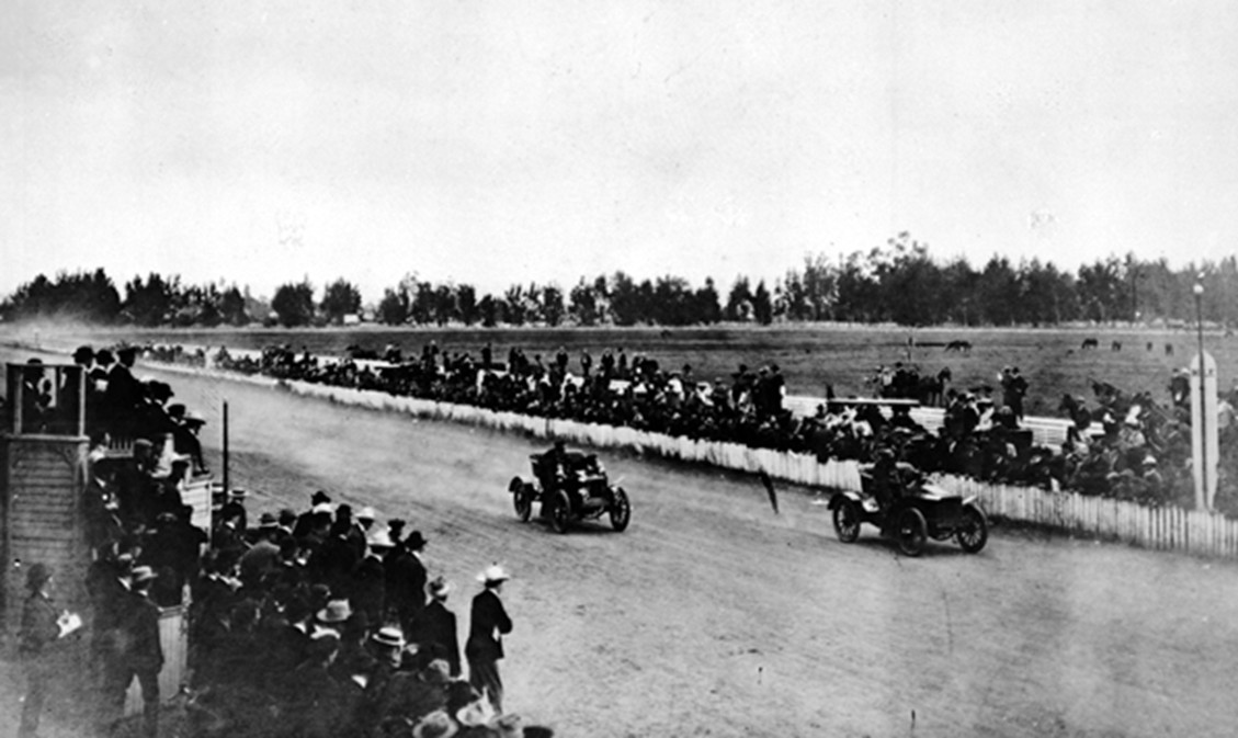 |
|
| (1903)* - A large crowd watches an automobile race at Agricultural Park, organized by the Automobile Club of Southern California. The club's original program from this meet survives with race results handwritten in the margins by a spectator keeping score, much like a baseball scorecard. |
| Historical Notes
Barney Oldfield had become the first person to drive a mile in one minute flat at the Indiana State Fairgrounds in June 1903. His November visit to Agricultural Park just months later brought that national celebrity to Los Angeles for the first time. On December 17, 1904, he set a track record of 54 seconds for the mile on the Agricultural Park oval, driving the eight-cylinder Peerless Green Dragon. The Automobile Club of Southern California, founded in 1900, was among the earliest automobile advocacy organizations in the country and used racing events at Agricultural Park to build public support for automobile-friendly road improvements throughout the region. |
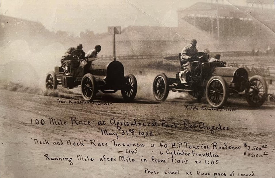 |
|
| (1908)* - Drivers compete in a 100 mile automobile race at Agricultural Park, capturing the transition from exhibition runs to organized competition. The image shows two early touring cars running neck and neck on the dusty oval, with the grandstand visible in the background. Photo from the Jim Miller Collection, courtesy of Gary Helsinger. |
Historical Notes By 1908 automobile racing at Agricultural Park had matured into organized competition, including endurance events such as the 100 mile race shown here. Drivers and machines were now tested not only for speed but for reliability over distance, reflecting the growing practical importance of the automobile. At the same time, the park itself was nearing the end of its racing era. The city had annexed the grounds in 1899 and outlawed gambling, but racing continued in diminished form. State acquisition in 1908 marked a turning point, and the following year California’s Walker Otis Law banned racetrack gambling statewide, removing the last economic incentive to maintain the track. The grandstand and related structures were soon demolished, clearing the way for the transformation into Exposition Park, formally dedicated on November 6, 1913. |
From Racetrack to Park |
California's 1909 ban on racetrack gambling removed the economic foundation on which the Agricultural Park oval had operated for three decades. A three-way agreement between the state, the county, and the city divided responsibility for the new grounds: the state would build an exposition building and an armory, the county would construct a museum of history, science, and art, and the city would maintain the grounds. Construction of the Natural History Museum began on December 17, 1910, and the park was formally renamed and dedicated as Exposition Park on November 6, 1913.The 1918 aerial photograph below shows the new park five years into its life as a public cultural center. The Natural History Museum, the Armory, and the Exposition Building frame the northern portion of the park, and between them the sunken garden, already laid out with its formal grid of walkways and circular center, occupies the ground directly north of the racetrack oval. The oval itself remained fully intact in 1918, its ellipse clearly visible in the center of the park. It was the Coliseum, breaking ground in December 1921 and opening in May 1923, that consumed the western and central portion of the oval, its elliptical bowl built within the old racetrack footprint. Where Barney Oldfield had once covered a mile in 54 seconds, 75,000 spectators would come to watch football — and in 1932, the Summer Olympic Games. |
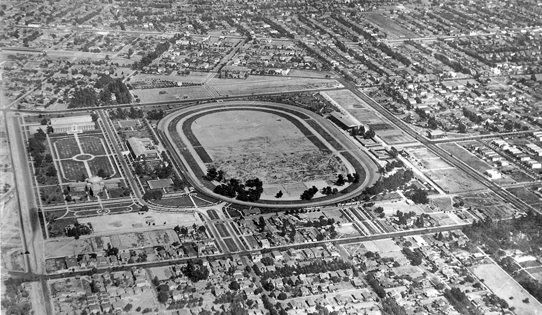 |
|
| (1918)* - An aerial view of Exposition Park five years after its formal dedication on November 6, 1913. The mile-long racetrack oval is clearly visible at center, still fully intact at the time of this photograph. To its north, framed on three sides by the Natural History Museum, the Armory, and the Exposition Building, the newly laid sunken garden is visible with its formal walkways and circular center. The Coliseum, built in 1923, was constructed within the western and central portion of the old racetrack footprint. The sunken garden to its north became the Rose Garden in 1928. |
| Historical Notes
The Natural History Museum building, designed by architects Frank Hudson and William Munsell in a blend of Spanish Renaissance, Romanesque, and Beaux Arts styles, was dedicated on November 6, 1913. The tripartite governance agreement between the state, Los Angeles County, and the City of Los Angeles established at that time still governs Exposition Park today. The Los Angeles Memorial Coliseum, completed in May 1923 and designed by architects John and Donald Parkinson, was built as a memorial to Los Angeles veterans of World War I and was constructed within the western and central portion of the old racetrack footprint. It was designated a National Historic Landmark in 1984 and has hosted the Summer Olympics in 1932 and 1984, with a third scheduled for 2028. The sunken garden, situated between the racetrack oval and the museum buildings to the north, was designed by landscape architect Fred H. Howard and laid out as part of the 1910 Exposition Park plan. Planted initially with grass and walkways, it was redesigned and rededicated as the Rose Garden in 1928. The full story continues in the next section. |
Then and Now
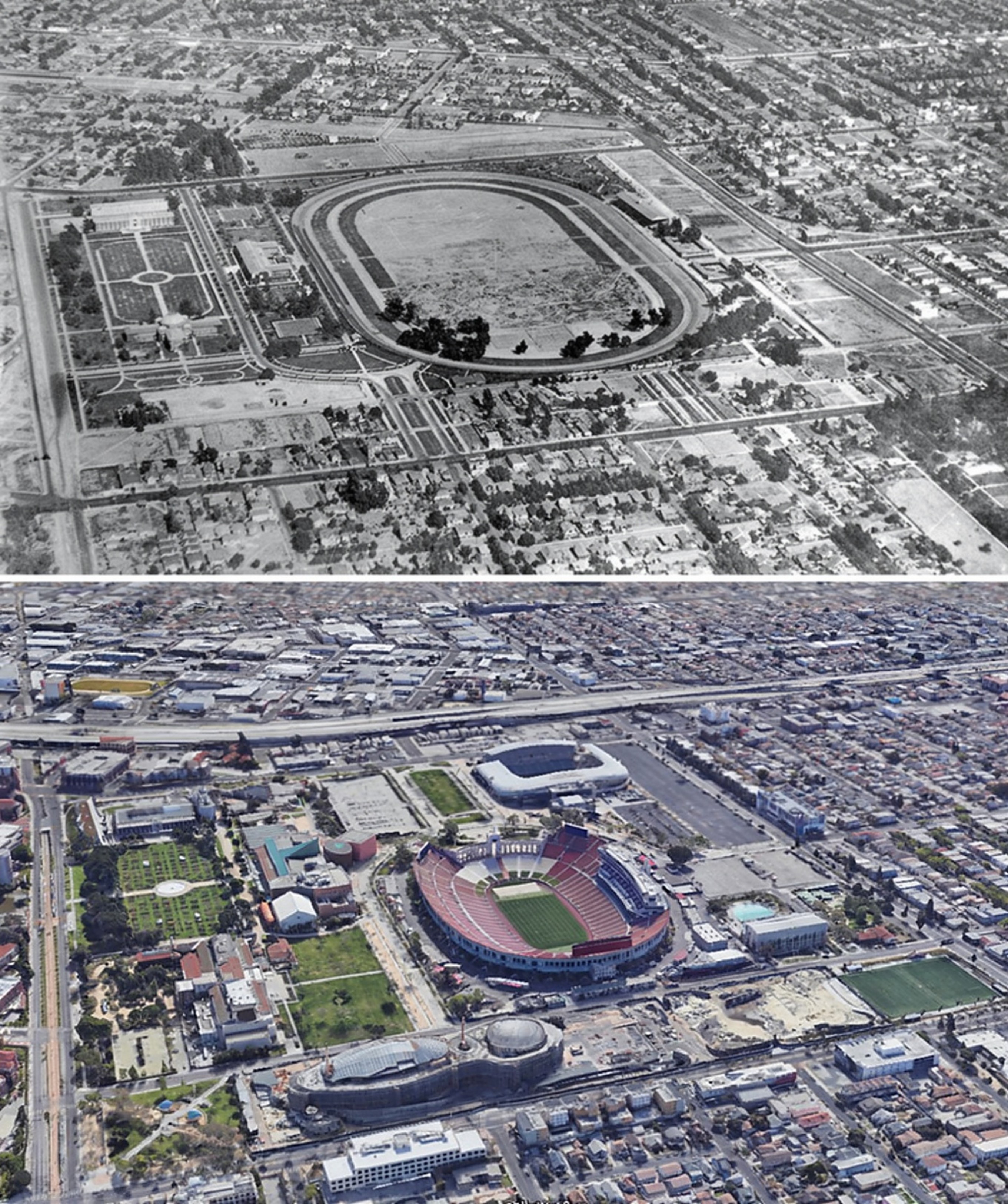 |
|
| (1918 vs. 2022) - Exposition Park Then and Now. Use the center of the sunken garden (left side of both images) as your reference point. The Coliseum now sits well within what was once a mile-long racetrack. Photo comparison by Jack Feldman. |
| Historical Notes
The Coliseum was built between 1921 and 1923 directly within the old racetrack footprint, its bowl occupying the same ground where Barney Oldfield had raced less than twenty years before. The oval that had defined Agricultural Park for three decades was gone within a decade of the 1918 photograph. The 2022 image shows what replaced it. The Coliseum now sits where the oval once ran, its elliptical bowl built within the western and central portion of the old racetrack footprint. The eastern portion disappeared into parking and surrounding streets. That the Coliseum itself is elliptical, echoing the shape of the track it replaced, is one of the more quietly satisfying continuities in the park's history. The sunken garden visible in its early unfinished state in the upper image became the Rose Garden in 1928 and was listed on the National Register of Historic Places in 1991. That transformation is the subject of the next section. |
* * * * * |
The Sunken Garden and the Rose Garden |
When the old Agricultural Park racetrack was cleared and Exposition Park took shape after 1910, the seven acres between the museum buildings were set aside for a formal public garden. For the first several years the space amounted to little more than a graded field with grass, a few trees, and walkways converging on a concrete circle at the center. Plans for a grand memorial fountain at that center point were announced at the 1913 dedication but never carried out, set aside when World War I began and other priorities took over. Through most of the 1910s the sunken garden was more plan than place.The transformation happened in stages. In 1915, the city proposed planting the beds with California wildflowers, including poppies, lupines, dahlias, and calendulas. In October 1921, the California Association of Nurserymen held a major horticultural exposition on the site, filling it with thousands of flowers, trees, and a new circular lily pond at the center. Many of those plantings stayed after the show closed. But the garden as it is recognized today did not take shape until 1926, when the city's Parks Department brought in rose experts George C. Robinson and Fred H. Howard, who had also designed the garden's original 1910 layout, to build what the Los Angeles Times called the world's finest public rose garden. The $15,000 project removed eight inches of topsoil across the entire site, replacing it with nutrient-rich soil and leaf mold brought from the canyons of Griffith Park. Workers laid 166 concrete-lined flower beds in four symmetrical quadrants, each anchored by a gazebo. Over 15,000 rose bushes, most donated by Southern California nurseries, were planted across the beds. The garden was completed in April 1928, remained the largest public rose garden in the country for 24 years, and has been operated by the Los Angeles City Department of Recreation and Parks ever since. It was listed on the National Register of Historic Places in 1991. |
The Early Sunken Garden |
The sunken garden went through several distinct phases before the roses arrived. In its earliest years after 1910, it was simply graded open ground, cut below the level of the surrounding walkways and left largely as grass with a central concrete circle. The park's 1913 dedication drew attention to the site's potential, but the World War I years delayed any serious development. By the early 1920s the garden finally had real flowers in it, thanks to the California Association of Nurserymen, whose 1921 show planted the space for the first time and introduced the central lily pond and fountain. Events like Pershing Day in January 1920 had already established the sunken garden as a gathering place even in its unfinished state, showing that Angelenos would embrace the space once it was properly planted.The photographs in this section document the garden during that transitional period, after the racetrack was gone but before the roses arrived, when the city was slowly discovering what the space could become. |
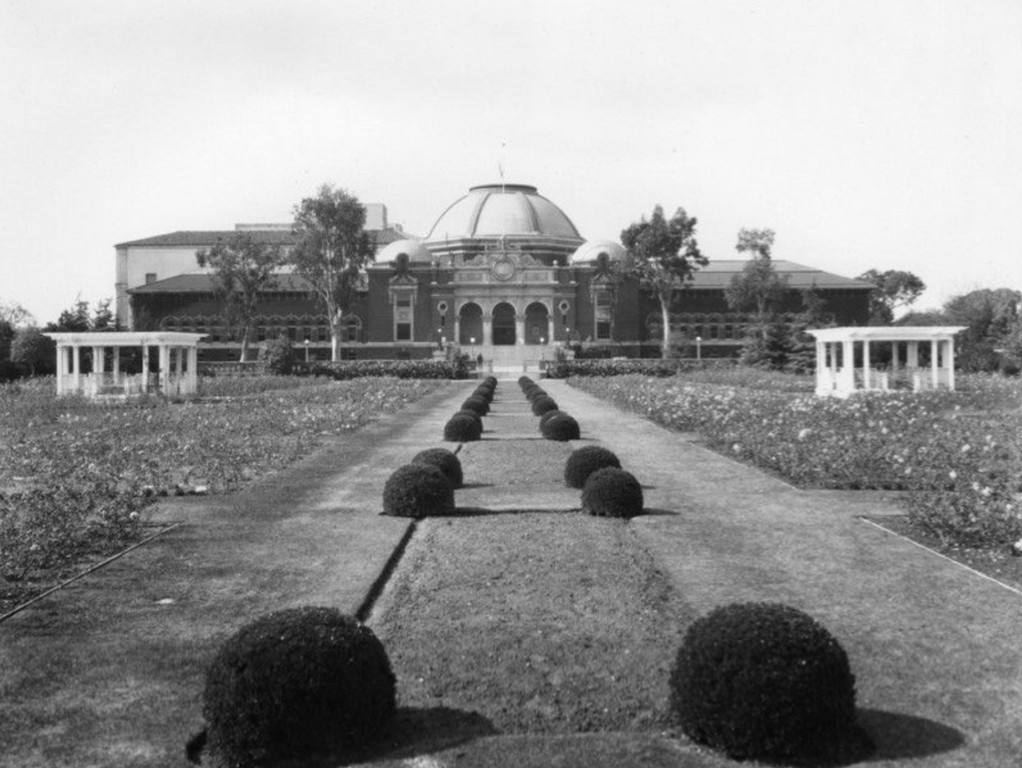 |
|
| (1920s)* – The sunken garden at Exposition Park, with the Natural History Museum visible in the background. Formal paths and walkways line the garden's central axis, flanked by planting beds and early garden structures. This view predates the 1926 rose garden redesign, when the space still reflected the plantings and lily pond installed for the 1921 California Association of Nurserymen horticultural show. |
Historical Notes The land seen here had been graded and laid out as part of the 1910 Exposition Park plan, with grass, pathways, and a circular concrete center. Through most of the decade the space sat largely unused, waiting for the civic will and funding to develop it. The 1921 California Flower Show and Horticultural Exposition was the first major use of the sunken garden for its intended purpose. The California Association of Nurserymen planted thousands of flowers and trees and installed a circular lily pond at the center. An electric fountain lit up the water at night during the event, and at the opening an orchestra played while performers danced traditional Spanish dances as visitors moved through displays of chrysanthemums, marigolds, and two acres of dahlias. Many of the show's plantings remained after the exposition closed, giving the garden its first real life as a planted space. |
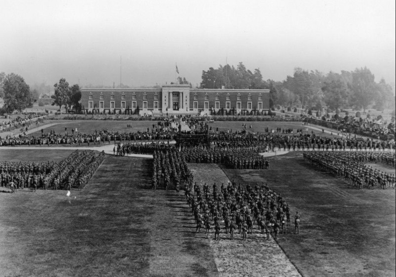 |
|
| (January 26, 1920)* - The sunken garden at Exposition Park on Pershing Day, with the State Armory Building in the background. At this date the garden was still in its early grass-and-pathway form, a year before the 1921 horticultural show would plant it with flowers and a central lily pond for the first time. |
Historical Notes Pershing Day marked the first anniversary of General John Pershing's return from World War I and was observed at public spaces across the country in January 1920. The event at Exposition Park reflected the park's growing role as a civic gathering place even before the sunken garden had been fully developed. The Armory Building visible here was designed by State Architect J.W. Woollett for the California National Guard 160th Infantry and was one of the four original anchor structures of the 1913 Exposition Park plan. It was later renamed the Wallis Annenberg Building for Science Learning and Innovation and now serves as the California Science Center's education annex. |
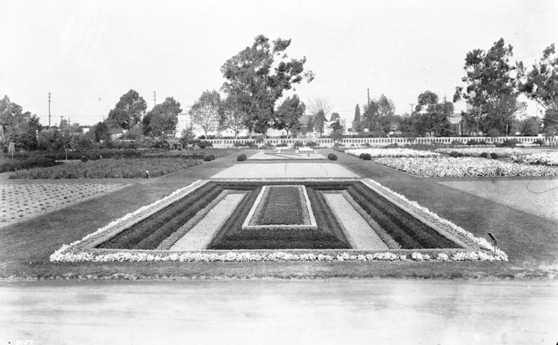 |
|
| (1925)* – The sunken garden planted with pansies and flowering beds, one year before the 1926 rose garden redesign began. The grid pattern of planting beds and grass walkways visible here foreshadow the formal layout that Fred H. Howard and George C. Robinson would adopt when they designed the rose garden the following year. The low concrete wall and perimeter trees mark the boundaries of the seven-acre site. |
Historical Notes By 1925 the sunken garden had evolved considerably from the grassy field of the early 1910s, with ornamental planting beds established following the 1921 horticultural show. The grid layout visible in this photograph was carried directly into the rose garden design that began the following year. To prepare the beds for roses, workers removed eight inches of existing topsoil from across the entire site and replaced it with nutrient-rich soil and leaf mold brought in from the canyons of Griffith Park, giving the roses the rich soil they needed to thrive. |
The Rose Garden |
By the mid-1920s, Los Angeles was a city in full expansion. The oil, aviation, and film industries were booming, the population had more than doubled during the decade, and civic leaders cared deeply about how the city looked to the rest of the nation. When the Parks Department announced in 1926 that it intended to build the finest public rose garden in the United States at Exposition Park, the Los Angeles Times applauded: no better demonstration could be made of the region's devotion to gardens and outdoor beauty, the paper wrote, than by placing the world's finest rose garden at the heart of its greatest city. The work matched the ambition. Rosarians Robinson and Howard designed 166 concrete-lined beds in four symmetrical quadrants, filled them with soil brought from Griffith Park, and planted more than 15,000 bushes representing over 100 varieties. The garden was completed in April 1928.It was an immediate success, drawing visitors from across the region and serving as a grand entrance corridor for the tens of thousands who came to the adjacent Coliseum for the 1932 Summer Olympics. Art deco lamp posts and concrete benches with Greek-style friezes were added to the garden's north entryway in 1932 in preparation for the Games. In 1936, Danish sculptor Thyra Boldsen donated four marble statues to the garden, one per quadrant, dedicated not to bravery and conquest as most public sculpture was but to love, life, and joy. The garden has remained largely unchanged in its layout since 1928 and continues to be visited by more than a million people a year. |
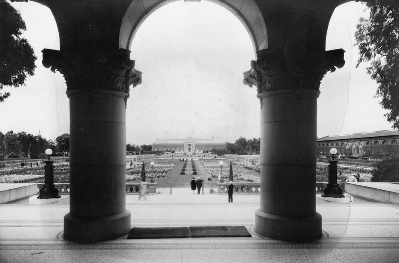 |
|
| (1929)* – The Exposition Park Rose Garden viewed through the grand arch of the Natural History Museum, one year after the garden's completion in April 1928. Formal flower beds, walkways, and pergolas stretch toward the Armory Building in the distance. At completion the garden held more than 15,000 rose bushes in 166 concrete-lined beds organized in four quadrants, each anchored by a white gazebo, making it the largest public rose garden in the United States. |
Historical Notes The rose garden opened in April 1928, timed to be in full bloom before the 1932 Olympics brought international visitors to the adjacent Coliseum. The Los Angeles Times had declared in 1926 that no better demonstration could be made of California's devotion to outdoor beauty than placing the world's finest rose garden at the heart of its greatest city. The garden held its position as the largest public rose garden in the country for 24 years. Danish sculptor Thyra Boldsen loaned four marble statues to the garden in 1936, one per quadrant, each honoring themes of love, life, and joy. They were reclaimed by a descendant in 1968. The All-America Rose Selection has donated its Rose of the Year to the garden annually since 1940. |
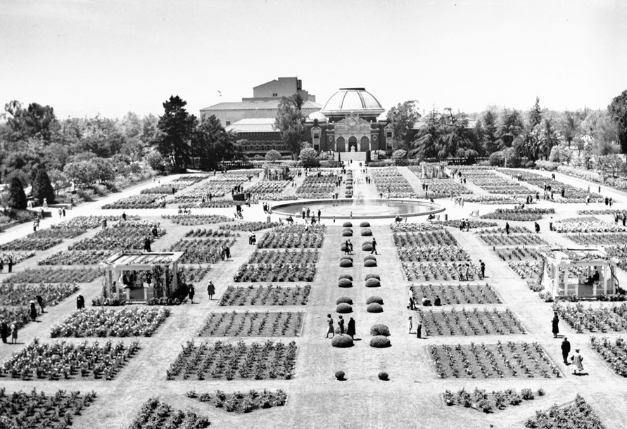 |
|
| (ca. 1950)* - A birdseye view of the Exposition Park Rose Garden from the Natural History Museum, with the Armory Building in the distance. Pedestrians move through the symmetrical grid of square rose beds. The central fountain shoots water into the air at center. By the 1950s the garden had become one of the city's most popular civic attractions, drawing thousands of visitors each year to the annual rose pruning demonstrations and summer photography days. |
Historical Notes The 1950s marked the rose garden's cultural peak. Annual pruning demonstrations held each January drew thousands of enthusiasts for panel discussions, how-to demonstrations on a large model rosebush, and appearances by a rose queen. By 1955 more than 3,000 people attended the event annually. Summer Camera Days brought amateur photographers to the garden each season with flowers, animals, and models in gardening clothes provided by the Parks Department. The garden survived a proposal by the NFL Raiders in 1980 to convert it into a practice field, and a second threat in 1986 when the Los Angeles Coliseum Commission proposed replacing it with a two-story parking garage. In both cases public opposition was swift and decisive. |
* * * * * |
The Rose Garden Fountain |
The fountain that stands at the center of the Exposition Park Rose Garden carries a history older than the roses themselves. Its story begins on November 6, 1913, the day Exposition Park was formally dedicated, the same day the city celebrated the opening of the Los Angeles Aqueduct, which had delivered Owens Valley water to the San Fernando Valley the day before. At the dedication ceremony, Senator John D. Works stepped to the platform in the sunken garden and, as he left, a jet of water shot thirty feet into the air from the concrete circle at the garden's center. It was a symbolic gesture, not a permanent structure. Water from the new aqueduct was pushed into the air as a public display. Plans were announced that day for a grand permanent fountain on the same spot, with a one-hundred-foot shaft flanked by sculptures representing California and the spirit of civic advancement. That monument was never built. World War I began, and the plans were shelved.The fountain that eventually found its permanent place at the center of the garden arrived more modestly. In 1921, the California Association of Nurserymen built a circular lily pond and fountain for their horticultural exposition on the site, and this became the garden's first lasting water feature. When Fred H. Howard redesigned the space as a rose garden in 1926, the fountain was retained and fitted with electric lights that changed color at night, making it one of the first illuminated public fountains in Los Angeles. The display became one of the garden's most popular attractions, visible from the museum buildings and park pathways after dark. The fountain has been operated continuously by the Los Angeles City Department of Recreation and Parks since 1928 and remains the visual anchor of the garden today, its jets still rising from the same concrete circle where Owens Valley water first made its symbolic appearance more than a century ago. |
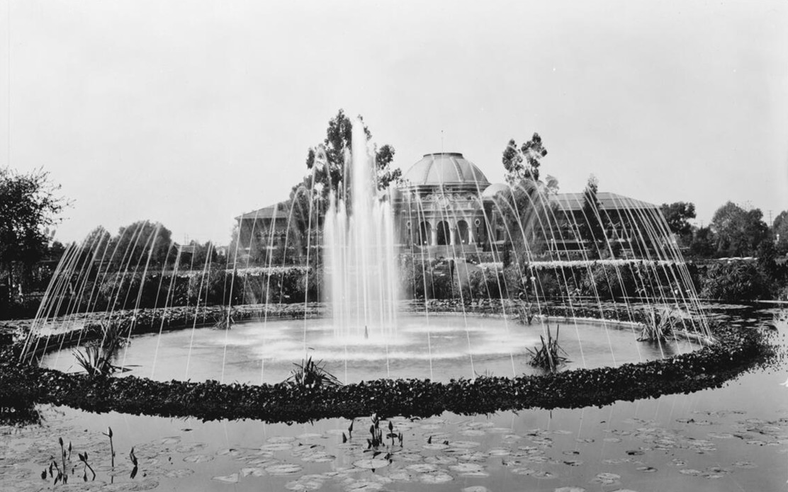 |
|
| (ca. 1925)* – The central fountain at Exposition Park, with arched water jets and a surrounding lily pond. The domed Natural History Museum rises above the hedged perimeter of the sunken garden in the background. This fountain and lily pond were installed by the California Association of Nurserymen for the 1921 horticultural exposition and remained as the garden's central feature when the rose garden redesign began the following year. |
Historical Notes The circular lily pond and fountain seen here were among the lasting contributions of the 1921 California Flower Show and Horticultural Exposition. When Fred H. Howard took on the rose garden design in 1926, he incorporated the existing fountain rather than replacing it, adding electric lighting that allowed the water display to continue into the evening hours — one of the first illuminated public fountains in Los Angeles. The Natural History Museum building visible in the background was designed by architects Frank Hudson and William Munsell in a blend of Spanish Renaissance, Romanesque, and Beaux Arts styles and dedicated on November 6, 1913. |
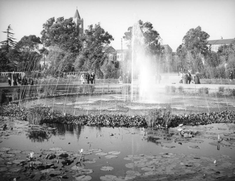 |
|
| (ca. 1937)* - Jets of water converge at the center of the Exposition Park Rose Garden fountain. The water display at this location dates to the park's dedication on November 6, 1913, when a jet of pressurized Owens Valley water was sent thirty feet into the air as a symbolic gesture marking the opening of the Los Angeles Aqueduct the day before. The permanent fountain installed in 1921 and refined in 1926 carried that symbolic connection forward. |
Historical Notes Senator John D. Works dedicated the water display at the 1913 opening ceremony, and as he left the platform a thirty-foot jet rose from the concrete circle at the garden's center. Plans for a grand permanent commemorative fountain, with a hundred-foot shaft and flanking sculptures honoring California and civic progress, were announced that day but never executed. Those plans reflected how confident Los Angeles felt in that moment. The aqueduct was done, Exposition Park was open, and the city saw itself on the edge of becoming one of the great cities of the world. For more on the opening ceremonies, see the Commemorative of the Official Opening of the Los Angeles Aqueduct and Exposition Park. Click HERE to see the Commemorative of the Official Opening of the LA Aqueduct and Exposition Park. |
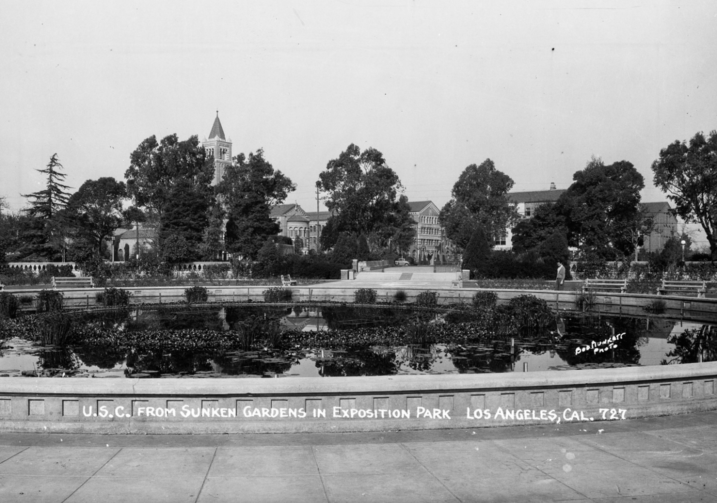 |
|
| (ca. 1930s)* - The lily-filled fountain at the center of Exposition Park's sunken garden, photographed by Bob Plunkett. In the distance, framed by trees and plantings, USC's Mudd Memorial Hall of Philosophy is visible just beyond the park's northern boundary. The formal rose beds and grassy walkways of the 1928 garden design are visible in the background. |
Historical Notes The lily pond at the fountain's base carried through every phase of the garden's development, from the 1921 horticultural show through the 1928 rose garden completion. The grand memorial fountain proposed at the 1913 dedication was never built, and the simpler fountain installed in 1921 became the garden's permanent water anchor. USC's Mudd Memorial Hall of Philosophy, visible in the background, was completed in 1930 and designed by architects Ralph Flewelling and Allison and Allison. It stands just north of the park boundary along Exposition Boulevard, directly across from the Natural History Museum. |
Then and Now
 |
|
| Seen top and bottom: the Exposition Park Rose Garden fountain in the 1930s and in 2014. The upper image shows the fountain during the garden's peak years, when the annual pruning demonstrations and summer Camera Days drew thousands of visitors each season. The lower image shows the same fountain more than eighty years later, its jets still rising from the same location where Owens Valley water first made its symbolic appearance on November 6, 1913. Click HERE to see the Commemorative of the Official Opening of the LA Aqueduct and Exposition Park. Photo comparison by Jack Feldman. |
Historical Notes The Rose Garden and its fountain have endured repeated threats to their existence over the decades. A proposal by the NFL Raiders in 1980 to convert the garden to a practice field was turned down. A 1986 plan by the Los Angeles Coliseum Commission to replace the garden with a two-story parking structure drew immediate public opposition and was defeated. The 1984 Summer Olympics had brought renewed investment to the park just two years earlier, with the city refurbishing the garden for the millions of visitors who passed through Exposition Park during the Games. The garden was listed on the National Register of Historic Places in 1991, giving it a level of formal protection it had not previously held. It remains one of the most visited public gardens in Southern California, with an estimated one million visitors each year. |
* * * * * |
🏛️ The Los Angeles Memorial Coliseum |
The Los Angeles Memorial Coliseum stands on ground that had already lived several lives before its construction. What began in 1872 as Agricultural Park, a fairground that evolved into a center for racing and public spectacle, was transformed after California's 1909 ban on racetrack gambling into a civic and cultural landscape known as Exposition Park. By the time of the 1918 aerial view, the mile-long oval remained intact, but its future had already shifted away from racing.That transformation accelerated in 1921, when Los Angeles leaders moved to construct a major stadium as a memorial to veterans of World War I. Designed by architects John and Donald Parkinson, the Coliseum was conceived not only as a place for sport but as a monumental civic structure, one that could anchor the growing city's cultural and ceremonial life.Construction began on December 21, 1921. In just over sixteen months, the elliptical bowl rose within the footprint of the former racetrack. When it opened on May 1, 1923, the Coliseum seated more than 75,000 spectators, immediately becoming the largest stadium in Los Angeles and one of the most prominent in the nation. |
From Racetrack Oval to Stadium Bowl |
The 1918 aerial shows the site at a turning point. The racetrack oval, once the defining feature of Agricultural Park, remained fully visible, even as the surrounding grounds had already been reshaped into a complex of museums, gardens, and public spaces.By 1922, that oval was being erased. Construction photographs show the Coliseum rising directly within the infield of the track, its form echoing the very shape it replaced. Rather than imposing a new geometry on the landscape, the designers built within it, preserving the ellipse while transforming its purpose.Where Barney Oldfield and other early drivers once raced against time, a new kind of spectacle took shape, one measured not in seconds but in crowds, ceremonies, and shared civic experience. |
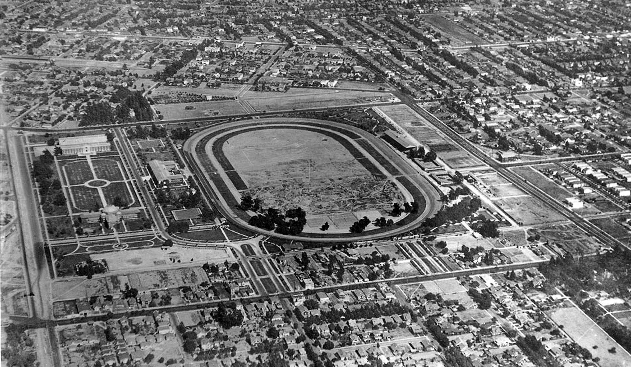 |
|
| (1918)* - An aerial view of Exposition Park five years after its formal dedication on November 6, 1913. The mile-long racetrack oval remains fully intact at center. To the north, the Natural History Museum, the Armory, and the Exposition Building frame the newly laid sunken garden with its formal walkways and circular concrete center. The Coliseum groundbreaking was still three years away. |
Historical Notes The Natural History Museum, designed by architects Frank Hudson and William Munsell in a blend of Spanish Renaissance, Romanesque, and Beaux Arts styles, was dedicated on November 6, 1913. The governance agreement established at that time between the state, Los Angeles County, and the City of Los Angeles still governs Exposition Park today. The sunken garden visible north of the oval had been graded and laid out as part of the 1910 Exposition Park plan, with grass, walkways, and a circular concrete center. It would not be seriously planted until the 1920s and would not become the Rose Garden until 1928. The International Olympic Committee selected Los Angeles as the host city for the 1932 Summer Olympics in April 1923, the same month the Coliseum was completed. The two events, arriving almost simultaneously, shaped the stadium's first decade in ways no one had fully anticipated. |
Engineering Speed and Scale |
The speed of construction remains notable. Built for $954,873, the original structure was completed in just over sixteen months. The design featured a continuous elliptical bowl open at the east end, where the peristyle would later become one of the Coliseum's most recognized architectural elements.The 1922 construction images show this rapid rise. The surrounding Exposition Park grounds, already anchored by the Exposition Building and the Museum of History, Science and Art (later the Natural History Museum), frame the emerging stadium within its broader civic setting. |
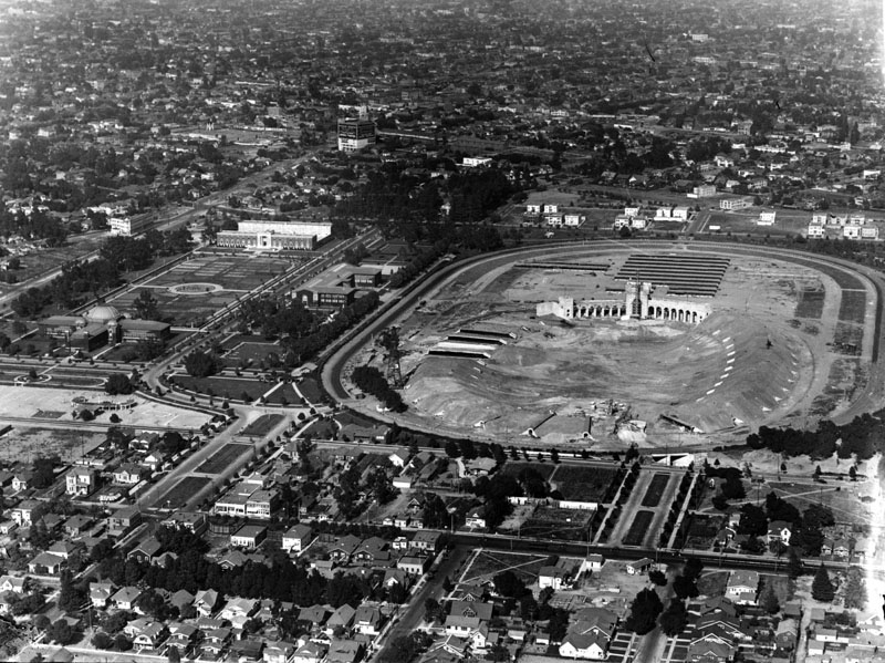 |
|
| (1922)^ - An aerial view of Exposition Park with the Coliseum under construction at right. At left, the sunken garden is surrounded by the state Exposition Building and the county Museum of History, Science and Art, later renamed the Natural History Museum. Workers excavated more than thirty feet below grade to set the playing field, using the removed soil to form the embankments that make up the bowl's outer walls. |
Historical Notes The Coliseum was commissioned in 1921 as a memorial to veterans of World War I and rededicated to veterans of all wars in 1968. The groundbreaking ceremony took place on December 21, 1921, with construction completed in just over sixteen months on May 1, 1923. John and Donald Parkinson, whose firm also designed Los Angeles City Hall, Union Station, and the Bullock's Wilshire Building, modeled the elliptical bowl on the Yale Bowl of 1914, the first bowl-style stadium in the United States. The field was excavated thirty-two feet below grade, with the removed soil used to build the surrounding embankments. The structure measures 1,038 feet long and 738 feet wide. Total construction cost was $954,873. |
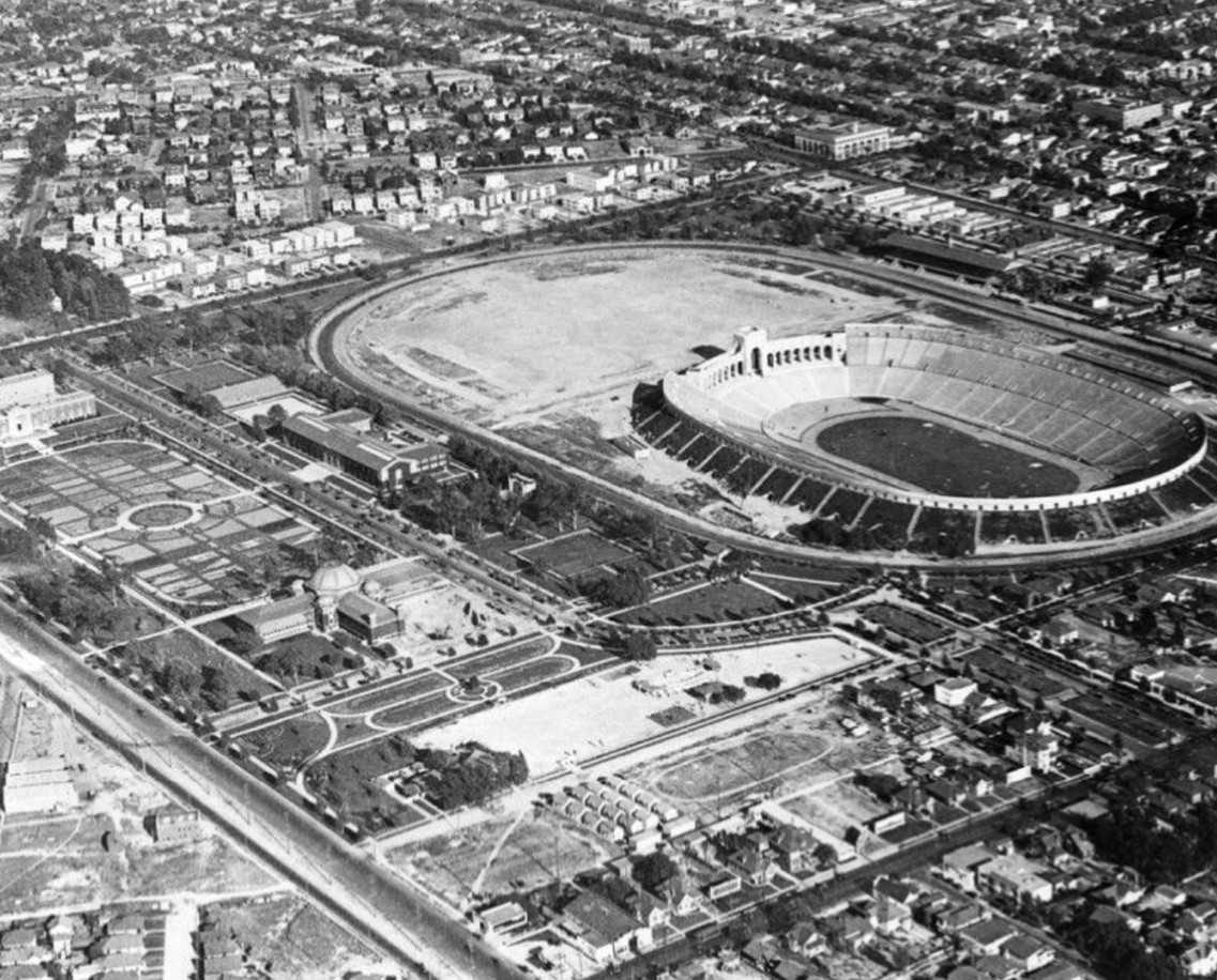 |
|
| (1922)* - A second aerial view of the Coliseum under construction, showing the elliptical concrete bowl taking shape within the old racetrack footprint. The surrounding residential streets and the USC campus to the north give a sense of the stadium's scale relative to the city around it. |
Historical Notes When the Coliseum opened in 1923, it was the largest stadium in Los Angeles, with a capacity of 75,144. The first event held there was not a sporting contest but the American Historical Review and Motion Picture Industrial Exposition, a month-long celebration of American history and the film industry that ran from July 2 to August 4, 1923, and drew more than 300,000 visitors. The first football game followed on October 6, 1923, when USC defeated Pomona College 23 to 7. |
Expansion for the World Stage |
The Coliseum's role expanded in preparation for the 1932 Summer Olympics. To accommodate the event, the stadium was enlarged in 1930, with additional rows and two tiers of tunnels raising capacity to more than 100,000 seats. The Olympic cauldron, still visible above the east end of the stadium, was installed at that time.
|
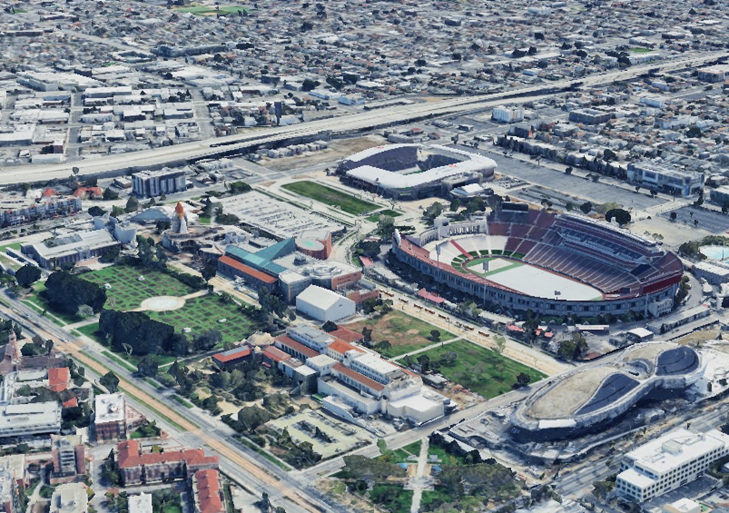 |
|
| (2024)* - A contemporary aerial view of the Coliseum and Exposition Park. The grounds that were still a working racetrack in 1909 now hold the Coliseum, the Rose Garden, the Natural History Museum, the California Science Center, and the Lucas Museum of Narrative Art. A $315 million renovation completed in 2019 updated the stadium's seating, press facilities, and amenities while preserving its historic fabric. |
| Historical Notes
The $315 million renovation completed in 2019 was funded by the University of Southern California under a 98-year lease agreement signed in 2013, which also transferred long-term management of the Coliseum to the university. The project added new seating throughout, a south side press box and suite structure, loge boxes, and a rooftop terrace with views of the surrounding park and city. Seating capacity was set at 77,500. The renovation was designed by DLR Group and carried out in compliance with the Secretary of the Interior's Standards for Rehabilitation, given the stadium's status as a National Historic Landmark. The Lucas Museum of Narrative Art, visible in the contemporary image, is scheduled to open on September 22, 2026, on the south side of Exposition Park. Designed by architect Ma Yansong of MAD Architects, it occupies ground that was once the eastern edge of the Agricultural Park racetrack oval. When it opens it will complete a transformation of Exposition Park that began when the racetrack was cleared more than a century earlier. |
Then and Now
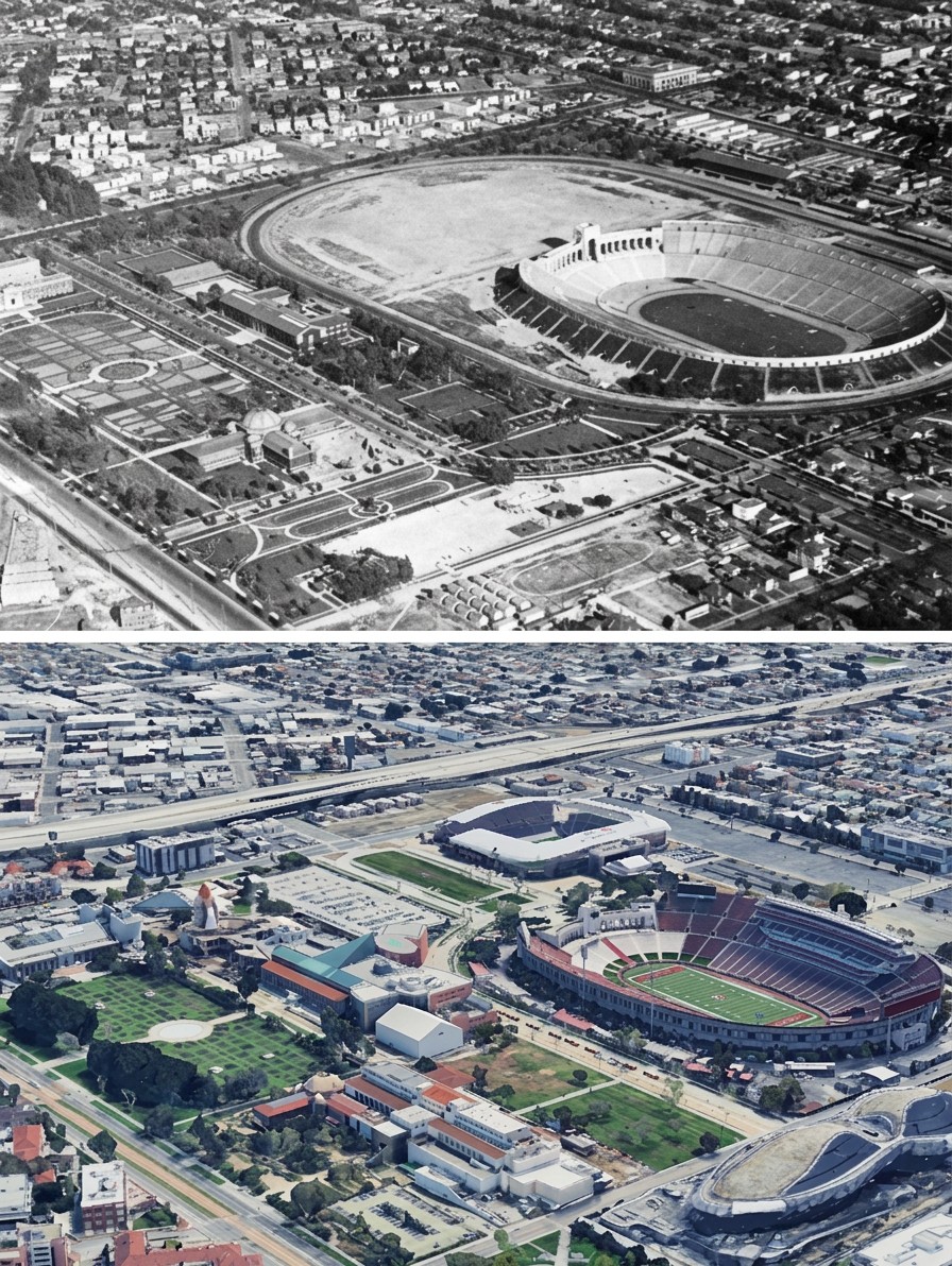 |
|
| (1922 vs. 2024)* - The Coliseum during construction and as it stands today. The elliptical shape of the bowl, set by architects John and Donald Parkinson in 1921, remains unchanged. The upper image shows the embankments still being formed from excavated soil. The lower image shows the stadium after its 2019 renovation, which brought seating capacity to 77,500. Photo comparison by Jack Feldman. |
| Historical Notes
The Coliseum's elliptical form was not an accident of its site. John Parkinson chose the shape deliberately, drawing on the Yale Bowl and on the ancient Roman amphitheater tradition, and built it within the western and central portion of the old Agricultural Park racetrack oval. The outer dimensions of the bowl, 1,038 feet long and 738 feet wide, made it the second most expensive stadium in the United States when it opened, behind only Yankee Stadium in New York. In 1930, with the 1932 Olympics awarded to Los Angeles, the stadium was expanded upward to seventy-nine rows and capacity was raised to more than 101,000. The Olympic cauldron added for the 1932 Games remains above the peristyle at the east end and is lit during every USC home game. The Coliseum hosted the Summer Olympics in 1932 and 1984 and will become the first stadium to host the Games three times when the 2028 Olympics open there. |
Continuity Within Change |
The then and now comparisons show one of the more interesting aspects of the Coliseum's history: the elliptical form of the stadium still traces the geometry of the racetrack that came before it. The sunken garden to the north, later redesigned as the Rose Garden, remains in place, connecting the park's early layout to its present form.The surrounding landscape has changed considerably. What were once open grounds and racetrack edges have given way to parking areas, museums, sports facilities, and dense residential streets. The Coliseum, once set within a largely open park, is now part of a much more active urban environment. |
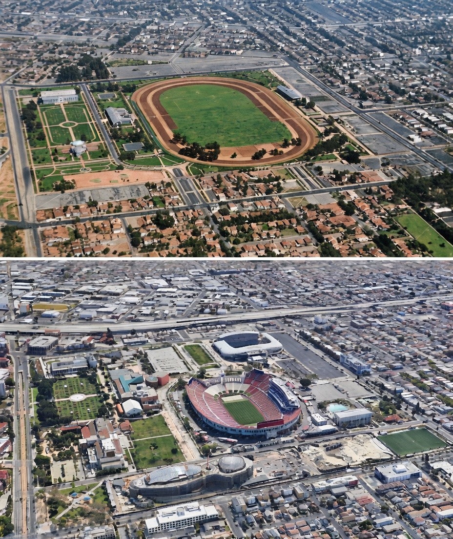 |
|
| (1918 vs. 2022)* – Exposition Park then and now. The center of the sunken garden on the left side of both images serves as the reference point. The mile-long racetrack oval visible in the upper image occupied the ground where the Coliseum now stands. The Rose Garden and the museum buildings to the north were already taking shape in 1918. Photo comparison by Jack Feldman. Original photo colorized by Rodolfo Rojas Patiño. |
Historical Notes The Coliseum was built between 1921 and 1923 directly within the old racetrack footprint, its bowl occupying the same ground where Barney Oldfield had raced less than twenty years before. The oval that had defined Agricultural Park for three decades was gone within a decade of the 1918 photograph. The Coliseum now sits where the oval once ran, its elliptical bowl built within the western and central portion of the old racetrack footprint. The eastern portion of the oval disappeared into parking and surrounding streets. That the Coliseum itself is elliptical, echoing the shape of the track it replaced, is one of the more quietly satisfying continuities in the park's history. The sunken garden visible in its early unfinished state in the upper image became the Rose Garden in 1928 and was listed on the National Register of Historic Places in 1991. That transformation is the subject of the next section. For a closer look at the Coliseum's construction, including ground level views of the arches, entranceway, and early seating structure, click HERE to see Early Views of the Los Angeles Memorial Coliseum Construction. |
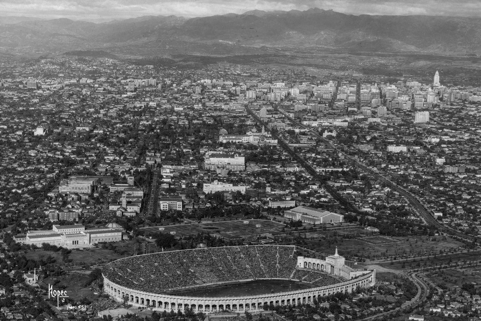 |
|
| (1932)* - Los Angeles looking north, photographed from the Goodyear airship during the 1932 Olympic Games. The Coliseum sits in the foreground. Between it and the downtown skyline, the University of Southern California campus is visible in the middle distance. |
Historical Notes The 1932 Summer Olympics opened at the Coliseum on July 30, 1932, before a crowd of more than 101,000. Athletes from 37 countries participated, and the Games drew an estimated 1.2 million visitors over their duration, roughly equal to the entire population of the City of Los Angeles at the time. The 1932 Games introduced several traditions that remain part of the Olympics today, including the use of an Olympic Village for visiting athletes, a three-tier medal podium, and the flying of winning nations' flags during award ceremonies.Click HERE to see more Early Views of the Los Angeles Memorial Coliseum during the Olympics. |
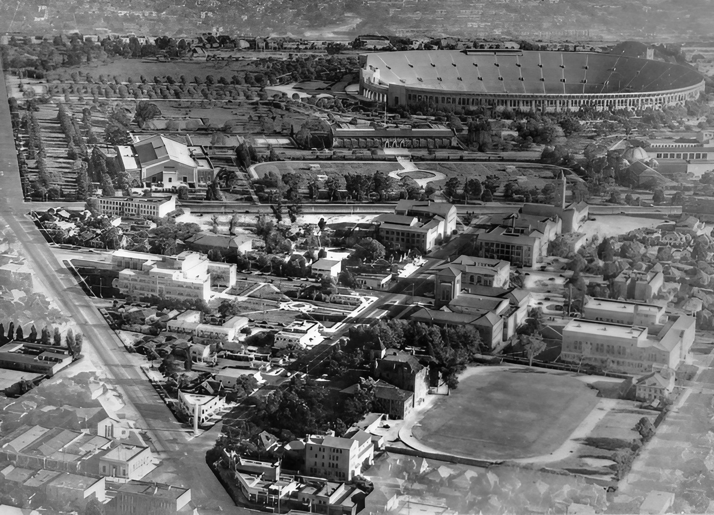 |
|
| (1930s)* - The University of Southern California campus in the foreground, with the Los Angeles Memorial Coliseum beyond. USC has played its home football games at the Coliseum since the inaugural game on October 6, 1923. |
Historical Notes USC agreed to play its home football games at the Coliseum when the stadium opened, a circumstance that contributed to the decision to build it where it was. The university took over long-term management of the Coliseum under a 98-year lease agreement in 2013 and funded the $315 million renovation completed in 2019. Click HERE to see more in Early Views of U.S.C. |
A Living Landmark Designated a National Historic Landmark in 1984, the Coliseum has served as more than a stadium. It has been a site of Olympic ceremonies, championship games, public gatherings, and civic commemoration. Originally dedicated as a memorial to World War I veterans and rededicated in 1968 to honor veterans of all wars, it remains both a working venue and a public monument. The images in this section, from racetrack days through construction, expansion, and present day views, document more than the evolution of a single structure. They trace the transformation of an entire landscape and the ways Los Angeles has redefined how public space is used and remembered over more than a century. |
* * * * * |
2nd Street Tunnel |
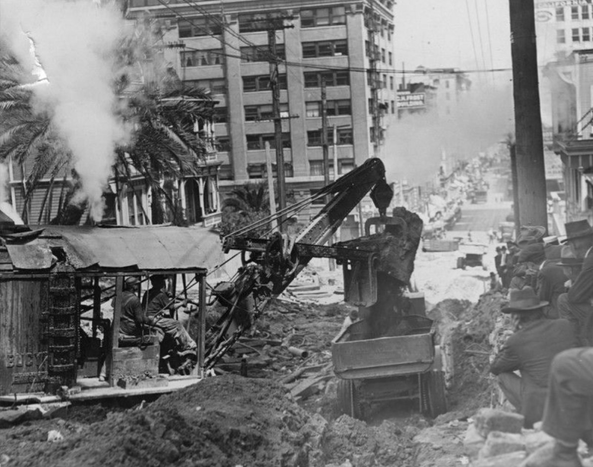 |
|
| (1921)* - Two men seated in the cabin of a Bucyrus backhoe operate the machine as steam rises from the top. One man holds onto the rope that leads to the pulleys. Another man operates the levers that dumps a mouthful of dirt into a dump truck. They are digging out Bunker Hill to construct the 2nd Street Tunnel. |
Historical Notes The 2nd Street Tunnel was built to relieve congestion on the earlier 3rd Street Tunnel. Construction actually began in 1916 but was stalled for five years by litigation. Steam shovels didn't begin tearing into the hillside until April 11, 1921. |
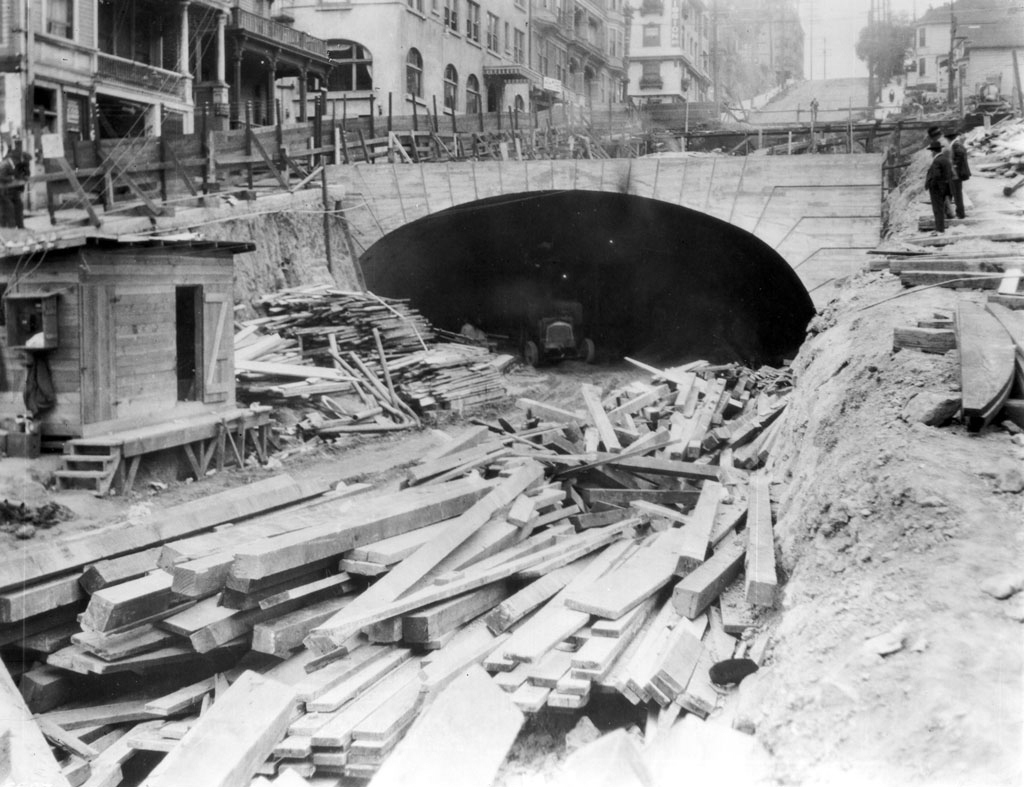 |
|
| (ca. 1921)* - Hill Street entrance to the 2nd Street tunnel under construction. A ditch filled with lumber stands in the foreground, quickly meeting an archway under which an automobile can be seen parked. A small workman's shack has been erected to the left, and scaffolding lines the street on the bridge above and the road leading up to it on the left side. Two men in suits stands amidst the building materials at the right side of the ditch. High rise buildings and an inclined street can be seen in the background. |
Historical Notes For a time, it seemed the tunnel would never open; it became the laughingstock of the city. But by July 25, 1924, workers had finally bored 1,502 feet through Bunker Hill’s shale and sandstone.* |
 |
|
| (1924)* - Grand opening of the 2nd Street Tunnel on July 25, 1924. A procession of dignitaries await the start of the parade while police on horseback maintain crowd control. |
Historical Notes Construction of the 2nd Street Tunnel began in 1916, and wasn't completed until 1924, with its formal opening on July 25 of that year. The distinctive white tiles, which give the tunnel its glow, came from Germany, which caused controversy at the time due to the legacy of World War I and protectionist feelings.^ |
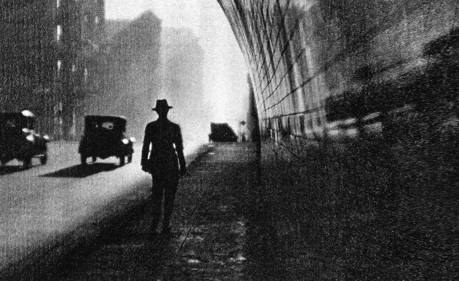 |
|
| (1930s)^ – Noir image showing a man wearing a hat walking through the 2nd Street Tunnel. |
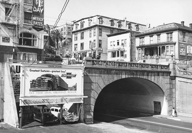 |
|
| (1950s)* - Close-up view of the east end of the 2nd Street Tunnel showing the deterioration of the neighborhood’s boarding houses and residential hotels. |
Historical Notes The last days of Bunker Hill: this view from the Second Street tunnel clearly shows the deterioration of the neighborhood’s boarding houses and residential hotels. The Hill would soon be scraped clean to make way for “redevelopment”. |
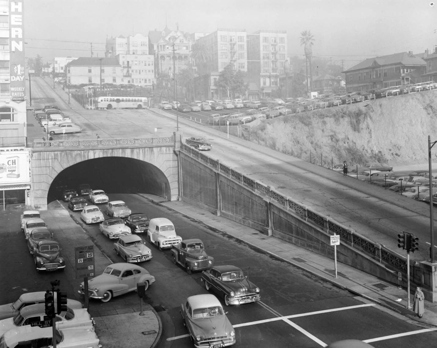 |
|
| (1950s)* – View looking at the eastern portal of the 2nd Street Tunnel showing a line of cars heading toward the civic center. Hill Street is in the foreground. |
.jpg) |
|
| (2017)* – Google street view showing the eastern portal of the 2nd Street Tunnel as seen from Hill Street. |
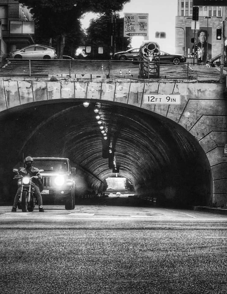 |
|
| (2020)* – Eastern portal of the Second Street Tunnel. Photo by Carlos G. Lucero |
* * * * * |
2nd Street Tunnel (Western Portal)
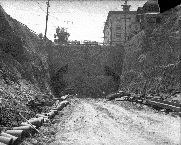 |
|
| (1921)* – View showing the 2nd Street Tunnel construction site before the boring of the tunnel, from the Figueroa Street side (Western Portal). The multi-story building at upper-right is the Stanley Hotel and Apartments. |
Historical Notes The above photo was published in the Aug. 22, 1921, Los Angeles Times with story claiming the tunnel would be finished in less than a year. The tunnel did not open for nearly three years. |
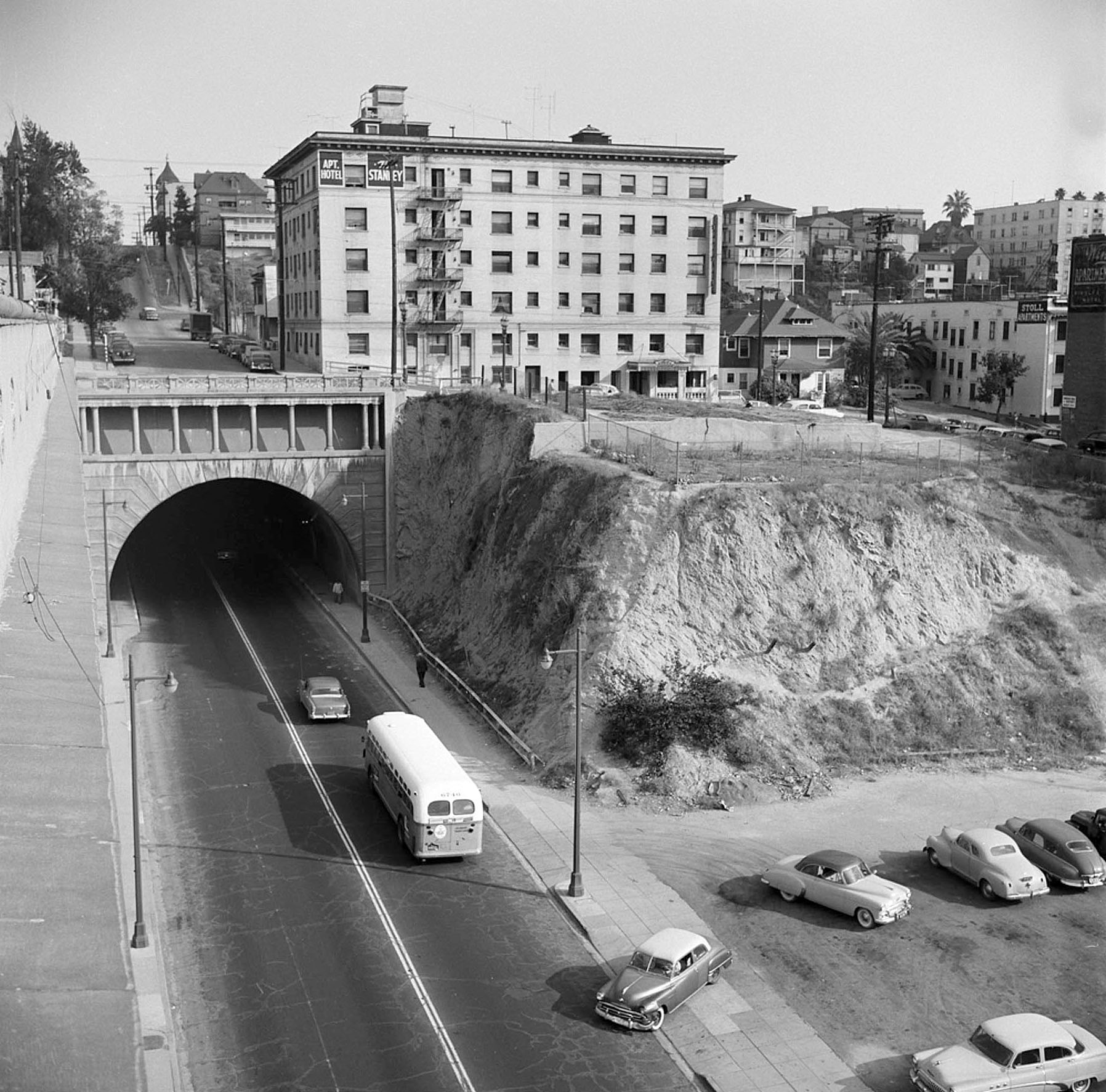 |
|
| (1950s)* - View looking east toward the west end of the 2nd Street Tunnel. The Stanley Hotel and Apartments stand above the tunnel on Bunker Hill. In the distance can be seen the dome of the Dome Hotel and Apartments on the SW corner of 2nd and Hill streets. Bunker Hill would soon be scraped clean to make way for “redevelopment”. |
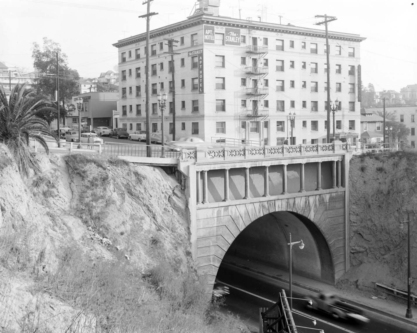 |
|
| (1950s)*++ – Close-up view showing the western portal to the 2nd Street Tunnel with the Stanley Hotel and Apartments above (demolished in 1966) for the redevelopment of Bunker Hill. |
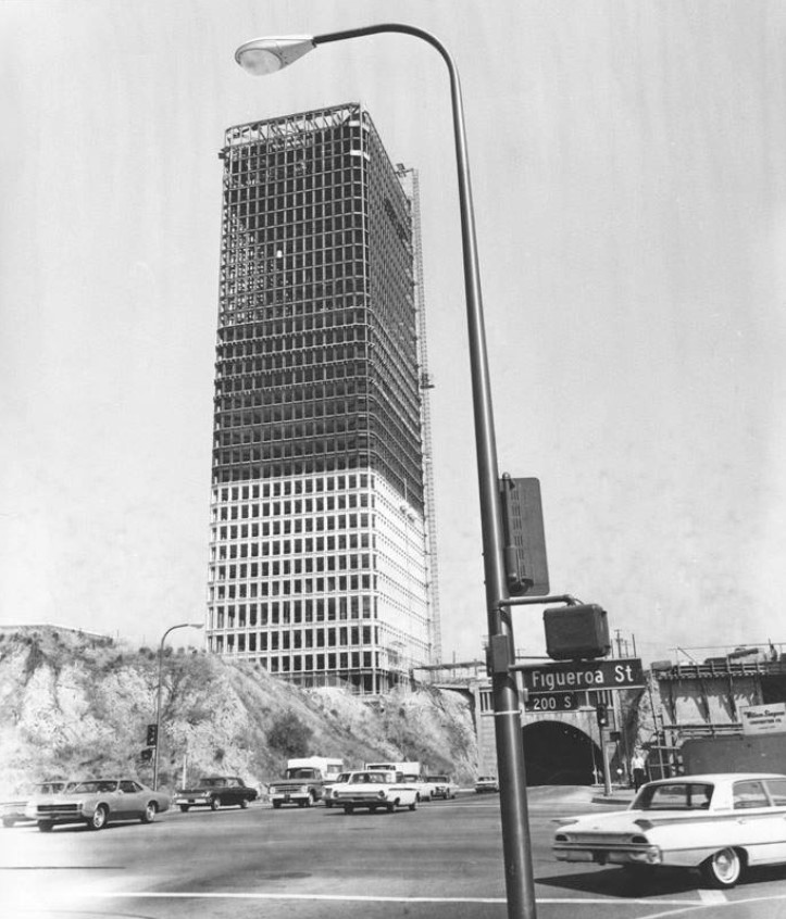 |
|
| (1968*– View looking east toward the west end of 2nd Street Tunnel as seen from the southwest corner of 2nd and Figueroa. Bunker HIll Tower (completed in 1968) is seen near the tunnel. |
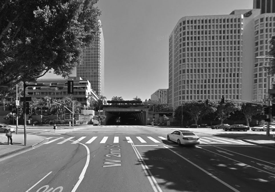 |
|
| (2015)* – Google street view showing the west end of the 2nd Street Tunnel as it appears today. |
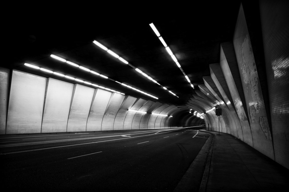 |
|
| (2012)* – View showing the west entrance of the 2nd Street Tunnel in downtown Los Angeles. Photo by Rian Long |
Historical Notes The tunnel's two entrances are very different in character – "the grittier east entrance and the glowing aperture of the west side, with flaring buttresses reminiscent of the shell of the Hollywood Bowl." The tunnel creates interesting light textures especially at night. It’s been frequently used as a backdrop in movies and even more frequently in car advertisements.^ |
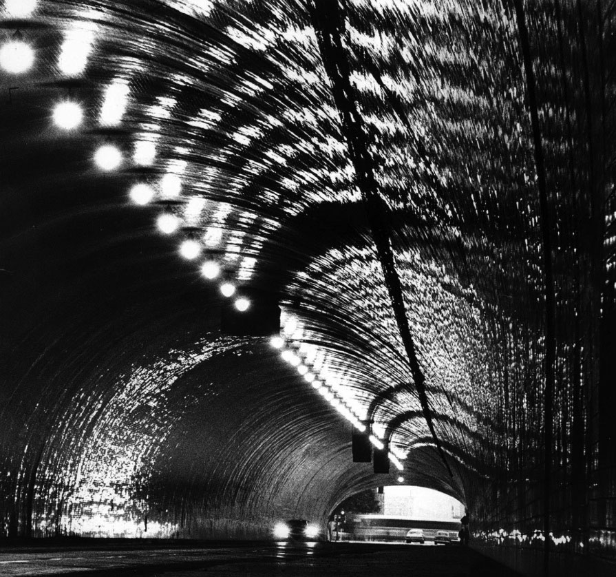 |
|
| (1978)* - Headlights bounce around on the tiled surface of the 2nd Street Tunnel in downtown Los Angeles during light rain. |
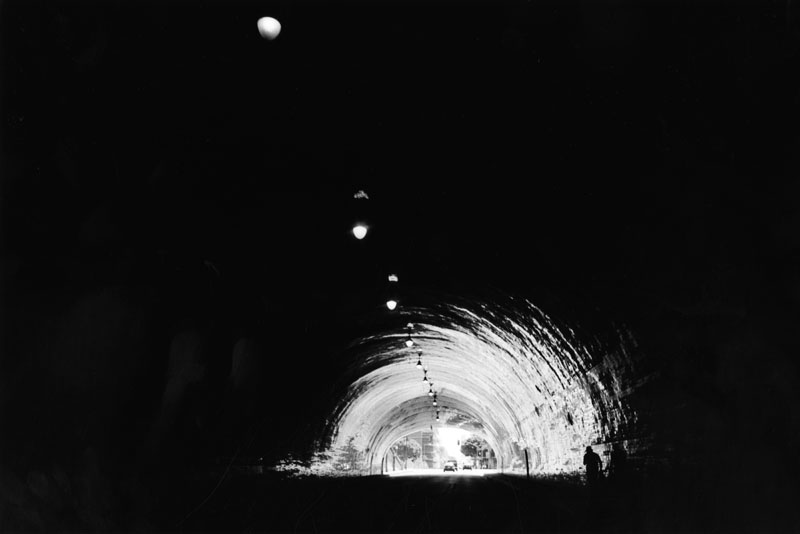 |
|
| (2000)^ - As if straight out of a science fiction movie, cars seem to spill out of the darkness and into the spiral-like light of day. The photo was taken from inside the 2nd Street Tunnel, two pedestrians walking on the right side, and a row of ceiling lights that are spaced out through the entire tunnel are the only visible things inside this black hole. |
Historical Notes The 2nd Street Tunnel in Los Angeles is probably the most recognizable city landmark most Americans have never heard of. The tunnel — a 1,500-foot-long bore lined with white tile, like a bathroom that never ends — has been used as an exterior in dozens of films and TV shows, most famously in the sci-fi masterpiece “Blade Runner.” |
* * * * * |
Research, writing, and image curation by Jack Feldman, Water and Power Associates, with editorial assistance.
* * * * * |
More Historical Early Views
Newest Additions
Early LA Buildings and City Views
History of Water and Electricity in Los Angeles
* * * * * |
References and Credits
* DWP - LA Public Library Image Archive
^ LA Public Library Image Archive
^*The Valley Observed: Street Name Origins; Timeline of Valley History
*# blogdowntown: Third Street Tunnel
#* About.Com: History of Electric Vehicles
#+Facebook.com: Classic Hollywood/Los Angeles/SFV
#**U.S. Geological Survey Photographic Library
+**You-are-here.com: Buena Vsta-Broadway Bridge
+*^Daily Breeze: Redondo Beach's Endless Pier
+^^Facebook: Garden of Allah Novels
+##Anna Sklar, Brown Acres - An Intimate History of the Los Angeles Sewers (Santa Monica, CA: Angel City Press: 2008). Original photos from the City of Los Angeles Archives/City of Los Angeles Bureau of Engineering.
++^Flickr.com: 2nd Street Tunnel
#*^Library of Congress: Brand Boulevard, ca. 1915
*##LA Times: Dig Into History You'll Find Snake Oil; Historic Bridge to Downtown Reopens; First Car Through Hill Street Tunnel; 2nd Street Tunnel Opens
^##Metropolitan Transportation Library and Archive
###Denver Public Library Image Archive
#^#Santa Monica Public Library Image Archive
#++Facebook.com: Los Angeles Streets and Boulevards
*#*Historical Los Angeles Theatres: The Philharmonic Auditorium; Downtown Theatre; Quinn's Superba; Lyceum Theatre
^#^Noirish Los Angeles - forum.skyscraperpage.com; Windsor Square Aerial; Victoria Park; LARy Driver; Inceville - Inceville - palipost.com; Redondo Beach
*^#LincolnHeightsLA.com: Legion Ascot Speedway
**#KCET - Lost Tunnels of Downtown LA; A Brief History of LA Bridges; When L.A.'s Most Famous Streets Were Dirt Roads; How Oil Wells Once Dominated Southern California's Landscape; Three Forgotten Incline Railways; A Brief History of Bridges in Los Angeles
*#^History of Hermosa Beach - Maureen Megowan
^#*City of Redondo Beach HIstory
^^*Early Downtown Los Angeles - Cory Stargel, Sarah Stargel
***Los Angeles Historic - Cultural Monuments Listing
**^Historicechopark.org: Echo Park Lake
^*#California State Library Image Archive
*^*California Historical Landmarks Listing (Los Angeles)
*^^Nuestra Señora la Reina de los Ángeles: losangelespast.com; Pinterest: losangelespast.com
^^^Aerofiles - US Aviation Firsts
***^Oviatt Library Digital Archives
^**^Pinterest: Splinters n Speed; Cars - Bertrand Lacheze; Beverly Boards Motorcycle Racing
*^^^Highland Park - amoeba.com
*^#^Huntington Digital Library Archive
^^^*Cinema Treasures: Quinn's Superba Theatre
^*^*Beverly HIlls Patch: The Beverly Hills Speedway
^#^^El Pueblo de Los Angeles Historical Monuments Listing
^^*#UCLA Library Digital Archive
^^^#Los Angeles Fire Department Historical Archive
*#^*USC Facebook.com
*#^^LAPL-El Pueblo de Los Angeles Historical Monument Photo Archive
*^*^Big Orange Landmarks: Cesar E. Chavez Avenue Viaduct
*^^*Vintage Los Angeles - Facebook: Pacific Telephone Switchboard
*^*#Santa Monica Beach Stories
^###Exposition Park History - Expositionpark.org
*^##LA Times: What's in a name? A family's history, Sanchez Street
*##*Chatsworth Historical Society
*#^#Flickr.com: Walking Over Santa Monica
^##^Glendale Historical Society
^#^*Facebook.com - City of Angels: Cyclone Racer
##^*Google Maps
##*^Ballona Blog
##++Facebook.com - Beverly Hills Heritage
^^^^Beverly Hills Board Track Racing
**^*# PlayaVistaProperties.com
^*^**Los Angeles City Historical Society
^*^*^Venice History: Roller Coasters and Carousels
*^*^*SantaMonicaPier.com
*^ Wikipedia: H.J. Whitley; Occidental College; Beverly Hills; Beverly Hills Hotel; Los Angeles Railway; Pershing Square; Broadway Tunnel: Isaac Van Nuys; Sawtelle; Port of Los Angeles; Tournament of Roses Parade; Angels Flight; Occidental College; Mt. Washington, LA; Broadway, LA; Hancock Park; La Brea Tar Pits; Los Angeles City Oil Field; Deadman's Island (San Pedro); Moses Sherman; Rose Bowl Game; Hollywood Hotel; Hollywood HIgh School; California Club; San Pedro; Salt Lake Oil Field - Gilmore Oil Field; Westwood; 2nd Street Tunnel; Hermosa Beach; Los Angeles Memorial Coliseum; Redondo Beach Pier; Redondo Beach; West Hollywood; Pacific Palisades; 1910 L.A. International Air Meet at Dominguez Hills; Hancock Park; Marlborough School; Beverly Hills Speedway; Santa Catalina Island; Palisades del Rey; Macy St. Bridge/Caesar Chavez Viaduct; Hollywood Bowl; Ford Model T; History of Los Angeles Population Growth; Quinn's Superba Theatre; Los Angeles Plaza Historic District; Windsor Square; Victoria Park; History of Santa Monica (Long Wharf); Marina del Rey; Glendale; World War I; Armistice Day; Atchison, Topeka and Santa Fe Railway; Hyperion Sewage Treatment Plant
< Back